Enable Location

We need your location to show you interesting places around you

Discover nearby places

Find interesting locations and hidden gems around you

Precise directions

Get accurate directions and distances to places

Your location is never shared with other users. It's only used when you tap the location button.

Gouldsboro State Park

Log in to your account

Start exploring — it's free

Trusted by 65,878 travelers worldwide

Continue with Google
Continue with Apple
or

We will send you a code to connect

By continuing, you accept our Terms and Conditions and our Privacy Policy

Check your inbox

We've sent a pincode in your inbox. Please enter the code below.

Gouldsboro State Park
Discussion Reviews 1 Photos
4.3k Popularity

Gouldsboro State Park, State park in Wayne County, Pennsylvania

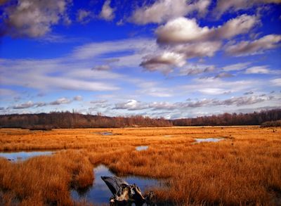
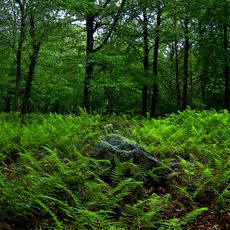
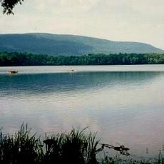
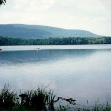
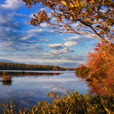
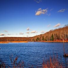
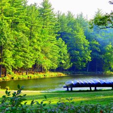
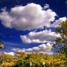
Gouldsboro State Park is a natural area in northeastern Pennsylvania built around a sizable lake, dense forest, and a network of wetlands. The terrain shifts between wooded hillsides, marshy lowlands, and open water as you move through the park.

The land was logged heavily in the early 1900s and then left to regrow before Pennsylvania took it over in the mid-20th century. The park was officially established in 1958 to protect the recovering forests and the water resources of the region.

Many visitors come to fish or paddle on the lake at the center of the park, which draws people from nearby towns throughout the year. In winter, the trails turn into cross-country ski routes, and the frozen lake becomes a spot for ice skating.

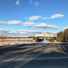
The park has two entrances on Route 507, which serve as starting points for trails, fishing spots, and the boat launch area. Arriving early on summer weekends is a good idea, as the parking area near the lake fills up quickly.

The wetlands in the park act as a natural filter for water flowing into the local watershed and shelter several rare amphibian species that are hard to find elsewhere in the region. On spring nights after rain, these animals can sometimes be spotted moving along the edges of the marshy areas.

The community of curious travelers

AroundUs brings together thousands of curated places, local tips, and hidden gems, enriched daily by 60,000 contributors worldwide.

Start exploring
Location
Inception
1958
GPS coordinates
41.21060,-75.45580
Latest update
March 3, 2026 08:11
Around this place
Pocono Raceway
United States of America

Pocono Raceway

17.9 km
Hickory Run State Park
United States of America

Hickory Run State Park

27.3 km
Promised Land State Park
United States of America

Promised Land State Park

24.4 km
Nay Aug Park
United States of America

Nay Aug Park

26.4 km
Camelback Mountain
United States of America

Camelback Mountain

20.7 km
Big Pocono State Park
United States of America

Big Pocono State Park

20.9 km
Camelbeach Waterpark
United States of America

Camelbeach Waterpark

19.6 km
Tobyhanna State Park
United States of America

Tobyhanna State Park

7.7 km
Everhart Museum
United States of America

Everhart Museum

26.4 km
United States of America

Tannersville Cranberry Bog

25 km
Delaware State Forest
United States of America

Delaware State Forest

26.1 km
Pinemere Camp
United States of America

Pinemere Camp

25.8 km
Kalahari Indoor Waterpark
United States of America

Kalahari Indoor Waterpark

13.5 km
St. Stanislaus Cathedral in Scranton, Pennsylvania
United States of America

St. Stanislaus Cathedral in Scranton, Pennsylvania

27.2 km
Pocono Manor Historic District
United States of America

Pocono Manor Historic District

24.1 km
Lacawac
United States of America

Lacawac

23.1 km
Harrison Avenue Bridge
United States of America

Harrison Avenue Bridge

26.7 km
Nesbitt Reservoir
United States of America

Nesbitt Reservoir

21 km
Stoddartsville Historic District
United States of America

Stoddartsville Historic District

17 km
Patriotic Order Sons of America Washington Camp 422
United States of America

Patriotic Order Sons of America Washington Camp 422

12.3 km
Roger Williams Public School No. 10
United States of America

Roger Williams Public School No. 10

26.9 km
Bear Creek Village Historic District
United States of America

Bear Creek Village Historic District

25.3 km
Bridge in Dreher Township
United States of America

Bridge in Dreher Township

13.5 km
Promised Land State Park Whittaker Lodge District
United States of America

Promised Land State Park Whittaker Lodge District

24.8 km
Promised Land State Park-Bear Wallow Cabins
United States of America

Promised Land State Park-Bear Wallow Cabins

23.6 km
Big Pocono Fire Tower
United States of America

Big Pocono Fire Tower

20.6 km
Hickory Run Boulder Field
United States of America

Hickory Run Boulder Field

23.7 km
Stony Point Fire Tower
United States of America

Stony Point Fire Tower

27.5 km
Show the full map
Reviews
Share your experience

No review yet

Discussions
Start a discussion...

No discussion yet

« Gouldsboro State Park - State park in Wayne County, Pennsylvania » is provided by Around Us (aroundus.com). Images and texts are derived from Wikimedia project under a Creative Commons license. You are allowed to copy, distribute, and modify copies of this page, under the conditions set by the license, as long as this note is clearly visible.

Discover hidden gems everywhere you go!

From secret cafés to breathtaking viewpoints, skip the crowded tourist spots and find places that match your style. Our app makes it easy with voice search, smart filtering, route optimization, and insider tips from travelers worldwide. Download now for the complete mobile experience.

Around Us App Screenshot

A unique approach to discovering new places

Le Figaro

All the places worth exploring

France Info

A tailor-made excursion in just a few clicks

20 Minutes

Around Us
Travel Guide & Maps
Download

Send to your phone

QR Code
1

Open the camera app on your mobile.

2

Point at the QR code with your camera. A notification will appear.

3

Tap the notification to open the link.