Enable Location

We need your location to show you interesting places around you

Discover nearby places

Find interesting locations and hidden gems around you

Precise directions

Get accurate directions and distances to places

Your location is never shared with other users. It's only used when you tap the location button.

Log in to your account

Start exploring — it's free

Trusted by 62,368 travelers worldwide

Continue with Google
Continue with Apple
or

We will send you a code to connect

By continuing, you accept our Terms and Conditions and our Privacy Policy

Check your inbox

We've sent a pincode in your inbox. Please enter the code below.

Tannersville Cranberry Bog

Tannersville Cranberry Bog, Protected wetland in Tannersville, United States.

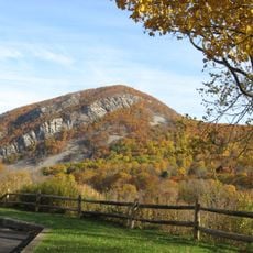
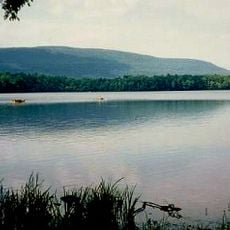
Tannersville Cranberry Bog is a protected wetland in the Pocono Mountains composed mostly of dense sphagnum moss and thick layers of peat. The area spans across open terrain with characteristic features of a bog ecosystem and specialized plant communities.

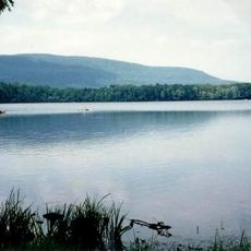
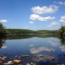
The site formed roughly 13,000 years ago when glaciers from the last ice age retreated and left behind a depression. This depression filled with water and gradually transformed over millennia into the bog ecosystem visible today.

The bog holds meaning for those interested in northern ecosystems and rare plants found nowhere else in this region. Visitors often notice how special this landscape feels when surrounded by the unusual vegetation and wildlife that thrive here.

Visitors can explore the area via a raised wooden boardwalk roughly 450 feet long that provides safe passage across the wet terrain. Guided walks are available during warmer months and help visitors understand the plants and geology of this special landscape.

This bog is the southernmost example of its ecosystem type in the eastern region and hosts carnivorous plants typically found in colder northern areas. The rare orchids and black spruce trees show how this place offers a living window into northern plant communities.

The community of curious travelers

AroundUs brings together thousands of curated places, local tips, and hidden gems, enriched daily by 60,000 contributors worldwide.

Start exploring
Location
GPS coordinates
41.04220,-75.25890
Latest update
December 8, 2025 21:02
Around this place
Mount Tammany
United States of America

Mount Tammany

14.8 km
Camelback Mountain
United States of America

Camelback Mountain

7.8 km
Big Pocono State Park
United States of America

Big Pocono State Park

7.3 km
Sunfish Pond
United States of America

Sunfish Pond

16.2 km
Delaware Water Gap Toll Bridge
United States of America

Delaware Water Gap Toll Bridge

12.7 km
Camelbeach Waterpark
United States of America

Camelbeach Waterpark

8.2 km
Delaware River Viaduct
United States of America

Delaware River Viaduct

17.4 km
Sherman Theater
United States of America

Sherman Theater

8.4 km
Worthington State Forest
United States of America

Worthington State Forest

15.6 km
Mount Minsi
United States of America

Mount Minsi

14.3 km
Delaware State Forest
United States of America

Delaware State Forest

11.9 km
Pinemere Camp
United States of America

Pinemere Camp

7.2 km
Kalahari Indoor Waterpark
United States of America

Kalahari Indoor Waterpark

13 km
Cherry Valley National Wildlife Refuge
United States of America

Cherry Valley National Wildlife Refuge

18.4 km
Pocono Manor Historic District
United States of America

Pocono Manor Historic District

3.1 km
Columcille Megalith Park
United States of America

Columcille Megalith Park

13.6 km
Stroud Mansion
United States of America

Stroud Mansion

8.2 km
Quiet Valley Farm
United States of America

Quiet Valley Farm

9.5 km
Worthington Hall
United States of America

Worthington Hall

13 km
Christ Hamilton United Lutheran Church and Cemetery
United States of America

Christ Hamilton United Lutheran Church and Cemetery

13.2 km
Shawnee-Minisink Site
United States of America

Shawnee-Minisink Site

12 km
Monroe County Courthouse
United States of America

Monroe County Courthouse

8.2 km
John Michael Farm
United States of America

John Michael Farm

17 km
Academy Hill Historic District
United States of America

Academy Hill Historic District

8 km
Fenner–Snyder Mill
United States of America

Fenner–Snyder Mill

12.7 km
Mount Tammany Lookout
United States of America

Mount Tammany Lookout

14.8 km
Kitson Woolen Mill
United States of America

Kitson Woolen Mill

8.5 km
Big Pocono Fire Tower
United States of America

Big Pocono Fire Tower

7.9 km
Show the full map
« Tannersville Cranberry Bog - Protected wetland in Tannersville, United States » is provided by Around Us (aroundus.com). Images and texts are derived from Wikimedia project under a Creative Commons license. You are allowed to copy, distribute, and modify copies of this page, under the conditions set by the license, as long as this note is clearly visible.

Discover hidden gems everywhere you go!

From secret cafés to breathtaking viewpoints, skip the crowded tourist spots and find places that match your style. Our app makes it easy with voice search, smart filtering, route optimization, and insider tips from travelers worldwide. Download now for the complete mobile experience.

Around Us App Screenshot

A unique approach to discovering new places

Le Figaro

All the places worth exploring

France Info

A tailor-made excursion in just a few clicks

20 Minutes

Around Us
Travel Guide & Maps
Download

Send to your phone

QR Code
1

Open the camera app on your mobile.

2

Point at the QR code with your camera. A notification will appear.

3

Tap the notification to open the link.