Chest opened
+${chestReward.xp} XP
Explorer
NOUVEAU ×${chestReward.collectible.quantity}
tapez pour fermer

See the monuments around you in AR Open chests in the app

Around Us is built for your phone — point your camera at the streets and discover the monuments and places around you in augmented reality. Around Us is built for your phone — chests unlock when you walk, explore and capture nearby places.

Enable Location

We need your location to show you interesting places around you

Discover nearby places

Find interesting locations and hidden gems around you

Precise directions

Get accurate directions and distances to places

Your location is never shared with other users. It's only used when you tap the location button.

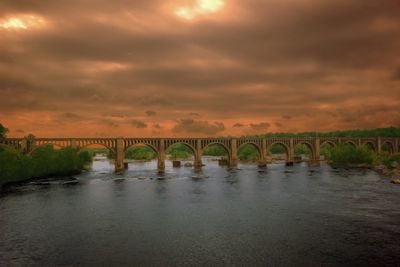
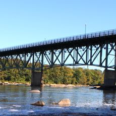
CSX A-Line Bridge

Log in to your account

Start exploring — it's free

Trusted by 86,362 travelers worldwide

Continue with Google
Continue with Apple
or

We will send you a code to connect

By continuing, you accept our Terms and Conditions and our Privacy Policy

Check your inbox

We've sent a pincode in your inbox. Please enter the code below.

CSX A-Line Bridge
Discussion Reviews 1 Photos
3.2k Popularity

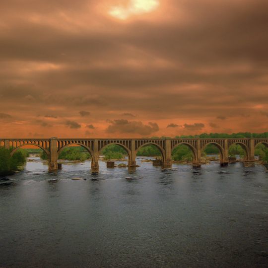
CSX A-Line Bridge, Railway bridge in Richmond, Virginia.

The CSX A-Line Bridge is a railway bridge crossing the James River in Richmond, connecting both banks with two parallel tracks for freight and passenger trains. The structure uses a series of large and small concrete arches to support the weight of passing trains.

An iron truss bridge was first built here in 1889, but the growing demands of rail traffic between Richmond and Washington D.C. required a stronger design. The current concrete arch structure was completed in 1919 to replace the earlier bridge.

The bridge displays a series of large concrete arches arranged in a rhythm that reflects early 20th-century engineering thinking. Walking along the nearby pathways, you can sense how this structure became a visual landmark in the Richmond landscape.

The bridge is best viewed from the riverside walkways and paths on both sides of the James River. Visiting during daytime hours allows you to see the arch details and structure clearly against the sky.

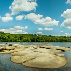
Stone piers from the original 1889 bridge remain visible just beneath the water surface, serving as a physical record of how the old structure was replaced. These submerged remains offer a tangible connection to the earlier engineering that once spanned the river.

The community of curious travelers

AroundUs brings together thousands of curated places, local tips, and hidden gems, enriched daily by 60,000 contributors worldwide.
Start exploring
Location
GPS coordinates
37.53640,-77.49390
Latest update
September 12, 2026 05:35
Around this place
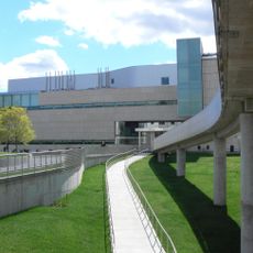
Virginia Museum of Fine Arts
United States of America

Virginia Museum of Fine Arts

1.7 mi
Maymont Park
United States of America

Maymont Park

0.9 mi
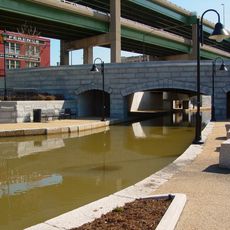
James River and Kanawha Canal
United States of America

James River and Kanawha Canal

3.4 mi
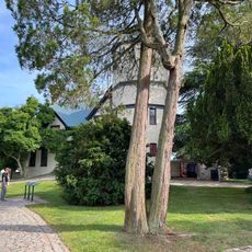
Agecroft Hall
United States of America

Agecroft Hall

1.3 mi
City Stadium
United States of America

City Stadium

1 mi
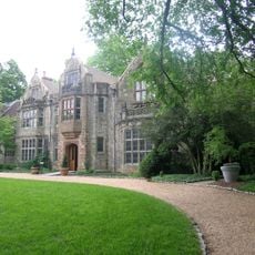
Virginia House
United States of America

Virginia House

1.3 mi
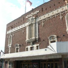
Byrd Theatre
United States of America

Byrd Theatre

1.4 mi
Pelican
Russian Federation

Pelican

1.8 mi
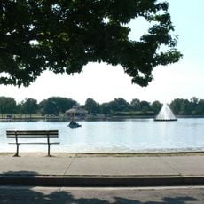
Byrd Park
United States of America

Byrd Park

0.6 mi
Boulevard Bridge
United States of America

Boulevard Bridge

0.6 mi
Forest Hill Park
United States of America

Forest Hill Park

1.6 mi
Statue of Christopher Columbus
United States of America

Statue of Christopher Columbus

307.9 mi
Rice House
United States of America

Rice House

1.9 mi
James River Park System
United States of America

James River Park System

0.9 mi
Robinson House
United States of America

Robinson House

1.7 mi
New Pump-House
United States of America

New Pump-House

0.5 mi
Confederate Memorial Chapel
United States of America

Confederate Memorial Chapel

1.7 mi
2900 Block Grove Avenue Historic District
United States of America

2900 Block Grove Avenue Historic District

1.6 mi
Forest Hill Historic District
United States of America

Forest Hill Historic District

1.6 mi
Marburg
United States of America

Marburg

0.5 mi
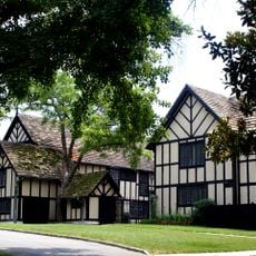
English Village
United States of America

English Village

1.6 mi
Byrd Park Court Historic District
United States of America

Byrd Park Court Historic District

1.3 mi
John Whitworth House
United States of America

John Whitworth House

1.8 mi
Reveille
United States of America

Reveille

1.7 mi
Carillon Neighborhood Historic District
United States of America

Carillon Neighborhood Historic District

0.7 mi
Virginia Commission for the Blind
United States of America

Virginia Commission for the Blind

1.3 mi
Virginia Museum of Fine Arts Sculpture Garden
United States of America

Virginia Museum of Fine Arts Sculpture Garden

1.7 mi
Boulevard Historic District
United States of America

Boulevard Historic District

1.5 mi
Show the full map
Reviews
Share your experience

No review yet

Discussions
Start a discussion...

No discussion yet

« CSX A-Line Bridge - Railway bridge in Richmond, Virginia » is provided by Around Us (aroundus.com). Images and texts are derived from Wikimedia project under a Creative Commons license. You are allowed to copy, distribute, and modify copies of this page, under the conditions set by the license, as long as this note is clearly visible.

Discover hidden gems everywhere you go!

From secret cafés to breathtaking viewpoints, skip the crowded tourist spots and find places that match your style. Our app makes it easy with voice search, smart filtering, route optimization, and insider tips from travelers worldwide. Download now for the complete mobile experience.
Around Us App Screenshot

A unique approach to discovering new places

Le Figaro

All the places worth exploring

France Info

A tailor-made excursion in just a few clicks

20 Minutes

Around Us
Travel Guide & Maps
Download

Send to your phone

QR Code
1

Open the camera app on your mobile.

2

Point at the QR code with your camera. A notification will appear.

3

Tap the notification to open the link.