Chest opened
+${chestReward.xp} XP
Explorer
NOUVEAU ×${chestReward.collectible.quantity}
tapez pour fermer
Chest locked

Open chests in the app

Around Us is built for your phone — chests unlock when you walk, explore and capture nearby places.

Enable Location

We need your location to show you interesting places around you

Discover nearby places

Find interesting locations and hidden gems around you

Precise directions

Get accurate directions and distances to places

Your location is never shared with other users. It's only used when you tap the location button.

Clinton Road

Log in to your account

Start exploring — it's free

Trusted by 72,882 travelers worldwide

Continue with Google
Continue with Apple
or

We will send you a code to connect

By continuing, you accept our Terms and Conditions and our Privacy Policy

Check your inbox

We've sent a pincode in your inbox. Please enter the code below.

Clinton Road
Discussion Reviews 1 Photos
181k Popularity

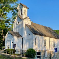
Clinton Road, Rural thoroughfare in West Milford, United States

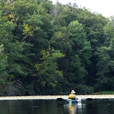
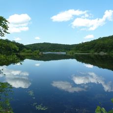
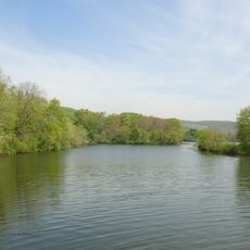
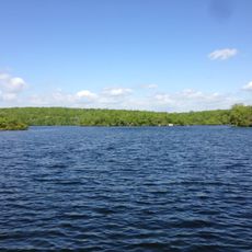
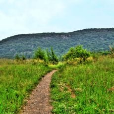
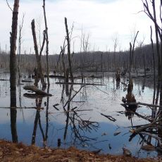
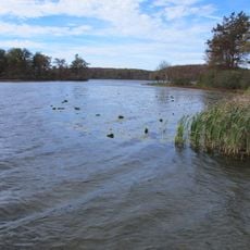
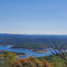
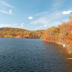
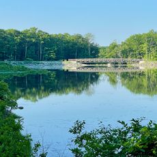
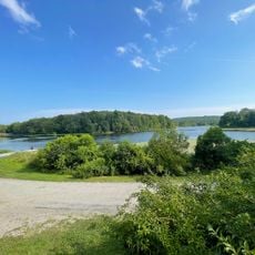
Clinton Road is a rural thoroughfare that stretches for 10 miles (16 km) through the dense forests of Passaic County, connecting Route 23 near Newfoundland to Upper Greenwood Lake. The route passes through uninhabited woodland with few side roads and crosses several ponds and streams that belong to the Newark watershed.

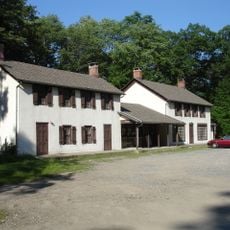
The route was established in the 18th century and took its name from the former settlement of Clinton, serving as a passage through New Jersey. Over the decades the area remained largely undeveloped as much of the surrounding land was reserved for regional water supply.

Local stories tell of a ghost boy at the bridge who tosses coins back from the water when travelers throw them in. This tale has spread over generations and draws curious visitors from across the region who want to experience the phenomenon themselves.

The traffic light at the Route 23 intersection can cause waits up to five minutes, making it one of the longest in the country. The route is narrow and winding, so careful driving is recommended especially after dark or in poor weather.

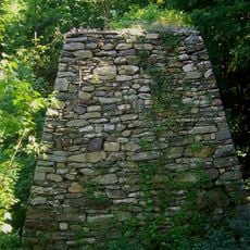
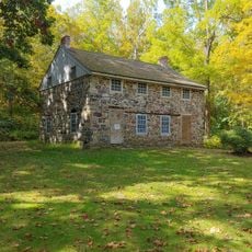
The remains of Cross Castle from 1905 stand along hiking trails near the route on Newark watershed property. The building was torn down in 1988, but foundation walls and staircases remain visible among trees and undergrowth.

The community of curious travelers

AroundUs brings together thousands of curated places, local tips, and hidden gems, enriched daily by 60,000 contributors worldwide.

Start exploring
Location
GPS coordinates
41.05430,-74.45220
Latest update
December 12, 2025 20:45
Around this place
Mountain Creek Waterpark
United States of America

Mountain Creek Waterpark

15.7 km
Wawayanda State Park
United States of America

Wawayanda State Park

12.6 km
United States of America

Wanaque Reservoir

13.6 km
Tripod Rock
United States of America

Tripod Rock

12.5 km
Norvin Green State Forest
United States of America

Norvin Green State Forest

10.7 km
Patriots' Path
United States of America

Patriots' Path

11.1 km
Apshawa Preserve
United States of America

Apshawa Preserve

7.3 km
Clinton Furnace
United States of America

Clinton Furnace

2 km
Pompton Lake
United States of America

Pompton Lake

15.8 km
Ramapo Lake
United States of America

Ramapo Lake

16 km
Wawayanda Mountain
United States of America

Wawayanda Mountain

16 km
Farny State Park
United States of America

Farny State Park

10.2 km
Bethany Chapel
United States of America

Bethany Chapel

14.5 km
Lawrence Mansion
United States of America

Lawrence Mansion

15.7 km
Mount Hope Miners' Church
United States of America

Mount Hope Miners' Church

16 km
James Dixon Farm
United States of America

James Dixon Farm

13.4 km
Rockaway Valley Methodist Church
United States of America

Rockaway Valley Methodist Church

14.1 km
Nicholas Vreeland Outkitchen
United States of America

Nicholas Vreeland Outkitchen

16.2 km
Methodist Episcopal Church
United States of America

Methodist Episcopal Church

12.6 km
Wawayanda Lake
United States of America

Wawayanda Lake

14.2 km
Franklin Mineral Museum Inc
United States of America

Franklin Mineral Museum Inc

13.2 km
White Deer Plaza and Boardwalk District
United States of America

White Deer Plaza and Boardwalk District

16.1 km
Long Pond Ironworks State Park
United States of America

Long Pond Ironworks State Park

15.4 km
Wyanokie High Point
United States of America

Wyanokie High Point

10.5 km
Monksville Reservoir
United States of America

Monksville Reservoir

14.9 km
Long Pond Ironworks
United States of America

Long Pond Ironworks

15.4 km
Mahlon Dickerson County Reservation
United States of America

Mahlon Dickerson County Reservation

13 km
Wawayanda Beach
United States of America

Wawayanda Beach

15.1 km
Show the full map
Reviews
Share your experience

No review yet

Discussions
Start a discussion...

No discussion yet

« Clinton Road - Rural thoroughfare in West Milford, United States » is provided by Around Us (aroundus.com). Images and texts are derived from Wikimedia project under a Creative Commons license. You are allowed to copy, distribute, and modify copies of this page, under the conditions set by the license, as long as this note is clearly visible.

Discover hidden gems everywhere you go!

From secret cafés to breathtaking viewpoints, skip the crowded tourist spots and find places that match your style. Our app makes it easy with voice search, smart filtering, route optimization, and insider tips from travelers worldwide. Download now for the complete mobile experience.

Around Us App Screenshot

A unique approach to discovering new places

Le Figaro

All the places worth exploring

France Info

A tailor-made excursion in just a few clicks

20 Minutes

Around Us
Travel Guide & Maps
Download

Send to your phone

QR Code
1

Open the camera app on your mobile.

2

Point at the QR code with your camera. A notification will appear.

3

Tap the notification to open the link.