Enable Location

We need your location to show you interesting places around you

Discover nearby places

Find interesting locations and hidden gems around you

Precise directions

Get accurate directions and distances to places

Your location is never shared with other users. It's only used when you tap the location button.

Log in to your account

Start exploring — it's free

Trusted by 62,033 travelers worldwide

Continue with Google
Continue with Apple
or

We will send you a code to connect

By continuing, you accept our Terms and Conditions and our Privacy Policy

Check your inbox

We've sent a pincode in your inbox. Please enter the code below.

Castelo Branco, Administrative district and electoral unit in Central Portugal.

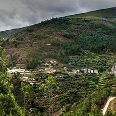
Castelo Branco is an administrative district in central Portugal that covers around 6,700 square kilometers. The district contains eleven municipalities and shares its eastern border with Spain.

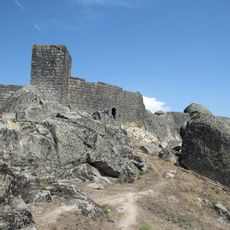
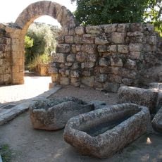
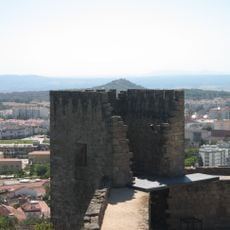
The Knights Templar established settlements and built fortifications in the region during the 12th and 13th centuries. These early structures formed the foundation for the area's later urban development.

The region preserves Portuguese embroidery techniques displayed at the Interpretation Centre in the city. Visitors can see the hand-stitched patterns and methods passed down through generations.

The district capital has regular train connections to Lisbon on the Beira Baixa Railway Line and direct highway access. Visitors will find good transport links when arriving to reach different towns across the region.

The Episcopal Palace Gardens feature Baroque stone sculptures depicting kings, zodiac signs, and seasons. These figures are arranged across multiple terraced levels, creating an unusual baroque artwork.

The community of curious travelers

AroundUs brings together thousands of curated places, local tips, and hidden gems, enriched daily by 60,000 contributors worldwide.

Start exploring
Location
Inception
January 1, 1835
Capital city
Castelo Branco
Shares border with
Guarda, Leiria, Santarém, Portalegre, Coimbra, Cáceres Province
GPS coordinates
39.82400,-7.49200
Latest update
December 20, 2025 12:24
« Castelo Branco - Administrative district and electoral unit in Central Portugal » is provided by Around Us (aroundus.com). Images and texts are derived from Wikimedia project under a Creative Commons license. You are allowed to copy, distribute, and modify copies of this page, under the conditions set by the license, as long as this note is clearly visible.

Discover hidden gems everywhere you go!

From secret cafés to breathtaking viewpoints, skip the crowded tourist spots and find places that match your style. Our app makes it easy with voice search, smart filtering, route optimization, and insider tips from travelers worldwide. Download now for the complete mobile experience.

Around Us App Screenshot

A unique approach to discovering new places

Le Figaro

All the places worth exploring

France Info

A tailor-made excursion in just a few clicks

20 Minutes

Around Us
Travel Guide & Maps
Download

Send to your phone

QR Code
1

Open the camera app on your mobile.

2

Point at the QR code with your camera. A notification will appear.

3

Tap the notification to open the link.