See the monuments around you in AROpen chests in the app
Around Us is built for your phone — point your camera at the streets and discover the monuments and places around you in augmented reality.Around Us is built for your phone — chests unlock when you walk, explore and capture nearby places.
Hong Kong contains numerous viewpoints that provide different perspectives on the city. From Victoria Peak at 1,810 feet (552 meters) above sea level to locations along the harbor, these sites show the interaction between urban development, water and mountain terrain. Observation points include summits such as Lion Rock and Tai Mo Shan, platforms like Sky100 at 1,289 feet (393 meters), and hiking trails such as Dragon's Back. The Lugard Road viewing area and Wilson Trail offer outlooks during short walks, while vehicles like the Ngong Ping cable car and Star Ferry provide moving vantage points.
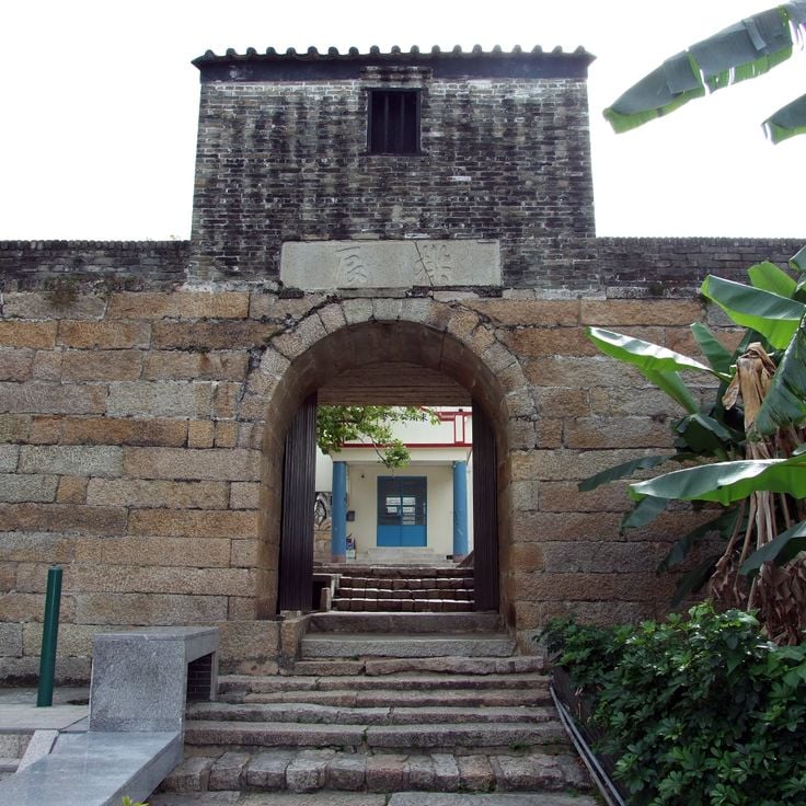
Historic structures complement the network. The Man Mo Temple from 1847 sits among multistory buildings in Sheung Wan. Ping Shan Tower in Yuen Long dates to the 18th century. The Kowloon Walled City Gardens mark the former site of a densely populated enclave. More recent facilities like the Yick Cheong Building in Quarry Bay display residential architecture from the 1960s. The Harbour Promenade in Tsim Sha Tsui runs along Victoria Harbour with direct views of the island skyline. Po Lin Monastery on Lantau stands at 1,640 feet (500 meters) elevation. The Cape D'Aguilar Marine Reserve on the Shek O Peninsula combines coastal formations with observation points. Each location shows a different aspect of Hong Kong's urban and natural environment.
Hong Kong contains numerous viewpoints that provide different perspectives on the city. From Victoria Peak at 1,810 feet (552 meters) above sea level to locations along the harbor, these sites show the interaction between urban development, water and mountain terrain. Observation points include summits such as Lion Rock and Tai Mo Shan, platforms like Sky100 at 1,289 feet (393 meters), and hiking trails such as Dragon's Back. The Lugard Road viewing area and Wilson Trail offer outlooks during short walks, while vehicles like the Ngong Ping cable car and Star Ferry provide moving vantage points.
Historic structures complement the network. The Man Mo Temple from 1847 sits among multistory buildings in Sheung Wan. Ping Shan Tower in Yuen Long dates to the 18th century. The Kowloon Walled City Gardens mark the former site of a densely populated enclave. More recent facilities like the Yick Cheong Building in Quarry Bay display residential architecture from the 1960s. The Harbour Promenade in Tsim Sha Tsui runs along Victoria Harbour with direct views of the island skyline. Po Lin Monastery on Lantau stands at 1,640 feet (500 meters) elevation. The Cape D'Aguilar Marine Reserve on the Shek O Peninsula combines coastal formations with observation points. Each location shows a different aspect of Hong Kong's urban and natural environment.
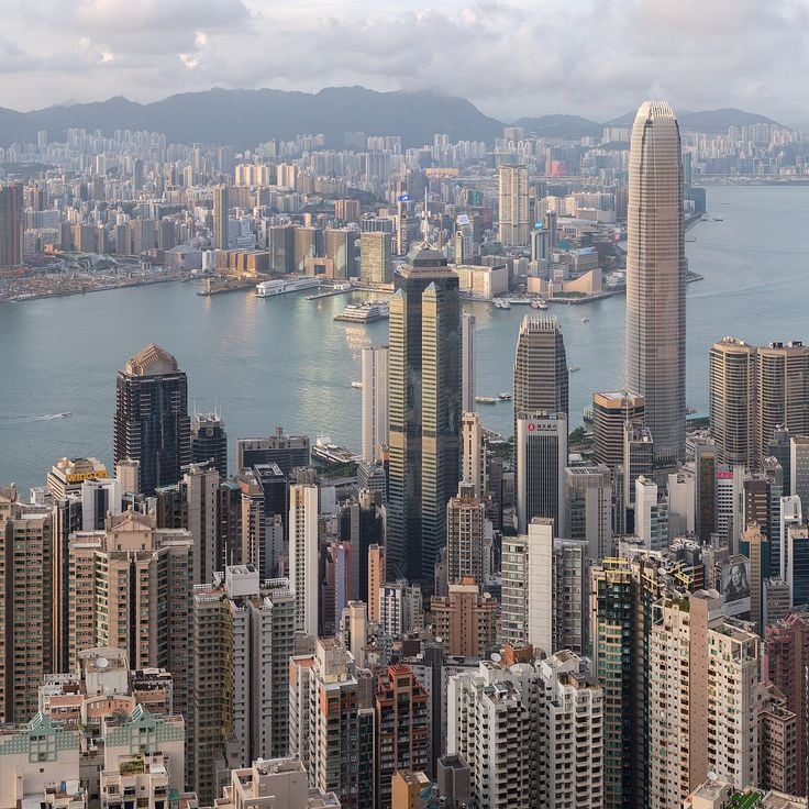
Victoria Peak is a viewpoint in this collection of Hong Kong's scenic locations. It sits at 552 meters above sea level and shows views of the city's central business district, the waters of Victoria Harbour, and the surrounding islands. From this high point, you can see how the urban development spreads across the water and mountain terrain.
The Lugard Road Lookout is one of the viewpoints showing different perspectives on Hong Kong. This lookout sits on a loop trail circling Victoria Peak and provides direct views northward toward the Central Business District and Victoria Harbour. The walking path winds through forested terrain and accesses several observation points along its route. From here the skyline of Central displays its high-rises, the harbor shows ferry traffic, and the urban spread of Hong Kong Island and Kowloon comes into view.
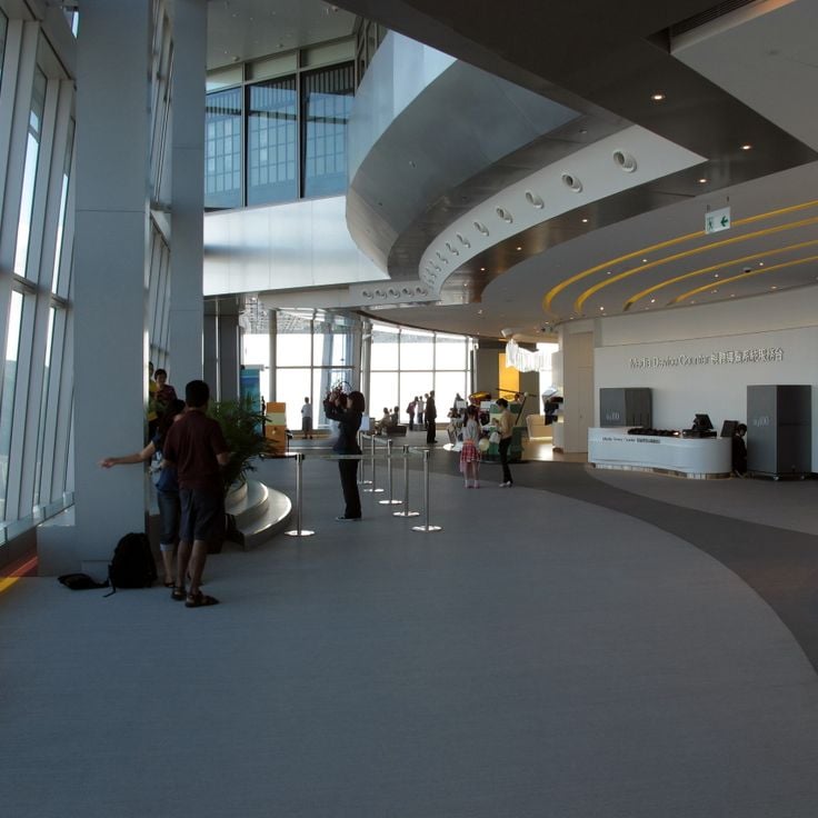
The Sky100 Observation Deck sits at 1,289 feet (393 meters) within the International Commerce Centre and gives visitors a full view of Hong Kong's densely built districts, Victoria Harbour and the surrounding hills. This enclosed platform allows you to see the scale of the vertical urban structure and understand how the city sits between water and hillsides. Information panels explain landmarks and the city's historical changes.
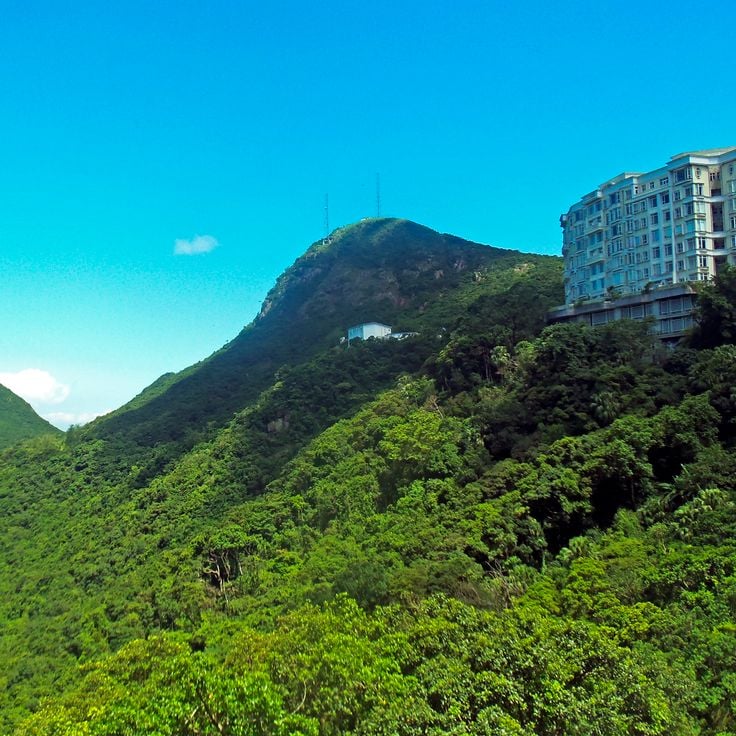
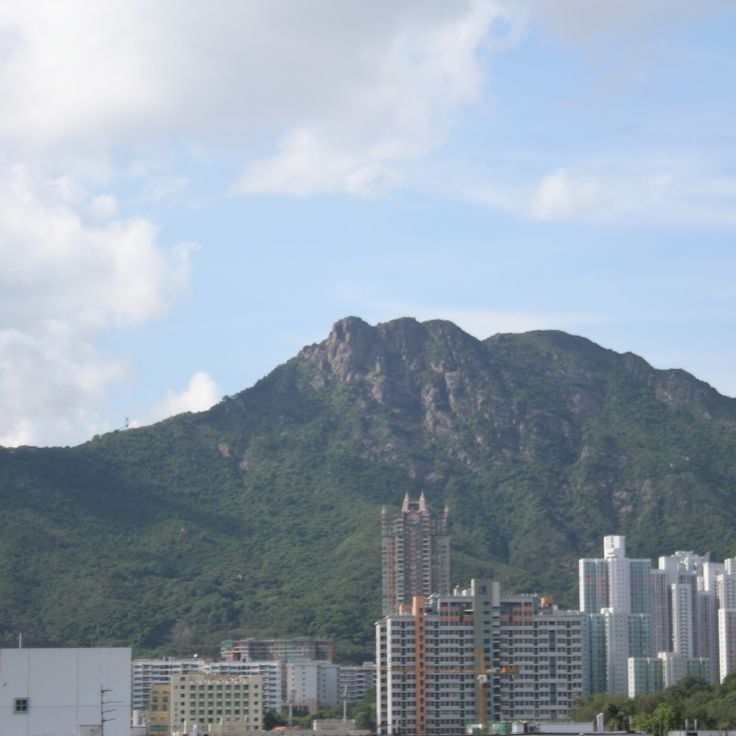
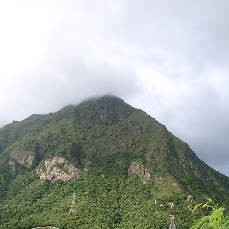
Lion Rock is a granite formation rising to 495 meters (1,620 feet) between Kowloon and the New Territories. As a viewpoint within Hong Kong's network of observation sites, its summit displays the northern and southern sections of the city. From the top, you see the densely built urban center, surrounding mountains, and Victoria Harbour. The hiking trail requires steep sections and scrambling over exposed rock near the highest point. Lion Rock has become an important symbol for Hong Kong.
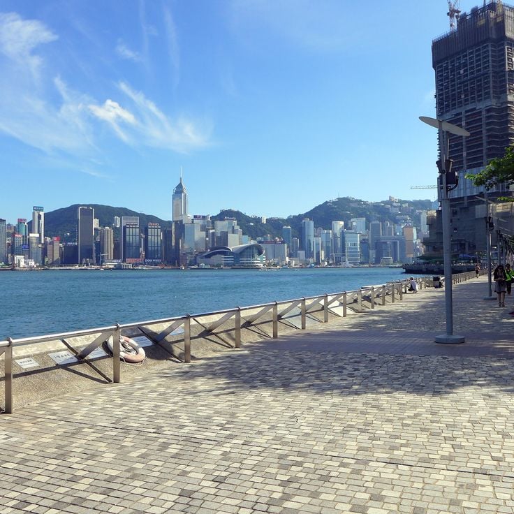
The Harbour Promenade serves as one of the collection's key viewing locations. It runs along Victoria Harbour and faces directly toward Hong Kong Island's skyline. The site allows visitors to observe how the water and tall buildings interact across the harbor. Each evening at 8 p.m., a light and laser show projects from buildings on both sides of the water, lasting about 13 minutes.
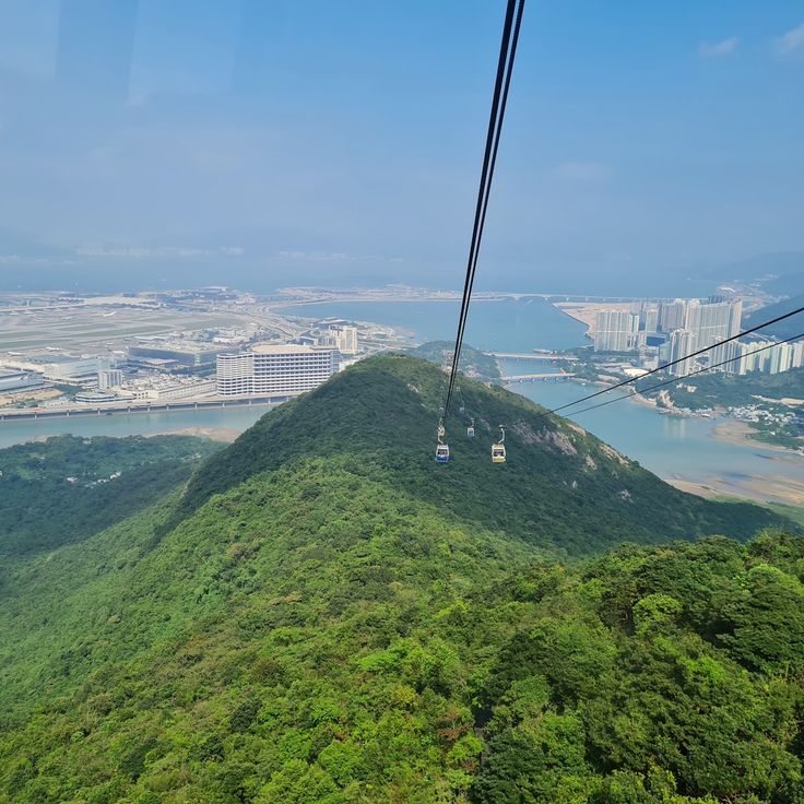
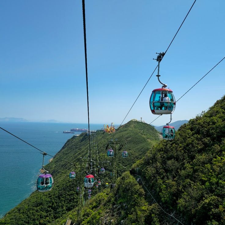
This cable car serves the collection of Hong Kong's viewpoints by connecting Tung Chung Station with the Tian Tan Buddha across terrain that spans sea level and mountains, offering views over Lantau Island throughout the journey. The ride takes about 25 minutes, and some cabins feature glass floors that allow passengers to look downward during the trip. The system opened in 2006 and carries several million passengers annually between the urban coastline and the Buddhist monastery complex.
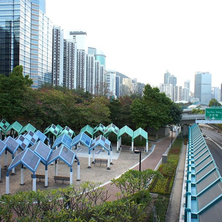
This waterfront park on Hong Kong Island provides trails with views across to the residential towers of East Kowloon and the shipping traffic moving through the harbor channels. As part of the network of Hong Kong's scenic viewpoints, Quarry Bay Park shows how the city's development meets the water, with commercial vessels passing through Victoria Harbour daily.
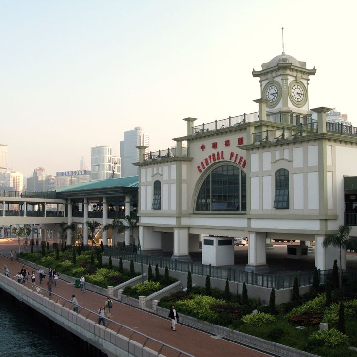
The Star Ferry is a historic ferry service that has connected Hong Kong Island to the Kowloon Peninsula since 1888. During the roughly ten-minute crossing of Victoria Harbour, the open decks of the green-and-white vessels provide views of the skyscrapers lining both shores, harbor activity and the surrounding mountains. This ferry is part of Hong Kong's network of viewpoints and allows visitors and commuters to experience the harbor from the water. Daily service between several piers offers an affordable way to see the city from a different perspective.
This cable car is part of Hong Kong's network of viewing points and connects the upper and lower sections of Ocean Park across an elevation of 205 meters (672 feet). During the journey between park zones, passengers see views of Aberdeen Harbour and the South China Sea.
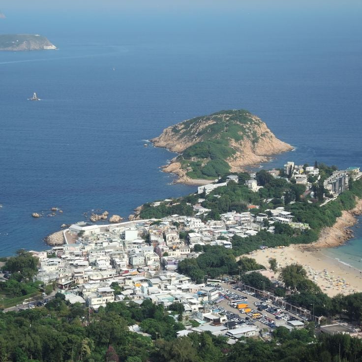
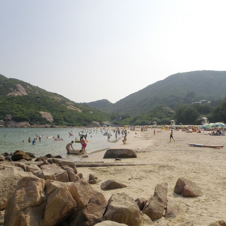
This mountain trail runs through the eastern part of Hong Kong Island, offering views of Shek O and Tai Long Wan beaches along with the South China Sea. The route follows a ridge between 266 and 284 meters in elevation, connecting Shek O Road and Big Wave Bay neighborhoods. The path forms part of the Hong Kong Trail sections and can be reached by public transport from Central in about 45 minutes. Within the collection of Hong Kong's scenic viewpoints, Dragon's Back serves as a hiking route that demonstrates the interaction between the island's coastal areas and mountain terrain.
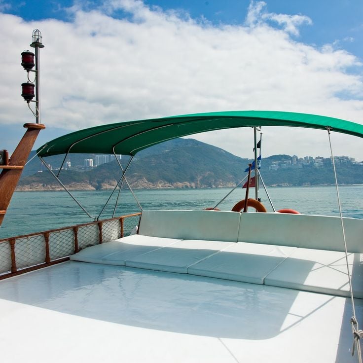
These traditional Chinese vessels navigate Victoria Harbour, offering perspectives on the coastal architecture and Hong Kong skyline from the water's surface. The journeys allow visitors to observe the urban landscape from the harbor and understand the connection between the city's maritime history and its modern development. As part of Hong Kong's network of viewing locations, the Junk Boat provides a moving vantage point that shows the interaction between urban development and water.
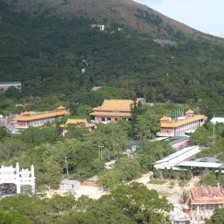
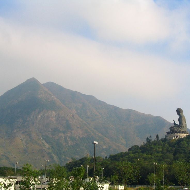
Po Lin Monastery in this collection of scenic viewpoints sits at 520 meters elevation on Lantau Island. From this location, the view stretches across forested slopes of the Lantau Peaks and the South China Sea, with Hong Kong's urban center visible in the distance. The monastery demonstrates how the natural topography of the territory's largest island transitions to coastal landscape.
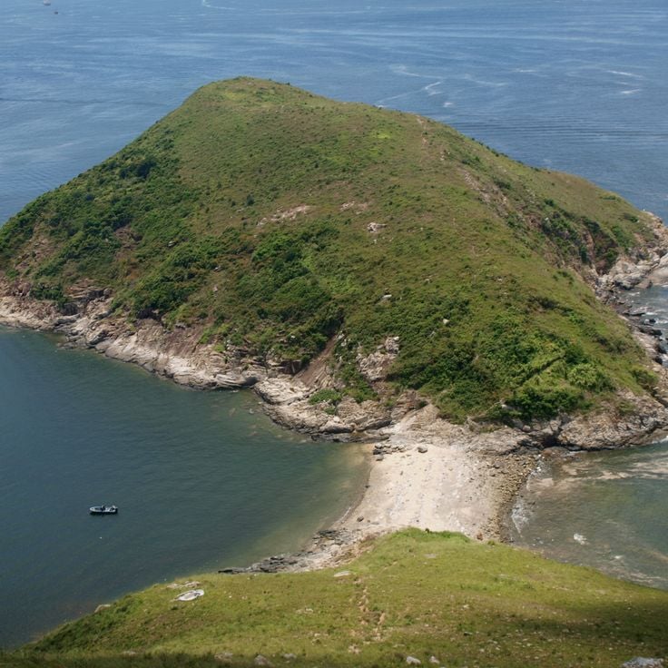
The Shek O Peninsula at the far southeast of Hong Kong Island offers, within this collection of viewing locations, perspectives across the open South China Sea, offshore islands and international shipping traffic moving between sea routes. This rocky coastal formation lies away from the high-rise districts and reveals a different character of the metropolis.
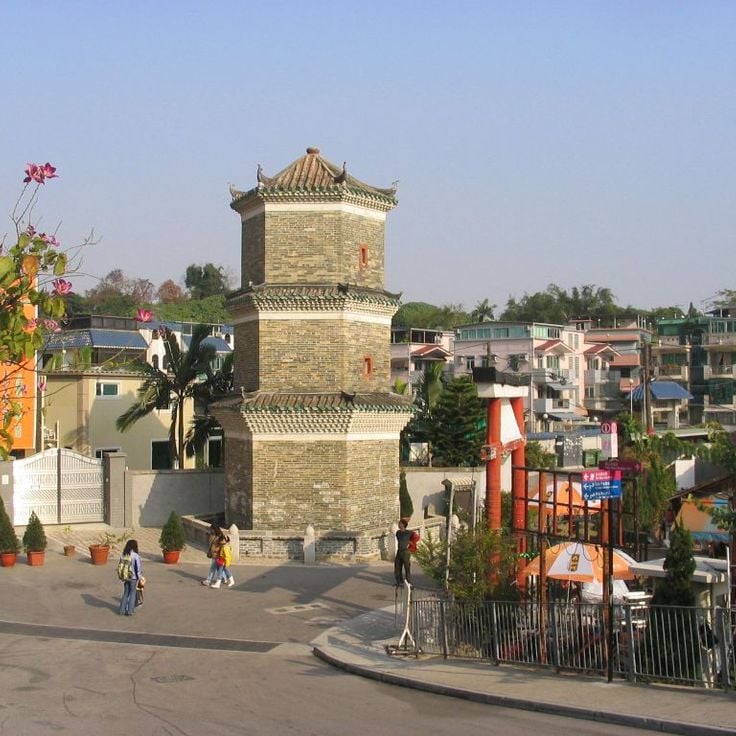
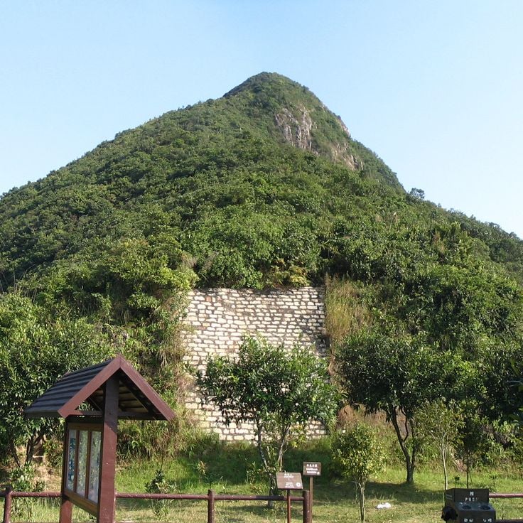
Ping Shan Tower is a three-story observation tower in Yuen Long that dates to the 18th century. From this vantage point, visitors look out over farmland in the northern New Territories and toward Shenzhen, where development continues across the border. The tower stands among other historic structures from the Tang era. As part of Hong Kong's network of viewpoints, this location shows how the city's rural areas, historic buildings, and modern growth come together.
This park stands on the site of a former fortress and provides elevated viewpoints and paths that offer views of the surrounding urban districts and residential buildings of Kowloon City. It is part of Hong Kong's network of viewpoints that show different perspectives on the city, from mountain summits to harbor promenades.
High West Summit rises to 1,620 feet (494 meters) on Hong Kong Island and provides views of Victoria Harbour, Pok Fu Lam Reservoir and Lamma Island via several hiking trails. Located west of Victoria Peak, this mountain peak offers perspectives of Hong Kong's urban development as well as the surrounding waters and offshore islands.
This park in Tsuen Wan serves the collection's purpose of showing different perspectives on Hong Kong's urban landscape. Observation trails above an artificial lake offer views of residential towers and mountain ranges to the north. The site combines green space with panoramic perspectives on Tsuen Wan's development and surrounding topography, displaying Hong Kong's contrast between dense construction and mountainous terrain.
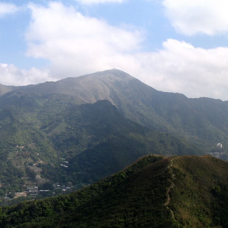
The Tai Mo Shan summit reaches 957 meters in elevation and is the highest point in Hong Kong. From this viewpoint, visitors survey the Kowloon Peninsula, the northern coastline, and Shenzhen on clear days. This summit is part of a network of observation sites that reveal the city's dense architecture and surrounding terrain from perspectives ranging from sea level to mountaintops exceeding 900 meters.
This military fort built in 1832 stands on elevated ground near Tung Chung Bay on Lantau Island. It offers views over the coastal waters and Lantau mountains. Within Hong Kong's range of viewing locations, this fort demonstrates how defensive structures from earlier centuries were positioned at strategic points to watch over the territory and its surroundings.
This concrete path connects the island to Aberdeen at 643 feet (196 meters) above sea level. From Ap Lei Pai, visitors see the South China Sea and several offshore islands, making it a quieter viewpoint in Hong Kong's southern island territory.
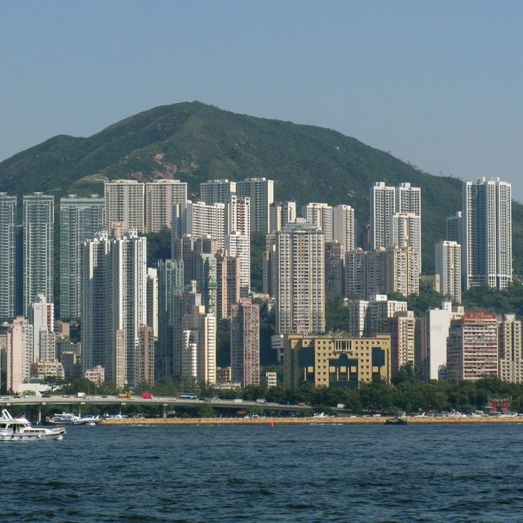
Fei Ngo Shan is a 602-meter summit that serves as one of Hong Kong's viewpoints, offering perspectives on the city's interaction between urban development, water and mountain terrain. From this peak, visitors look out over the Kowloon Peninsula, Victoria Harbour and Hong Kong Island. The outlook extends across densely built urban areas, waterways and surrounding mountain ranges.
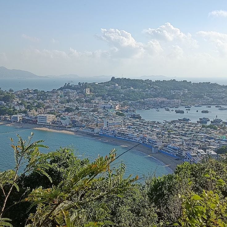
The Cheung Chau Viewpoint Pavilion is part of Hong Kong's network of viewing locations that offer different perspectives on the city and harbor. This covered structure sits on the northern section of the Mini Great Wall trail, overlooking the harbor and nearby islands. Like other observation points throughout Hong Kong, this pavilion shows how hiking trails connect visitors to places where the interaction between water, islands and developed areas becomes clear.
This viewpoint sits on a 433-meter (1,421-foot) hill and provides views across Victoria Harbour, the Causeway Bay district and the slopes of Mount Butler. Jardine's Lookout forms part of Hong Kong's elevated observation network, offering perspectives on the city's urban development and coastal geography.
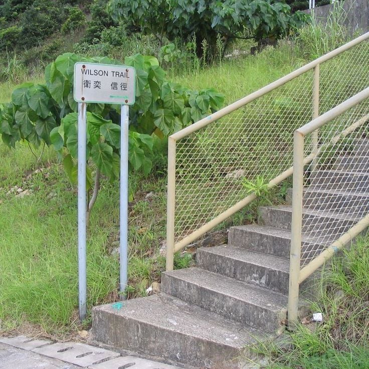
Wilson Trail Section 2 is one of the hiking routes within Hong Kong's network of scenic viewpoints. This trail passes through wooded terrain and offers views of Tai Tam Reservoir and the surrounding mountains. The route demonstrates how the city relates to its water features and mountain landscape.
The Ma On Shan Promenade is one of Hong Kong's viewpoints that shows how the city interacts with water and mountains. This waterfront path stretches along Tolo Harbour, linking Ma On Shan Park to Wu Kai Sha MTR station. Along the way, covered rest areas, benches, and viewing spots sit at regular intervals. From these points, you can look across the harbor toward the forested slopes of the surrounding hills. Local residents use this route for walking, jogging, and cycling throughout the day.
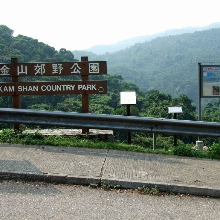
Kam Shan Country Park is one of Hong Kong's scenic viewpoints with hiking trails through forested areas where wild macaques roam freely. These animals are frequently seen along the pathways. The park's multiple peaks and wooded sections provide recreation outside the densely built urban areas. Visitors should not feed or touch the macaques, as they are wild animals that may react unpredictably.
This 934-foot (285-meter) peak on Lantau Island stands among the city's notable viewpoints. The ascent takes about two hours and typically starts before dawn, allowing hikers to witness sunrise over the South China Sea. From the summit, visitors see surrounding islands, mountains and on clear days portions of the urban area to the north.
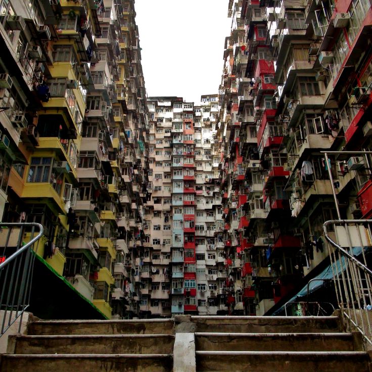
The Yick Cheong Building in Quarry Bay demonstrates the evolution of urban housing in this densely populated city. This 1960s residential complex contains forty floors of small apartments arranged in a rectangular grid of identical windows and concrete balconies. The architecture documents construction practices from a period of rapid population growth, when functional apartment blocks provided solutions to increasing housing demands. From different vantage points, the uniform facade pattern shows characteristic features of Hong Kong's postwar residential development.
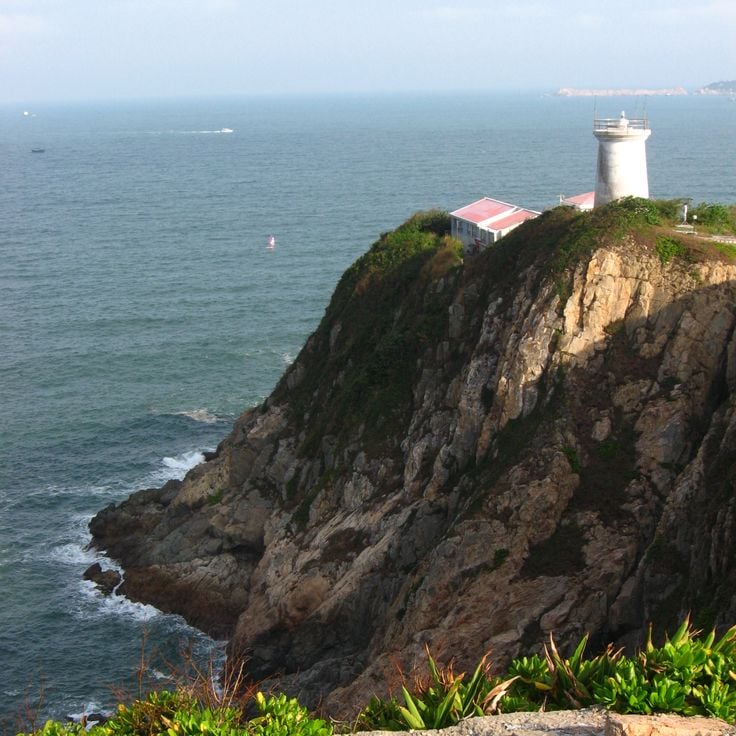
This marine reserve on the Shek O Peninsula shows Hong Kong's coastal landscape with rocky cliffs, tidal pools, and natural caves that support diverse marine life. A Victorian-era lighthouse sits on the coastal cliffs where scientists study species diversity. As part of the collection of Hong Kong's viewpoints, this reserve offers a perspective on how coastal formations and ocean life interact.
Victoria Peak is a viewpoint in this collection of Hong Kong's scenic locations. It sits at 552 meters above sea level and shows views of the city's central business district, the waters of Victoria Harbour, and the surrounding islands. From this high point, you can see how the urban development spreads across the water and mountain terrain.
The Lugard Road Lookout is one of the viewpoints showing different perspectives on Hong Kong. This lookout sits on a loop trail circling Victoria Peak and provides direct views northward toward the Central Business District and Victoria Harbour. The walking path winds through forested terrain and accesses several observation points along its route. From here the skyline of Central displays its high-rises, the harbor shows ferry traffic, and the urban spread of Hong Kong Island and Kowloon comes into view.
The Sky100 Observation Deck sits at 1,289 feet (393 meters) within the International Commerce Centre and gives visitors a full view of Hong Kong's densely built districts, Victoria Harbour and the surrounding hills. This enclosed platform allows you to see the scale of the vertical urban structure and understand how the city sits between water and hillsides. Information panels explain landmarks and the city's historical changes.
Lion Rock is a granite formation rising to 495 meters (1,620 feet) between Kowloon and the New Territories. As a viewpoint within Hong Kong's network of observation sites, its summit displays the northern and southern sections of the city. From the top, you see the densely built urban center, surrounding mountains, and Victoria Harbour. The hiking trail requires steep sections and scrambling over exposed rock near the highest point. Lion Rock has become an important symbol for Hong Kong.
The Harbour Promenade serves as one of the collection's key viewing locations. It runs along Victoria Harbour and faces directly toward Hong Kong Island's skyline. The site allows visitors to observe how the water and tall buildings interact across the harbor. Each evening at 8 p.m., a light and laser show projects from buildings on both sides of the water, lasting about 13 minutes.
This cable car serves the collection of Hong Kong's viewpoints by connecting Tung Chung Station with the Tian Tan Buddha across terrain that spans sea level and mountains, offering views over Lantau Island throughout the journey. The ride takes about 25 minutes, and some cabins feature glass floors that allow passengers to look downward during the trip. The system opened in 2006 and carries several million passengers annually between the urban coastline and the Buddhist monastery complex.
This waterfront park on Hong Kong Island provides trails with views across to the residential towers of East Kowloon and the shipping traffic moving through the harbor channels. As part of the network of Hong Kong's scenic viewpoints, Quarry Bay Park shows how the city's development meets the water, with commercial vessels passing through Victoria Harbour daily.
The Star Ferry is a historic ferry service that has connected Hong Kong Island to the Kowloon Peninsula since 1888. During the roughly ten-minute crossing of Victoria Harbour, the open decks of the green-and-white vessels provide views of the skyscrapers lining both shores, harbor activity and the surrounding mountains. This ferry is part of Hong Kong's network of viewpoints and allows visitors and commuters to experience the harbor from the water. Daily service between several piers offers an affordable way to see the city from a different perspective.
This cable car is part of Hong Kong's network of viewing points and connects the upper and lower sections of Ocean Park across an elevation of 205 meters (672 feet). During the journey between park zones, passengers see views of Aberdeen Harbour and the South China Sea.
This mountain trail runs through the eastern part of Hong Kong Island, offering views of Shek O and Tai Long Wan beaches along with the South China Sea. The route follows a ridge between 266 and 284 meters in elevation, connecting Shek O Road and Big Wave Bay neighborhoods. The path forms part of the Hong Kong Trail sections and can be reached by public transport from Central in about 45 minutes. Within the collection of Hong Kong's scenic viewpoints, Dragon's Back serves as a hiking route that demonstrates the interaction between the island's coastal areas and mountain terrain.
These traditional Chinese vessels navigate Victoria Harbour, offering perspectives on the coastal architecture and Hong Kong skyline from the water's surface. The journeys allow visitors to observe the urban landscape from the harbor and understand the connection between the city's maritime history and its modern development. As part of Hong Kong's network of viewing locations, the Junk Boat provides a moving vantage point that shows the interaction between urban development and water.
Po Lin Monastery in this collection of scenic viewpoints sits at 520 meters elevation on Lantau Island. From this location, the view stretches across forested slopes of the Lantau Peaks and the South China Sea, with Hong Kong's urban center visible in the distance. The monastery demonstrates how the natural topography of the territory's largest island transitions to coastal landscape.
The Shek O Peninsula at the far southeast of Hong Kong Island offers, within this collection of viewing locations, perspectives across the open South China Sea, offshore islands and international shipping traffic moving between sea routes. This rocky coastal formation lies away from the high-rise districts and reveals a different character of the metropolis.
Ping Shan Tower is a three-story observation tower in Yuen Long that dates to the 18th century. From this vantage point, visitors look out over farmland in the northern New Territories and toward Shenzhen, where development continues across the border. The tower stands among other historic structures from the Tang era. As part of Hong Kong's network of viewpoints, this location shows how the city's rural areas, historic buildings, and modern growth come together.
This park stands on the site of a former fortress and provides elevated viewpoints and paths that offer views of the surrounding urban districts and residential buildings of Kowloon City. It is part of Hong Kong's network of viewpoints that show different perspectives on the city, from mountain summits to harbor promenades.
High West Summit rises to 1,620 feet (494 meters) on Hong Kong Island and provides views of Victoria Harbour, Pok Fu Lam Reservoir and Lamma Island via several hiking trails. Located west of Victoria Peak, this mountain peak offers perspectives of Hong Kong's urban development as well as the surrounding waters and offshore islands.
This park in Tsuen Wan serves the collection's purpose of showing different perspectives on Hong Kong's urban landscape. Observation trails above an artificial lake offer views of residential towers and mountain ranges to the north. The site combines green space with panoramic perspectives on Tsuen Wan's development and surrounding topography, displaying Hong Kong's contrast between dense construction and mountainous terrain.
The Tai Mo Shan summit reaches 957 meters in elevation and is the highest point in Hong Kong. From this viewpoint, visitors survey the Kowloon Peninsula, the northern coastline, and Shenzhen on clear days. This summit is part of a network of observation sites that reveal the city's dense architecture and surrounding terrain from perspectives ranging from sea level to mountaintops exceeding 900 meters.
This military fort built in 1832 stands on elevated ground near Tung Chung Bay on Lantau Island. It offers views over the coastal waters and Lantau mountains. Within Hong Kong's range of viewing locations, this fort demonstrates how defensive structures from earlier centuries were positioned at strategic points to watch over the territory and its surroundings.
This concrete path connects the island to Aberdeen at 643 feet (196 meters) above sea level. From Ap Lei Pai, visitors see the South China Sea and several offshore islands, making it a quieter viewpoint in Hong Kong's southern island territory.
Fei Ngo Shan is a 602-meter summit that serves as one of Hong Kong's viewpoints, offering perspectives on the city's interaction between urban development, water and mountain terrain. From this peak, visitors look out over the Kowloon Peninsula, Victoria Harbour and Hong Kong Island. The outlook extends across densely built urban areas, waterways and surrounding mountain ranges.
The Cheung Chau Viewpoint Pavilion is part of Hong Kong's network of viewing locations that offer different perspectives on the city and harbor. This covered structure sits on the northern section of the Mini Great Wall trail, overlooking the harbor and nearby islands. Like other observation points throughout Hong Kong, this pavilion shows how hiking trails connect visitors to places where the interaction between water, islands and developed areas becomes clear.
This viewpoint sits on a 433-meter (1,421-foot) hill and provides views across Victoria Harbour, the Causeway Bay district and the slopes of Mount Butler. Jardine's Lookout forms part of Hong Kong's elevated observation network, offering perspectives on the city's urban development and coastal geography.
Wilson Trail Section 2 is one of the hiking routes within Hong Kong's network of scenic viewpoints. This trail passes through wooded terrain and offers views of Tai Tam Reservoir and the surrounding mountains. The route demonstrates how the city relates to its water features and mountain landscape.
The Ma On Shan Promenade is one of Hong Kong's viewpoints that shows how the city interacts with water and mountains. This waterfront path stretches along Tolo Harbour, linking Ma On Shan Park to Wu Kai Sha MTR station. Along the way, covered rest areas, benches, and viewing spots sit at regular intervals. From these points, you can look across the harbor toward the forested slopes of the surrounding hills. Local residents use this route for walking, jogging, and cycling throughout the day.
Kam Shan Country Park is one of Hong Kong's scenic viewpoints with hiking trails through forested areas where wild macaques roam freely. These animals are frequently seen along the pathways. The park's multiple peaks and wooded sections provide recreation outside the densely built urban areas. Visitors should not feed or touch the macaques, as they are wild animals that may react unpredictably.
This 934-foot (285-meter) peak on Lantau Island stands among the city's notable viewpoints. The ascent takes about two hours and typically starts before dawn, allowing hikers to witness sunrise over the South China Sea. From the summit, visitors see surrounding islands, mountains and on clear days portions of the urban area to the north.
The Yick Cheong Building in Quarry Bay demonstrates the evolution of urban housing in this densely populated city. This 1960s residential complex contains forty floors of small apartments arranged in a rectangular grid of identical windows and concrete balconies. The architecture documents construction practices from a period of rapid population growth, when functional apartment blocks provided solutions to increasing housing demands. From different vantage points, the uniform facade pattern shows characteristic features of Hong Kong's postwar residential development.
This marine reserve on the Shek O Peninsula shows Hong Kong's coastal landscape with rocky cliffs, tidal pools, and natural caves that support diverse marine life. A Victorian-era lighthouse sits on the coastal cliffs where scientists study species diversity. As part of the collection of Hong Kong's viewpoints, this reserve offers a perspective on how coastal formations and ocean life interact.