Kowloon Peak, Mountain peak in Sai Kung District, Hong Kong.
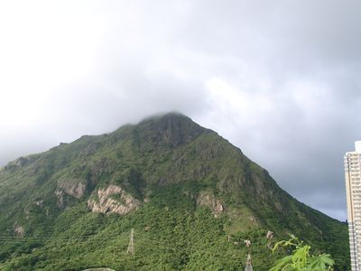
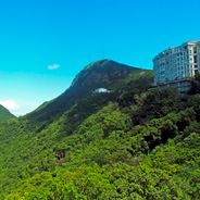
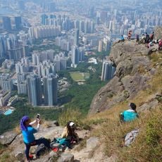
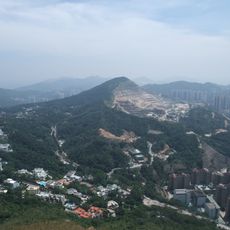
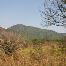
Kowloon Peak is a mountain rising 602 meters between Wong Tai Sin and Sai Kung districts in Hong Kong. Its terrain features steep slopes and exposed rock walls, particularly along the southern ridge.
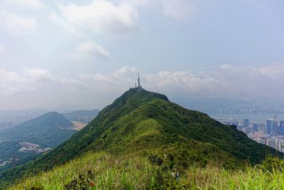
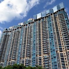
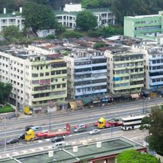
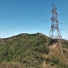
The mountain became part of the Ma On Shan Country Park system, which led to the creation of maintained hiking trails and viewpoints. This incorporation made the area more accessible for walkers.
Local people call this mountain Fei Ngo Shan, meaning Soaring Goose Mountain, a name inspired by its distinctive silhouette. The name shows how the community sees this landform as part of their surroundings.
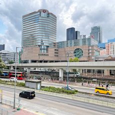
You can reach the peak by taxi from Choi Hung MTR station or by hiking trails starting from Jat's Incline and Fei Ngo Shan Road. Some sections are steep, so wear proper footwear.
One section is known as Suicide Cliff, where the south-facing slope drops sharply and offers views across Kowloon Peninsula. This dramatic spot is known among experienced hikers.
Location: Hong Kong
Location: Sai Kung District
Location: Wong Tai Sin District
Elevation above the sea: 602 m
GPS coordinates: 22.33642,114.22893
Latest update: December 6, 2025 16:01
Hong Kong contains numerous viewpoints that provide different perspectives on the city. From Victoria Peak at 1,810 feet (552 meters) above sea level to locations along the harbor, these sites show the interaction between urban development, water and mountain terrain. Observation points include summits such as Lion Rock and Tai Mo Shan, platforms like Sky100 at 1,289 feet (393 meters), and hiking trails such as Dragon's Back. The Lugard Road viewing area and Wilson Trail offer outlooks during short walks, while vehicles like the Ngong Ping cable car and Star Ferry provide moving vantage points. Historic structures complement the network. The Man Mo Temple from 1847 sits among multistory buildings in Sheung Wan. Ping Shan Tower in Yuen Long dates to the 18th century. The Kowloon Walled City Gardens mark the former site of a densely populated enclave. More recent facilities like the Yick Cheong Building in Quarry Bay display residential architecture from the 1960s. The Harbour Promenade in Tsim Sha Tsui runs along Victoria Harbour with direct views of the island skyline. Po Lin Monastery on Lantau stands at 1,640 feet (500 meters) elevation. The Cape D'Aguilar Marine Reserve on the Shek O Peninsula combines coastal formations with observation points. Each location shows a different aspect of Hong Kong's urban and natural environment.
Chi Lin Nunnery
2.5 km
Nan Lian Garden
2.5 km
Po Kong Village Road Park
2.5 km
Ngau Chi Wan Park
1.6 km
Aria
1.6 km
Suicide Cliff
638 m
Diamond Hill Columbarium
2.4 km
Anderson Road Quarry
1.5 km
MTR Headquarters Building
2.3 km
St. Joseph's Home for the Aged
1.9 km
Kowloon Bay Park
2.2 km
Kai Tak Mansion
2 km
Amoycan Industrial Centre
1.9 km
The Bay Hub
2.6 km
Sau Mau Ping Shopping Centre
1.9 km
彩德商場
1.8 km
Kwun Tong Government Offices
2.6 km
Jordan Valley Reservoir
1.3 km
Hammer Hill Park
2.4 km
Sau Mau Ping Memorial Park
2.1 km
China Construction Bank Centre
2.5 km
Razor Hill
2.4 km
Tung Shan
1.9 km
Sam Shan Kwok Wong Temple
2.1 km
Tai Sing Fat Tong
2.1 km
Bun Ha Tung
2.1 km
Tai Wong Ye Temple (Tsui Ping Estate)
2.6 km
Ngau Tau Kok Public Library
2.2 kmReviews
Visited this place? Tap the stars to rate it and share your experience / photos with the community! Try now! You can cancel it anytime.
Discover hidden gems everywhere you go!
From secret cafés to breathtaking viewpoints, skip the crowded tourist spots and find places that match your style. Our app makes it easy with voice search, smart filtering, route optimization, and insider tips from travelers worldwide. Download now for the complete mobile experience.
A unique approach to discovering new places❞
— Le Figaro
All the places worth exploring❞
— France Info
A tailor-made excursion in just a few clicks❞
— 20 Minutes