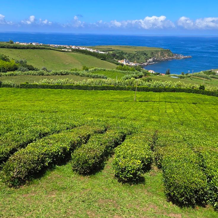
The Azores archipelago stretches about 1500 kilometers off the coast of Portugal in the Atlantic Ocean. The nine islands were born through volcanic activity, creating a land of unusual sights: craters turned into lakes, hot springs bubbling from the ground, caves formed naturally in the rocks, and gardens where plants grow around geothermal pools. São Miguel is the largest island and has many of these features. You can visit the Terra Nostra Park in Furnas with its hot baths at 39 degrees Celsius, the Fogo Lake sitting at 575 meters above sea level, and the Gorreana tea plantation that has been operating since 1883.
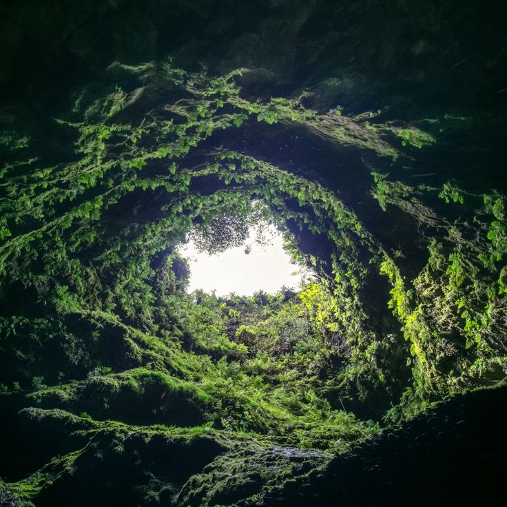
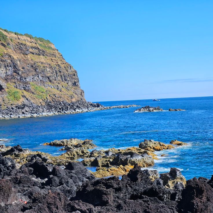
Across the islands, you will see interesting rock formations. The Algar do Carvão on Terceira is a cave that goes down 90 meters underground. The little Vila Franca do Campo is an old crater turned into a small bay. The vineyards on Pico Island are on the UNESCO World Heritage list. They show how people have learned to grow grapes on rocky ground. In addition to nature, the historic centers tell stories from the past: old churches and buildings from the 1500s still stand, especially in Angra do Heroísmo on Terceira, where you can walk through streets with a long history.
The Azores archipelago stretches about 1500 kilometers off the coast of Portugal in the Atlantic Ocean. The nine islands were born through volcanic activity, creating a land of unusual sights: craters turned into lakes, hot springs bubbling from the ground, caves formed naturally in the rocks, and gardens where plants grow around geothermal pools. São Miguel is the largest island and has many of these features. You can visit the Terra Nostra Park in Furnas with its hot baths at 39 degrees Celsius, the Fogo Lake sitting at 575 meters above sea level, and the Gorreana tea plantation that has been operating since 1883.
Across the islands, you will see interesting rock formations. The Algar do Carvão on Terceira is a cave that goes down 90 meters underground. The little Vila Franca do Campo is an old crater turned into a small bay. The vineyards on Pico Island are on the UNESCO World Heritage list. They show how people have learned to grow grapes on rocky ground. In addition to nature, the historic centers tell stories from the past: old churches and buildings from the 1500s still stand, especially in Angra do Heroísmo on Terceira, where you can walk through streets with a long history.
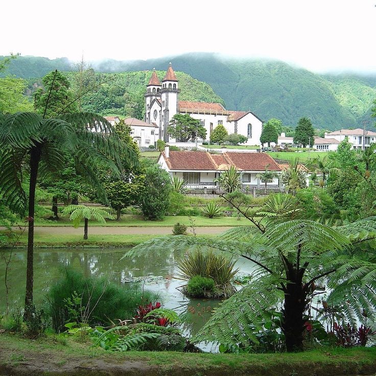
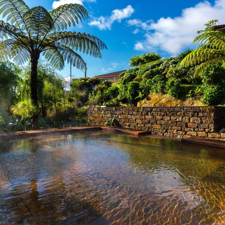
Parque Terra Nostra in Furnas is a botanical garden with roots going back centuries. It spreads across 12 hectares and holds over 2000 tree species from five continents, including rare plants native to the Azores and a large collection of camellias. The park's main feature is a large thermal pool fed by geothermal springs, where iron-rich water stays at a constant 39 degrees Celsius. The garden was created at the end of the 18th century and expanded between 1850 and 1870 with plants brought from Australia, New Zealand, and South Africa. Walking through the park, you pass subtropical vegetation, ferns, and tree ferns that thrive in the region's humid climate.
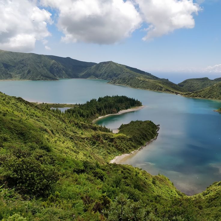
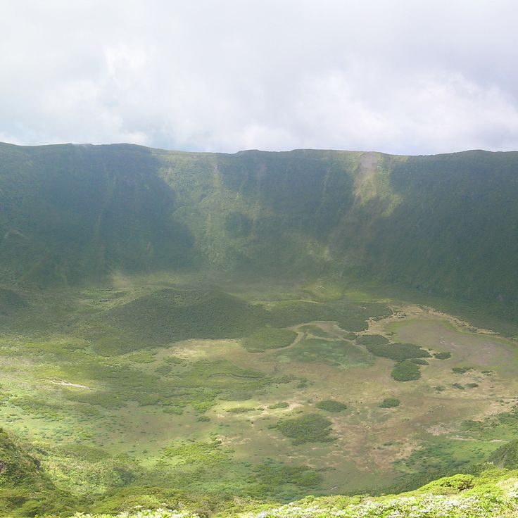
Lagoa do Fogo lies at the center of São Miguel island at 575 meters (1,886 feet) elevation within a crater whose last eruption was in 1563. The lake is edged by white volcanic sand beaches along certain shoreline sections, while the surrounding slopes support protected native vegetation. A paved road from the southern coast leads to the crater rim, where trails descend to the water.
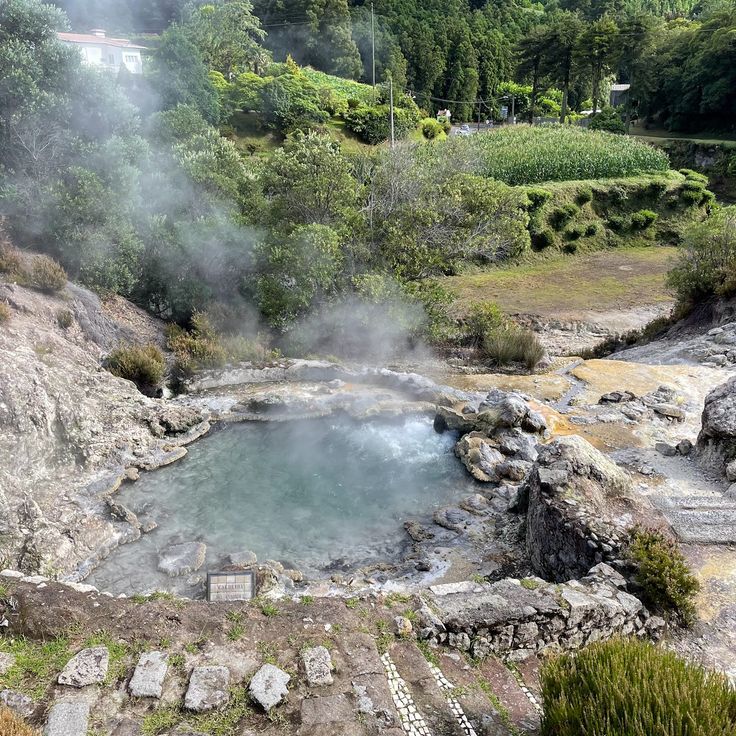
Caldeira das Furnas is a volcanic depression on the eastern side of São Miguel in the Azores. Geothermal springs and steam vents mark the landscape here. Local people have used this place for generations to cook the traditional dish called Cozido. They dig pots filled with meat, vegetables, and sausage deep into the warm ground and leave them for hours. The heat comes from below the surface, powered by the island's volcanic activity. Several public areas let visitors see the steam rising from the earth and watch mineral deposits build up around the spots where hot water and gases escape.
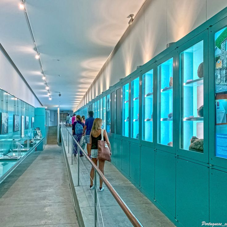
Algar do Carvão is an ancient lava tube that descends 90 meters into the rock. Inside, visitors see colorful rock layers, silica formations, and an underground lake. This cave reveals the volcanic history of Terceira island and shows how the geological forces that shaped the Azores are still visible beneath the surface.
Poça da Dona Beija at Furnas is a collection of five open-air pools fed by natural iron-rich springs. The water reaches 39 degrees Celsius and comes from volcanic activity beneath São Miguel. The pools are bordered by stone walls and separated by vegetation. The iron-laden water leaves characteristic orange-brown deposits along the pool edges. The facility sits in Furnas' thermal zone, where several geothermal springs emerge at the surface, and is open daily.
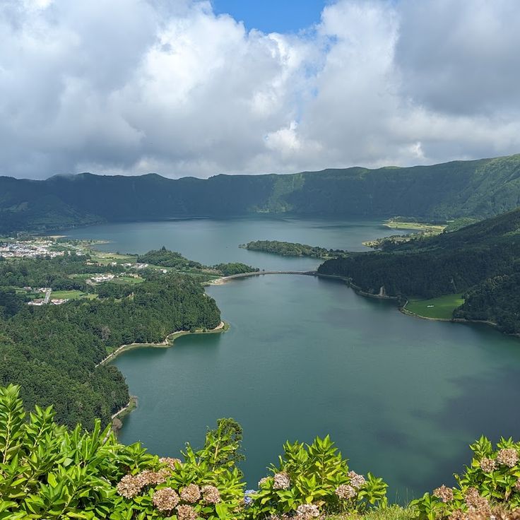
This viewpoint on São Miguel sits on a mountain ridge at 1000 meters high. From here you can see the Sete Cidades lake and the volcanic craters of the region. These geological formations are typical of the Azores, where the archipelago was created by volcanic activity.
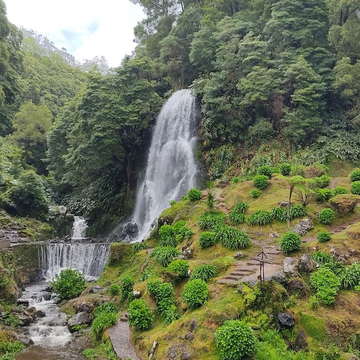
This park in the northeast of São Miguel features five restored water mills from the 19th century arranged along a river, showing the agricultural past of the Azores. A trail winds through the vegetation to a waterfall that drops 40 meters (131 feet). The site combines geological elements of volcanic origin with the historical use of water power.
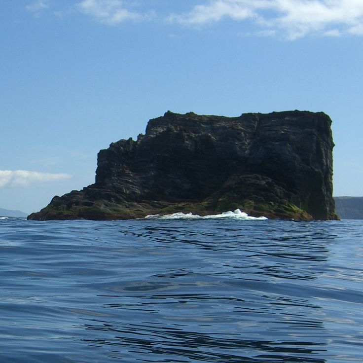
This islet at Vila Franca do Campo is the result of a partially sunken volcanic crater that has formed a natural lagoon a few hundred meters off the southern coast of São Miguel. You can reach it only by boat. A circular basin about 150 meters in diameter is surrounded by rock walls rising about 15 meters high. Swimming in the lagoon is possible during the summer months when conditions allow.
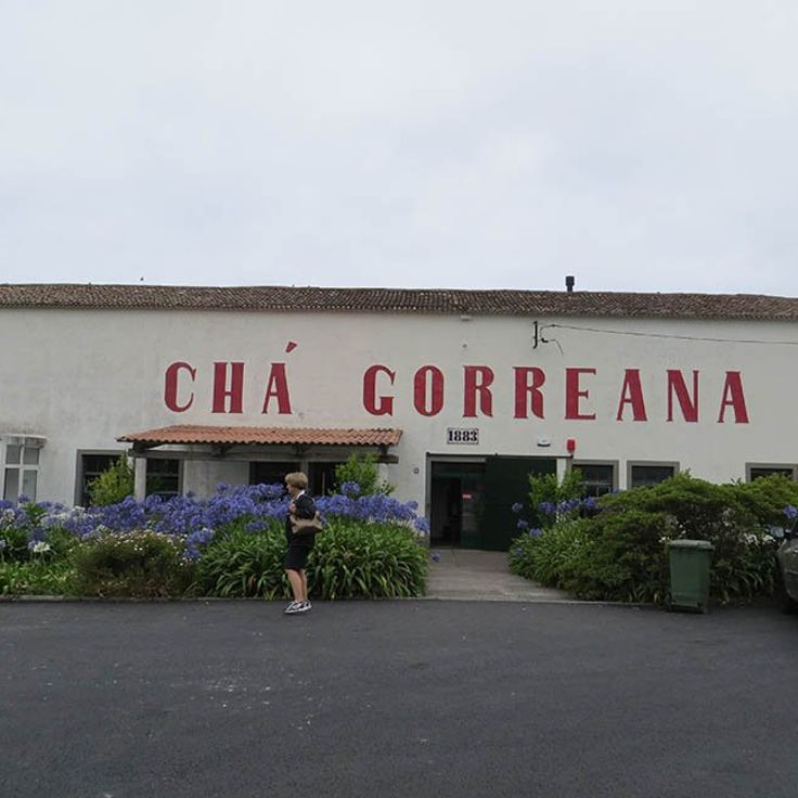
The Gorreana tea plantation sits on the north coast of São Miguel and has been producing tea since 1883. It uses machines from the late 1800s to process black and green tea grown on volcanic soil. The fields spread across terraced slopes overlooking the Atlantic. Visitors can walk through the processing facilities where leaves are fermented, dried, and packed using traditional methods.
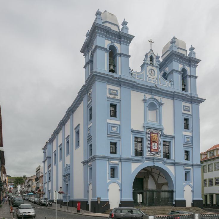
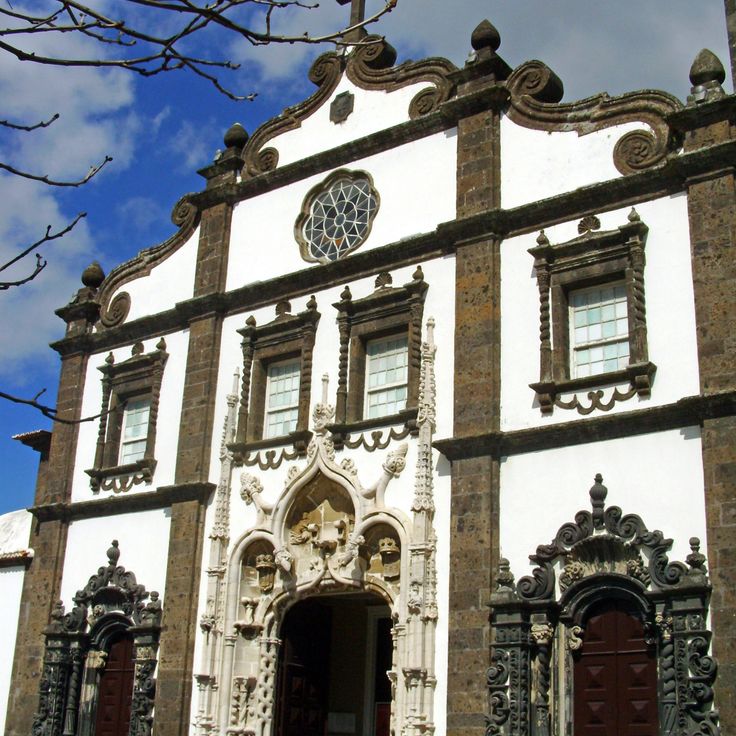
This church dates from the 16th century and stands in the historic center of Angra do Heroísmo on the island of Terceira. The church is part of a neighborhood that has been a UNESCO World Heritage site since 1983. On its facade, you can see decorative details in the Baroque style that are typical of religious architecture in the Azores. You can observe here the traces of a time when the Azores were an important port for ships traveling between Europe and America.
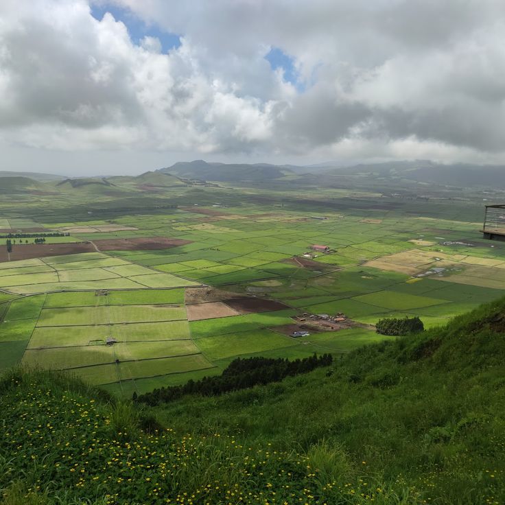
Serra do Cume on the island of Terceira sits at 545 meters (1,785 feet) in elevation. From this viewpoint, you look down at fields divided by walls of volcanic stone into rectangular plots. The stone walls create a regular pattern across the coastal plain. This location shows how people have organized and farmed their land for generations. A paved road climbs up from the main route between Praia da Vitória and Angra do Heroísmo.
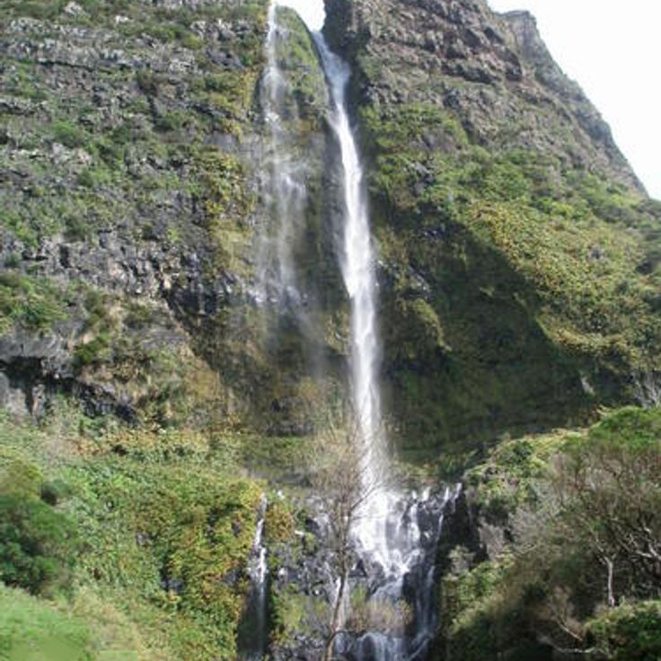
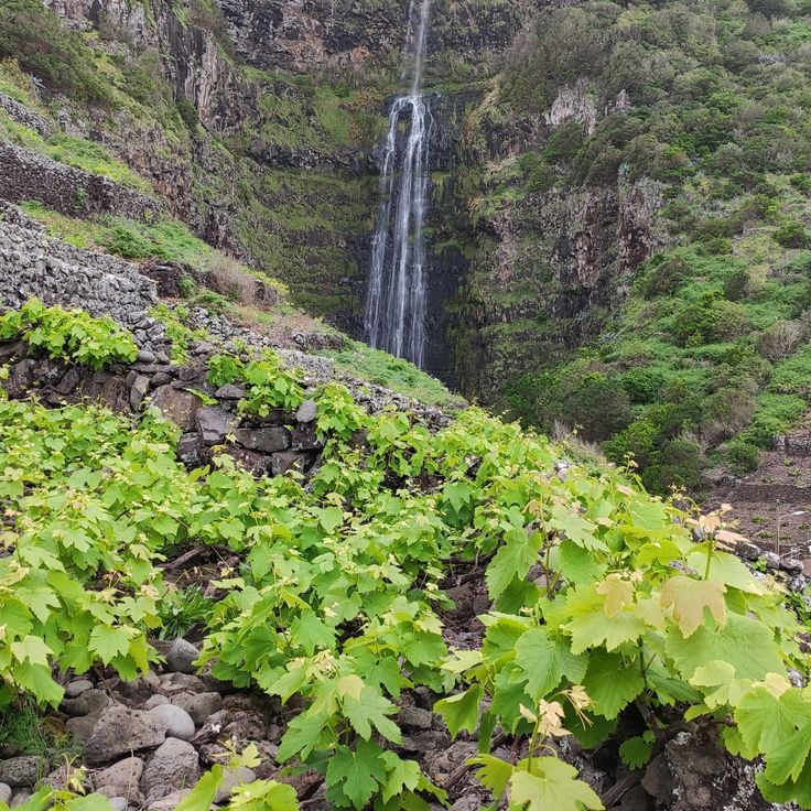
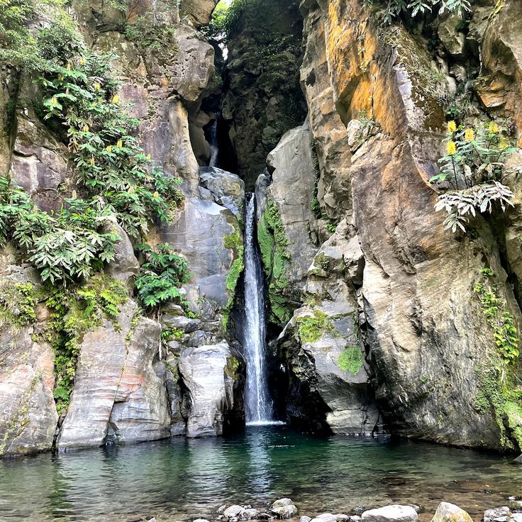
This waterfall on the island of Flores drops 90 meters into a natural pool where swimming is possible. A network of trails leads to several viewpoints and provides access to both the upper and lower sections of the fall, which cuts through the island's volcanic rock. The Cascade de Poço do Bacalhau displays the geological forces that shaped the Azores and offers visitors a chance to experience the archipelago's nature firsthand.
Capelinhos Volcano is a volcanic formation that emerged from the Atlantic Ocean after an eruption in 1958. The eruption created a new peninsula on the western coast of Faial and shaped the landscape that visitors see today. This site shows how the volcanic forces that built the Azores archipelago are still active and continue to transform the islands.
The Caldeira do Cabeço Gordo sits at the center of Faial island, rising 1043 meters high. This crater spans two kilometers across and drops 400 meters deep. The volcanic formation reveals how the island took shape through powerful eruptions. A marked trail runs along the crater's edge and offers several viewpoints overlooking the crater's interior slopes and the surrounding island landscape.
Porto Formoso tea plantation was founded in 1920 on the island of São Miguel and produces black and green tea using traditional methods. Visitors can discover the historic processing machines and taste different varieties grown in the surrounding fields. This plantation shows how the Azores have kept their agricultural traditions alive, fitting into an island shaped by volcanic activity and geothermal springs.
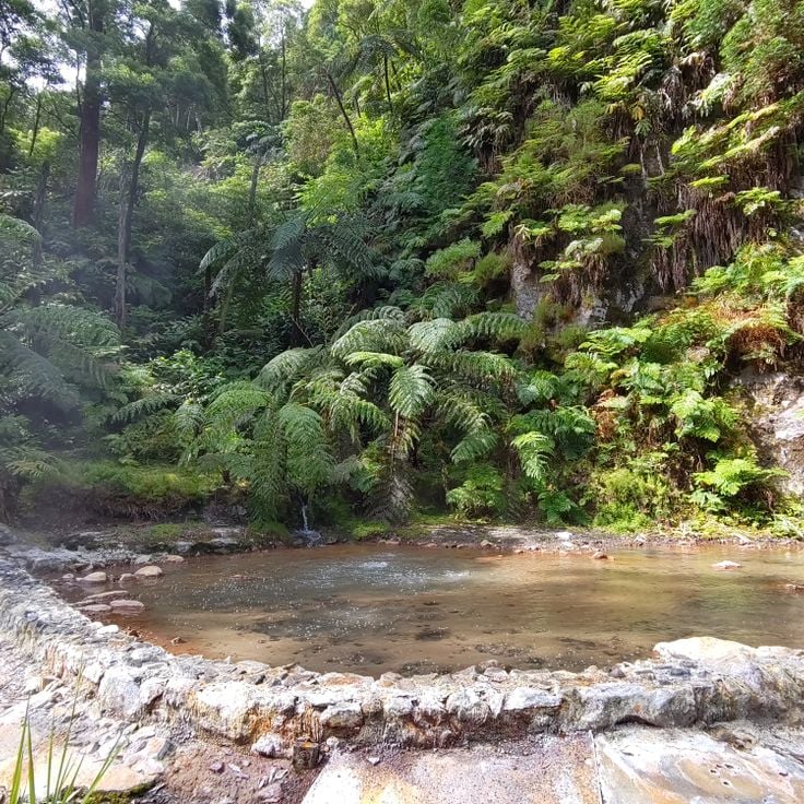
Caldeira Velha is a geothermal spring located in the volcanic zone of São Miguel. It feeds a thermal pool and a waterfall with iron-rich waters that maintain a steady temperature of about 38 degrees. The site reveals the volcanic heritage of the Azores.
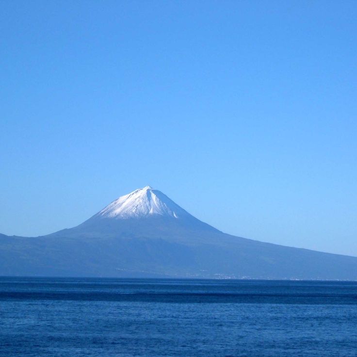
Ponta do Pico stands at 2,351 meters (7,713 feet) and is the highest mountain in Portugal. This volcanic cone formed on an extinct volcano and dominates the landscape of the island that bears its name in the archipelago. The climb passes through different vegetation zones and can be demanding depending on weather conditions, as fog and wind are frequent. From the summit, you see the surrounding islands and the Atlantic Ocean. The geological features of this peak show the volcanic origins of the Azores, where eruptions shaped the island territory over thousands of years.
The Aveiro waterfall on the island of Santa Maria is part of the natural landscape of the Azores archipelago. With a drop of 40 meters, the water cascades into a small pool below. A marked hiking trail of about 500 meters connects the main road to the base of the waterfall. The surrounding area features dense vegetation characteristic of the Azores climate. The path has a moderate slope and is easy to walk.
Built in the 16th century, this church stands in Ponta Delgada with a baroque facade carved from dark basalt stone. Inside, a gilded wooden altar catches the light and speaks to the craftsmanship of that era. The building is a clear example of how religious architecture took shape across the Azores.
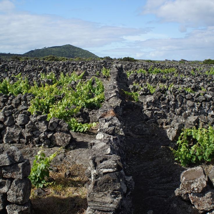
The vineyards of Pico spread across volcanic fields with low stone walls made from black volcanic rock, protecting the vines from wind and salt spray. This cultivation method emerged in the 15th century and made possible the production of Verdelho wine, exported to Europe and the Americas until the 19th century. The vineyards sit between the coast and roughly 400 meters in elevation. UNESCO recognized the site as a World Heritage site in 2004, acknowledging how the inhabitants adapted to the volcanic setting and maintained traditional farming techniques developed over five centuries.
This viewpoint at Miradouro da Vista do Rei sits at 550 meters (1,800 feet) high and looks out over the two crater lakes of Sete Cidades and the volcanic mountains around them. These are some of the most remarkable geological formations in the Azores. The two lakes formed from volcanic activity and now create a striking natural sight. On clear days, you can see the entire landscape spread before you, with the water showing different shades across the basins.
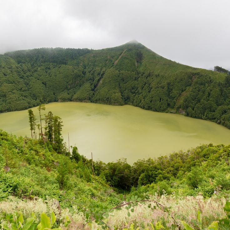
Lagoa de Santiago is a volcanic lake that fills a crater near the Sete Cidades massif on the island of São Miguel. The crater walls are covered with vegetation and several trails lead down to the lake's edge. This lake is one of many crater lakes in the region that reveal the geological heritage of the Azores.
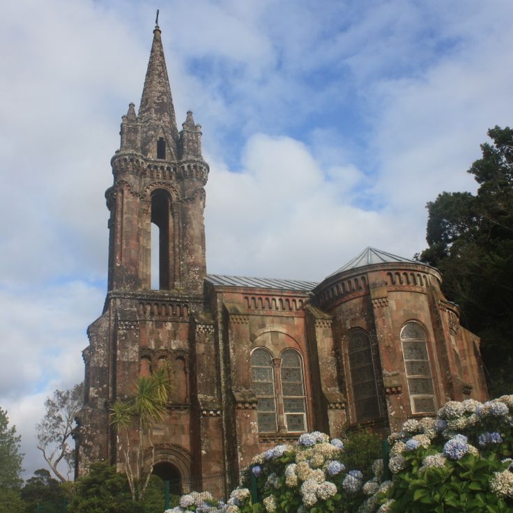
This neogothic chapel was built in 1886 from black basalt stone on the shores of Furnas Lake on São Miguel. It sits within the volcanic landscape of the island and shows how locals have used materials from the surrounding geology in their architecture. The stone comes from the volcanic activity that has shaped the Azores.
The Salto do Cabrito waterfall on São Miguel island drops about 40 meters down. It sits near a hydroelectric power station and can be reached via a trail that winds through dense vegetation filled with ferns. This waterfall is one of the natural features of the volcanic archipelago, where the terrain and rainfall have created such waterfalls.
Ponta da Ferraria is a thermal spring on a rocky headland on the western coast of São Miguel. Water of volcanic origin flows out through cracks in the rock and mixes with the Atlantic Ocean. The water temperature ranges between 15 and 35 degrees Celsius, depending on tides and wave action. A natural pool in the rocks allows for swimming when the tide is favorable. A handrail leads across the rocks to the access point. The location is in the parish of Ginetes and can be reached by paved road.
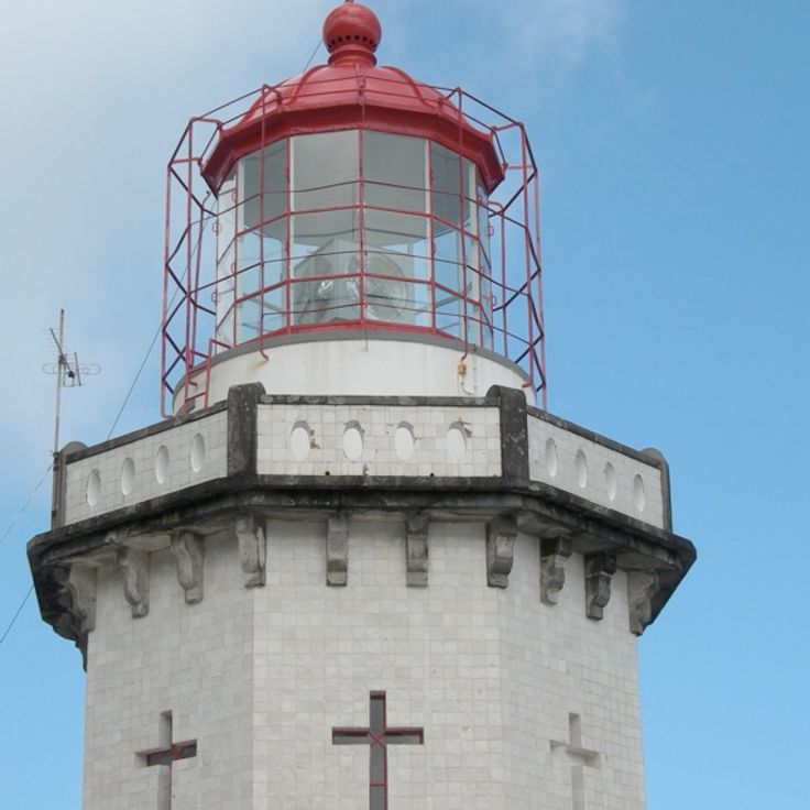
This white stone lighthouse rises 50 meters above the ocean at the northeastern tip of São Miguel and marks one of the most exposed points in the archipelago. Farol do Arnel is accessible by a staircase of 242 steps and offers insight into the maritime infrastructure of the Azores. The structure illustrates the importance of navigation for a volcanic island territory in the Atlantic.
The Monchique rock is a basalt formation that rises about two kilometers off the coast of Flores, and at 31 meters high, it marks the westernmost point of Europe in the Atlantic. It stands as a geological record of the volcanic origin of the Azores archipelago, where nine islands were born from volcanic activity. Throughout this island group, you can find impressive geological formations such as craters turned into lakes, hot springs that bubble from the ground, and caves carved naturally into the rock. On São Miguel, thermal pools and tea plantations draw visitors, while historic centers still preserve traces from the 16th century.
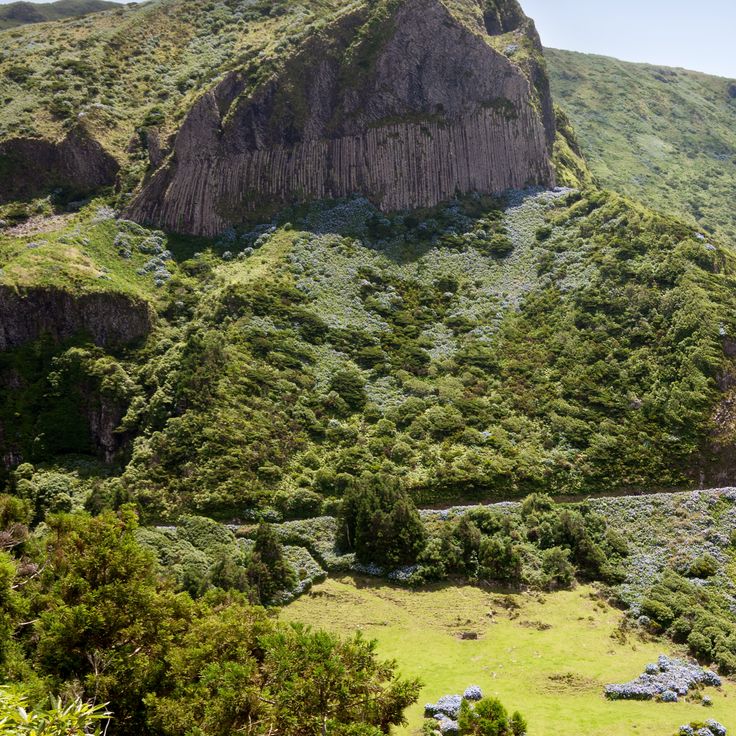
The basalt columns at Rocher de Bordoes on the west coast of Flores are among the most notable volcanic formations in the Azores archipelago. These rock structures formed from the slow cooling of lava and create natural organ pipes on the hillside. The columns rise about 65 feet (20 meters) high and demonstrate the geological processes that shaped all nine islands.
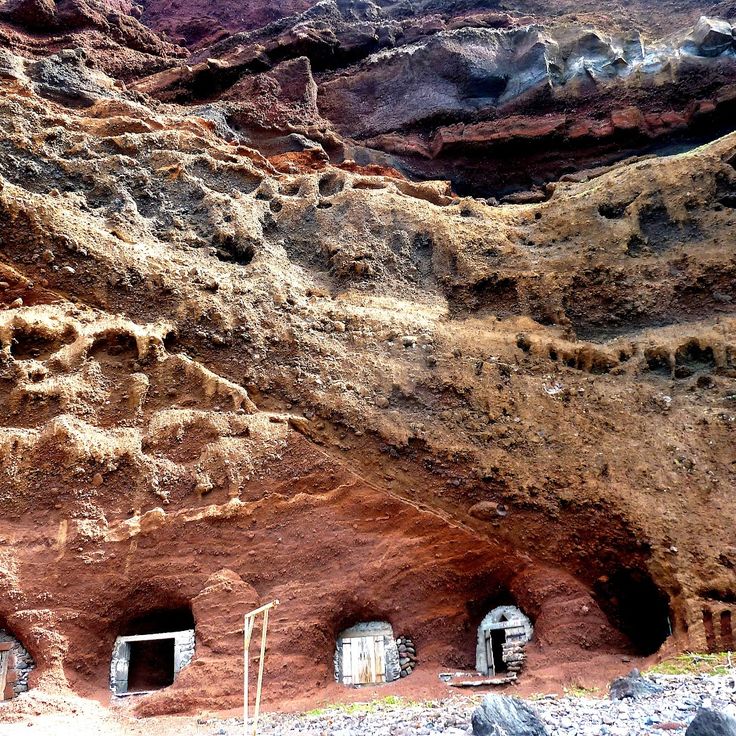
This fishing harbor on Graciosa sits on ochre-colored cliffs dotted with caves carved into the rocky walls. The natural cavities once served as storage for fishing boats and equipment, showing how islanders adapted the volcanic rock formations to meet their maritime needs. The caves and old structures here tell the story of fishing traditions that have shaped life in the Azores for many generations.
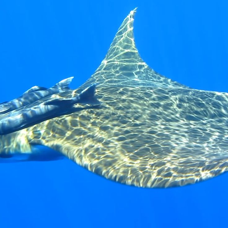
The Princess Alice Bank dive site sits about 150 kilometers south of the island of Flores in the Azores. This underwater plateau is shaped by strong ocean currents that sweep across the seafloor. The waters here are rich with marine life, from large fish to sharks and deep-sea creatures. Divers come to this spot to explore the life that thrives in these waters. The currents make diving here demanding, but the rewards are significant.
Parque Terra Nostra in Furnas is a botanical garden with roots going back centuries. It spreads across 12 hectares and holds over 2000 tree species from five continents, including rare plants native to the Azores and a large collection of camellias. The park's main feature is a large thermal pool fed by geothermal springs, where iron-rich water stays at a constant 39 degrees Celsius. The garden was created at the end of the 18th century and expanded between 1850 and 1870 with plants brought from Australia, New Zealand, and South Africa. Walking through the park, you pass subtropical vegetation, ferns, and tree ferns that thrive in the region's humid climate.
Lagoa do Fogo lies at the center of São Miguel island at 575 meters (1,886 feet) elevation within a crater whose last eruption was in 1563. The lake is edged by white volcanic sand beaches along certain shoreline sections, while the surrounding slopes support protected native vegetation. A paved road from the southern coast leads to the crater rim, where trails descend to the water.
Caldeira das Furnas is a volcanic depression on the eastern side of São Miguel in the Azores. Geothermal springs and steam vents mark the landscape here. Local people have used this place for generations to cook the traditional dish called Cozido. They dig pots filled with meat, vegetables, and sausage deep into the warm ground and leave them for hours. The heat comes from below the surface, powered by the island's volcanic activity. Several public areas let visitors see the steam rising from the earth and watch mineral deposits build up around the spots where hot water and gases escape.
Algar do Carvão is an ancient lava tube that descends 90 meters into the rock. Inside, visitors see colorful rock layers, silica formations, and an underground lake. This cave reveals the volcanic history of Terceira island and shows how the geological forces that shaped the Azores are still visible beneath the surface.
Poça da Dona Beija at Furnas is a collection of five open-air pools fed by natural iron-rich springs. The water reaches 39 degrees Celsius and comes from volcanic activity beneath São Miguel. The pools are bordered by stone walls and separated by vegetation. The iron-laden water leaves characteristic orange-brown deposits along the pool edges. The facility sits in Furnas' thermal zone, where several geothermal springs emerge at the surface, and is open daily.
This viewpoint on São Miguel sits on a mountain ridge at 1000 meters high. From here you can see the Sete Cidades lake and the volcanic craters of the region. These geological formations are typical of the Azores, where the archipelago was created by volcanic activity.
This park in the northeast of São Miguel features five restored water mills from the 19th century arranged along a river, showing the agricultural past of the Azores. A trail winds through the vegetation to a waterfall that drops 40 meters (131 feet). The site combines geological elements of volcanic origin with the historical use of water power.
This islet at Vila Franca do Campo is the result of a partially sunken volcanic crater that has formed a natural lagoon a few hundred meters off the southern coast of São Miguel. You can reach it only by boat. A circular basin about 150 meters in diameter is surrounded by rock walls rising about 15 meters high. Swimming in the lagoon is possible during the summer months when conditions allow.
The Gorreana tea plantation sits on the north coast of São Miguel and has been producing tea since 1883. It uses machines from the late 1800s to process black and green tea grown on volcanic soil. The fields spread across terraced slopes overlooking the Atlantic. Visitors can walk through the processing facilities where leaves are fermented, dried, and packed using traditional methods.
This church dates from the 16th century and stands in the historic center of Angra do Heroísmo on the island of Terceira. The church is part of a neighborhood that has been a UNESCO World Heritage site since 1983. On its facade, you can see decorative details in the Baroque style that are typical of religious architecture in the Azores. You can observe here the traces of a time when the Azores were an important port for ships traveling between Europe and America.
Serra do Cume on the island of Terceira sits at 545 meters (1,785 feet) in elevation. From this viewpoint, you look down at fields divided by walls of volcanic stone into rectangular plots. The stone walls create a regular pattern across the coastal plain. This location shows how people have organized and farmed their land for generations. A paved road climbs up from the main route between Praia da Vitória and Angra do Heroísmo.
This waterfall on the island of Flores drops 90 meters into a natural pool where swimming is possible. A network of trails leads to several viewpoints and provides access to both the upper and lower sections of the fall, which cuts through the island's volcanic rock. The Cascade de Poço do Bacalhau displays the geological forces that shaped the Azores and offers visitors a chance to experience the archipelago's nature firsthand.
Capelinhos Volcano is a volcanic formation that emerged from the Atlantic Ocean after an eruption in 1958. The eruption created a new peninsula on the western coast of Faial and shaped the landscape that visitors see today. This site shows how the volcanic forces that built the Azores archipelago are still active and continue to transform the islands.
The Caldeira do Cabeço Gordo sits at the center of Faial island, rising 1043 meters high. This crater spans two kilometers across and drops 400 meters deep. The volcanic formation reveals how the island took shape through powerful eruptions. A marked trail runs along the crater's edge and offers several viewpoints overlooking the crater's interior slopes and the surrounding island landscape.
Porto Formoso tea plantation was founded in 1920 on the island of São Miguel and produces black and green tea using traditional methods. Visitors can discover the historic processing machines and taste different varieties grown in the surrounding fields. This plantation shows how the Azores have kept their agricultural traditions alive, fitting into an island shaped by volcanic activity and geothermal springs.
Caldeira Velha is a geothermal spring located in the volcanic zone of São Miguel. It feeds a thermal pool and a waterfall with iron-rich waters that maintain a steady temperature of about 38 degrees. The site reveals the volcanic heritage of the Azores.
Ponta do Pico stands at 2,351 meters (7,713 feet) and is the highest mountain in Portugal. This volcanic cone formed on an extinct volcano and dominates the landscape of the island that bears its name in the archipelago. The climb passes through different vegetation zones and can be demanding depending on weather conditions, as fog and wind are frequent. From the summit, you see the surrounding islands and the Atlantic Ocean. The geological features of this peak show the volcanic origins of the Azores, where eruptions shaped the island territory over thousands of years.
The Aveiro waterfall on the island of Santa Maria is part of the natural landscape of the Azores archipelago. With a drop of 40 meters, the water cascades into a small pool below. A marked hiking trail of about 500 meters connects the main road to the base of the waterfall. The surrounding area features dense vegetation characteristic of the Azores climate. The path has a moderate slope and is easy to walk.
Built in the 16th century, this church stands in Ponta Delgada with a baroque facade carved from dark basalt stone. Inside, a gilded wooden altar catches the light and speaks to the craftsmanship of that era. The building is a clear example of how religious architecture took shape across the Azores.
The vineyards of Pico spread across volcanic fields with low stone walls made from black volcanic rock, protecting the vines from wind and salt spray. This cultivation method emerged in the 15th century and made possible the production of Verdelho wine, exported to Europe and the Americas until the 19th century. The vineyards sit between the coast and roughly 400 meters in elevation. UNESCO recognized the site as a World Heritage site in 2004, acknowledging how the inhabitants adapted to the volcanic setting and maintained traditional farming techniques developed over five centuries.
This viewpoint at Miradouro da Vista do Rei sits at 550 meters (1,800 feet) high and looks out over the two crater lakes of Sete Cidades and the volcanic mountains around them. These are some of the most remarkable geological formations in the Azores. The two lakes formed from volcanic activity and now create a striking natural sight. On clear days, you can see the entire landscape spread before you, with the water showing different shades across the basins.
Lagoa de Santiago is a volcanic lake that fills a crater near the Sete Cidades massif on the island of São Miguel. The crater walls are covered with vegetation and several trails lead down to the lake's edge. This lake is one of many crater lakes in the region that reveal the geological heritage of the Azores.
This neogothic chapel was built in 1886 from black basalt stone on the shores of Furnas Lake on São Miguel. It sits within the volcanic landscape of the island and shows how locals have used materials from the surrounding geology in their architecture. The stone comes from the volcanic activity that has shaped the Azores.
The Salto do Cabrito waterfall on São Miguel island drops about 40 meters down. It sits near a hydroelectric power station and can be reached via a trail that winds through dense vegetation filled with ferns. This waterfall is one of the natural features of the volcanic archipelago, where the terrain and rainfall have created such waterfalls.
Ponta da Ferraria is a thermal spring on a rocky headland on the western coast of São Miguel. Water of volcanic origin flows out through cracks in the rock and mixes with the Atlantic Ocean. The water temperature ranges between 15 and 35 degrees Celsius, depending on tides and wave action. A natural pool in the rocks allows for swimming when the tide is favorable. A handrail leads across the rocks to the access point. The location is in the parish of Ginetes and can be reached by paved road.
This white stone lighthouse rises 50 meters above the ocean at the northeastern tip of São Miguel and marks one of the most exposed points in the archipelago. Farol do Arnel is accessible by a staircase of 242 steps and offers insight into the maritime infrastructure of the Azores. The structure illustrates the importance of navigation for a volcanic island territory in the Atlantic.
The Monchique rock is a basalt formation that rises about two kilometers off the coast of Flores, and at 31 meters high, it marks the westernmost point of Europe in the Atlantic. It stands as a geological record of the volcanic origin of the Azores archipelago, where nine islands were born from volcanic activity. Throughout this island group, you can find impressive geological formations such as craters turned into lakes, hot springs that bubble from the ground, and caves carved naturally into the rock. On São Miguel, thermal pools and tea plantations draw visitors, while historic centers still preserve traces from the 16th century.
The basalt columns at Rocher de Bordoes on the west coast of Flores are among the most notable volcanic formations in the Azores archipelago. These rock structures formed from the slow cooling of lava and create natural organ pipes on the hillside. The columns rise about 65 feet (20 meters) high and demonstrate the geological processes that shaped all nine islands.
This fishing harbor on Graciosa sits on ochre-colored cliffs dotted with caves carved into the rocky walls. The natural cavities once served as storage for fishing boats and equipment, showing how islanders adapted the volcanic rock formations to meet their maritime needs. The caves and old structures here tell the story of fishing traditions that have shaped life in the Azores for many generations.
The Princess Alice Bank dive site sits about 150 kilometers south of the island of Flores in the Azores. This underwater plateau is shaped by strong ocean currents that sweep across the seafloor. The waters here are rich with marine life, from large fish to sharks and deep-sea creatures. Divers come to this spot to explore the life that thrives in these waters. The currents make diving here demanding, but the rewards are significant.