See the monuments around you in AROpen chests in the app
Around Us is built for your phone — point your camera at the streets and discover the monuments and places around you in augmented reality.Around Us is built for your phone — chests unlock when you walk, explore and capture nearby places.
Tennessee offers a notable mix of geological formations and historical sites that document different periods of American history. The state extends from the Appalachian Mountains in the east to the Mississippi River in the west, encompassing extensive cave systems, waterfalls, and forested areas. Underground attractions include The Lost Sea Adventure near Sweetwater, one of the largest underground lakes in America, and Tuckaleechee Caverns near Townsend with its flowstone formations. Ruby Falls in Chattanooga takes visitors 1,100 feet (335 m) below ground to an underground waterfall.
The state's natural parks protect waterfalls of varying size and accessibility. Fall Creek Falls near Spencer drops 256 feet (78 m) and ranks among the highest waterfalls east of the Mississippi. Burgess Falls and Cummins Falls offer hiking trails to cascades, while Ozone Falls is accessible directly from the roadside. Big South Fork National River includes gorges and whitewater sections in the Cumberland Plateau. Historical sites document the Civil War through battlefields like Fort Donelson and Shiloh, and through preserved structures such as the Carter House in Franklin. Belle Meade Plantation near Nashville shows life on a 19th-century horse farm, while Chucalissa Archaeological Museum presents pre-Columbian settlements of the Mississippian culture.
This underground lake covers 4.5 acres (1.8 hectares) and allows visitors to explore by boat while observing cave formations below. The Lost Sea Adventure provides access to one of the largest underground lakes in the United States, presenting geological structures that formed over thousands of years. Guided boat tours through the clear water reveal stalactites, stalagmites and other natural limestone formations that are part of the extensive Craighead Caverns system.
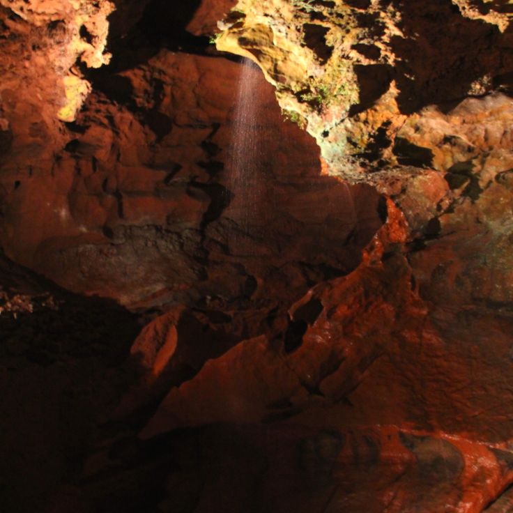
This limestone cave from the 19th century was the setting for paranormal events and local legends that remain part of Tennessee's historical narrative. The cave draws visitors interested in folklore and documented accounts of unexplained phenomena. As a natural formation, it provides insight into the geological structures of the region, while the historical stories reflect the cultural traditions of the community. The site combines natural history with local storytelling traditions that have persisted across generations.
This underground waterfall sits within a limestone cave 1,100 feet (335 meters) beneath the surface and presents a 145-foot (44-meter) drop. The mineral-rich water originates from a source in the rock and flows through a narrow limestone shaft. The cave was opened to visitors in 1928 and displays dripstone formations, stalagmites and stalactites. Guided tours follow illuminated pathways to this underground waterfall, which ranks among the accessible geological formations in Tennessee and documents the karst landscape of the region.
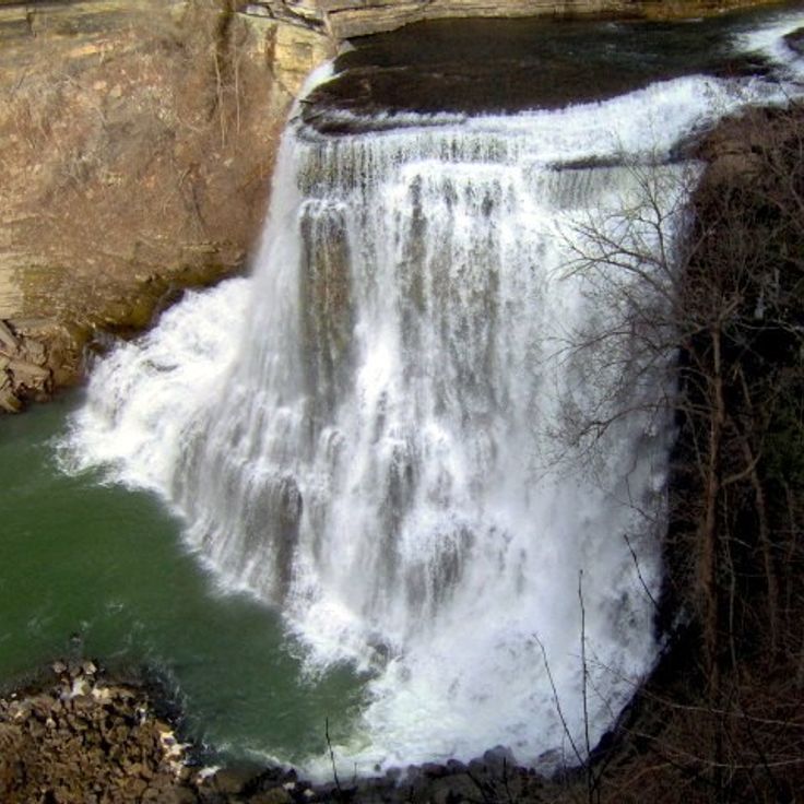
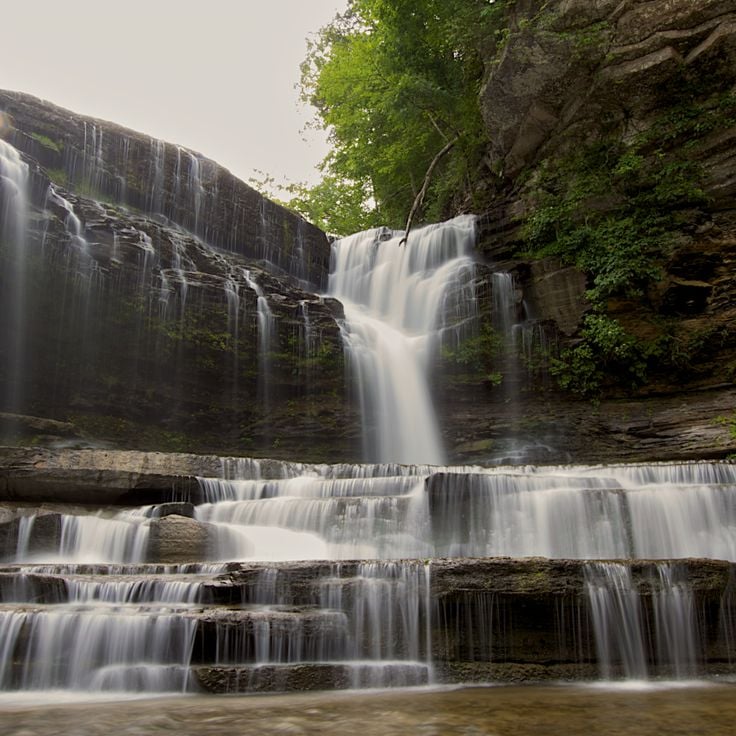
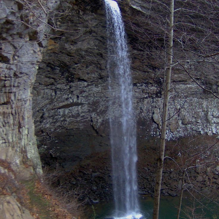
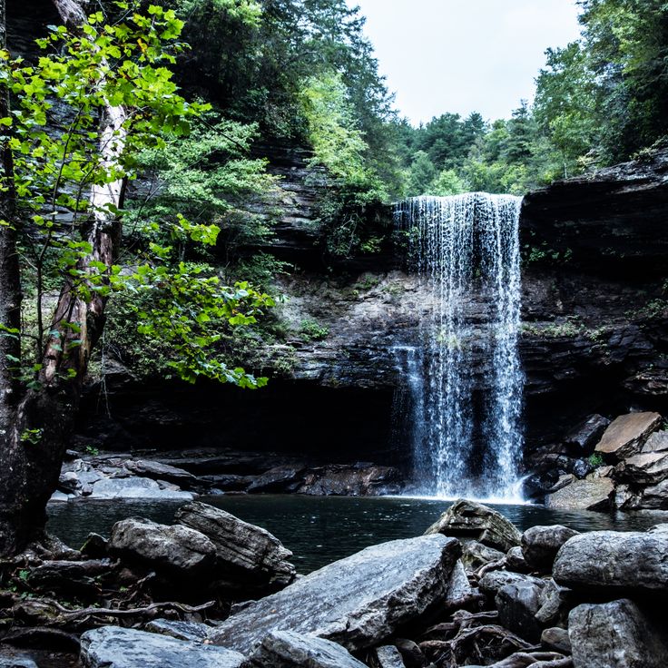
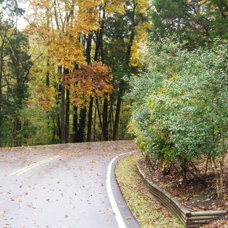
This park south of Sparta offers a trail along the Falling Water River where four waterfalls descend in sequence into a gorge. The final and largest fall measures around 130 feet (40 meters). A hiking path follows the river through wooded terrain to the main cascade. The falls have cut through limestone layers and form pools between each drop. Viewing points lie above and below the main cascade. The park covers roughly 550 acres and sits within the Cumberland Plateau region.
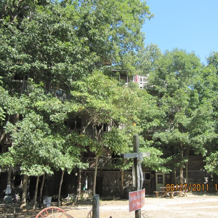
This wooden structure rises 100 feet above the ground and contains 80 rooms, constructed between 1993 and 2004 by minister Horace Burgess. The Minister's Tree House documents an unusual architectural vision among Tennessee's historical sites and demonstrates the region's individual building traditions. The construction uses multiple tree trunks as support pillars and combines religious symbolism with manual craftsmanship. The structure stands as an example of private religious architecture in rural Tennessee during the late 20th century.
Cummins Falls is a 75-foot (23-meter) waterfall with a natural swimming basin, surrounded by sandstone cliffs and forested areas. This waterfall represents one of the notable natural landscapes within Tennessee's collection of geological formations. The basin at the base formed through centuries of erosion cutting through sandstone layers, creating a deep pool that serves as a popular swimming destination during summer months.
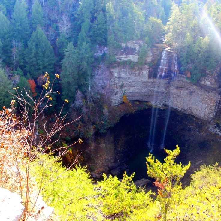
This 256-foot (78-meter) waterfall forms the centerpiece of a 29,000-acre park in the Cumberland Mountains, combining natural landmarks with traces of early settlement in Tennessee. The protected area reveals Carboniferous geological formations and documents regional development through marked trails that lead to observation points along the cliff face. The park preserves native species habitats and displays the landforms created by thousands of years of erosion.
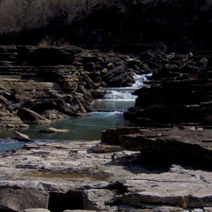
Rock Island State Park extends across 883 acres along the Caney Fork River and offers multiple waterfalls, natural swimming pools and geological formations. This park documents Tennessee's natural landscapes with rock formations and river habitats. Visitors find trails along the gorges and access to waterfalls carved into the rock formations. The terrain displays the region's geology through exposed rock layers and water-shaped features. The natural pools form through river dynamics and provide habitat for regional plant and animal species.
This historic street in Memphis has served as a center of blues culture since the 1920s and now contains music clubs, restaurants and shops. The district extends several blocks through the heart of downtown and documents the musical development that made Memphis a significant location in American music history. Many buildings date from the late 19th and early 20th centuries and have been restored to preserve the architectural heritage.
This archaeological park protects earthworks built by Native Americans about 2000 years ago, adding to Tennessee's natural and historic sites with an interpretation center and waterfalls. The complex covers 82 acres (33 hectares) where the Duck River meets Big and Little Duck rivers. Visitors find maintained trails leading to the prehistoric walls and three waterfalls, while the museum presents artifacts and information about the people who constructed the site.
This cave displays stalactites, stalagmites and an underground stream that have been part of regional history for centuries. Native Americans used Forbidden Caverns as shelter, and during Prohibition the system served moonshiners as a hiding place for illegal distilling operations. Tours follow lighted pathways through several chambers where visitors observe various geological formations and the clear water flow. The cave maintains a constant temperature year round and documents both natural processes and human use in Tennessee's Appalachian region.
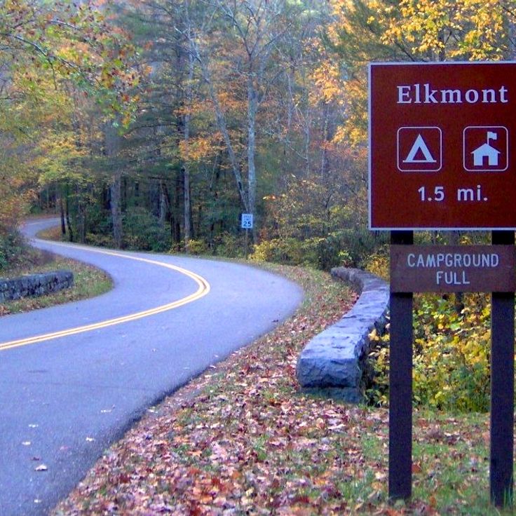
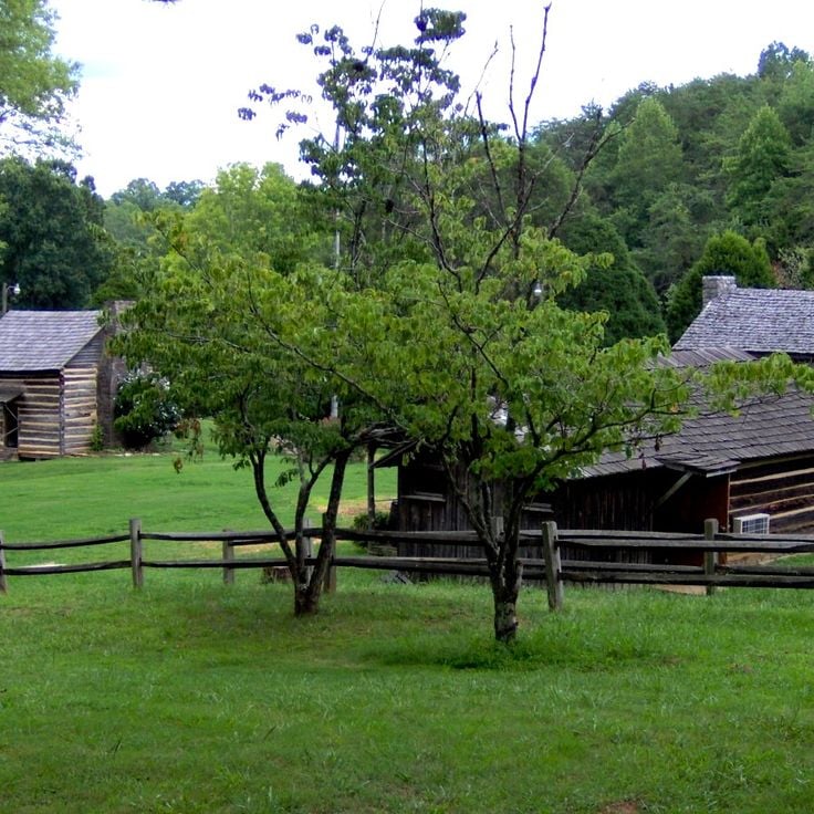
This abandoned settlement in Great Smoky Mountains National Park preserves wooden houses from the 1920s that recall a former mountain community. The structures document early recreational life in the Smokies, when well-to-do families from Knoxville built summer cottages along the Little River. The site illustrates the transition from private development to national park and offers insights into early 20th-century Appalachian architecture and social history.
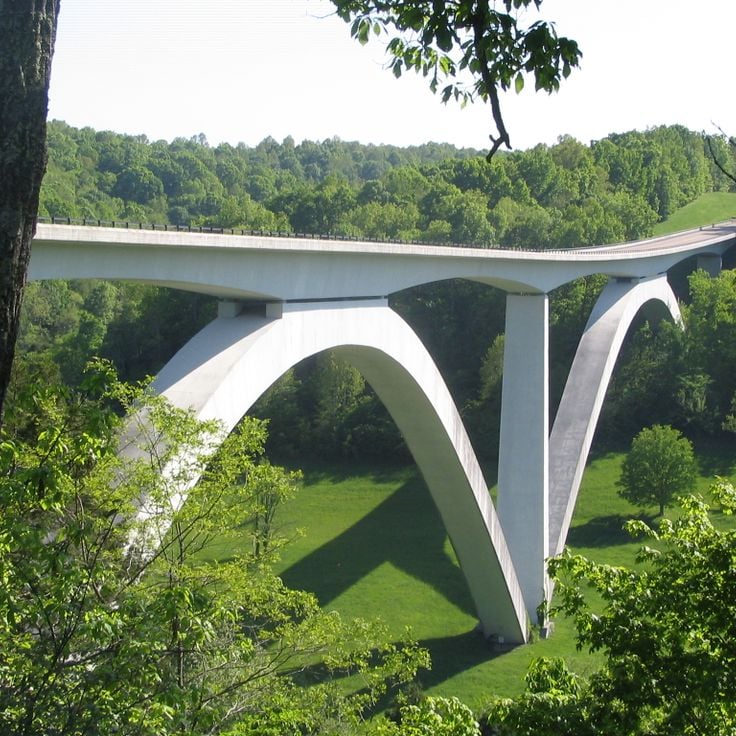
This 444-mile (715-kilometer) parkway follows an ancient Native American trading path through forests and fields in Tennessee. The route documents centuries of use by Cherokee and Chickasaw peoples, later by European settlers and traders. The road connects Nashville to Natchez, Mississippi, passing through varied landscapes. Interpretive sites along the way explain the importance of this route for trade between the Gulf Coast and northern regions. The parkway provides access to burial mounds, historic inns, and natural overlooks that document the development of the region.
This 13,000-acre (5,260-hectare) forest park along the Mississippi River offers hiking trails through varied habitats that have documented more than 200 bird species. Meeman-Shelby Forest State Park encompasses hardwood forests, wetlands and bottomlands that provide important stopover points for migratory birds, particularly during spring and fall migrations. Visitors will find marked trails of varying difficulty levels and camping facilities within the park boundaries.
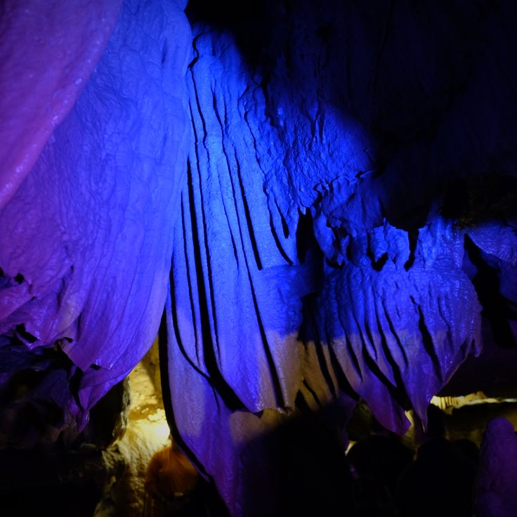
These underground caves extend for nearly 1.2 miles (2 kilometers) and display stalactite formations along with a 200-foot (60-meter) underground waterfall. Tuckaleechee Caverns is among the geological sites in Tennessee that provide insight into the formation of the state's landscape and document habitats that developed beneath the surface.
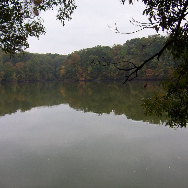
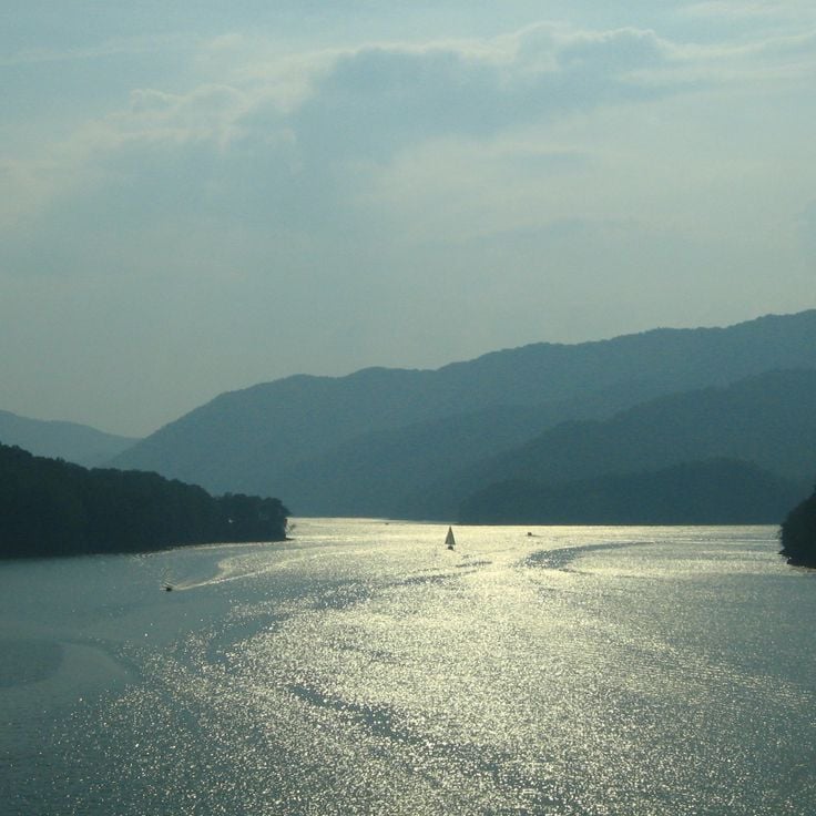
This 10-square-mile (26-square-kilometer) reservoir in the mountains of Cherokee National Forest provides 105 miles (169 kilometers) of shoreline. Watauga Lake formed through dam construction in the 1940s and now serves as a recreation area for boating, fishing and camping. The surrounding forests contain hiking trails that access elevated viewpoints over the water. The lake sits at an elevation of approximately 1,950 feet (595 meters) and reaches a maximum depth of 270 feet (82 meters).
Ozone Falls is a 110-foot-high (33-meter) waterfall in a state natural area in Tennessee, demonstrating the geological and natural features that define the region. A hiking trail leads to a viewing point at the base, where visitors can explore the sandstone gorge and surrounding forest. This waterfall drops over a rock ledge into a pool, creating a formation shaped by thousands of years of erosion.
This historic park preserves the original home, gristmill, and museum dedicated to the celebrated World War I soldier. The site documents the life and military career of Alvin York, who earned recognition for his actions during the 1918 Meuse-Argonne Offensive and became one of the most decorated American figures of the war.
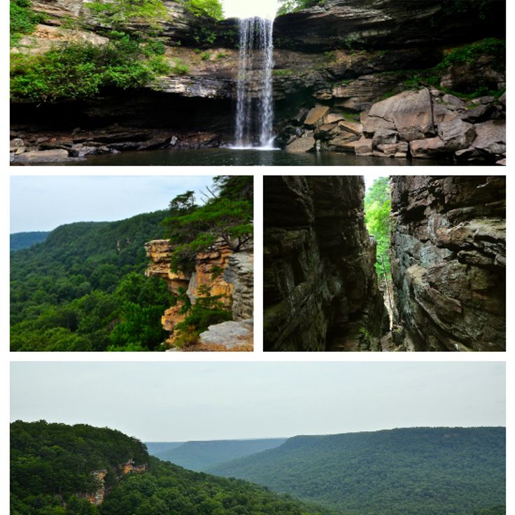
This park covers 30,000 acres (12,140 hectares) with canyons, waterfalls and 80 miles (129 kilometers) of marked trails through various natural areas. South Cumberland State Park documents the natural diversity of the Cumberland Plateau and includes several separate areas with geological formations. The waterfalls form from the sandstone layers that characterize the plateau, and trails lead through forests and to viewpoints over the valleys.
This 50-foot (15-meter) waterfall features a natural swimming pool accessible via a hiking trail with metal stairs, representing Tennessee's natural areas that include caves, waterfalls and lakes. Greeter Falls sits in the southern Cumberland Mountains and forms part of a larger trail system that showcases geological formations and forest ecosystems. The path descends through hardwood forest and provides views of the surrounding gorges, which illustrate the region's limestone geology.
This tower was built for the 1982 World's Fair and provides views across Knoxville and the Tennessee Valley from its observation deck. The structure stands 266 feet (81 meters) tall and features gold-tinted glass panels that reflect sunlight. The observation level on the sixth floor offers vistas of downtown Knoxville, the Great Smoky Mountains to the east, and the Tennessee River Valley. The Sunsphere Tower remains in World's Fair Park and represents Knoxville's role as host to an international exposition during the late 20th century.
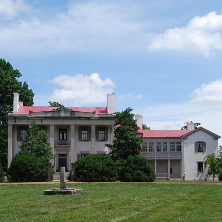
This historic plantation was established in the mid-1800s and grew into one of the leading thoroughbred breeding farms in the United States. Belle Meade Plantation now documents the lives of the wealthy horse breeders and the enslaved people who made the operation possible. The grounds include the Greek Revival main house, several outbuildings, and a carriage house. Tours explain the history of the Harding and Jackson families and the agricultural practices of the era. The museum displays furniture, artwork, and personal items from the 19th century.
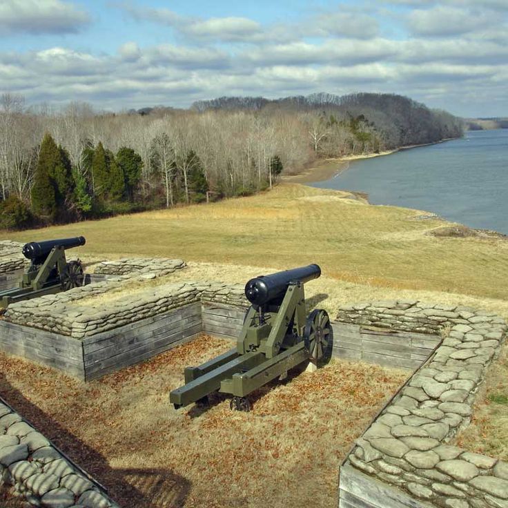
This Civil War battlefield marks the Union's first major victory under General Ulysses S. Grant in February 1862. Fort Donelson offers guided tours through preserved earthworks, a visitor center with historical displays documenting the siege, and a national cemetery. The site includes several miles of trails along the Cumberland River fortifications, cannon batteries, and the Dover Hotel where surrender negotiations took place. The grounds document military strategies and soldier life during this decisive campaign that opened Tennessee to Union forces.
This museum occupies a prehistoric village site and documents the culture of indigenous peoples who settled in the region between 1000 and 1500 CE. The collection displays pottery, tools and other artifacts recovered from archaeological excavations. Reconstructed houses and platform mounds illustrate the way of life of the Mississippian culture. The Chucalissa Archaeological Museum serves as a research center and provides visitors with insights into the pre-Columbian history of Tennessee.
This 19th century building displays artifacts and exhibits about the 1864 Battle of Franklin and its impact on local civilians. The collection documents military events during the Civil War and the experiences of residents during this period. The museum presents historical objects that were damaged or left behind during the fighting, and conveys the experiences of the family who lived here as the battle raged around their home.
This state park along the Tennessee River maintains woodland trails, fishing access points and camping facilities near the historic riverboat landing site. The grounds preserve bottomland forests and riverfront landscapes that document the waterway's role in regional transportation and commerce. Visitors find boat ramps, picnic areas and paths through hardwood stands. The park protects natural habitats along this section of the Tennessee River while providing access to water recreation and forest exploration.
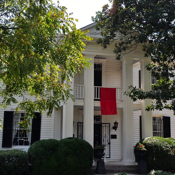
The Carter House in Franklin stands as one of the most documented Civil War structures in Tennessee, preserving evidence of the Battle of Franklin fought in November 1864. The exterior walls of this historic building still display numerous bullet holes that mark the intensity of combat that took place around the property. This house serves as a museum today, offering visitors direct insight into the events of that day when Confederate forces launched one of the war's most costly assaults. The preserved structures and artifacts help convey both the military and human dimensions of this significant engagement.
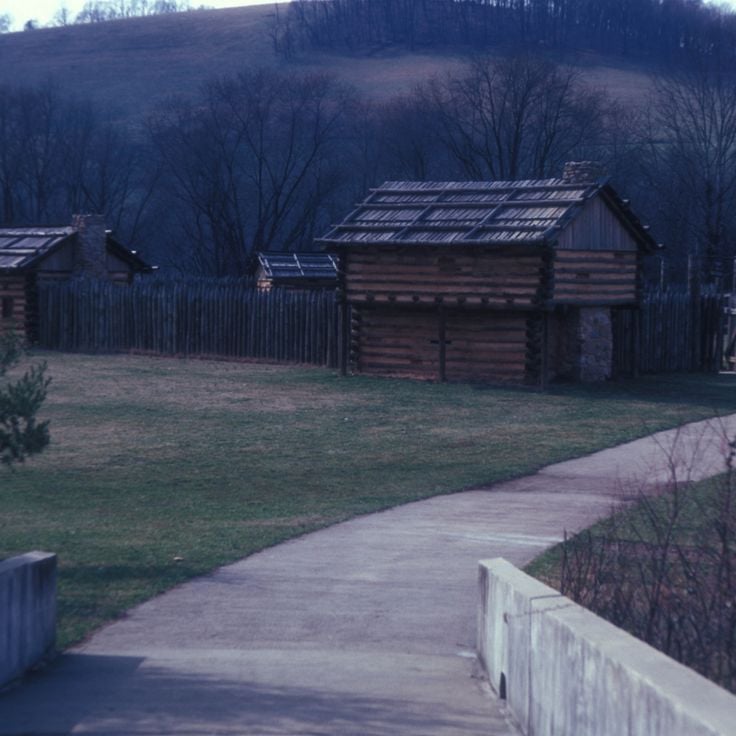
This historic site preserves the 18th century farm of John Sevier, who served as the first governor of Tennessee. The property includes original buildings such as a log cabin and agricultural structures that document frontier life during the state's founding era. Visitors can explore the preserved structures and learn about how Sevier and his family lived and worked on this homestead before Tennessee became a state in 1796.
This park encompasses 5200 acres (2105 hectares) of Civil War historic grounds featuring a museum, monuments, and marked walking trails. Shiloh National Military Park preserves the site of a major battle fought in April 1862. Visitors follow marked routes across the battlefield where interpretive signs explain military movements and events. The visitor center displays artifacts, maps, and exhibits about the two-day engagement. More than 150 monuments and markers identify regimental positions and key points of the battle.
Big South Fork National River & Recreation Area covers 125,000 acres (50,600 hectares) across northern Tennessee and southern Kentucky, protecting the upper reaches of the Cumberland River system. This natural area preserves deep gorges cut through sandstone plateaus, with forested slopes, natural stone arches, and bluffs rising more than 300 feet (90 meters) above the waterways. Over 150 miles (240 kilometers) of marked trails cross the terrain, providing access to waterfalls, historic mining settlements, and overlooks above the river valleys. The recreation area demonstrates the geology and forest habitats found throughout Tennessee and the Cumberland Plateau region.
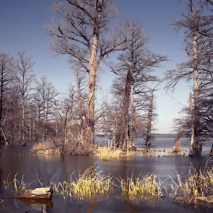
This 40-square-mile lake with cypress forests, waterways and observation points forms part of Tennessee's natural areas. The wetland emerged after an early 19th century earthquake and now serves as a stopover for migratory birds in winter. Boardwalks wind through flooded forests where bald cypress trees rise from shallow water. Trails along the shoreline allow views of herons, eagles and ducks during the migration season.
This historic park encompasses a reconstructed 18th-century fort, a visitor center and regular demonstrations of colonial crafts. Sycamore Shoals State Historic Park documents early settlement history in Tennessee and presents colonial era life through practical demonstrations and preserved structures that provide insight into the development of the region during this formative period.
This underground lake covers 4.5 acres (1.8 hectares) and allows visitors to explore by boat while observing cave formations below. The Lost Sea Adventure provides access to one of the largest underground lakes in the United States, presenting geological structures that formed over thousands of years. Guided boat tours through the clear water reveal stalactites, stalagmites and other natural limestone formations that are part of the extensive Craighead Caverns system.
This limestone cave from the 19th century was the setting for paranormal events and local legends that remain part of Tennessee's historical narrative. The cave draws visitors interested in folklore and documented accounts of unexplained phenomena. As a natural formation, it provides insight into the geological structures of the region, while the historical stories reflect the cultural traditions of the community. The site combines natural history with local storytelling traditions that have persisted across generations.
This underground waterfall sits within a limestone cave 1,100 feet (335 meters) beneath the surface and presents a 145-foot (44-meter) drop. The mineral-rich water originates from a source in the rock and flows through a narrow limestone shaft. The cave was opened to visitors in 1928 and displays dripstone formations, stalagmites and stalactites. Guided tours follow illuminated pathways to this underground waterfall, which ranks among the accessible geological formations in Tennessee and documents the karst landscape of the region.
This park south of Sparta offers a trail along the Falling Water River where four waterfalls descend in sequence into a gorge. The final and largest fall measures around 130 feet (40 meters). A hiking path follows the river through wooded terrain to the main cascade. The falls have cut through limestone layers and form pools between each drop. Viewing points lie above and below the main cascade. The park covers roughly 550 acres and sits within the Cumberland Plateau region.
This wooden structure rises 100 feet above the ground and contains 80 rooms, constructed between 1993 and 2004 by minister Horace Burgess. The Minister's Tree House documents an unusual architectural vision among Tennessee's historical sites and demonstrates the region's individual building traditions. The construction uses multiple tree trunks as support pillars and combines religious symbolism with manual craftsmanship. The structure stands as an example of private religious architecture in rural Tennessee during the late 20th century.
Cummins Falls is a 75-foot (23-meter) waterfall with a natural swimming basin, surrounded by sandstone cliffs and forested areas. This waterfall represents one of the notable natural landscapes within Tennessee's collection of geological formations. The basin at the base formed through centuries of erosion cutting through sandstone layers, creating a deep pool that serves as a popular swimming destination during summer months.
This 256-foot (78-meter) waterfall forms the centerpiece of a 29,000-acre park in the Cumberland Mountains, combining natural landmarks with traces of early settlement in Tennessee. The protected area reveals Carboniferous geological formations and documents regional development through marked trails that lead to observation points along the cliff face. The park preserves native species habitats and displays the landforms created by thousands of years of erosion.
Rock Island State Park extends across 883 acres along the Caney Fork River and offers multiple waterfalls, natural swimming pools and geological formations. This park documents Tennessee's natural landscapes with rock formations and river habitats. Visitors find trails along the gorges and access to waterfalls carved into the rock formations. The terrain displays the region's geology through exposed rock layers and water-shaped features. The natural pools form through river dynamics and provide habitat for regional plant and animal species.
This historic street in Memphis has served as a center of blues culture since the 1920s and now contains music clubs, restaurants and shops. The district extends several blocks through the heart of downtown and documents the musical development that made Memphis a significant location in American music history. Many buildings date from the late 19th and early 20th centuries and have been restored to preserve the architectural heritage.
This archaeological park protects earthworks built by Native Americans about 2000 years ago, adding to Tennessee's natural and historic sites with an interpretation center and waterfalls. The complex covers 82 acres (33 hectares) where the Duck River meets Big and Little Duck rivers. Visitors find maintained trails leading to the prehistoric walls and three waterfalls, while the museum presents artifacts and information about the people who constructed the site.
This cave displays stalactites, stalagmites and an underground stream that have been part of regional history for centuries. Native Americans used Forbidden Caverns as shelter, and during Prohibition the system served moonshiners as a hiding place for illegal distilling operations. Tours follow lighted pathways through several chambers where visitors observe various geological formations and the clear water flow. The cave maintains a constant temperature year round and documents both natural processes and human use in Tennessee's Appalachian region.
This abandoned settlement in Great Smoky Mountains National Park preserves wooden houses from the 1920s that recall a former mountain community. The structures document early recreational life in the Smokies, when well-to-do families from Knoxville built summer cottages along the Little River. The site illustrates the transition from private development to national park and offers insights into early 20th-century Appalachian architecture and social history.
This 444-mile (715-kilometer) parkway follows an ancient Native American trading path through forests and fields in Tennessee. The route documents centuries of use by Cherokee and Chickasaw peoples, later by European settlers and traders. The road connects Nashville to Natchez, Mississippi, passing through varied landscapes. Interpretive sites along the way explain the importance of this route for trade between the Gulf Coast and northern regions. The parkway provides access to burial mounds, historic inns, and natural overlooks that document the development of the region.
This 13,000-acre (5,260-hectare) forest park along the Mississippi River offers hiking trails through varied habitats that have documented more than 200 bird species. Meeman-Shelby Forest State Park encompasses hardwood forests, wetlands and bottomlands that provide important stopover points for migratory birds, particularly during spring and fall migrations. Visitors will find marked trails of varying difficulty levels and camping facilities within the park boundaries.
These underground caves extend for nearly 1.2 miles (2 kilometers) and display stalactite formations along with a 200-foot (60-meter) underground waterfall. Tuckaleechee Caverns is among the geological sites in Tennessee that provide insight into the formation of the state's landscape and document habitats that developed beneath the surface.
This 10-square-mile (26-square-kilometer) reservoir in the mountains of Cherokee National Forest provides 105 miles (169 kilometers) of shoreline. Watauga Lake formed through dam construction in the 1940s and now serves as a recreation area for boating, fishing and camping. The surrounding forests contain hiking trails that access elevated viewpoints over the water. The lake sits at an elevation of approximately 1,950 feet (595 meters) and reaches a maximum depth of 270 feet (82 meters).
Ozone Falls is a 110-foot-high (33-meter) waterfall in a state natural area in Tennessee, demonstrating the geological and natural features that define the region. A hiking trail leads to a viewing point at the base, where visitors can explore the sandstone gorge and surrounding forest. This waterfall drops over a rock ledge into a pool, creating a formation shaped by thousands of years of erosion.
This historic park preserves the original home, gristmill, and museum dedicated to the celebrated World War I soldier. The site documents the life and military career of Alvin York, who earned recognition for his actions during the 1918 Meuse-Argonne Offensive and became one of the most decorated American figures of the war.
This park covers 30,000 acres (12,140 hectares) with canyons, waterfalls and 80 miles (129 kilometers) of marked trails through various natural areas. South Cumberland State Park documents the natural diversity of the Cumberland Plateau and includes several separate areas with geological formations. The waterfalls form from the sandstone layers that characterize the plateau, and trails lead through forests and to viewpoints over the valleys.
This 50-foot (15-meter) waterfall features a natural swimming pool accessible via a hiking trail with metal stairs, representing Tennessee's natural areas that include caves, waterfalls and lakes. Greeter Falls sits in the southern Cumberland Mountains and forms part of a larger trail system that showcases geological formations and forest ecosystems. The path descends through hardwood forest and provides views of the surrounding gorges, which illustrate the region's limestone geology.
This tower was built for the 1982 World's Fair and provides views across Knoxville and the Tennessee Valley from its observation deck. The structure stands 266 feet (81 meters) tall and features gold-tinted glass panels that reflect sunlight. The observation level on the sixth floor offers vistas of downtown Knoxville, the Great Smoky Mountains to the east, and the Tennessee River Valley. The Sunsphere Tower remains in World's Fair Park and represents Knoxville's role as host to an international exposition during the late 20th century.
This historic plantation was established in the mid-1800s and grew into one of the leading thoroughbred breeding farms in the United States. Belle Meade Plantation now documents the lives of the wealthy horse breeders and the enslaved people who made the operation possible. The grounds include the Greek Revival main house, several outbuildings, and a carriage house. Tours explain the history of the Harding and Jackson families and the agricultural practices of the era. The museum displays furniture, artwork, and personal items from the 19th century.
This Civil War battlefield marks the Union's first major victory under General Ulysses S. Grant in February 1862. Fort Donelson offers guided tours through preserved earthworks, a visitor center with historical displays documenting the siege, and a national cemetery. The site includes several miles of trails along the Cumberland River fortifications, cannon batteries, and the Dover Hotel where surrender negotiations took place. The grounds document military strategies and soldier life during this decisive campaign that opened Tennessee to Union forces.
This museum occupies a prehistoric village site and documents the culture of indigenous peoples who settled in the region between 1000 and 1500 CE. The collection displays pottery, tools and other artifacts recovered from archaeological excavations. Reconstructed houses and platform mounds illustrate the way of life of the Mississippian culture. The Chucalissa Archaeological Museum serves as a research center and provides visitors with insights into the pre-Columbian history of Tennessee.
This 19th century building displays artifacts and exhibits about the 1864 Battle of Franklin and its impact on local civilians. The collection documents military events during the Civil War and the experiences of residents during this period. The museum presents historical objects that were damaged or left behind during the fighting, and conveys the experiences of the family who lived here as the battle raged around their home.
This state park along the Tennessee River maintains woodland trails, fishing access points and camping facilities near the historic riverboat landing site. The grounds preserve bottomland forests and riverfront landscapes that document the waterway's role in regional transportation and commerce. Visitors find boat ramps, picnic areas and paths through hardwood stands. The park protects natural habitats along this section of the Tennessee River while providing access to water recreation and forest exploration.
The Carter House in Franklin stands as one of the most documented Civil War structures in Tennessee, preserving evidence of the Battle of Franklin fought in November 1864. The exterior walls of this historic building still display numerous bullet holes that mark the intensity of combat that took place around the property. This house serves as a museum today, offering visitors direct insight into the events of that day when Confederate forces launched one of the war's most costly assaults. The preserved structures and artifacts help convey both the military and human dimensions of this significant engagement.
This historic site preserves the 18th century farm of John Sevier, who served as the first governor of Tennessee. The property includes original buildings such as a log cabin and agricultural structures that document frontier life during the state's founding era. Visitors can explore the preserved structures and learn about how Sevier and his family lived and worked on this homestead before Tennessee became a state in 1796.
This park encompasses 5200 acres (2105 hectares) of Civil War historic grounds featuring a museum, monuments, and marked walking trails. Shiloh National Military Park preserves the site of a major battle fought in April 1862. Visitors follow marked routes across the battlefield where interpretive signs explain military movements and events. The visitor center displays artifacts, maps, and exhibits about the two-day engagement. More than 150 monuments and markers identify regimental positions and key points of the battle.
Big South Fork National River & Recreation Area covers 125,000 acres (50,600 hectares) across northern Tennessee and southern Kentucky, protecting the upper reaches of the Cumberland River system. This natural area preserves deep gorges cut through sandstone plateaus, with forested slopes, natural stone arches, and bluffs rising more than 300 feet (90 meters) above the waterways. Over 150 miles (240 kilometers) of marked trails cross the terrain, providing access to waterfalls, historic mining settlements, and overlooks above the river valleys. The recreation area demonstrates the geology and forest habitats found throughout Tennessee and the Cumberland Plateau region.
This 40-square-mile lake with cypress forests, waterways and observation points forms part of Tennessee's natural areas. The wetland emerged after an early 19th century earthquake and now serves as a stopover for migratory birds in winter. Boardwalks wind through flooded forests where bald cypress trees rise from shallow water. Trails along the shoreline allow views of herons, eagles and ducks during the migration season.
This historic park encompasses a reconstructed 18th-century fort, a visitor center and regular demonstrations of colonial crafts. Sycamore Shoals State Historic Park documents early settlement history in Tennessee and presents colonial era life through practical demonstrations and preserved structures that provide insight into the development of the region during this formative period.