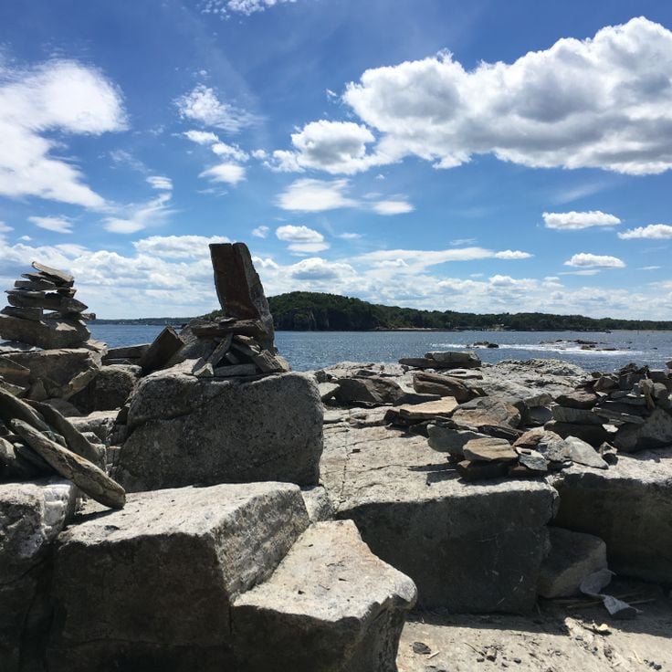
Maine offers coastal areas, forest landscapes and many historic sites. The region extends from the Atlantic Ocean to wooded mountains inland. Visitors find state parks like Baxter and Acadia, which provide opportunities for hiking and observing wildlife. The coast is lined with lighthouses, including Pemaquid Point and West Quoddy Head. Islands such as Monhegan and Peaks Island lie offshore. Waterfalls like Screw Auger Falls and Angel Falls draw hikers. Lakes such as Moosehead Lake attract people in warmer months. Old military structures like Fort Gorges remain from earlier centuries. Trails lead through areas like Gulf Hagas and Vaughan Woods. The landscape includes beaches at Roque Bluffs and Reid State Park, where sand meets the ocean. Mountain trails at Tumbledown offer views of surrounding valleys. The Carriage Roads on Mount Desert Island provide paths through forests and along lakeshores. Nature areas like Orono Bog Boardwalk allow close views of wetland plants. These places show the variety of terrain Maine contains, from rocky shores to inland wilderness.
Maine offers coastal areas, forest landscapes and many historic sites. The region extends from the Atlantic Ocean to wooded mountains inland. Visitors find state parks like Baxter and Acadia, which provide opportunities for hiking and observing wildlife. The coast is lined with lighthouses, including Pemaquid Point and West Quoddy Head. Islands such as Monhegan and Peaks Island lie offshore. Waterfalls like Screw Auger Falls and Angel Falls draw hikers. Lakes such as Moosehead Lake attract people in warmer months. Old military structures like Fort Gorges remain from earlier centuries. Trails lead through areas like Gulf Hagas and Vaughan Woods. The landscape includes beaches at Roque Bluffs and Reid State Park, where sand meets the ocean. Mountain trails at Tumbledown offer views of surrounding valleys. The Carriage Roads on Mount Desert Island provide paths through forests and along lakeshores. Nature areas like Orono Bog Boardwalk allow close views of wetland plants. These places show the variety of terrain Maine contains, from rocky shores to inland wilderness.
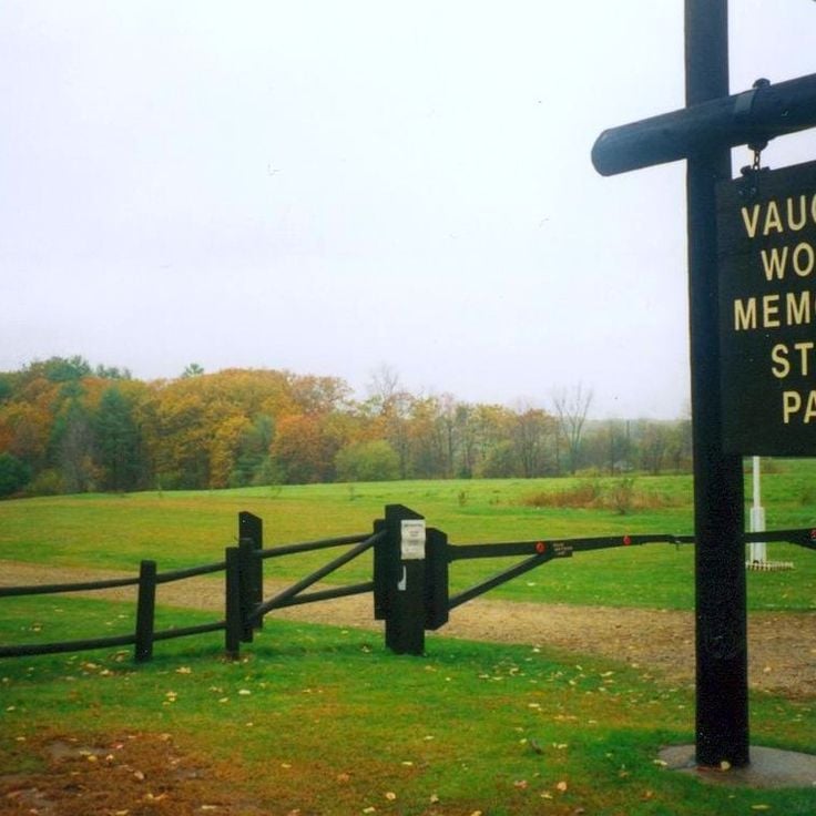
This natural area in Hallowell protects 165 acres (67 hectares) of forest along the Kennebec River. Walking trails lead through old growth trees and across stone bridges built in the 19th century. The paths follow the riverside where you can watch migratory birds in spring and fall. Remains of early settler buildings still stand among the trees. The forest consists mostly of oak, maple and hemlock. In summer the thick canopy provides shade, while autumn brings colors from yellow to deep red. The area sits just minutes from downtown and offers access to quiet woodland sections.
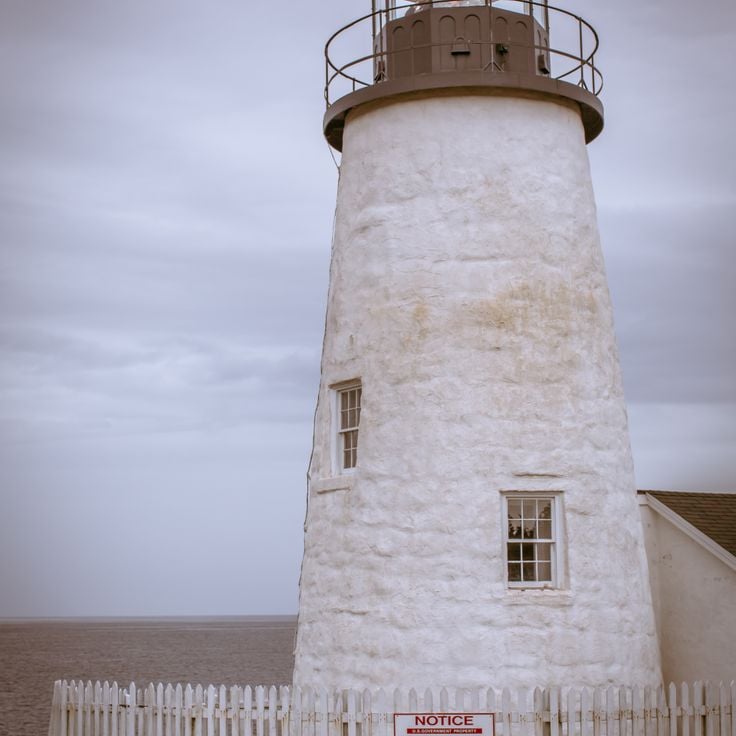
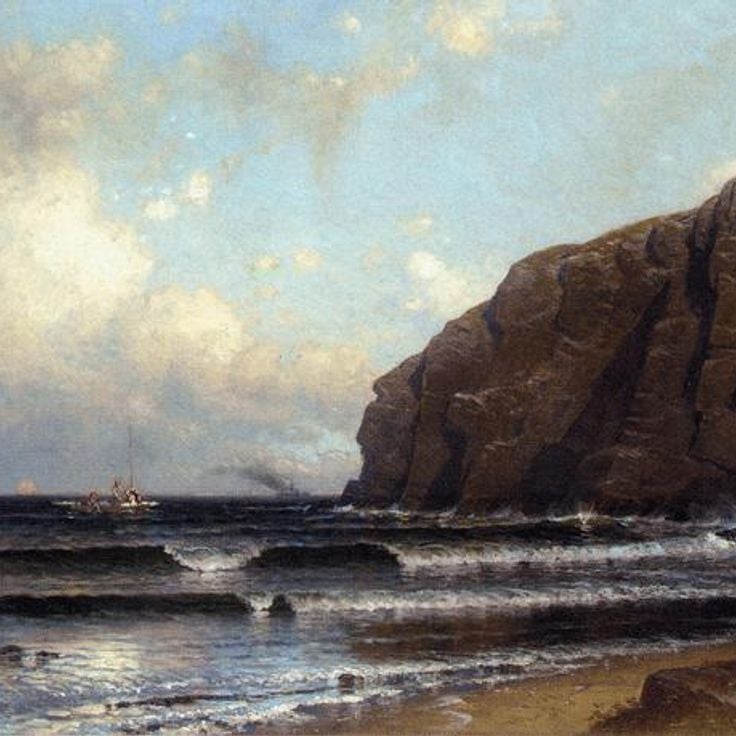
This lighthouse has stood on granite rocks since 1827, marking the coast near Bristol. The white tower rises above rock formations that slope into the Atlantic. Beside the lighthouse, a small museum covers the history of fishing and navigation. Visitors walk along the rocks and watch waves crash below. The site is one of the older coastal landmarks in Maine and shows the region's connection to the sea.
This beach extends for about 1,100 feet (350 meters) along the coast and consists mainly of pebbles rather than sand. Hiking trails wind through the area, and a freshwater lake of about 60 acres (24 hectares) sits nearby. Visitors come here to fish or walk along the shore. The setting combines coastal landscape with wooded sections and offers access to calm waters away from the ocean.
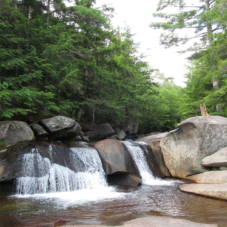
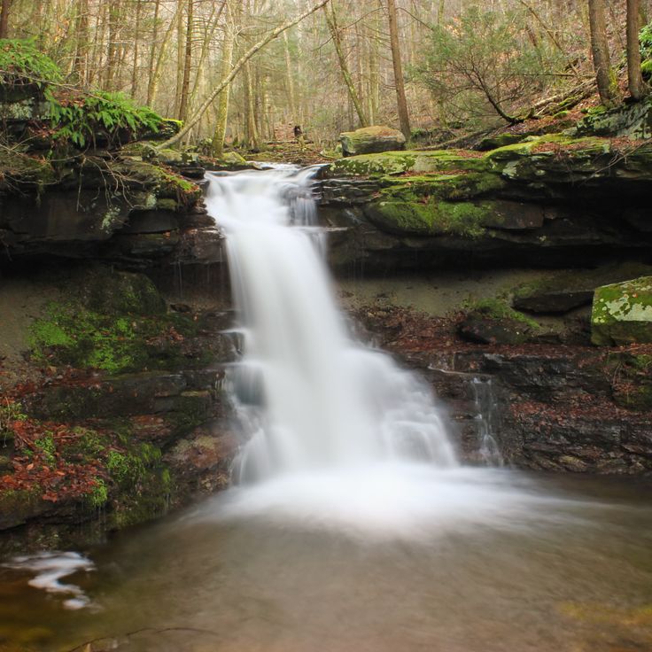
This waterfall drops about 23 feet over granite ledges in the Bear River, creating several smaller cascades along the way. The water has carved depressions into the rock that fill with clear pools. Screw Auger Waterfall sits in a wooded valley where trails follow the riverbank. In summer, visitors use the natural basins for swimming, while fall brings color to the surrounding trees. The rock formations show the slow work of flowing water on hard stone.
This canyon runs about 3 miles through the Maine woods, where the river has carved between rock walls rising roughly 400 feet. Hiking paths follow the water past several waterfalls, moving through the narrow passage. Dark stone frames the river while conifers grow at the rim. Gulf Hagas sits away from main roads and requires a walk through thick forest before reaching the gorge.
This car-free island is home to a small community of 65 residents and several art galleries. The coastline offers 17 marked hiking trails that wind through forested areas and along rocky shores. Fishermen and artists have worked here for generations. Visitors arrive by ferry and move around on foot. In summer, studios open their doors, and hikers explore the paths that lead to cliffs and secluded coves. The pace of life follows the tides and the changing seasons.
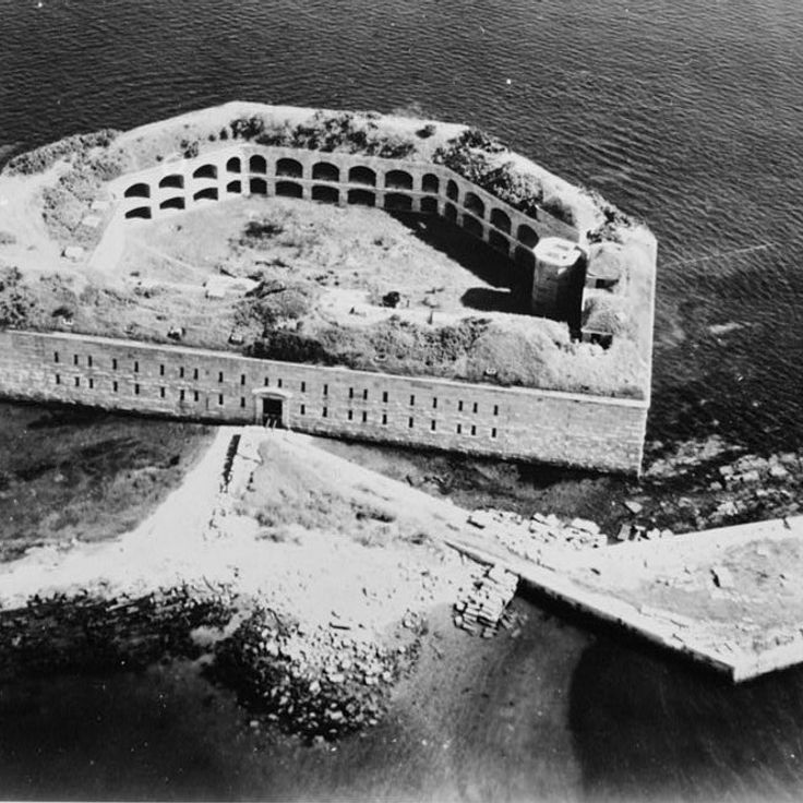
Fort Gorges stands on a small island in Portland Harbor. This granite fortress was built in 1864, when coastal defense seemed necessary. No battles ever happened here. The walls and casemates remain intact. Seen from the water, the fort shows its rounded arches and thick stone walls. At low tide, visitors can walk across. The rooms inside are open and empty. Light enters through the gun ports where cannons once pointed toward the sea. Gulls nest in the niches. The place feels quiet because few boats dock and visitors are rare.
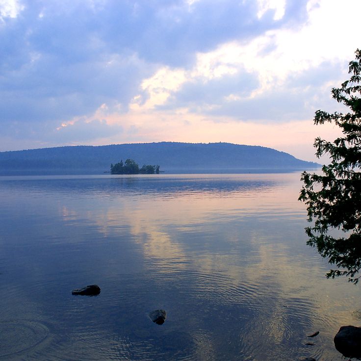
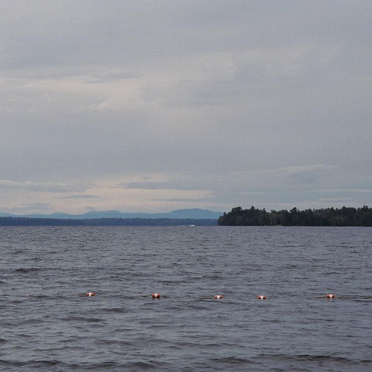
This lake sits in the northern mountains of Maine and is the largest lake in the state. The water stretches for many miles between forested hills, and the shores are mostly lined with woods. In summer, visitors come for fishing and boating, while in autumn the leaves around the shoreline turn red and orange. The area is lightly populated, and from many spots you see only forest and water. The region is known for moose, which are often spotted near the shore.
This island in Casco Bay contains a small residential community, private properties and several military installations from the 19th century. Trails wind through woods and along rocky shoreline. The island is accessible only by boat and maintains the character of a secluded retreat despite its proximity to Portland. Old fortifications from the Civil War era still stand on the cliffs.
This mountain in western Maine rises to roughly 3000 feet (915 meters) and shows granite cliffs emerging from its upper slopes. Hikers follow steep trails through forests that open into exposed terrain at higher elevations. Near the summit sits a natural mountain pond among the rocks, surrounded by talus and low shrubs. On clear days the view stretches across forested valleys and other peaks in the region. The ascent requires stamina, especially on the rocky sections near the top. In summer some hikers cool off in the cold water of the pond. The descent demands care on the steep, rocky passages.
This island in Knox County is part of Acadia National Park and offers about 17 miles of marked trails through dense conifer forests. Granite rocks line the coast, and the Atlantic is visible from almost any point on the island. Most paths lead through shaded woods of spruce and pine, others along the rocky shoreline. Ferries connect the island to the mainland, and in summer day visitors come to hike. In winter only a few residents remain, and the island becomes quiet. The trails vary in steepness, some climb to viewpoints above the water, others pass through valleys in the island interior.
This island lies roughly 3 miles (5 km) off Portland and shows military bunkers from earlier centuries, sand beaches along the coast and a historic lighthouse. Visitors reach Peaks Island by ferry and explore paths that run through wooded sections and rocky shorelines. The bunkers date to the Second World War and now stand open for walkers. The lighthouse has marked the harbor entrance since the 19th century and remains a landmark for ships. Beaches invite rest, while small houses and gardens shape the local setting.
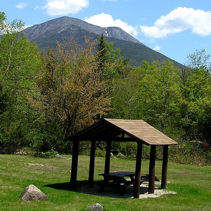
This park covers a large area in northern Maine and includes forests, lakes and Mount Katahdin, the tallest mountain in the state. Trails lead through different elevations and past bodies of water shaped by glaciers. The landscape ranges from dense woodland to alpine zones above the tree line. In autumn, hardwood trees turn red and orange. Visitors may see moose, bears and other wildlife. The park remains largely undeveloped, with few roads and simple facilities.
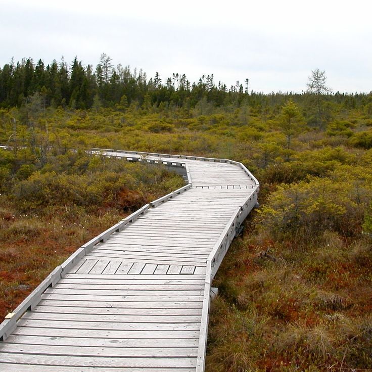
This wooden walkway extends roughly one mile through the peat bog and allows visitors to observe carnivorous plants and the vegetation common to wetland areas. The Orono Bog Boardwalk winds through a landscape that has formed over thousands of years. Thick layers of peat hold water and create an acidic, low-nutrient environment. Sundews and pitcher plants grow here, trapping insects to obtain nitrogen. Mosses cover the ground, small pools mirror the sky. The boardwalk sits just above the bog surface and you can feel it sway slightly when others walk past. In spring and summer, marsh flowers bloom. In fall, shrubs turn red and orange. Birds nest among reeds, dragonflies hover over the water.
Angel Falls drops over ninety feet (27 meters) through a gorge of granite. A short path through the woods leads to this waterfall. The water flows over smooth rock walls and collects in a pool at the base of the falls. Trees surround the gorge and filter the light. In spring, the waterfall carries more water. The trail is easy to walk and ends at a viewing area close to the water.
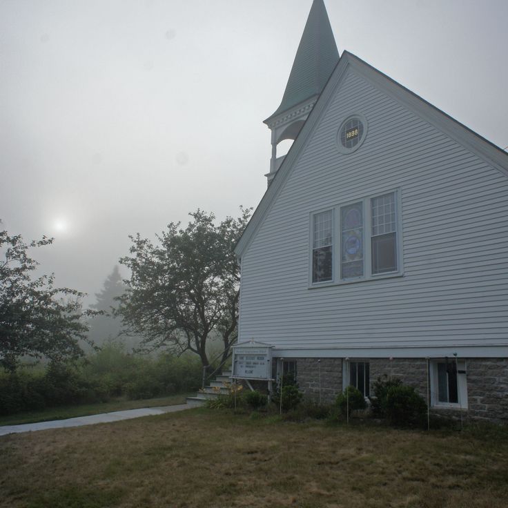
This lighthouse dates from 1898 and stands on a rocky point overlooking the mouth of the Kennebec River. Squirrel Point Light is among the historic navigation aids along the coast of Maine, positioned where the river meets the Atlantic. The setting is quiet, with pine trees and granite ledges nearby. The structure once guided vessels into the harbor. Today visitors can walk the grounds and take in views of the water and passing boats.
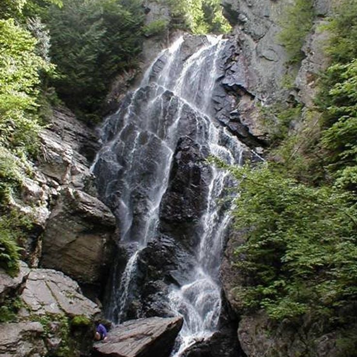
This trail follows a gorge with several waterfalls. Coniferous trees grow along the path. The trail passes through a narrow valley where water flows down between rocks. The sound of water accompanies hikers along the entire route. The path runs close to the stream and offers views of the falls. The landscape shows typical features of wooded areas in Maine, with firs and spruces. In summer, the trail is green and shaded. The Gorge Trail sits in a quiet area, away from larger towns.
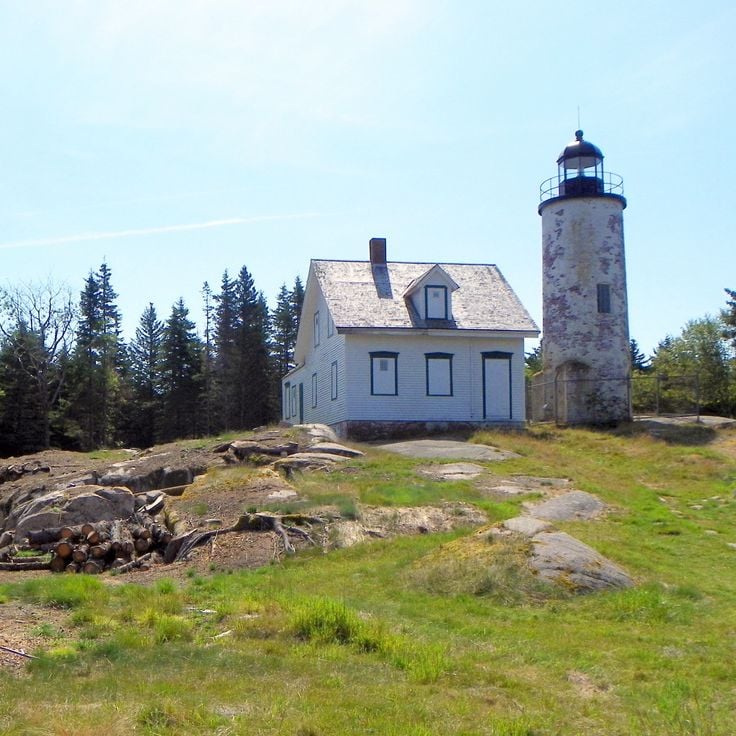
This island sits off the coast of Acadia and can only be reached by boat. The lighthouse dates to the 19th century and still stands along the shore. Old wooden fishing cabins are scattered across the grounds. In summer, wildflowers grow in open meadows. Walking paths lead through wooded sections and along rocky shorelines. The grounds remain quiet since only a few visitors arrive on organized tours or private boats. Gulls and other seabirds nest in the cliffs.
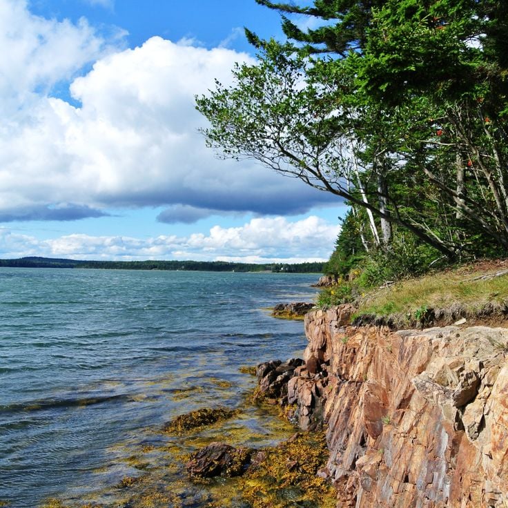
This peninsula extends east of the main section of Acadia and shows granite cliffs that drop into the ocean. Forests of spruce and fir grow close to the shore. Hiking paths lead through the terrain and up to Schoodic Head, which offers views over the Atlantic. Access is less crowded than other parts of the park. Waves and spray form against the rocks in the water.
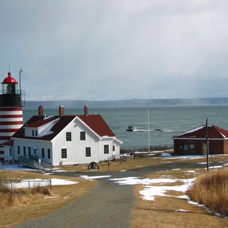
This striped lighthouse stands at the easternmost point of the United States and offers views toward Canada. West Quoddy Head Light joins Maine's collection of coastal landmarks, where lighthouses have served sailors for centuries. The red and white stripes stand out against the sky and sea. From here, visitors see the Canadian coast across the water. Fog often rolls in, giving the place a muted, cool feeling. Wind comes off the Atlantic and brings salty air. Trails lead around the headland, passing through low vegetation shaped by the weather.
This historic transport system from 1902 carried logs over 8 miles (13 kilometers) through the forests of northern Maine. Eagle Lake Tramway was part of the lumber industry that operated in the region at the time. The cable construction crossed rough terrain between lakes and wooded areas. Today, remains of the system recall the earlier use of this remote place.
This 18th century farmhouse served as a storage facility for military supplies during the Revolutionary War. Colburn House State Historic Site sits in a rural area and shows the architecture of that period. The wooden structure stands among open fields. Visitors see the rooms where American troops stored provisions before marching toward Canada. The furnishings and construction offer insight into settler life and wartime conditions.
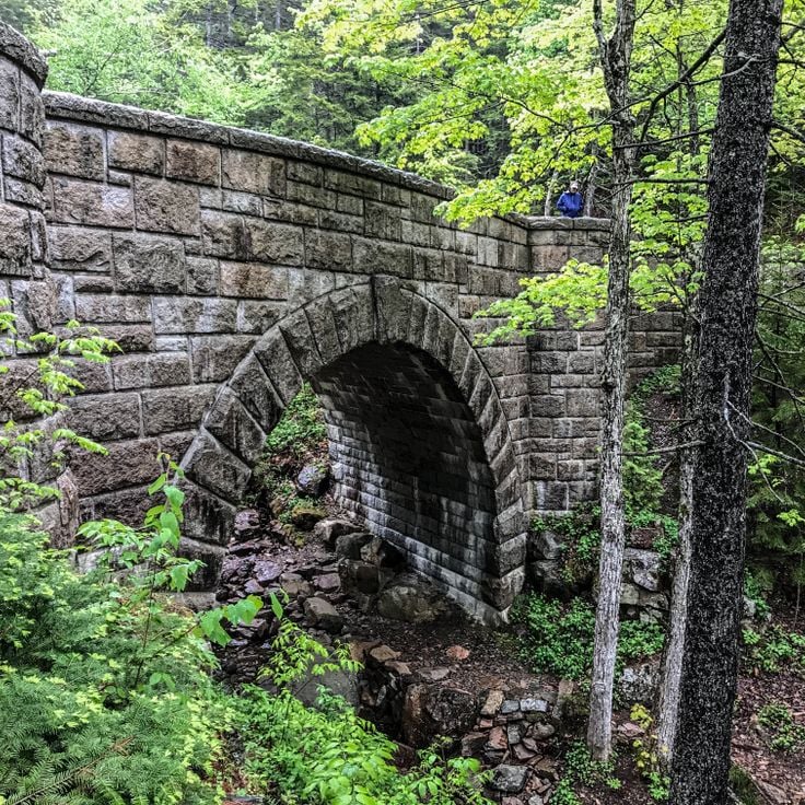
These gravel roads in Acadia were built between 1913 and 1940 and stretch for 57 kilometers through the wooded hills and valleys of the island. The routes were originally designed for horse carriages and now lead through forests of pine and hardwood, past small ponds and over stone bridges. The paths rise gently and offer views of the coast and inland areas. In autumn the leaves turn red and orange. The roads are wide enough for cyclists and walkers and remain free of cars. In some places you can see the carefully cut granite blocks of the bridges and retaining walls, which were set by hand.
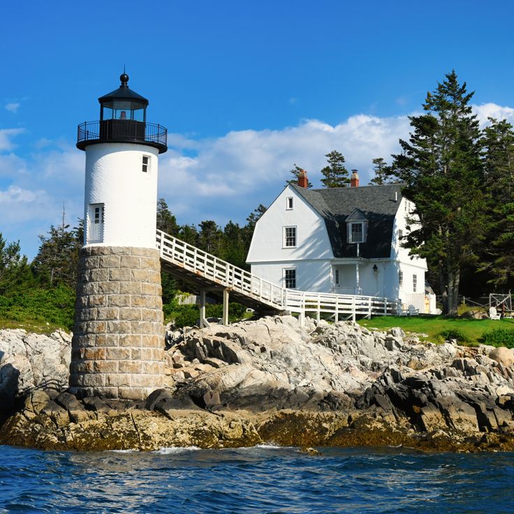
This lighthouse stands on a small island, just a short distance from the mainland. The red and white building dates back to 1879 and has served as a coastal marker in Maine since that time. Its position on the rocky outcrop makes it one of the most photographed lighthouses in the region. Visitors view it from the shore, particularly at sunset or when waves crash against the rocks.
Lily Bay State Park has campsites and swimming spots along the shore of Moosehead Lake. This park covers 2 kilometers of lakefront and works well for swimming, fishing and water sports. Visitors find trails through the forest and places to grill. The landscape shows pines and birches that reach down to the water. In summer, families come to picnic and paddle canoes.
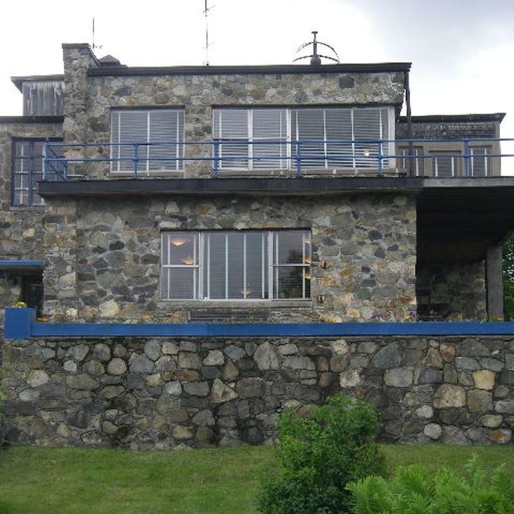
The Wilhelm Reich Museum displays research instruments, laboratory equipment and personal items of scientist Wilhelm Reich from the 1940s and 1950s. This facility sits in the western mountains of Maine and provides insight into Reich's work methods and scientific studies on energy and biology. The collection includes microscopes, measurement devices and handwritten notes from his time in Rangeley. This site connects the history of research with the natural surroundings of the region.
This botanical area on the outskirts of Augusta holds a tree collection with more than 200 species from different climate zones. Walking paths lead through open meadows and forested sections, past sculptures made from local granite. In spring magnolias and rhododendrons bloom, in fall maples turn red and orange. Visitors walk here, watch birds or picnic beneath old oaks. Viles Arboretum forms part of the nature sites in Maine and links garden culture with open wilderness.
This state park extends over salt marshes, coniferous forests, rocky shorelines and tidal zones, with trails through different natural habitats. Holbrook Island Sanctuary State Park is among the nature preserves in Maine where visitors walk along the coast and explore wooded areas. The landscape shifts between forest sections and open shore zones. Birds nest in the trees and along the water edges. Trails lead through the different sections of the park.
This island is home to an artist community and lies off the coast of Mount Desert Island. Little Cranberry Island is reached by ferry and offers quiet paths along the water, small houses set among pines and rocks, workshops and galleries in former fishing buildings. The community lives from the sea and from creative work. Visitors walk across the island, see boats in the harbor, and often hear the call of gulls. The feel is reserved and friendly. Those who come here find a different pace than on the mainland, silence among the trees, and the sense of a community that keeps its traditions.
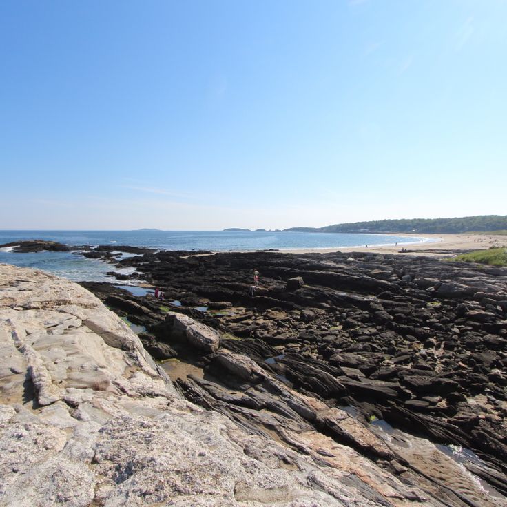
This state park sits on a peninsula in Georgetown, where sandy beaches meet tidal wetlands and rocky shoreline. The sand stretches in wide sections, separated by ledges and outcrops that rise from the water. Behind the dunes, a saltwater lagoon forms part of a wetland system that attracts wading birds and offers a quieter contrast to the open coast. The water stays cool even in summer. At high tide, waves reach the upper beach. At low tide, tide pools and wet sand appear along the rocks. Trails lead to overlooks above the ocean. The park is among the few public swimming beaches on this part of the Maine coast. Visitors come for swimming, walking the shore, or simply watching the weather roll in from the Atlantic.
This park sits at the easternmost point of the United States, protecting a peninsula that juts far into the Atlantic. The red and white West Quoddy Head Light stands on cliffs that drop sharply to the sea. Visitors often spot whales swimming offshore and seabirds circling above the waves. Fog banks frequently roll in from the ocean, wrapping the landscape in milky light. Walking trails lead through low forests of spruce and pine that bend in the wind. The shoreline reveals boulders, smooth stones and small coves where the water pulls back at low tide.
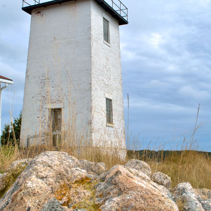
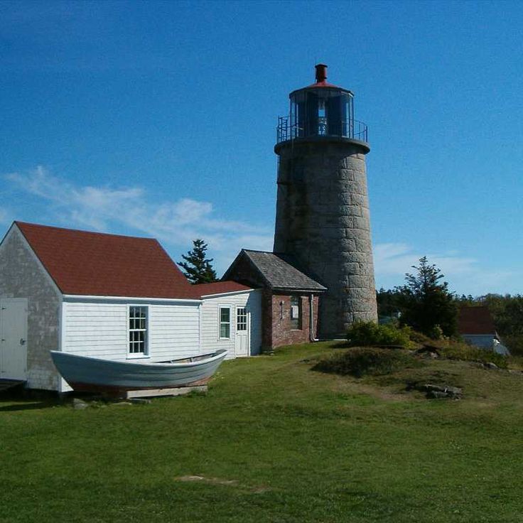
This lighthouse station on Swans Island has been operating since the 19th century and opens its doors to visitors. The tower allows views over rocky shores, wooded hills and open water. Tours through the rooms show how lighthouse keepers once worked here. The island sits off the Maine coast and is reached only by ferry. Around the station, wildflowers and coastal grasses grow. On clear days you can see neighboring islands and passing boats. The station remains a working beacon for marine traffic.
This natural area in Hallowell protects 165 acres (67 hectares) of forest along the Kennebec River. Walking trails lead through old growth trees and across stone bridges built in the 19th century. The paths follow the riverside where you can watch migratory birds in spring and fall. Remains of early settler buildings still stand among the trees. The forest consists mostly of oak, maple and hemlock. In summer the thick canopy provides shade, while autumn brings colors from yellow to deep red. The area sits just minutes from downtown and offers access to quiet woodland sections.
This lighthouse has stood on granite rocks since 1827, marking the coast near Bristol. The white tower rises above rock formations that slope into the Atlantic. Beside the lighthouse, a small museum covers the history of fishing and navigation. Visitors walk along the rocks and watch waves crash below. The site is one of the older coastal landmarks in Maine and shows the region's connection to the sea.
This beach extends for about 1,100 feet (350 meters) along the coast and consists mainly of pebbles rather than sand. Hiking trails wind through the area, and a freshwater lake of about 60 acres (24 hectares) sits nearby. Visitors come here to fish or walk along the shore. The setting combines coastal landscape with wooded sections and offers access to calm waters away from the ocean.
This waterfall drops about 23 feet over granite ledges in the Bear River, creating several smaller cascades along the way. The water has carved depressions into the rock that fill with clear pools. Screw Auger Waterfall sits in a wooded valley where trails follow the riverbank. In summer, visitors use the natural basins for swimming, while fall brings color to the surrounding trees. The rock formations show the slow work of flowing water on hard stone.
This canyon runs about 3 miles through the Maine woods, where the river has carved between rock walls rising roughly 400 feet. Hiking paths follow the water past several waterfalls, moving through the narrow passage. Dark stone frames the river while conifers grow at the rim. Gulf Hagas sits away from main roads and requires a walk through thick forest before reaching the gorge.
This car-free island is home to a small community of 65 residents and several art galleries. The coastline offers 17 marked hiking trails that wind through forested areas and along rocky shores. Fishermen and artists have worked here for generations. Visitors arrive by ferry and move around on foot. In summer, studios open their doors, and hikers explore the paths that lead to cliffs and secluded coves. The pace of life follows the tides and the changing seasons.
Fort Gorges stands on a small island in Portland Harbor. This granite fortress was built in 1864, when coastal defense seemed necessary. No battles ever happened here. The walls and casemates remain intact. Seen from the water, the fort shows its rounded arches and thick stone walls. At low tide, visitors can walk across. The rooms inside are open and empty. Light enters through the gun ports where cannons once pointed toward the sea. Gulls nest in the niches. The place feels quiet because few boats dock and visitors are rare.
This lake sits in the northern mountains of Maine and is the largest lake in the state. The water stretches for many miles between forested hills, and the shores are mostly lined with woods. In summer, visitors come for fishing and boating, while in autumn the leaves around the shoreline turn red and orange. The area is lightly populated, and from many spots you see only forest and water. The region is known for moose, which are often spotted near the shore.
This island in Casco Bay contains a small residential community, private properties and several military installations from the 19th century. Trails wind through woods and along rocky shoreline. The island is accessible only by boat and maintains the character of a secluded retreat despite its proximity to Portland. Old fortifications from the Civil War era still stand on the cliffs.
This mountain in western Maine rises to roughly 3000 feet (915 meters) and shows granite cliffs emerging from its upper slopes. Hikers follow steep trails through forests that open into exposed terrain at higher elevations. Near the summit sits a natural mountain pond among the rocks, surrounded by talus and low shrubs. On clear days the view stretches across forested valleys and other peaks in the region. The ascent requires stamina, especially on the rocky sections near the top. In summer some hikers cool off in the cold water of the pond. The descent demands care on the steep, rocky passages.
This island in Knox County is part of Acadia National Park and offers about 17 miles of marked trails through dense conifer forests. Granite rocks line the coast, and the Atlantic is visible from almost any point on the island. Most paths lead through shaded woods of spruce and pine, others along the rocky shoreline. Ferries connect the island to the mainland, and in summer day visitors come to hike. In winter only a few residents remain, and the island becomes quiet. The trails vary in steepness, some climb to viewpoints above the water, others pass through valleys in the island interior.
This island lies roughly 3 miles (5 km) off Portland and shows military bunkers from earlier centuries, sand beaches along the coast and a historic lighthouse. Visitors reach Peaks Island by ferry and explore paths that run through wooded sections and rocky shorelines. The bunkers date to the Second World War and now stand open for walkers. The lighthouse has marked the harbor entrance since the 19th century and remains a landmark for ships. Beaches invite rest, while small houses and gardens shape the local setting.
This park covers a large area in northern Maine and includes forests, lakes and Mount Katahdin, the tallest mountain in the state. Trails lead through different elevations and past bodies of water shaped by glaciers. The landscape ranges from dense woodland to alpine zones above the tree line. In autumn, hardwood trees turn red and orange. Visitors may see moose, bears and other wildlife. The park remains largely undeveloped, with few roads and simple facilities.
This wooden walkway extends roughly one mile through the peat bog and allows visitors to observe carnivorous plants and the vegetation common to wetland areas. The Orono Bog Boardwalk winds through a landscape that has formed over thousands of years. Thick layers of peat hold water and create an acidic, low-nutrient environment. Sundews and pitcher plants grow here, trapping insects to obtain nitrogen. Mosses cover the ground, small pools mirror the sky. The boardwalk sits just above the bog surface and you can feel it sway slightly when others walk past. In spring and summer, marsh flowers bloom. In fall, shrubs turn red and orange. Birds nest among reeds, dragonflies hover over the water.
Angel Falls drops over ninety feet (27 meters) through a gorge of granite. A short path through the woods leads to this waterfall. The water flows over smooth rock walls and collects in a pool at the base of the falls. Trees surround the gorge and filter the light. In spring, the waterfall carries more water. The trail is easy to walk and ends at a viewing area close to the water.
This lighthouse dates from 1898 and stands on a rocky point overlooking the mouth of the Kennebec River. Squirrel Point Light is among the historic navigation aids along the coast of Maine, positioned where the river meets the Atlantic. The setting is quiet, with pine trees and granite ledges nearby. The structure once guided vessels into the harbor. Today visitors can walk the grounds and take in views of the water and passing boats.
This trail follows a gorge with several waterfalls. Coniferous trees grow along the path. The trail passes through a narrow valley where water flows down between rocks. The sound of water accompanies hikers along the entire route. The path runs close to the stream and offers views of the falls. The landscape shows typical features of wooded areas in Maine, with firs and spruces. In summer, the trail is green and shaded. The Gorge Trail sits in a quiet area, away from larger towns.
This island sits off the coast of Acadia and can only be reached by boat. The lighthouse dates to the 19th century and still stands along the shore. Old wooden fishing cabins are scattered across the grounds. In summer, wildflowers grow in open meadows. Walking paths lead through wooded sections and along rocky shorelines. The grounds remain quiet since only a few visitors arrive on organized tours or private boats. Gulls and other seabirds nest in the cliffs.
This peninsula extends east of the main section of Acadia and shows granite cliffs that drop into the ocean. Forests of spruce and fir grow close to the shore. Hiking paths lead through the terrain and up to Schoodic Head, which offers views over the Atlantic. Access is less crowded than other parts of the park. Waves and spray form against the rocks in the water.
This striped lighthouse stands at the easternmost point of the United States and offers views toward Canada. West Quoddy Head Light joins Maine's collection of coastal landmarks, where lighthouses have served sailors for centuries. The red and white stripes stand out against the sky and sea. From here, visitors see the Canadian coast across the water. Fog often rolls in, giving the place a muted, cool feeling. Wind comes off the Atlantic and brings salty air. Trails lead around the headland, passing through low vegetation shaped by the weather.
This historic transport system from 1902 carried logs over 8 miles (13 kilometers) through the forests of northern Maine. Eagle Lake Tramway was part of the lumber industry that operated in the region at the time. The cable construction crossed rough terrain between lakes and wooded areas. Today, remains of the system recall the earlier use of this remote place.
This 18th century farmhouse served as a storage facility for military supplies during the Revolutionary War. Colburn House State Historic Site sits in a rural area and shows the architecture of that period. The wooden structure stands among open fields. Visitors see the rooms where American troops stored provisions before marching toward Canada. The furnishings and construction offer insight into settler life and wartime conditions.
These gravel roads in Acadia were built between 1913 and 1940 and stretch for 57 kilometers through the wooded hills and valleys of the island. The routes were originally designed for horse carriages and now lead through forests of pine and hardwood, past small ponds and over stone bridges. The paths rise gently and offer views of the coast and inland areas. In autumn the leaves turn red and orange. The roads are wide enough for cyclists and walkers and remain free of cars. In some places you can see the carefully cut granite blocks of the bridges and retaining walls, which were set by hand.
This lighthouse stands on a small island, just a short distance from the mainland. The red and white building dates back to 1879 and has served as a coastal marker in Maine since that time. Its position on the rocky outcrop makes it one of the most photographed lighthouses in the region. Visitors view it from the shore, particularly at sunset or when waves crash against the rocks.
Lily Bay State Park has campsites and swimming spots along the shore of Moosehead Lake. This park covers 2 kilometers of lakefront and works well for swimming, fishing and water sports. Visitors find trails through the forest and places to grill. The landscape shows pines and birches that reach down to the water. In summer, families come to picnic and paddle canoes.
The Wilhelm Reich Museum displays research instruments, laboratory equipment and personal items of scientist Wilhelm Reich from the 1940s and 1950s. This facility sits in the western mountains of Maine and provides insight into Reich's work methods and scientific studies on energy and biology. The collection includes microscopes, measurement devices and handwritten notes from his time in Rangeley. This site connects the history of research with the natural surroundings of the region.
This botanical area on the outskirts of Augusta holds a tree collection with more than 200 species from different climate zones. Walking paths lead through open meadows and forested sections, past sculptures made from local granite. In spring magnolias and rhododendrons bloom, in fall maples turn red and orange. Visitors walk here, watch birds or picnic beneath old oaks. Viles Arboretum forms part of the nature sites in Maine and links garden culture with open wilderness.
This state park extends over salt marshes, coniferous forests, rocky shorelines and tidal zones, with trails through different natural habitats. Holbrook Island Sanctuary State Park is among the nature preserves in Maine where visitors walk along the coast and explore wooded areas. The landscape shifts between forest sections and open shore zones. Birds nest in the trees and along the water edges. Trails lead through the different sections of the park.
This island is home to an artist community and lies off the coast of Mount Desert Island. Little Cranberry Island is reached by ferry and offers quiet paths along the water, small houses set among pines and rocks, workshops and galleries in former fishing buildings. The community lives from the sea and from creative work. Visitors walk across the island, see boats in the harbor, and often hear the call of gulls. The feel is reserved and friendly. Those who come here find a different pace than on the mainland, silence among the trees, and the sense of a community that keeps its traditions.
This state park sits on a peninsula in Georgetown, where sandy beaches meet tidal wetlands and rocky shoreline. The sand stretches in wide sections, separated by ledges and outcrops that rise from the water. Behind the dunes, a saltwater lagoon forms part of a wetland system that attracts wading birds and offers a quieter contrast to the open coast. The water stays cool even in summer. At high tide, waves reach the upper beach. At low tide, tide pools and wet sand appear along the rocks. Trails lead to overlooks above the ocean. The park is among the few public swimming beaches on this part of the Maine coast. Visitors come for swimming, walking the shore, or simply watching the weather roll in from the Atlantic.
This park sits at the easternmost point of the United States, protecting a peninsula that juts far into the Atlantic. The red and white West Quoddy Head Light stands on cliffs that drop sharply to the sea. Visitors often spot whales swimming offshore and seabirds circling above the waves. Fog banks frequently roll in from the ocean, wrapping the landscape in milky light. Walking trails lead through low forests of spruce and pine that bend in the wind. The shoreline reveals boulders, smooth stones and small coves where the water pulls back at low tide.
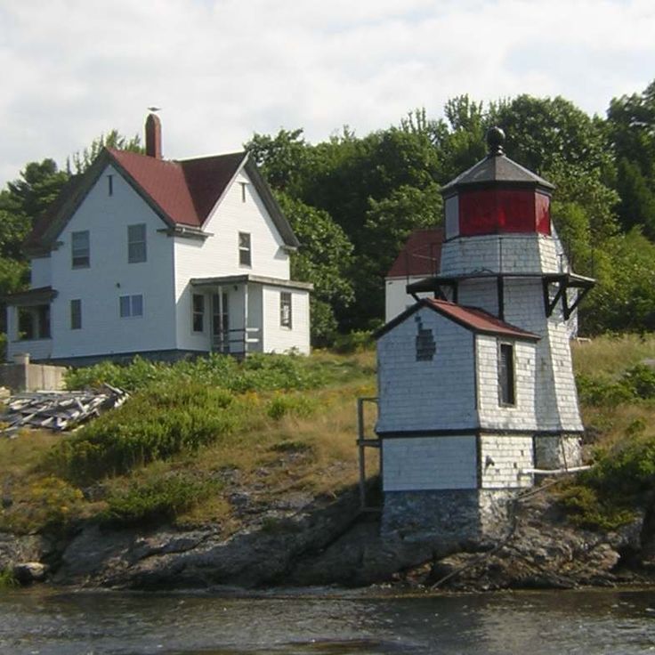
This lighthouse station on Swans Island has been operating since the 19th century and opens its doors to visitors. The tower allows views over rocky shores, wooded hills and open water. Tours through the rooms show how lighthouse keepers once worked here. The island sits off the Maine coast and is reached only by ferry. Around the station, wildflowers and coastal grasses grow. On clear days you can see neighboring islands and passing boats. The station remains a working beacon for marine traffic.