Enable Location

We need your location to show you interesting places around you

Discover nearby places

Find interesting locations and hidden gems around you

Precise directions

Get accurate directions and distances to places

Your location is never shared with other users. It's only used when you tap the location button.

Tehama County

Log in to your account

Start exploring — it's free

Trusted by 63,661 travelers worldwide

Continue with Google
Continue with Apple
or

We will send you a code to connect

By continuing, you accept our Terms and Conditions and our Privacy Policy

Check your inbox

We've sent a pincode in your inbox. Please enter the code below.

Discussion Reviews 5 Photos
45.8k Popularity

Tehama County, Administrative county in northern California, US

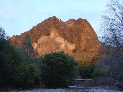
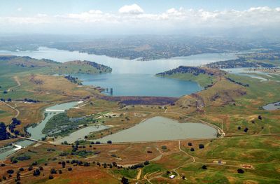
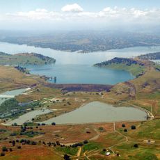
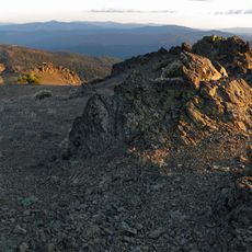
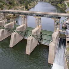
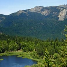
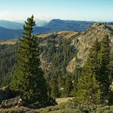
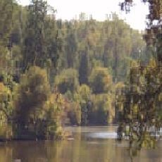
Tehama County is an administrative county in northern California between Sacramento and the Oregon border. The Sacramento River flows through its central portion, shaping the landscape with valleys, riverbanks, and hills.

The county was established in 1856 from portions of Butte, Colusa, and Shasta Counties. This creation followed the Mexican-American War and coincided with settler expansion during the era of gold mining in California.

The name Tehama comes from the Wintun language and means either high water or salmon, reflecting the indigenous roots of the region. These words held significance for the people who lived here long before the county was established.

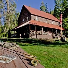
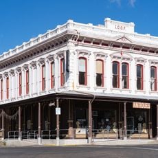
Red Bluff serves as the county seat and administrative center where visitors can find local government services. The best time to explore is spring and fall when temperatures are moderate and trails are accessible.

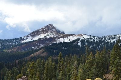
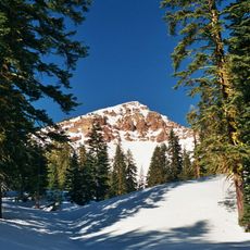
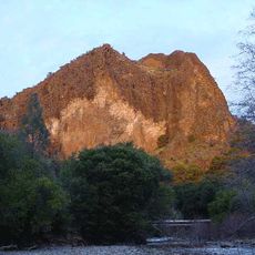
The area contains an extensive network of hiking trails, including a section of the famous long-distance trail that runs from Mexico to Canada. A significant portion of the county's border sits adjacent to an active volcano park with hot springs and geothermal phenomena.

The community of curious travelers

AroundUs brings together thousands of curated places, local tips, and hidden gems, enriched daily by 60,000 contributors worldwide.

Start exploring
Location
Inception
1856
Capital city
Red Bluff
Shares border with
Shasta County, Plumas County, Glenn County, Butte County, Mendocino County, Trinity County
GPS coordinates
40.13000,-122.23000
Latest update
December 14, 2025 20:07
Around this place
Mount Tehama
United States of America

Mount Tehama

66.9 km
Abbey of New Clairvaux
United States of America

Abbey of New Clairvaux

26.1 km
Ishi Wilderness
United States of America

Ishi Wilderness

40.4 km
Saint Herman of Alaska Brotherhood
United States of America

Saint Herman of Alaska Brotherhood

61.8 km
Yolla Bolly-Middle Eel Wilderness
United States of America

Yolla Bolly-Middle Eel Wilderness

66.7 km
Black Butte Lake
United States of America

Black Butte Lake

37.7 km
Mount Linn
United States of America

Mount Linn

54.2 km
Drakesbad Guest Ranch
United States of America

Drakesbad Guest Ranch

78.4 km
Poe Dam
United States of America

Poe Dam

76.8 km
Chico Air Museum
United States of America

Chico Air Museum

48.2 km
United States of America

Hall City Cave

73.4 km
Anthony Peak
United States of America

Anthony Peak

70.2 km
North Yolla Bolly Mountain
United States of America

North Yolla Bolly Mountain

63.7 km
Butte Creek Ecological Reserve
United States of America

Butte Creek Ecological Reserve

69.5 km
State Theatre
United States of America

State Theatre

5.2 km
United States of America

Монастырь Святого Иоанна Шанхайского

45.5 km
Inskip Hotel
United States of America

Inskip Hotel

60.7 km
Odd Fellows Building
United States of America

Odd Fellows Building

5.2 km
Park Headquarters, Lassen Volcanic National Park
United States of America

Park Headquarters, Lassen Volcanic National Park

58 km
Old Bank of America Building
United States of America

Old Bank of America Building

5.4 km
Warner Valley Ranger Station
United States of America

Warner Valley Ranger Station

79.9 km
Saint Mary's Parish
United States of America

Saint Mary's Parish

5.1 km
Cottonwood Historic District
United States of America

Cottonwood Historic District

28.4 km
Maywood Woman's Club
United States of America

Maywood Woman's Club

23 km
United States of America

Beegum Peak

59.6 km
Kohm Yah-mah-nee Visitor Center
United States of America

Kohm Yah-mah-nee Visitor Center

68.3 km
United States of America

Captain Jones Rapids

26.2 km
Reading Adobe Site
United States of America

Reading Adobe Site

29.2 km
Show the full map
Reviews
Share your experience

No review yet

Discussions
Start a discussion...

No discussion yet

« Tehama County - Administrative county in northern California, US » is provided by Around Us (aroundus.com). Images and texts are derived from Wikimedia project under a Creative Commons license. You are allowed to copy, distribute, and modify copies of this page, under the conditions set by the license, as long as this note is clearly visible.

Discover hidden gems everywhere you go!

From secret cafés to breathtaking viewpoints, skip the crowded tourist spots and find places that match your style. Our app makes it easy with voice search, smart filtering, route optimization, and insider tips from travelers worldwide. Download now for the complete mobile experience.

Around Us App Screenshot

A unique approach to discovering new places

Le Figaro

All the places worth exploring

France Info

A tailor-made excursion in just a few clicks

20 Minutes

Around Us
Travel Guide & Maps
Download

Send to your phone

QR Code
1

Open the camera app on your mobile.

2

Point at the QR code with your camera. A notification will appear.

3

Tap the notification to open the link.