Enable Location

We need your location to show you interesting places around you

Discover nearby places

Find interesting locations and hidden gems around you

Precise directions

Get accurate directions and distances to places

Your location is never shared with other users. It's only used when you tap the location button.

Log in to your account

Start exploring — it's free

Trusted by 63,023 travelers worldwide

Continue with Google
Continue with Apple
or

We will send you a code to connect

By continuing, you accept our Terms and Conditions and our Privacy Policy

Check your inbox

We've sent a pincode in your inbox. Please enter the code below.

Hall City Cave
Discussion Reviews Photo
2.1k Popularity

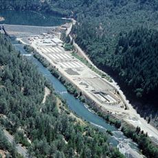
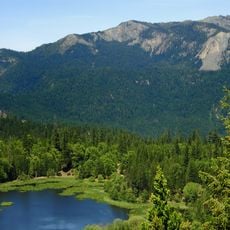
Hall City Cave, Limestone cave near Hayfork, Northern California, US.

Hall City Cave is a limestone cavern near Hayfork in Northern California that penetrates about 200 yards into the mountainside. The passage terminates at a large underground pool with a deep vertical shaft dropping below the water surface.

The cave was first documented during an exploration in 1903, which resulted in finding a significant fossil from the Permian period. This early expedition contributed to understanding the geological history of the area.

This location held spiritual significance for the Native American groups who lived in the surrounding lands and incorporated it into their sacred practices.

The cave stays cold and constant year-round at around 9 to 10 degrees Celsius, so bring warm layers regardless of the season. Specialized climbing and safety equipment is necessary for exploring deeper sections, particularly when approaching the underground pool.

A mysterious stone ring measuring roughly 2 feet (60 cm) across rests beneath the water surface, positioned directly above the deepest part of the cave. The purpose and origin of this object remain unclear to this day.

The community of curious travelers

AroundUs brings together thousands of curated places, local tips, and hidden gems, enriched daily by 60,000 contributors worldwide.

Start exploring
Location
GPS coordinates
40.41140,-123.01200
Latest update
December 13, 2025 17:02
Around this place
Sundial Bridge at Turtle Bay
United States of America

Sundial Bridge at Turtle Bay

57.4 km
Trinity Lake
United States of America

Trinity Lake

50.3 km
Whiskeytown Lake
United States of America

Whiskeytown Lake

45 km
Trinity Dam
United States of America

Trinity Dam

48.2 km
Saint Herman of Alaska Brotherhood
United States of America

Saint Herman of Alaska Brotherhood

11.9 km
Yolla Bolly-Middle Eel Wilderness
United States of America

Yolla Bolly-Middle Eel Wilderness

42.9 km
Turtle Bay Exploration Park
United States of America

Turtle Bay Exploration Park

57.4 km
Keswick Dam
United States of America

Keswick Dam

52.8 km
Mount Linn
United States of America

Mount Linn

43.9 km
Whiskeytown Dam
United States of America

Whiskeytown Dam

45 km
Thompson Peak
United States of America

Thompson Peak

65.6 km
Spring Creek Dam
United States of America

Spring Creek Dam

51.6 km
Cascade Theatre
United States of America

Cascade Theatre

56 km
Lewiston Lake
United States of America

Lewiston Lake

39.7 km
Lewiston Dam
United States of America

Lewiston Dam

39.4 km
WaterWorks Park
United States of America

WaterWorks Park

58.9 km
Anthony Peak
United States of America

Anthony Peak

63 km
North Yolla Bolly Mountain
United States of America

North Yolla Bolly Mountain

24.2 km
Spring Creek Reservoir
United States of America

Spring Creek Reservoir

51.6 km
McConnell Arboretum & Botanical Gardens
United States of America

McConnell Arboretum & Botanical Gardens

57.1 km
Oasis Fun Center
United States of America

Oasis Fun Center

61.3 km
United States of America

Signal Peak

46.8 km
Cottonwood Historic District
United States of America

Cottonwood Historic District

62.1 km
Bowerman Barn
United States of America

Bowerman Barn

58.2 km
Edward Frisbie House
United States of America

Edward Frisbie House

56.3 km
French Gulch Historic District
United States of America

French Gulch Historic District

45.5 km
Brandy Creek Beach
United States of America

Brandy Creek Beach

43.8 km
Weaverville Joss House State Historic Park
United States of America

Weaverville Joss House State Historic Park

36.2 km
Show the full map
Reviews
Share your experience

No review yet

Discussions
Start a discussion...

No discussion yet

« Hall City Cave - Limestone cave near Hayfork, Northern California, US » is provided by Around Us (aroundus.com). Images and texts are derived from Wikimedia project under a Creative Commons license. You are allowed to copy, distribute, and modify copies of this page, under the conditions set by the license, as long as this note is clearly visible.

Discover hidden gems everywhere you go!

From secret cafés to breathtaking viewpoints, skip the crowded tourist spots and find places that match your style. Our app makes it easy with voice search, smart filtering, route optimization, and insider tips from travelers worldwide. Download now for the complete mobile experience.

Around Us App Screenshot

A unique approach to discovering new places

Le Figaro

All the places worth exploring

France Info

A tailor-made excursion in just a few clicks

20 Minutes

Around Us
Travel Guide & Maps
Download

Send to your phone

QR Code
1

Open the camera app on your mobile.

2

Point at the QR code with your camera. A notification will appear.

3

Tap the notification to open the link.