Enable Location

We need your location to show you interesting places around you

Discover nearby places

Find interesting locations and hidden gems around you

Precise directions

Get accurate directions and distances to places

Your location is never shared with other users. It's only used when you tap the location button.

Sullivan County

Log in to your account

Start exploring — it's free

Trusted by 61,829 travelers worldwide

Continue with Google
Continue with Apple
or

We will send you a code to connect

By continuing, you accept our Terms and Conditions and our Privacy Policy

Check your inbox

We've sent a pincode in your inbox. Please enter the code below.

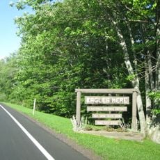
Sullivan County, Administrative county in Pennsylvania, United States.

Description

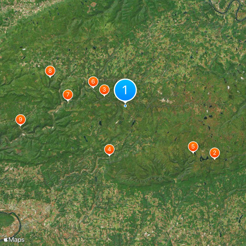
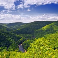
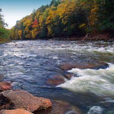
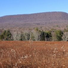
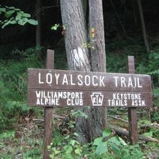
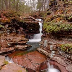
Sullivan County is an administrative division in the Appalachian region of Pennsylvania, encompassing mountains, valleys, forests, farmland, and several creeks including Loyalsock Creek. The landscape features wooded hills and waterways that define the area's character.

History

The area was separated from Lycoming County in 1847 and named after state senator Charles C. Sullivan. This establishment marked the creation of an independent administrative unit in the Appalachian region.

Culture

The Sullivan County Fair and Dushore Dairy Parade celebrate local traditions through competitions, carnival rides, and agricultural exhibitions throughout the year. These events bring community members together and reflect the rural character of the region.

Practical

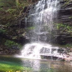
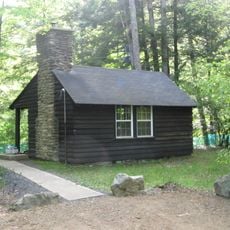
Ricketts Glen State Park and Worlds End State Park offer extended hiking trails, waterfalls, camping, and outdoor recreation. Visitors should prepare appropriate gear for hiking and be ready for seasonal conditions.

Did you know?

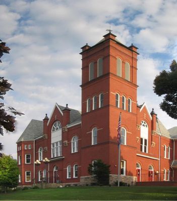
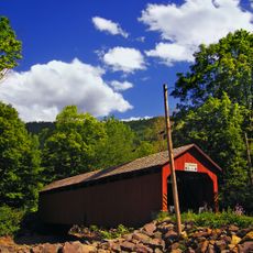
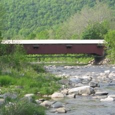
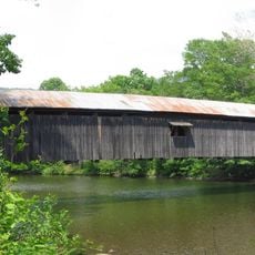
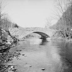
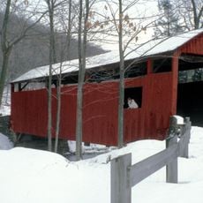
Three wooden bridges in Forksville, Hillsgrove, and Sonestown are notable examples of bridge engineering from earlier times. These structures are listed in the National Register of Historic Places.

Location
Inception
March 15, 1847
Capital city
Laporte
Shares border with
Bradford County, Wyoming County, Luzerne County, Columbia County, Lycoming County
GPS coordinates
41.45000,-76.51000
Latest update
December 20, 2025 11:23

AroundUs brings together thousands of curated places, local tips, and hidden gems, enriched daily by 60,000 contributors worldwide. Discover all places nearby (Pennsylvania).

Around this place
Ricketts Glen State Park
United States of America

Ricketts Glen State Park

24.2 km
Worlds End State Park
United States of America

Worlds End State Park

5.4 km
Sonestown Covered Bridge
United States of America

Sonestown Covered Bridge

12.1 km
Clemuel Ricketts Mansion
United States of America

Clemuel Ricketts Mansion

19.2 km
Forksville Covered Bridge
United States of America

Forksville Covered Bridge

8.6 km
Hillsgrove Covered Bridge
United States of America

Hillsgrove Covered Bridge

13.5 km
Loyalsock State Forest
United States of America

Loyalsock State Forest

18.8 km
Plunketts Creek Bridge No. 3
United States of America

Plunketts Creek Bridge No. 3

24.9 km
State Game Lands Number 13
United States of America

State Game Lands Number 13

15.3 km
Central Mountain
United States of America

Central Mountain

21.6 km
Eagles Mere Historic District
United States of America

Eagles Mere Historic District

6.7 km
United States of America

Sullivan County Courthouse

3.2 km
Eagles Mere Air Museum
United States of America

Eagles Mere Air Museum

4.2 km
Lake Rose
United States of America

Lake Rose

22.4 km
Y Covered Bridge No. 156
United States of America

Y Covered Bridge No. 156

21.6 km
United States of America

Saxe Pond

19.2 km
Worlds End State Park Family Cabin District
United States of America

Worlds End State Park Family Cabin District

5.8 km
Loyalsock Trail
United States of America

Loyalsock Trail

9.2 km
United States of America

Connell Pond

14.3 km
United States of America

State Game Lands Number 134

22.4 km
United States of America

Maple Lake

11.7 km
United States of America

State Game Lands Number 57

21.9 km
United States of America

State Game Lands Number 66

20.5 km
United States of America

Mount Spring Lake

26.4 km
United States of America

Lake Jean

20.7 km
Adams Falls
United States of America

Adams Falls

25.9 km
United States of America

New Theatre

14.4 km
United States of America

Picture Rocks

25.2 km
Show the full map
« Sullivan County - Administrative county in Pennsylvania, United States » is provided by Around Us (aroundus.com). Images and texts are derived from Wikimedia project under a Creative Commons license. You are allowed to copy, distribute, and modify copies of this page, under the conditions set by the license, as long as this note is clearly visible.

Discover hidden gems everywhere you go!

From secret cafés to breathtaking viewpoints, skip the crowded tourist spots and find places that match your style. Our app makes it easy with voice search, smart filtering, route optimization, and insider tips from travelers worldwide. Download now for the complete mobile experience.

Around Us App Screenshot

A unique approach to discovering new places

Le Figaro

All the places worth exploring

France Info

A tailor-made excursion in just a few clicks

20 Minutes

Around Us
Travel Guide & Maps
Download

Send to your phone

QR Code
1

Open the camera app on your mobile.

2

Point at the QR code with your camera. A notification will appear.

3

Tap the notification to open the link.