Fort Machault

Log in to your account

AroundUs is a community-driven map of interesting places, built by curious explorers like you. It grows with every review, story, and photo you share.
Connect to save your favorite spots, contribute locations, and create personalized routes.
Continue with Google
Continue with Apple
Continue with X
Continue with Facebook
Continue with email
By continuing, you accept our Terms and Conditions and our Privacy Policy
Create an account
Add to collection
Map
Suggest a change
Share

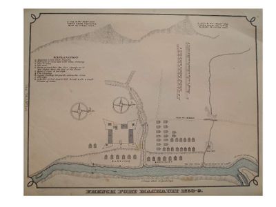
Fort Machault, French colonial fort in Pennsylvania, United States.

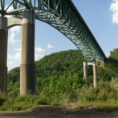
Fort Machault was a French military post located where French Creek meets the Allegheny River in what is now Pennsylvania. The installation featured wooden walls with corner bastions designed to defend the position against British attack.

French forces built the post in 1754 to secure their territorial claims against British expansion in the region. The installation was later destroyed by French troops to prevent it from becoming a British stronghold.

The fort was named after a French colonial official and served as a symbol of French power along the river valley. Visitors can sense how this place once represented French influence in a contested frontier landscape.

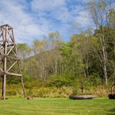
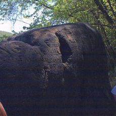
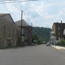
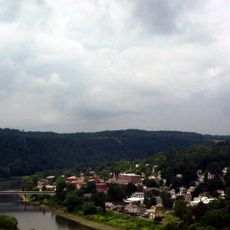
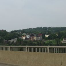
The site sits in a river valley and today features interpretive markers explaining the location's historical importance. Visitors should wear good walking shoes since the terrain is uneven and pathways are somewhat limited.

The post witnessed early diplomatic missions between French and British colonial representatives during the 1750s. These encounters reflected the tensions that would soon escalate into larger conflict in the region.

Location: Pennsylvania

GPS coordinates: 41.38610,-79.82170

Latest update: December 11, 2025 11:00

Photos
Around this place
Drake Well
United States of America

Drake Well

28.5 km
Drake Well Museum
United States of America

Drake Well Museum

28.5 km
Foxburg Country Club
United States of America

Foxburg Country Club

28.9 km
Oil Creek State Park
United States of America

Oil Creek State Park

22.5 km
Emlenton Bridge
United States of America

Emlenton Bridge

25.8 km
Indian God Rock
United States of America

Indian God Rock

6.2 km
United States of America

Fort Venango

361 m
Maurice K. Goddard State Park
United States of America

Maurice K. Goddard State Park

27.4 km
Erie National Wildlife Refuge
United States of America

Erie National Wildlife Refuge

29.4 km
Rockland Furnace
United States of America

Rockland Furnace

18 km
Samuel F. Dale House
United States of America

Samuel F. Dale House

1.8 km
McClintocksville, Pennsylvania
United States of America

McClintocksville, Pennsylvania

23.7 km
Pithole Stone Arch Bridge
United States of America

Pithole Stone Arch Bridge

22 km
Titusville City Hall
United States of America

Titusville City Hall

29.5 km
Emlenton Historic District
United States of America

Emlenton Historic District

24.7 km
Emlenton Low Level Bridge
United States of America

Emlenton Low Level Bridge

25.3 km
Jersey Bridge
United States of America

Jersey Bridge

29 km
Bridge in Oil Creek Township
United States of America

Bridge in Oil Creek Township

28.8 km
Titusville Historic District
United States of America

Titusville Historic District

29.8 km
Franklin Historic District
United States of America

Franklin Historic District

1.1 km
Bridge in French Creek Township
United States of America

Bridge in French Creek Township

19 km
Bridge in Clinton Township
United States of America

Bridge in Clinton Township

16.7 km
Witherup Bridge
United States of America

Witherup Bridge

14.7 km
Oil City Pennsylvania Railroad Bridge
United States of America

Oil City Pennsylvania Railroad Bridge

11.1 km
Barrow Civic Theater
United States of America

Barrow Civic Theater

1.4 km
Oil City Downtown Commercial Historic District
United States of America

Oil City Downtown Commercial Historic District

10.9 km
Oil City South Side Historic District
United States of America

Oil City South Side Historic District

9.4 km
Oil City North Side Historic District
United States of America

Oil City North Side Historic District

10.6 km
Show the full map
Reviews

Visited this place? Tap the stars to rate it and share your experience / photos with the community! Try now! You can cancel it anytime.

« Fort Machault - French colonial fort in Pennsylvania, United States » is provided by Around Us (aroundus.com). Images and texts are derived from Wikimedia project under a Creative Commons license. You are allowed to copy, distribute, and modify copies of this page, under the conditions set by the license, as long as this note is clearly visible.

Discover hidden gems everywhere you go!

From secret cafés to breathtaking viewpoints, skip the crowded tourist spots and find places that match your style. Our app makes it easy with voice search, smart filtering, route optimization, and insider tips from travelers worldwide. Download now for the complete mobile experience.

Around Us App Screenshot

A unique approach to discovering new places

Le Figaro

All the places worth exploring

France Info

A tailor-made excursion in just a few clicks

20 Minutes