Enable Location

We need your location to show you interesting places around you

Discover nearby places

Find interesting locations and hidden gems around you

Precise directions

Get accurate directions and distances to places

Your location is never shared with other users. It's only used when you tap the location button.

Oil Creek State Park

Log in to your account

Join the adventure

Create your free account and start exploring (like 60k+ others)

We will send you a code to connect

or
Continue with Google
Continue with Apple
By continuing, you accept our Terms and Conditions and our Privacy Policy

Check your inbox

We've sent a pincode in your inbox. Please enter the code below.

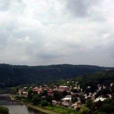
Oil Creek State Park, State park in Venango County, United States

Description

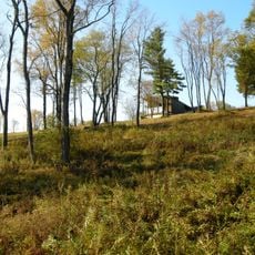
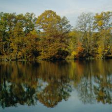
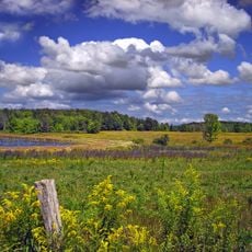
Oil Creek State Park is a nature reserve in Pennsylvania covering about 6,250 acres of forested land with streams and remnants of historical oil extraction equipment scattered throughout. The grounds have an extensive network of hiking and biking trails that connect different parts of the park.

History

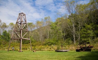
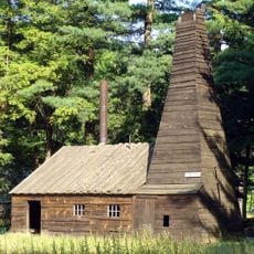
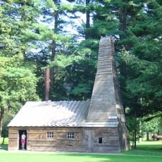
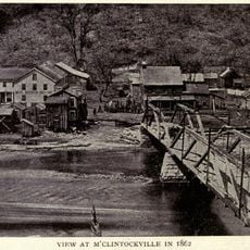
The park marks where the first commercial oil well in the United States was drilled in 1859, beginning Pennsylvania's oil industry. This event triggered major industrial change that transformed the region.

Culture

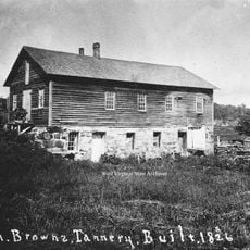
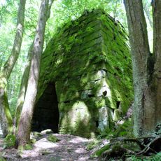
The Gerard Hiking Trail shows how people extracted oil in the 1800s through preserved equipment, abandoned settlements, and informational signs you can see along the way. Walking this path helps you understand what daily life looked like for those workers and their communities.

Practical

The park has multiple parking areas, restrooms, picnic spots, and camping facilities distributed across its trail network. Visitors should wear sturdy shoes and be prepared for different trail conditions depending on the season.

Did you know?

The Oil Creek and Titusville Railroad runs through the park, offering riders views of Miller Falls and other industrial structures from the 1800s oil boom era. This train ride blends transportation with a glimpse into how goods and people moved during that industrial period.

Location
Inception
1931
Operator
Pennsylvania Bureau of State Parks
GPS coordinates
41.54170,-79.64970
Latest update
December 8, 2025 20:03

AroundUs brings together thousands of curated places, local tips, and hidden gems, enriched daily by 60,000 contributors worldwide. Discover all places nearby (Venango County).

Around this place
Drake Well
United States of America

Drake Well

7.7 km
Pithole
United States of America

Pithole

6 km
Drake Well Museum
United States of America

Drake Well Museum

7.8 km
Foxburg Country Club
United States of America

Foxburg Country Club

43.7 km
Emlenton Bridge
United States of America

Emlenton Bridge

41.1 km
Riverside Inn
United States of America

Riverside Inn

44.6 km
Fort Machault
United States of America

Fort Machault

22.5 km
Indian God Rock
United States of America

Indian God Rock

27.7 km
John Brown Tannery Site
United States of America

John Brown Tannery Site

31.9 km
United States of America

Fort Venango

22.2 km
Maurice K. Goddard State Park
United States of America

Maurice K. Goddard State Park

43.1 km
Erie National Wildlife Refuge
United States of America

Erie National Wildlife Refuge

27.9 km
Hearts Content Scenic Area
United States of America

Hearts Content Scenic Area

37 km
United States of America

Baldwin-Reynolds House

43.4 km
United States of America

Tanbark Trail

38.2 km
United States of America

Hickory Creek Wilderness

33.3 km
Rockland Furnace
United States of America

Rockland Furnace

35.2 km
Samuel F. Dale House
United States of America

Samuel F. Dale House

22.2 km
McClintocksville, Pennsylvania
United States of America

McClintocksville, Pennsylvania

4.1 km
Bentley Hall
United States of America

Bentley Hall

43.1 km
Sutton-Ditz House
United States of America

Sutton-Ditz House

42.6 km
Independent Congregational Church
United States of America

Independent Congregational Church

43 km
Pithole Stone Arch Bridge
United States of America

Pithole Stone Arch Bridge

7.6 km
Clarion County Courthouse and Jail
United States of America

Clarion County Courthouse and Jail

42.5 km
Titusville City Hall
United States of America

Titusville City Hall

9.7 km
Emlenton Historic District
United States of America

Emlenton Historic District

40.6 km
Emlenton Low Level Bridge
United States of America

Emlenton Low Level Bridge

41 km
Amos Kelly House
United States of America

Amos Kelly House

44.7 km
Show the full map
« Oil Creek State Park - State park in Venango County, United States » is provided by Around Us (aroundus.com). Images and texts are derived from Wikimedia project under a Creative Commons license. You are allowed to copy, distribute, and modify copies of this page, under the conditions set by the license, as long as this note is clearly visible.

Discover hidden gems everywhere you go!

From secret cafés to breathtaking viewpoints, skip the crowded tourist spots and find places that match your style. Our app makes it easy with voice search, smart filtering, route optimization, and insider tips from travelers worldwide. Download now for the complete mobile experience.

Around Us App Screenshot

A unique approach to discovering new places

Le Figaro

All the places worth exploring

France Info

A tailor-made excursion in just a few clicks

20 Minutes

Around Us
Travel Guide & Maps
Download

Send to your phone

QR Code
1

Open the camera app on your mobile.

2

Point at the QR code with your camera. A notification will appear.

3

Tap the notification to open the link.