Chest opened
+${chestReward.xp} XP
Explorer
NOUVEAU ×${chestReward.collectible.quantity}
tapez pour fermer
Chest locked

Open chests in the app

Around Us is built for your phone — chests unlock when you walk, explore and capture nearby places.

Enable Location

We need your location to show you interesting places around you

Discover nearby places

Find interesting locations and hidden gems around you

Precise directions

Get accurate directions and distances to places

Your location is never shared with other users. It's only used when you tap the location button.

Roan Mountain

Log in to your account

Start exploring — it's free

Trusted by 72,986 travelers worldwide

Continue with Google
Continue with Apple
or

We will send you a code to connect

By continuing, you accept our Terms and Conditions and our Privacy Policy

Check your inbox

We've sent a pincode in your inbox. Please enter the code below.

Discussion Reviews 1 Photos
13.5k Popularity

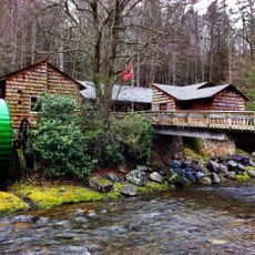
Roan Mountain, Census-designated place in Carter County, Tennessee, United States.

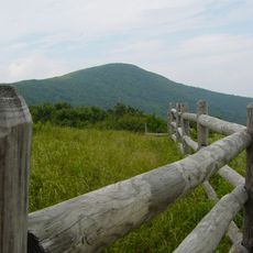
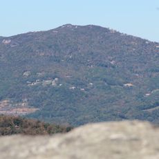
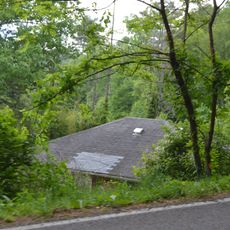
Roan Mountain is a census-designated place in southeastern Carter County near the Tennessee-North Carolina border. The settlement sits at roughly 2,600 feet (800 meters) elevation and covers several square miles of residential and natural areas.

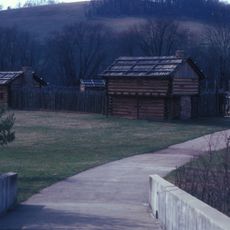
In September 1780, the Overmountain Men traveled through the area on their way to the Battle of Kings Mountain. They established camp at Shelving Rock during this significant journey in early American frontier history.

The Roan Mountain Rhododendron Festival has drawn visitors since 1947 with local food, handmade crafts, and live music performances. This celebration keeps regional traditions alive and remains a gathering point for the community.

The area connects to surrounding communities through Interstate 26 and U.S. Routes 19E and 321. Local schools provide basic services, and the location is accessible for travelers passing through the region.

A severe winter storm in 1998 caused major flooding that affected the community and its residents. This event left a lasting mark on the area's local memory.

The community of curious travelers

AroundUs brings together thousands of curated places, local tips, and hidden gems, enriched daily by 60,000 contributors worldwide.

Start exploring
Location
Elevation above the sea
786 m
GPS coordinates
36.19417,-82.06833
Latest update
December 7, 2025 20:26
Around this place
Grandfather Mountain
United States of America

Grandfather Mountain

24.9 km
Watauga Lake
United States of America

Watauga Lake

16.5 km
Sycamore Shoals
United States of America

Sycamore Shoals

23.6 km
Roan Mountain State Park
United States of America

Roan Mountain State Park

4.1 km
Overmountain Victory National Historic Trail
United States of America

Overmountain Victory National Historic Trail

21.4 km
Sugar Mountain
United States of America

Sugar Mountain

19 km
Sycamore Shoals State Historic Area
United States of America

Sycamore Shoals State Historic Area

23.5 km
Beech Mountain
United States of America

Beech Mountain

16.8 km
Elizabethton Covered Bridge
United States of America

Elizabethton Covered Bridge

21.4 km
Grassy Ridge Bald
United States of America

Grassy Ridge Bald

10.6 km
Sabine Hill
United States of America

Sabine Hill

23.3 km
Big Yellow Mountain
United States of America

Big Yellow Mountain

10.1 km
Valle Crucis Episcopal Mission
United States of America

Valle Crucis Episcopal Mission

24.5 km
Sycamore Shoals State Historic Park
United States of America

Sycamore Shoals State Historic Park

23.5 km
Simerly-Butler House
United States of America

Simerly-Butler House

13.7 km
John T. Wilder House
United States of America

John T. Wilder House

311 m
Avery County Jail
United States of America

Avery County Jail

17.5 km
Elk Park School
United States of America

Elk Park School

8.7 km
Ward Family House
United States of America

Ward Family House

22.9 km
Avery County Courthouse
United States of America

Avery County Courthouse

17.5 km
Mitchell County Courthouse
United States of America

Mitchell County Courthouse

21.4 km
Ray Wiseman House
United States of America

Ray Wiseman House

25.1 km
Dellinger Mill
United States of America

Dellinger Mill

19.9 km
Milligan Shuford Wise and Theron Colbert Dellinger Houses
United States of America

Milligan Shuford Wise and Theron Colbert Dellinger Houses

23 km
Land of Oz
United States of America

Land of Oz

16.9 km
Shook Branch Swimming Area
United States of America

Shook Branch Swimming Area

13.2 km
Mast General Store
United States of America

Mast General Store

25.9 km
Linn Cove Visitor Center
United States of America

Linn Cove Visitor Center

25.6 km
Show the full map
Reviews
Share your experience

No review yet

Discussions
Start a discussion...

No discussion yet

« Roan Mountain - Census-designated place in Carter County, Tennessee, United States » is provided by Around Us (aroundus.com). Images and texts are derived from Wikimedia project under a Creative Commons license. You are allowed to copy, distribute, and modify copies of this page, under the conditions set by the license, as long as this note is clearly visible.

Discover hidden gems everywhere you go!

From secret cafés to breathtaking viewpoints, skip the crowded tourist spots and find places that match your style. Our app makes it easy with voice search, smart filtering, route optimization, and insider tips from travelers worldwide. Download now for the complete mobile experience.

Around Us App Screenshot

A unique approach to discovering new places

Le Figaro

All the places worth exploring

France Info

A tailor-made excursion in just a few clicks

20 Minutes

Around Us
Travel Guide & Maps
Download

Send to your phone

QR Code
1

Open the camera app on your mobile.

2

Point at the QR code with your camera. A notification will appear.

3

Tap the notification to open the link.