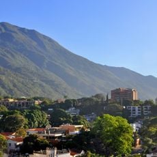
Quebrada El Ávila, Mountain stream in Caracas, Venezuela.
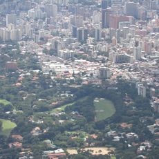
Quebrada El Ávila is a natural watercourse that flows north to south through the mountainous terrain surrounding Caracas. The stream descends through the urban landscape, carving through different neighborhoods and elevation zones.
Since the 1500s, this stream has served as a natural boundary and water source for settlements that developed into present-day Caracas. The watercourse shaped how the city expanded and divided into different neighborhoods over centuries.
The stream connects different neighborhoods and is woven into how residents navigate their city daily. Local people use the paths along its banks as shortcuts and gathering spaces within the urban landscape.
The stream can be observed at several points along its path, with main access near the Chacaito neighborhood. Water flow varies with rainfall, so the experience changes depending on the season and recent weather conditions.
The stream feeds into the Guaire River system through a connection with Quebrada Chacaito, forming part of the city's drainage network. This hidden connection is rarely noticed by visitors exploring the urban landscape.
The community of curious travelers
AroundUs brings together thousands of curated places, local tips, and hidden gems, enriched daily by 60,000 contributors worldwide.