Enable Location

We need your location to show you interesting places around you

Discover nearby places

Find interesting locations and hidden gems around you

Precise directions

Get accurate directions and distances to places

Your location is never shared with other users. It's only used when you tap the location button.

Salisbury Road

Log in to your account

Start exploring — it's free

Trusted by 62,832 travelers worldwide

Continue with Google
Continue with Apple
or

We will send you a code to connect

By continuing, you accept our Terms and Conditions and our Privacy Policy

Check your inbox

We've sent a pincode in your inbox. Please enter the code below.

Salisbury Road

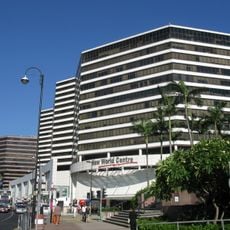
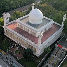
Salisbury Road, Major arterial road in Tsim Sha Tsui, Yau Tsim Mong District, Hong Kong.

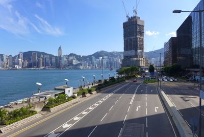
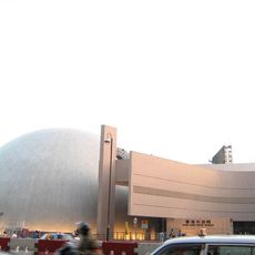
Salisbury Road stretches approximately 2 miles (3.2 kilometers) along the waterfront, connecting the Star Ferry Pier to key landmarks including the Hong Kong Cultural Centre, Hong Kong Museum of Art, and Hong Kong Space Museum while facilitating significant vehicular and pedestrian traffic through Tsim Sha Tsui.

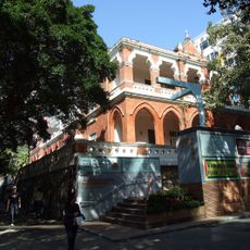
The road was extended westward to the shoreline in 1904 to connect train and ferry terminals, and it hosted the Kowloon-Canton Railway terminus until 1974, when the station was relocated to Hung Hom and the original Clock Tower structure remained as a preserved landmark.

Named after Robert Gascoyne-Cecil, the 3rd Marquess of Salisbury, the road reflects Hong Kong's colonial heritage, and its Chinese name was refined in the 1970s to more accurately represent the English pronunciation, demonstrating the city's linguistic and historical connections to Britain.

The road is well connected by public transport with nearby East Tsim Sha Tsui and Tsim Sha Tsui stations providing easy access, and its multiple intersections with Canton Road, Nathan Road, and Kowloon Park Drive make navigation straightforward for both residents and visitors exploring the district.

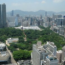
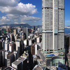
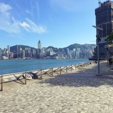
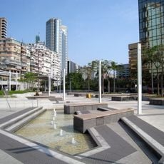
Salisbury Road provides direct access to the Tsim Sha Tsui East Promenade, a popular public space offering unobstructed views of Victoria Harbour and the Hong Kong skyline, and it hosts numerous events and leisure activities that draw both tourists and local residents year-round.

The community of curious travelers

AroundUs brings together thousands of curated places, local tips, and hidden gems, enriched daily by 60,000 contributors worldwide.

Start exploring
GPS coordinates
22.29693,114.17754
Latest update
November 28, 2025 15:19
« Salisbury Road - Major arterial road in Tsim Sha Tsui, Yau Tsim Mong District, Hong Kong » is provided by Around Us (aroundus.com). Images and texts are derived from Wikimedia project under a Creative Commons license. You are allowed to copy, distribute, and modify copies of this page, under the conditions set by the license, as long as this note is clearly visible.

Discover hidden gems everywhere you go!

From secret cafés to breathtaking viewpoints, skip the crowded tourist spots and find places that match your style. Our app makes it easy with voice search, smart filtering, route optimization, and insider tips from travelers worldwide. Download now for the complete mobile experience.

Around Us App Screenshot

A unique approach to discovering new places

Le Figaro

All the places worth exploring

France Info

A tailor-made excursion in just a few clicks

20 Minutes

Around Us
Travel Guide & Maps
Download

Send to your phone

QR Code
1

Open the camera app on your mobile.

2

Point at the QR code with your camera. A notification will appear.

3

Tap the notification to open the link.