Enable Location

We need your location to show you interesting places around you

Discover nearby places

Find interesting locations and hidden gems around you

Precise directions

Get accurate directions and distances to places

Your location is never shared with other users. It's only used when you tap the location button.

Brec de Chambeyron

Log in to your account

Start exploring — it's free

Trusted by 61,963 travelers worldwide

Continue with Google
Continue with Apple
or

We will send you a code to connect

By continuing, you accept our Terms and Conditions and our Privacy Policy

Check your inbox

We've sent a pincode in your inbox. Please enter the code below.

Brec de Chambeyron

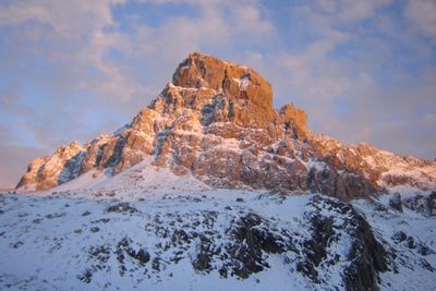
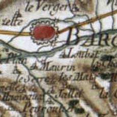
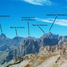
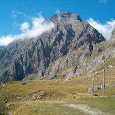
Brec de Chambeyron, Mountain summit in Ubaye Valley, France.

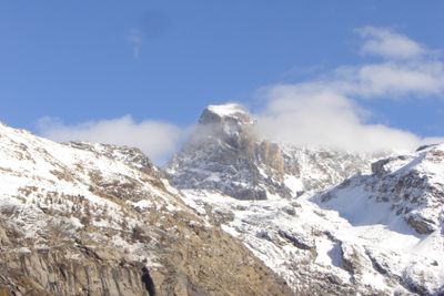
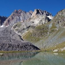
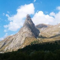
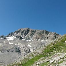
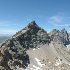
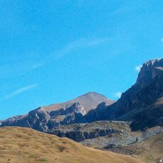
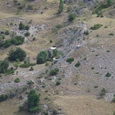
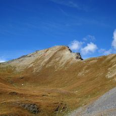
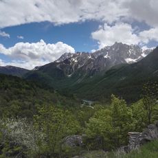
Brec de Chambeyron is a mountain summit in the French Alps reaching about 3,389 meters (11,120 feet) in elevation, marked by a sharp, rocky peak. The summit dominates the upper Ubaye Valley landscape and is surrounded by steep slopes and rock couloirs.

The mountain was first climbed in 1878, and these early ascents became milestones in the alpine exploration of the region. Early mountaineers established routes that shaped climbing development in the French Alps.

The name comes from French alpine terminology, where "Brec" describes a peak shaped like a pointed tooth rising sharply from the valley. Visitors can recognize this distinctive form from below and understand the origin of its name.

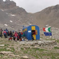
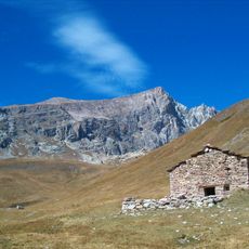
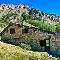
The Chambeyron Mountain Hut at about 2,626 meters (8,615 feet) serves as a base for summit attempts and offers basic overnight accommodations. Access is on foot via marked trails, though hikers need sure-footedness and experience on steep terrain.

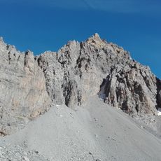
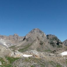
The north face with its steep couloir presents one of the technically demanding routes and requires advanced climbing skills. This section is known among experienced alpinists who bring a high level of skill and willingness to accept risk.

The community of curious travelers

AroundUs brings together thousands of curated places, local tips, and hidden gems, enriched daily by 60,000 contributors worldwide.

Start exploring
Elevation above the sea
3,389 m
Part of
France–Italy border
GPS coordinates
44.52785,6.85332
Latest update
December 14, 2025 11:42
« Brec de Chambeyron - Mountain summit in Ubaye Valley, France » is provided by Around Us (aroundus.com). Images and texts are derived from Wikimedia project under a Creative Commons license. You are allowed to copy, distribute, and modify copies of this page, under the conditions set by the license, as long as this note is clearly visible.

Discover hidden gems everywhere you go!

From secret cafés to breathtaking viewpoints, skip the crowded tourist spots and find places that match your style. Our app makes it easy with voice search, smart filtering, route optimization, and insider tips from travelers worldwide. Download now for the complete mobile experience.

Around Us App Screenshot

A unique approach to discovering new places

Le Figaro

All the places worth exploring

France Info

A tailor-made excursion in just a few clicks

20 Minutes

Around Us
Travel Guide & Maps
Download

Send to your phone

QR Code
1

Open the camera app on your mobile.

2

Point at the QR code with your camera. A notification will appear.

3

Tap the notification to open the link.