Enable Location

We need your location to show you interesting places around you

Discover nearby places

Find interesting locations and hidden gems around you

Precise directions

Get accurate directions and distances to places

Your location is never shared with other users. It's only used when you tap the location button.

Ōmine Okugakemichi

Log in to your account

Start exploring — it's free

Trusted by 61,345 travelers worldwide

Continue with Google
Continue with Apple
or

We will send you a code to connect

By continuing, you accept our Terms and Conditions and our Privacy Policy

Check your inbox

We've sent a pincode in your inbox. Please enter the code below.

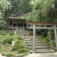
Ōmine Okugakemichi, Sacred pilgrimage route between Yoshino and Kumano Sanzan, Japan.

Description

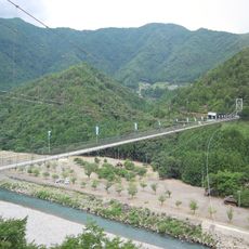
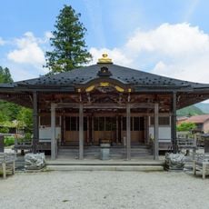
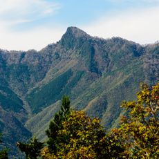
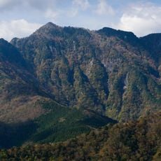
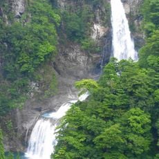
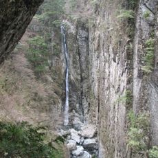
Ōmine Okugakemichi is a pilgrimage route between Yoshino and Kumano Sanzan that extends approximately 98 kilometers through mountain ridges above 1000 meters in elevation. The path links shrines and sacred sites across challenging high-altitude terrain.

History

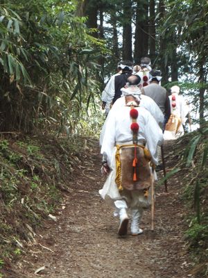
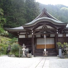
The route was founded in the 8th century by En no Gyoja as a training ground for practitioners seeking spiritual awakening through ascetic discipline. This early establishment as a practice pathway established a tradition that continues to the present day.

Culture

The route passes through sacred sites where Shugendo practitioners today conduct rituals blending Buddhist, Shinto, and mountain worship traditions. These living practices shape how the landscape is used and experienced by those who walk the path.

Practical

The route typically takes five days to walk from start to finish and crosses challenging mountain terrain with significant elevation changes. Mountain lodges provide overnight stays along the path, and sturdy footwear and proper preparation are essential for this trek.

Did you know?

Mount Omine, a central point along the route, has maintained for centuries a tradition restricting entry to male practitioners only. This strict custom distinguishes this path from other pilgrimage routes and remains in practice today.

Location
Inception
8 century
Founders
En no Gyōja
Part of
Sacred Sites and Pilgrimage Routes in the Kii Mountain Range
GPS coordinates
34.17970,135.90940
Latest update
December 20, 2025 12:25

AroundUs brings together thousands of curated places, local tips, and hidden gems, enriched daily by 60,000 contributors worldwide. Discover all places nearby (Wakayama Prefecture).

« Ōmine Okugakemichi - Sacred pilgrimage route between Yoshino and Kumano Sanzan, Japan » is provided by Around Us (aroundus.com). Images and texts are derived from Wikimedia project under a Creative Commons license. You are allowed to copy, distribute, and modify copies of this page, under the conditions set by the license, as long as this note is clearly visible.

Discover hidden gems everywhere you go!

From secret cafés to breathtaking viewpoints, skip the crowded tourist spots and find places that match your style. Our app makes it easy with voice search, smart filtering, route optimization, and insider tips from travelers worldwide. Download now for the complete mobile experience.

Around Us App Screenshot

A unique approach to discovering new places

Le Figaro

All the places worth exploring

France Info

A tailor-made excursion in just a few clicks

20 Minutes

Around Us
Travel Guide & Maps
Download

Send to your phone

QR Code
1

Open the camera app on your mobile.

2

Point at the QR code with your camera. A notification will appear.

3

Tap the notification to open the link.