Enable Location

We need your location to show you interesting places around you

Discover nearby places

Find interesting locations and hidden gems around you

Precise directions

Get accurate directions and distances to places

Your location is never shared with other users. It's only used when you tap the location button.

Mount Ōmuro

Log in to your account

Start exploring — it's free

Trusted by 61,940 travelers worldwide

Continue with Google
Continue with Apple
or

We will send you a code to connect

By continuing, you accept our Terms and Conditions and our Privacy Policy

Check your inbox

We've sent a pincode in your inbox. Please enter the code below.

Mount Ōmuro

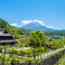
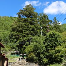
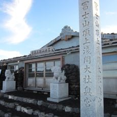
Mount Ōmuro, Lateral volcano in Fujikawaguchiko, Japan.

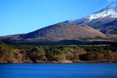
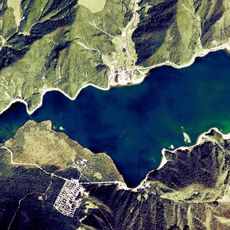
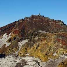
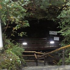
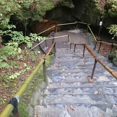
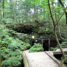
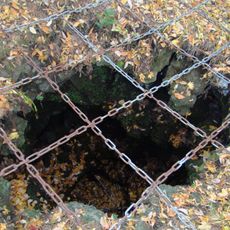
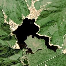
Mount Ōmuro sits at the northwestern base of Mount Fuji and rises to around 1,468 meters with gentle slopes and a crater depression at the top. The mountain contains several wind caves such as Motosu, Omuro, and Kamukura that visitors can explore today.

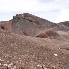
The mountain formed through volcanic activity and last erupted about 3,300 years ago. Since then it has remained geologically inactive and developed into the quiet peak you see today.

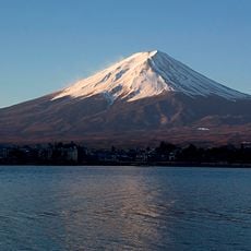
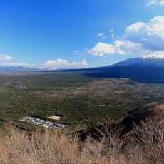
The mountain is called 'Kodaki-Fuji' because of its location next to Mount Fuji, reflecting a Japanese idea about parent-child relationships in nature. You can see this connection when you look at how the two peaks relate to each other from certain viewpoints.

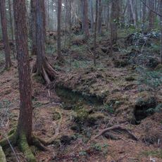
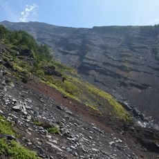
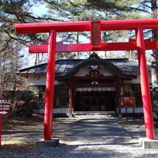
The mountain has no official trails leading to the summit, but the wind caves are open for visitors to explore. Keep in mind this is a protected area, so insects and wildflowers are protected under strict rules.

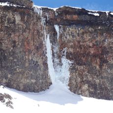
The mountain contains natural ice caves that hold ice crystals even in summer, showing an unexpected natural phenomenon in this region. These caves offer a rare chance to see ice in an otherwise warm environment.

The community of curious travelers

AroundUs brings together thousands of curated places, local tips, and hidden gems, enriched daily by 60,000 contributors worldwide.

Start exploring
Location
Elevation above the sea
1,468 m
GPS coordinates
35.44083,138.65361
Latest update
December 10, 2025 16:20
« Mount Ōmuro - Lateral volcano in Fujikawaguchiko, Japan » is provided by Around Us (aroundus.com). Images and texts are derived from Wikimedia project under a Creative Commons license. You are allowed to copy, distribute, and modify copies of this page, under the conditions set by the license, as long as this note is clearly visible.

Discover hidden gems everywhere you go!

From secret cafés to breathtaking viewpoints, skip the crowded tourist spots and find places that match your style. Our app makes it easy with voice search, smart filtering, route optimization, and insider tips from travelers worldwide. Download now for the complete mobile experience.

Around Us App Screenshot

A unique approach to discovering new places

Le Figaro

All the places worth exploring

France Info

A tailor-made excursion in just a few clicks

20 Minutes

Around Us
Travel Guide & Maps
Download

Send to your phone

QR Code
1

Open the camera app on your mobile.

2

Point at the QR code with your camera. A notification will appear.

3

Tap the notification to open the link.