Chest opened
+${chestReward.xp} XP
Explorer
NOUVEAU ×${chestReward.collectible.quantity}
tapez pour fermer
Chest locked

Open chests in the app

Around Us is built for your phone — chests unlock when you walk, explore and capture nearby places.

Enable Location

We need your location to show you interesting places around you

Discover nearby places

Find interesting locations and hidden gems around you

Precise directions

Get accurate directions and distances to places

Your location is never shared with other users. It's only used when you tap the location button.

Log in to your account

Start exploring — it's free

Trusted by 72,889 travelers worldwide

Continue with Google
Continue with Apple
or

We will send you a code to connect

By continuing, you accept our Terms and Conditions and our Privacy Policy

Check your inbox

We've sent a pincode in your inbox. Please enter the code below.

Woolpack walk
Discussion Reviews Photo
1.3k Popularity

Woolpack walk, Circular hiking trail in Lake District, England.

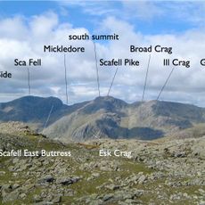
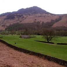
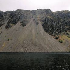
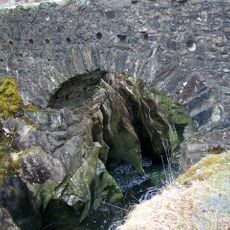
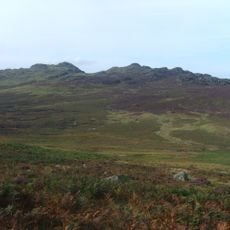
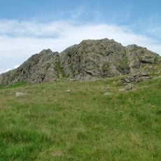
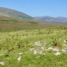
Woolpack Walk is a circular hiking trail in the Lake District that winds through mountainous terrain with steep slopes and ridge lines. The route passes multiple peaks and traverses rocky landscapes typical of this elevated region.

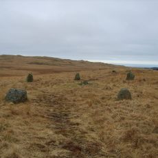
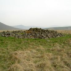
The trail follows ancient shepherd paths that linked valleys in the Lake District for centuries. These routes were used to move wool between remote farming settlements across the region.

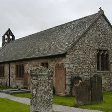
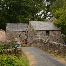
The Woolpack Inn serves as the meeting point where walkers begin and end their journey through the fells. The pub continues a tradition that has welcomed travelers crossing these mountains for generations.

This hike demands good planning and preparation because of unpredictable mountain weather conditions. Bring waterproof clothing, a map, and enough food and water before setting out on the trail.

The route takes hikers past several prominent peaks that open up sweeping views of neighboring valleys below. These vantage points reveal the depth and scale of the surrounding landscape in ways that feel especially striking from the ridge lines.

The community of curious travelers

AroundUs brings together thousands of curated places, local tips, and hidden gems, enriched daily by 60,000 contributors worldwide.

Start exploring
GPS coordinates
54.39780,-3.24861
Latest update
December 14, 2025 18:11
Around this place
Sca Fell
United Kingdom

Sca Fell

5.7 km
Hardknott Roman Fort
United Kingdom

Hardknott Roman Fort

3 km
Harter Fell
United Kingdom

Harter Fell

3.1 km
Cairnfield including a prehistoric enclosure, 5 stone circles, 10 funerary cairns, 6 stone banks, 2 stone walls, a lynchet and a
United Kingdom

Cairnfield including a prehistoric enclosure, 5 stone circles, 10 funerary cairns, 6 stone banks, 2 stone walls, a lynchet and a

2.3 km
Illgill Head
United Kingdom

Illgill Head

4.5 km
Slight Side
United Kingdom

Slight Side

4.5 km
Birks Bridge
United Kingdom

Birks Bridge

4.7 km
Green Crag
United Kingdom

Green Crag

2.9 km
St Catherine's Church, Boot
United Kingdom

St Catherine's Church, Boot

1.6 km
Eskdale Centre
United Kingdom

Eskdale Centre

4.7 km
St Bega's Church
United Kingdom

St Bega's Church

4.9 km
Eskdale Mill
United Kingdom

Eskdale Mill

1.4 km
Bridge Over Whillan Beck To South West Of Corn Mill
United Kingdom

Bridge Over Whillan Beck To South West Of Corn Mill

1.4 km
Doctor Bridge
United Kingdom

Doctor Bridge

258 m
Eskdale War Memorial
United Kingdom

Eskdale War Memorial

1.9 km
Forge House With Attached Barn, Stable And Byres
United Kingdom

Forge House With Attached Barn, Stable And Byres

4.6 km
K6 Telephone Kiosk
United Kingdom

K6 Telephone Kiosk

2.2 km
Bridge End Farmhouse
United Kingdom

Bridge End Farmhouse

1.4 km
Boot House And Whillanside
United Kingdom

Boot House And Whillanside

1.4 km
Dalegarth Hall
United Kingdom

Dalegarth Hall

2.2 km
Barn West Of Forge House
United Kingdom

Barn West Of Forge House

4.7 km
Building To South West Of Corn Mill On East Side Of Road At North End Of Bridge
United Kingdom

Building To South West Of Corn Mill On East Side Of Road At North End Of Bridge

1.4 km
Barn To South West Of Whillanside
United Kingdom

Barn To South West Of Whillanside

1.4 km
Barn To North West Of Bridge End Farmhouse
United Kingdom

Barn To North West Of Bridge End Farmhouse

1.4 km
Great Crag prehistoric cairnfield and associated field system 710m south east of Birkerthwaite
United Kingdom

Great Crag prehistoric cairnfield and associated field system 710m south east of Birkerthwaite

3.3 km
Prehistoric enclosure, hut circle and adjacent cairnfield east of Whillan Beck, Burnmoor
United Kingdom

Prehistoric enclosure, hut circle and adjacent cairnfield east of Whillan Beck, Burnmoor

2.3 km
Maiden Castle round cairn, Burnmoor
United Kingdom

Maiden Castle round cairn, Burnmoor

4.5 km
Eskdale Corn Mill
United Kingdom

Eskdale Corn Mill

1.4 km
Show the full map
Reviews
Share your experience

No review yet

Discussions
Start a discussion...

No discussion yet

« Woolpack walk - Circular hiking trail in Lake District, England » is provided by Around Us (aroundus.com). Images and texts are derived from Wikimedia project under a Creative Commons license. You are allowed to copy, distribute, and modify copies of this page, under the conditions set by the license, as long as this note is clearly visible.

Discover hidden gems everywhere you go!

From secret cafés to breathtaking viewpoints, skip the crowded tourist spots and find places that match your style. Our app makes it easy with voice search, smart filtering, route optimization, and insider tips from travelers worldwide. Download now for the complete mobile experience.

Around Us App Screenshot

A unique approach to discovering new places

Le Figaro

All the places worth exploring

France Info

A tailor-made excursion in just a few clicks

20 Minutes

Around Us
Travel Guide & Maps
Download

Send to your phone

QR Code
1

Open the camera app on your mobile.

2

Point at the QR code with your camera. A notification will appear.

3

Tap the notification to open the link.