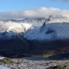
Illgill Head, Mountain summit in Lake District, United Kingdom.
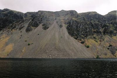
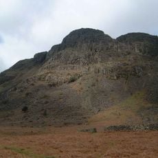
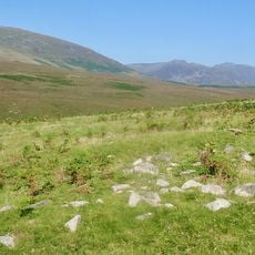
Illgill Head is a 609 meter summit located on the southeastern shore of Wastwater lake in the Lake District. The mountain features a gentle heather-covered southern slope and a much steeper northern face that drops sharply toward the lake.
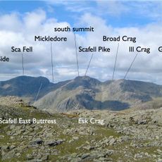
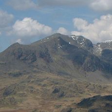
The mountain formed through ancient volcanic activity during the Borrowdale Volcanic period, which shaped the southwestern Lake District millions of years ago. This geological past created the hard rock that defines the summit's structure today.
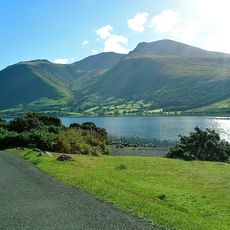
Local hikers and writers have long been drawn to the mountain's striking rock formations and the contrast between its two faces. People who visit often spend time observing how the landscape changes so dramatically from one side to the other.
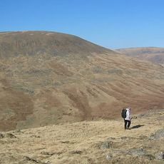
Several routes lead to the summit, with some starting from Wasdale Head to the northwest or from Boot in Eskdale further south. Visitors should bring weather-appropriate gear as the terrain can be slippery, especially on the steep northern section when wet.
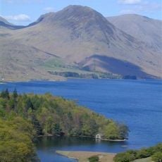
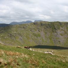
England's deepest lake sits directly below the northern cliff face, creating a remarkable contrast between the height of the mountain and the depth of the water below. This dramatic arrangement of peak and abyss is unusual for the region and gives the location a memorable quality.
Elevation above the sea: 609 m
GPS coordinates: 54.43293,-3.28259
Latest update: December 13, 2025 11:41
Scafell Pike
5.2 km
Sca Fell
4.1 km
Yewbarrow
3.6 km
Lingmell
5.2 km
Cairnfield including a prehistoric enclosure, 5 stone circles, 10 funerary cairns, 6 stone banks, 2 stone walls, a lynchet and a
2.4 km
Seatallan
4.6 km
Slight Side
4.1 km
Buckbarrow
3.5 km
Middle Fell
2.9 km
Church of St Olaf
4.2 km
Ritson's Force
4.7 km
St Catherine's Church, Boot
4.7 km
Eskdale Centre
5.3 km
Church of St Michael and All Angels
4.5 km
Eskdale Mill
3.8 km
Bridge Over Whillan Beck To South West Of Corn Mill
3.9 km
Doctor Bridge
4.7 km
Eskdale War Memorial
4.4 km
Boot House And Whillanside
3.9 km
Dalegarth Hall
4.8 km
Row Bridge North Of Hotel
4.3 km
Bridge End Farmhouse
3.9 km
Barn To North West Of Bridge End Farmhouse
3.9 km
Building To South West Of Corn Mill On East Side Of Road At North End Of Bridge
3.9 km
Barn To South West Of Whillanside
3.9 km
Boundary Stone Circa 15 Feet East Of Overbeck Bridge On North Side Of Road
1.9 km
Eskdale Corn Mill
3.9 km
Prehistoric enclosure, hut circle and adjacent cairnfield east of Whillan Beck, Burnmoor
2.5 kmVisited this place? Tap the stars to rate it and share your experience / photos with the community! Try now! You can cancel it anytime.
Discover hidden gems everywhere you go!
From secret cafés to breathtaking viewpoints, skip the crowded tourist spots and find places that match your style. Our app makes it easy with voice search, smart filtering, route optimization, and insider tips from travelers worldwide. Download now for the complete mobile experience.
A unique approach to discovering new places❞
— Le Figaro
All the places worth exploring❞
— France Info
A tailor-made excursion in just a few clicks❞
— 20 Minutes