Enable Location

We need your location to show you interesting places around you

Discover nearby places

Find interesting locations and hidden gems around you

Precise directions

Get accurate directions and distances to places

Your location is never shared with other users. It's only used when you tap the location button.

Clarkesville

Log in to your account

Start exploring — it's free

Trusted by 63,696 travelers worldwide

Continue with Google
Continue with Apple
or

We will send you a code to connect

By continuing, you accept our Terms and Conditions and our Privacy Policy

Check your inbox

We've sent a pincode in your inbox. Please enter the code below.

Discussion Reviews 1 Photos
18.4k Popularity

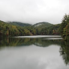
Clarkesville, city of Habersham County, Georgia, United States

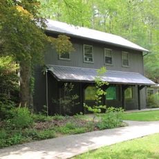
Clarkesville is a small city in Habersham County, Georgia, featuring a mix of older and newer buildings that reflect its past. Main Street offers easy walking access to shops, cafes, and restaurants arranged throughout the downtown area.

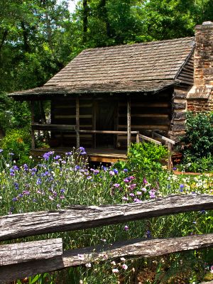
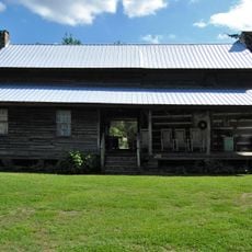
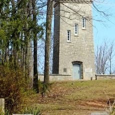
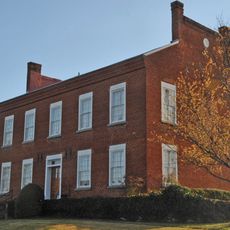
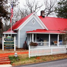
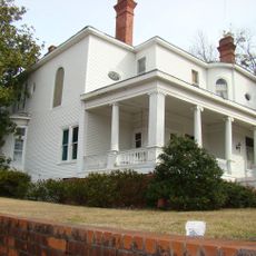
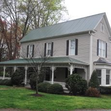
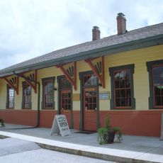
Clarkesville was established in 1823 and developed as a peaceful place for families and workers. The town has intentionally preserved its historic buildings and character through ongoing restoration efforts over the years.

The name Clarkesville reflects the town's founding families and their lasting connection to the community. Main Street serves as the heart where residents gather, local shops operate, and seasonal events celebrate shared traditions that bring people together.

Most places in town are open during daylight hours, and parking is usually available near Main Street. The town is easy to explore on foot or by car since distances are short and streets are straightforward.

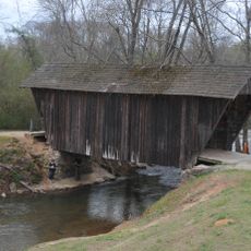
A self-guided walking tour starts at the visitor center in the Mauldin House and passes 19 historic sites scattered throughout town. Each location tells a different story about how the community grew and changed over time.

The community of curious travelers

AroundUs brings together thousands of curated places, local tips, and hidden gems, enriched daily by 60,000 contributors worldwide.

Start exploring
Location
Inception
1821
Elevation above the sea
413 m
GPS coordinates
34.61060,-83.52500
Latest update
February 16, 2026 23:41
Around this place
Currahee Mountain
United States of America

Currahee Mountain

16.4 km
Arrendale State Prison
United States of America

Arrendale State Prison

18.9 km
Anna Ruby Falls
United States of America

Anna Ruby Falls

24.2 km
Yonah Mountain
United States of America

Yonah Mountain

17.5 km
Tallulah Gorge State Park
United States of America

Tallulah Gorge State Park

18.7 km
Unicoi State Park
United States of America

Unicoi State Park

22.1 km
Toccoa Falls
United States of America

Toccoa Falls

15.2 km
Nacoochee Mound
United States of America

Nacoochee Mound

18.7 km
Dukes Creek
United States of America

Dukes Creek

26.4 km
Minnehaha Falls
United States of America

Minnehaha Falls

15.7 km
Tray Mountain
United States of America

Tray Mountain

25.8 km
Smithgall Woods Conservation Area
United States of America

Smithgall Woods Conservation Area

24 km
Fort Hollingsworth–White House
United States of America

Fort Hollingsworth–White House

20.5 km
Stovall Mill Covered Bridge
United States of America

Stovall Mill Covered Bridge

16.5 km
Caledonia Cascade
United States of America

Caledonia Cascade

19.5 km
Panther Falls
United States of America

Panther Falls

18.1 km
Chenocetah Mountain
United States of America

Chenocetah Mountain

12.2 km
Angel Falls
United States of America

Angel Falls

17.4 km
Nacoochee Valley Historic District
United States of America

Nacoochee Valley Historic District

17 km
Stephens County Courthouse
United States of America

Stephens County Courthouse

18.1 km
Chenocetah Fire Tower
United States of America

Chenocetah Fire Tower

12.2 km
Old White County Courthouse
United States of America

Old White County Courthouse

23.5 km
Mauldin House Welcome Center
United States of America

Mauldin House Welcome Center

552 m
James B. Simmons House
United States of America

James B. Simmons House

18.1 km
Sautee Valley Historic District
United States of America

Sautee Valley Historic District

16.1 km
Henry Asbury House
United States of America

Henry Asbury House

714 m
Jarrett-Hayes House
United States of America

Jarrett-Hayes House

24.5 km
Currahee Military Museum
United States of America

Currahee Military Museum

18 km
Show the full map
Reviews
Share your experience

No review yet

Discussions
Start a discussion...

No discussion yet

« Clarkesville - city of Habersham County, Georgia, United States » is provided by Around Us (aroundus.com). Images and texts are derived from Wikimedia project under a Creative Commons license. You are allowed to copy, distribute, and modify copies of this page, under the conditions set by the license, as long as this note is clearly visible.

Discover hidden gems everywhere you go!

From secret cafés to breathtaking viewpoints, skip the crowded tourist spots and find places that match your style. Our app makes it easy with voice search, smart filtering, route optimization, and insider tips from travelers worldwide. Download now for the complete mobile experience.

Around Us App Screenshot

A unique approach to discovering new places

Le Figaro

All the places worth exploring

France Info

A tailor-made excursion in just a few clicks

20 Minutes

Around Us
Travel Guide & Maps
Download

Send to your phone

QR Code
1

Open the camera app on your mobile.

2

Point at the QR code with your camera. A notification will appear.

3

Tap the notification to open the link.