Enable Location

We need your location to show you interesting places around you

Discover nearby places

Find interesting locations and hidden gems around you

Precise directions

Get accurate directions and distances to places

Your location is never shared with other users. It's only used when you tap the location button.

Fire Island Inlet Bridge

Log in to your account

Start exploring — it's free

Trusted by 63,038 travelers worldwide

Continue with Google
Continue with Apple
or

We will send you a code to connect

By continuing, you accept our Terms and Conditions and our Privacy Policy

Check your inbox

We've sent a pincode in your inbox. Please enter the code below.

Fire Island Inlet Bridge
Discussion Reviews 1 Photos
3.9k Popularity

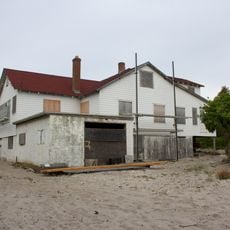
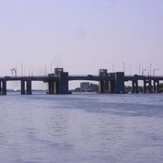
Fire Island Inlet Bridge, Road bridge at Fire Island Inlet, US

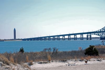
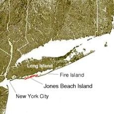
Fire Island Inlet Bridge is a road bridge that crosses the water between Long Island and Robert Moses State Park, carrying vehicles across the inlet with two traffic lanes. The structure uses steel construction to span the marine channel and connects the mainland to the barrier island.

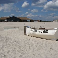
The bridge opened in 1964 as part of a major infrastructure project connecting barrier islands to Long Island. This completion allowed direct road access from the mainland to Robert Moses State Park for the first time.

The bridge forms part of the Robert Moses Causeway, named after the urban planner who shaped the development of Long Island's coastal infrastructure.

The bridge is accessible to vehicles but has weight restrictions in place, with regular safety inspections performed to maintain it. Saltwater exposure requires ongoing maintenance work to keep the structure in good condition over time.

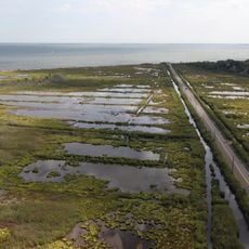
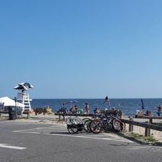
From the bridge, visitors have views of Fire Island's shoreline and can see the distant New York City skyline at the same time. This vantage point combines natural coastal landscape with urban architecture in a single view.

The community of curious travelers

AroundUs brings together thousands of curated places, local tips, and hidden gems, enriched daily by 60,000 contributors worldwide.

Start exploring
Official opening
1964
GPS coordinates
40.63222,-73.26278
Latest update
December 11, 2025 18:04
Around this place
112 Ocean Avenue
United States of America

112 Ocean Avenue

13.4 km
United States of America

Oak Beach Inn

2.2 km
Heckscher State Park
United States of America

Heckscher State Park

12 km
Fire Island Light
United States of America

Fire Island Light

3.7 km
Bayard Cutting Arboretum State Park
United States of America

Bayard Cutting Arboretum State Park

15.1 km
Outer barrier
United States of America

Outer barrier

1.4 km
Belmont Lake State Park
United States of America

Belmont Lake State Park

12.7 km
Captree State Park
United States of America

Captree State Park

1.1 km
Connetquot River State Park Preserve
United States of America

Connetquot River State Park Preserve

16.2 km
Great South Bay Bridge
United States of America

Great South Bay Bridge

5 km
Alfonse M. D'Amato United States Courthouse
United States of America

Alfonse M. D'Amato United States Courthouse

15.4 km
Fire Island Inlet
United States of America

Fire Island Inlet

3.9 km
Robert Moses State Park
United States of America

Robert Moses State Park

1.4 km
Westbrook, Suffolk County, New York
United States of America

Westbrook, Suffolk County, New York

15.1 km
Sagtikos Manor
United States of America

Sagtikos Manor

7.9 km
Seatuck National Wildlife Refuge
United States of America

Seatuck National Wildlife Refuge

9.7 km
Carrington House
United States of America

Carrington House

16 km
United States of America

The Moorings, New York

10.2 km
State Boat Channel Bridge
United States of America

State Boat Channel Bridge

1.1 km
Sisters of St. Dominic Motherhouse Complex
United States of America

Sisters of St. Dominic Motherhouse Complex

14.4 km
United States of America

Lindenhurst Memorial Library

10.5 km
Modern Times School
United States of America

Modern Times School

16.1 km
Cherry Grove Community House and Theatre
United States of America

Cherry Grove Community House and Theatre

14.9 km
Babylon Town Hall
United States of America

Babylon Town Hall

8.8 km
Wereholme
United States of America

Wereholme

9.9 km
Jacob Ockers House
United States of America

Jacob Ockers House

16.8 km
Islip Beach
United States of America

Islip Beach

9.2 km
Seatuck Environmental Association
United States of America

Seatuck Environmental Association

10.1 km
Show the full map
Reviews
Share your experience

No review yet

Discussions
Start a discussion...

No discussion yet

« Fire Island Inlet Bridge - Road bridge at Fire Island Inlet, US » is provided by Around Us (aroundus.com). Images and texts are derived from Wikimedia project under a Creative Commons license. You are allowed to copy, distribute, and modify copies of this page, under the conditions set by the license, as long as this note is clearly visible.

Discover hidden gems everywhere you go!

From secret cafés to breathtaking viewpoints, skip the crowded tourist spots and find places that match your style. Our app makes it easy with voice search, smart filtering, route optimization, and insider tips from travelers worldwide. Download now for the complete mobile experience.

Around Us App Screenshot

A unique approach to discovering new places

Le Figaro

All the places worth exploring

France Info

A tailor-made excursion in just a few clicks

20 Minutes

Around Us
Travel Guide & Maps
Download

Send to your phone

QR Code
1

Open the camera app on your mobile.

2

Point at the QR code with your camera. A notification will appear.

3

Tap the notification to open the link.