Outer barrier

Log in to your account

AroundUs is a community-driven map of interesting places, built by curious explorers like you. It grows with every review, story, and photo you share.
Connect to save your favorite spots, contribute locations, and create personalized routes.
By continuing, you accept our Terms and Conditions and our Privacy Policy

Outer barrier

Add to collection
Map
Suggest a change
Share

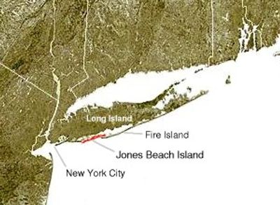
Outer barrier, Coastal barrier formation in Long Island, United States

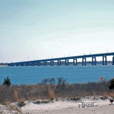
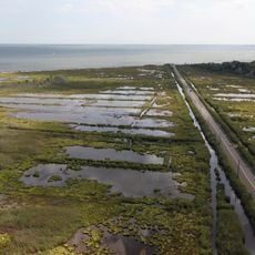
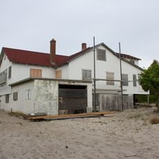
The Outer Barrier is a chain of sandy islands stretching along the Atlantic coast that shields the mainland from waves and tidal action. This barrier system consists of several distinct island groups separated by tidal channels, each with dunes, marshes, and beaches shaped by continuous coastal processes.

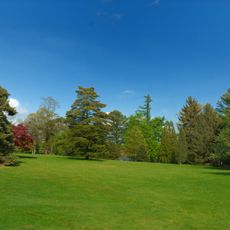
This barrier system formed thousands of years ago as waves and Atlantic currents deposited sand and sediment layer by layer. Over time, storms and coastal erosion have continuously reshaped the islands, creating the configuration we see today.

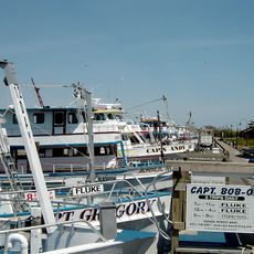
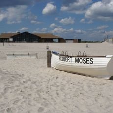
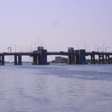
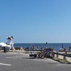
Local communities depend on fishing and shellfish harvesting in these waters, activities that have shaped daily life here for generations. You can see this maritime heritage reflected in the working waterfront and local boat yards.

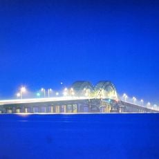
You can reach different sections through bridges and boat services, with parking areas at multiple entry points along the coast. Plan around tide times and weather, as these affect both access and visibility of the barrier landscape.

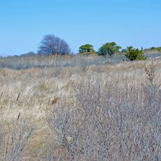
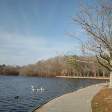
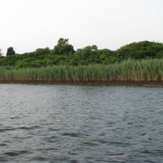
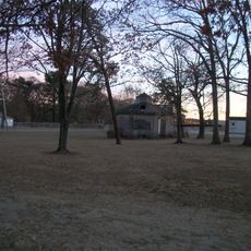
The barrier contains extensive salt marshes that serve as fish nursery grounds and support water circulation in the system. These hidden sections form complex ecosystems that are often overlooked but fascinating for those who take time to explore them.

GPS coordinates: 40.62000,-73.26000

Latest update: December 10, 2025 15:57

Photos
Around this place
112 Ocean Avenue
United States of America

112 Ocean Avenue

14.1 km
Oak Beach Inn
United States of America

Oak Beach Inn

3.1 km
Heckscher State Park
United States of America

Heckscher State Park

12.8 km
Fire Island Light
United States of America

Fire Island Light

3.8 km
Bayard Cutting Arboretum State Park
United States of America

Bayard Cutting Arboretum State Park

16.1 km
Belmont Lake State Park
United States of America

Belmont Lake State Park

14 km
Captree State Park
United States of America

Captree State Park

2.3 km
Connetquot River State Park Preserve
United States of America

Connetquot River State Park Preserve

17.2 km
Great South Bay Bridge
United States of America

Great South Bay Bridge

6.4 km
Alfonse M. D'Amato United States Courthouse
United States of America

Alfonse M. D'Amato United States Courthouse

16.6 km
Fire Island Inlet
United States of America

Fire Island Inlet

4.3 km
Fire Island Inlet Bridge
United States of America

Fire Island Inlet Bridge

1.4 km
Robert Moses State Park
United States of America

Robert Moses State Park

0 m
Westbrook, Suffolk County, New York
United States of America

Westbrook, Suffolk County, New York

16.1 km
Sagtikos Manor
United States of America

Sagtikos Manor

9.3 km
Seatuck National Wildlife Refuge
United States of America

Seatuck National Wildlife Refuge

10.9 km
Carrington House
United States of America

Carrington House

16.1 km
The Moorings, New York
United States of America

The Moorings, New York

11.3 km
State Boat Channel Bridge
United States of America

State Boat Channel Bridge

2.5 km
Sisters of St. Dominic Motherhouse Complex
United States of America

Sisters of St. Dominic Motherhouse Complex

15.4 km
Lindenhurst Memorial Library
United States of America

Lindenhurst Memorial Library

11.5 km
Modern Times School
United States of America

Modern Times School

17.4 km
Cherry Grove Community House and Theatre
United States of America

Cherry Grove Community House and Theatre

15 km
Babylon Town Hall
United States of America

Babylon Town Hall

10.1 km
Wereholme
United States of America

Wereholme

11.1 km
Islip Beach
United States of America

Islip Beach

10.4 km
Seatuck Environmental Association
United States of America

Seatuck Environmental Association

11.3 km
Nathaniel Conklin House
United States of America

Nathaniel Conklin House

10.4 km
Show the full map
Reviews

Visited this place? Tap the stars to rate it and share your experience / photos with the community! Try now! You can cancel it anytime.

« Outer barrier - Coastal barrier formation in Long Island, United States » is provided by Around Us (aroundus.com). Images and texts are derived from Wikimedia project under a Creative Commons license. You are allowed to copy, distribute, and modify copies of this page, under the conditions set by the license, as long as this note is clearly visible.

Discover hidden gems everywhere you go!

From secret cafés to breathtaking viewpoints, skip the crowded tourist spots and find places that match your style. Our app makes it easy with voice search, smart filtering, route optimization, and insider tips from travelers worldwide. Download now for the complete mobile experience.

Around Us App Screenshot

A unique approach to discovering new places

Le Figaro

All the places worth exploring

France Info

A tailor-made excursion in just a few clicks

20 Minutes