Chest opened
+${chestReward.xp} XP
Explorer
NOUVEAU ×${chestReward.collectible.quantity}
tapez pour fermer
Chest locked

Open chests in the app

Around Us is built for your phone — chests unlock when you walk, explore and capture nearby places.

Enable Location

We need your location to show you interesting places around you

Discover nearby places

Find interesting locations and hidden gems around you

Precise directions

Get accurate directions and distances to places

Your location is never shared with other users. It's only used when you tap the location button.

Log in to your account

Start exploring — it's free

Trusted by 72,985 travelers worldwide

Continue with Google
Continue with Apple
or

We will send you a code to connect

By continuing, you accept our Terms and Conditions and our Privacy Policy

Check your inbox

We've sent a pincode in your inbox. Please enter the code below.

Hart Miller Island
Discussion Reviews Photo
6.6k Popularity

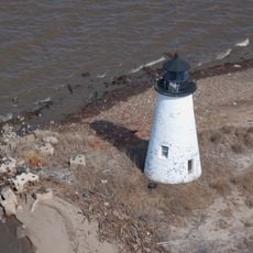
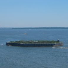
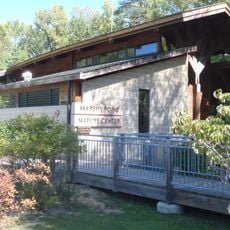
Hart Miller Island, River island in Baltimore County, United States.

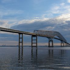
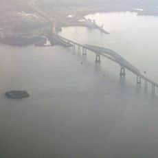
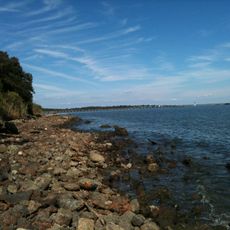
Hart Miller Island is a river island in Baltimore County, Maryland, situated where Back River and Middle River meet before emptying into the Chesapeake Bay. The island is made up of sandy beach, dunes, wetlands, and open water areas spread across its surface.

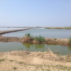
Maryland took ownership of the land in the late 1970s with plans to turn it into a public park. Over the following years, dredged material from Baltimore Harbor was deposited here, which added land and gave the island much of its current shape.

Hart Miller Island sits along the Atlantic flyway, making it a regular stop for migratory birds traveling up and down the East Coast. Shorebirds and waterfowl gather here in numbers that draw birdwatchers from across the region.

The only way to reach the island is by private boat, so you will need to plan your own transport before visiting. Once there, no facilities of any kind are available, so pack food, water, and anything else you may need for the day.

Much of the island sits just about 3 feet (roughly 1 meter) above sea level, which makes it prone to flooding and creates the kind of low, flat habitat that certain shorebirds and coastal plants depend on. The long sandy beach on the island is one of the few stretches of natural beach found this close to Baltimore.

The community of curious travelers

AroundUs brings together thousands of curated places, local tips, and hidden gems, enriched daily by 60,000 contributors worldwide.

Start exploring
Location
GPS coordinates
39.25167,-76.37333
Latest update
March 3, 2026 10:10
Around this place
NS Savannah
United States of America

NS Savannah

15.7 km
Francis Scott Key Bridge
United States of America

Francis Scott Key Bridge

13.9 km
SS John W. Brown
United States of America

SS John W. Brown

17 km
Fort Carroll
United States of America

Fort Carroll

13.2 km
Fort Howard
United States of America

Fort Howard

8.5 km
Greater Grace World Outreach
United States of America

Greater Grace World Outreach

16.2 km
Fort Smallwood Park
United States of America

Fort Smallwood Park

13.2 km
Pooles Island Light
United States of America

Pooles Island Light

10.2 km
Hart-Miller Island State Park, Maryland
United States of America

Hart-Miller Island State Park, Maryland

317 m
Glenn L. Martin Maryland Aviation Museum
United States of America

Glenn L. Martin Maryland Aviation Museum

9.5 km
Craighill Channel Lower Range Front Light
United States of America

Craighill Channel Lower Range Front Light

7.3 km
Bengie's Drive-In Theatre
United States of America

Bengie's Drive-In Theatre

9.7 km
Fort Carroll Light
United States of America

Fort Carroll Light

13.3 km
Todd Farmhouse
United States of America

Todd Farmhouse

7 km
Hancock's Resolution
United States of America

Hancock's Resolution

14.5 km
Craighill Channel Lower Range Rear Light
United States of America

Craighill Channel Lower Range Rear Light

3.1 km
Ballestone Mansion
United States of America

Ballestone Mansion

3.8 km
Lazaretto Point Light
United States of America

Lazaretto Point Light

17.1 km
Bodkin Island Light
United States of America

Bodkin Island Light

13.9 km
Craighill Channel Upper Range Front Light
United States of America

Craighill Channel Upper Range Front Light

8.9 km
Craighill Channel Upper Range Rear Light
United States of America

Craighill Channel Upper Range Rear Light

8.7 km
Fairlee Manor Camp House
United States of America

Fairlee Manor Camp House

14.7 km
Carvill Hall
United States of America

Carvill Hall

14.8 km
Hinchingham
United States of America

Hinchingham

12.5 km
Gobbler Hill
United States of America

Gobbler Hill

14.7 km
North Point State Park
United States of America

North Point State Park

6.5 km
Marshy Point Nature Center
United States of America

Marshy Point Nature Center

11 km
Statue of John O'Donnell
United States of America

Statue of John O'Donnell

17.6 km
Show the full map
Reviews
Share your experience

No review yet

Discussions
Start a discussion...

No discussion yet

« Hart Miller Island - River island in Baltimore County, United States » is provided by Around Us (aroundus.com). Images and texts are derived from Wikimedia project under a Creative Commons license. You are allowed to copy, distribute, and modify copies of this page, under the conditions set by the license, as long as this note is clearly visible.

Discover hidden gems everywhere you go!

From secret cafés to breathtaking viewpoints, skip the crowded tourist spots and find places that match your style. Our app makes it easy with voice search, smart filtering, route optimization, and insider tips from travelers worldwide. Download now for the complete mobile experience.

Around Us App Screenshot

A unique approach to discovering new places

Le Figaro

All the places worth exploring

France Info

A tailor-made excursion in just a few clicks

20 Minutes

Around Us
Travel Guide & Maps
Download

Send to your phone

QR Code
1

Open the camera app on your mobile.

2

Point at the QR code with your camera. A notification will appear.

3

Tap the notification to open the link.