·

Enable Location

We need your location to show you interesting places around you

Discover nearby places

Find interesting locations and hidden gems around you

Precise directions

Get accurate directions and distances to places

Your location is never shared with other users. It's only used when you tap the location button.

Homecroft Historic District

Log in to your account

Start exploring — it's free

Trusted by 62,749 travelers worldwide

Continue with Google
Continue with Apple
or

We will send you a code to connect

By continuing, you accept our Terms and Conditions and our Privacy Policy

Check your inbox

We've sent a pincode in your inbox. Please enter the code below.

Homecroft Historic District, historic district in Indiana, United States

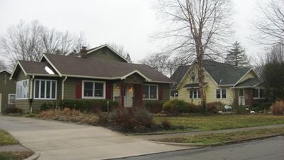
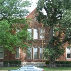
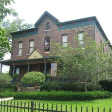
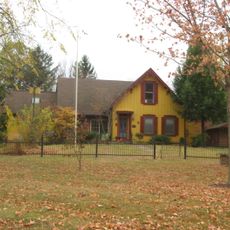
Homecroft Historic District is a residential area in Indiana with approximately 63 homes built mainly in the 1920s. Most houses are made of brick or stone with modest sizes but careful construction, showing Craftsman, Colonial, and Tudor styles with features like gabled roofs and front porches.

The area developed after World War I as transportation connections like the 1900 streetcar line and the Michigan Road allowed people to live outside downtown Indianapolis. In the 1930s, the Works Progress Administration built sidewalks and planted maple trees, which have shaped the neighborhood ever since.

The name Homecroft means 'home town' and was chosen in 1923 by a real estate company to express the idea of a friendly residential community. Today, visitors can see neighbors sitting on porches, chatting with each other, and participating in traditional events like the Halloween candy giveaway that strengthens the sense of belonging.

The district sits about four miles south of downtown Indianapolis and is easy to reach, with wide streets and sidewalks making walking safe and straightforward. The quiet, shaded streets lined with maple trees invite leisurely strolls and make the area especially pleasant during warm weather.

A surprising part of the history is that in the 1930s, the Works Progress Administration not only built sidewalks but also deliberately planted maple trees to beautify the neighborhood. These trees are now nearly a century old and continue to shape the streets with their shade and beauty.

The community of curious travelers

AroundUs brings together thousands of curated places, local tips, and hidden gems, enriched daily by 60,000 contributors worldwide.

Start exploring
Location
GPS coordinates
39.67000,-86.13190
Latest update
February 9, 2026 07:43
Around this place
First Church of Cannabis
United States of America

First Church of Cannabis

5.5 km
Garfield Park Conservatory and Gardens
United States of America

Garfield Park Conservatory and Gardens

7 km
Slippery Noodle Inn
United States of America

Slippery Noodle Inn

10.5 km
Confederate Soldiers and Sailors Monument
United States of America

Confederate Soldiers and Sailors Monument

6.8 km
Nicholson-Rand House
United States of America

Nicholson-Rand House

9.8 km
General German Protestant Orphans Home
United States of America

General German Protestant Orphans Home

8.7 km
United States of America

The Idle

9.6 km
United States of America

G. C. Murphy Building

9.2 km
George Stumpf House
United States of America

George Stumpf House

5.8 km
Big Run Baptist Church and Cemetery
United States of America

Big Run Baptist Church and Cemetery

9.7 km
Old Southport High School
United States of America

Old Southport High School

371 m
Hanna-Ochler-Elder House
United States of America

Hanna-Ochler-Elder House

4.7 km
Sacred Heart of Jesus
United States of America

Sacred Heart of Jesus

8.8 km
Horace Mann Public School No. 13
United States of America

Horace Mann Public School No. 13

9.5 km
Administration Building, Indiana Central University
United States of America

Administration Building, Indiana Central University

4.2 km
Indiana Oxygen Company
United States of America

Indiana Oxygen Company

10.3 km
Holy Rosary-Danish Church Historic District
United States of America

Holy Rosary-Danish Church Historic District

9.7 km
John Fitch Hill House
United States of America

John Fitch Hill House

10.7 km
United States of America

Latin School of Indianapolis

9.9 km
Virginia Avenue District
United States of America

Virginia Avenue District

9.2 km
State and Prospect District
United States of America

State and Prospect District

9.2 km
Laurel and Prospect District
United States of America

Laurel and Prospect District

9.2 km
Anderson-Thompson House
United States of America

Anderson-Thompson House

6.8 km
Fountain Square Theatre
United States of America

Fountain Square Theatre

9.2 km
Greenwood Commercial Historic District
United States of America

Greenwood Commercial Historic District

6.5 km
Radio Radio
United States of America

Radio Radio

9.2 km
Bates-Hendricks House
United States of America

Bates-Hendricks House

8.6 km
Holy Rosary Church
United States of America

Holy Rosary Church

9.9 km
Show the full map
« Homecroft Historic District - historic district in Indiana, United States » is provided by Around Us (aroundus.com). Images and texts are derived from Wikimedia project under a Creative Commons license. You are allowed to copy, distribute, and modify copies of this page, under the conditions set by the license, as long as this note is clearly visible.

Discover hidden gems everywhere you go!

From secret cafés to breathtaking viewpoints, skip the crowded tourist spots and find places that match your style. Our app makes it easy with voice search, smart filtering, route optimization, and insider tips from travelers worldwide. Download now for the complete mobile experience.

Around Us App Screenshot

A unique approach to discovering new places

Le Figaro

All the places worth exploring

France Info

A tailor-made excursion in just a few clicks

20 Minutes

Around Us
Travel Guide & Maps
Download

Send to your phone

QR Code
1

Open the camera app on your mobile.

2

Point at the QR code with your camera. A notification will appear.

3

Tap the notification to open the link.