Enable Location

We need your location to show you interesting places around you

Discover nearby places

Find interesting locations and hidden gems around you

Precise directions

Get accurate directions and distances to places

Your location is never shared with other users. It's only used when you tap the location button.

Irishtown Bend

Log in to your account

Start exploring — it's free

Trusted by 63,016 travelers worldwide

Continue with Google
Continue with Apple
or

We will send you a code to connect

By continuing, you accept our Terms and Conditions and our Privacy Policy

Check your inbox

We've sent a pincode in your inbox. Please enter the code below.

Irishtown Bend
Discussion Reviews 1 Photos
3.5k Popularity

Irishtown Bend, Historic district on Cuyahoga River west bank, Cleveland, United States

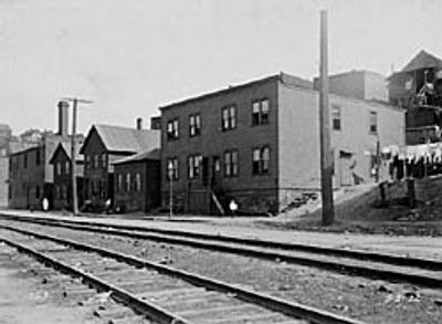
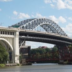
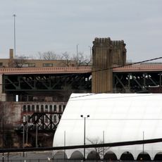
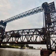
Irishtown Bend is a historic district on the west bank of the Cuyahoga River between West 25th Street and Detroit Avenue, with steep hillsides rising above a river meander. The land slopes dramatically toward the water, creating the distinctive geography that shaped daily life in this riverside settlement.

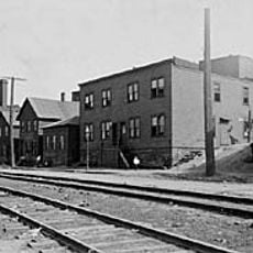
Irish immigrants established this settlement around 1830, working in canal and dock labor as the area developed. The neighborhood transformed into an Eastern European community by 1900 before being officially designated an Archaeological District in 1990.

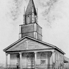
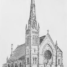
Saint Malachi Church, built in 1868, still stands as a landmark that shaped community life for Irish residents. The church served as a gathering place where people celebrated important moments and deepened their bonds with neighbors and faith.

The area is best explored on foot to fully experience the steep hillsides and narrow streets that define the neighborhood. Start from either Detroit Avenue or West 25th Street to get oriented and move through the district at your own pace.

Archaeological digs from 1987 to 1989 uncovered hundreds of everyday objects that revealed how dock workers, police officers, and residents lived in this riverside community. These discoveries provide direct evidence of 19th century daily life that written records alone could not tell.

The community of curious travelers

AroundUs brings together thousands of curated places, local tips, and hidden gems, enriched daily by 60,000 contributors worldwide.

Start exploring
GPS coordinates
41.48950,-81.70490
Latest update
December 12, 2025 07:55
Around this place
Franklin Castle
United States of America

Franklin Castle

1.1 km
Terminal Tower
United States of America

Terminal Tower

1.3 km
Hope Memorial Bridge
United States of America

Hope Memorial Bridge

943 m
West Side Market
United States of America

West Side Market

584 m
United States of America

Greater Cleveland Aquarium

762 m
Detroit–Superior Bridge
United States of America

Detroit–Superior Bridge

557 m
Rockefeller Building
United States of America

Rockefeller Building

1.1 km
Ernst & Young Tower
United States of America

Ernst & Young Tower

1.3 km
Time Warner Cable Amphitheater
United States of America

Time Warner Cable Amphitheater

1.3 km
Carl B. Stokes Federal Court House Building
United States of America

Carl B. Stokes Federal Court House Building

985 m
George V. Voinovich Bridges
United States of America

George V. Voinovich Bridges

1.3 km
Innerbelt Bridge
United States of America

Innerbelt Bridge

1.3 km
Main Avenue Bridge
United States of America

Main Avenue Bridge

1 km
Lakeview Terrace
United States of America

Lakeview Terrace

522 m
St. Mary's on the Flats
United States of America

St. Mary's on the Flats

388 m
Bingham Company Warehouse
United States of America

Bingham Company Warehouse

1.1 km
Cuyahoga River Bridge 1
United States of America

Cuyahoga River Bridge 1

1.2 km
Frank J. Lausche State Office Building
United States of America

Frank J. Lausche State Office Building

1.1 km
Annunciation Church
United States of America

Annunciation Church

508 m
Skylight Office Tower
United States of America

Skylight Office Tower

1.3 km
Chase Financial Plaza
United States of America

Chase Financial Plaza

1.2 km
Bradley Building
United States of America

Bradley Building

1.3 km
Irishtown Bend Archeological District
United States of America

Irishtown Bend Archeological District

0 m
The Pinnacle
United States of America

The Pinnacle

1.3 km
The Crittenden
United States of America

The Crittenden

1 km
Rialto Theatre
United States of America

Rialto Theatre

427 m
Spaces
United States of America

Spaces

534 m
Moses Cleaveland's "Capitol Town"
United States of America

Moses Cleaveland's "Capitol Town"

845 m
Show the full map
Reviews
Share your experience

No review yet

Discussions
Start a discussion...

No discussion yet

« Irishtown Bend - Historic district on Cuyahoga River west bank, Cleveland, United States » is provided by Around Us (aroundus.com). Images and texts are derived from Wikimedia project under a Creative Commons license. You are allowed to copy, distribute, and modify copies of this page, under the conditions set by the license, as long as this note is clearly visible.

Discover hidden gems everywhere you go!

From secret cafés to breathtaking viewpoints, skip the crowded tourist spots and find places that match your style. Our app makes it easy with voice search, smart filtering, route optimization, and insider tips from travelers worldwide. Download now for the complete mobile experience.

Around Us App Screenshot

A unique approach to discovering new places

Le Figaro

All the places worth exploring

France Info

A tailor-made excursion in just a few clicks

20 Minutes

Around Us
Travel Guide & Maps
Download

Send to your phone

QR Code
1

Open the camera app on your mobile.

2

Point at the QR code with your camera. A notification will appear.

3

Tap the notification to open the link.