Chest opened
+${chestReward.xp} XP
Explorer
NOUVEAU ×${chestReward.collectible.quantity}
tapez pour fermer
Chest locked

Open chests in the app

Around Us is built for your phone — chests unlock when you walk, explore and capture nearby places.

Enable Location

We need your location to show you interesting places around you

Discover nearby places

Find interesting locations and hidden gems around you

Precise directions

Get accurate directions and distances to places

Your location is never shared with other users. It's only used when you tap the location button.

Log in to your account

Start exploring — it's free

Trusted by 72,978 travelers worldwide

Continue with Google
Continue with Apple
or

We will send you a code to connect

By continuing, you accept our Terms and Conditions and our Privacy Policy

Check your inbox

We've sent a pincode in your inbox. Please enter the code below.

Raritan Bayshore
Discussion Reviews Photo
9k Popularity

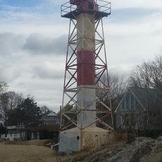
Raritan Bayshore, Coastal inlet between Staten Island and New Jersey, United States.

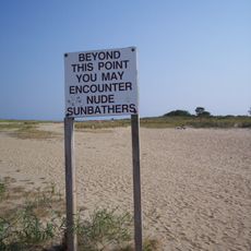
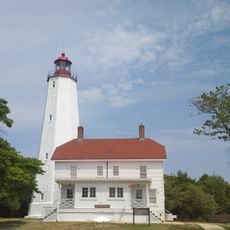
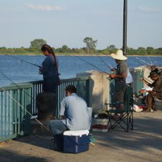
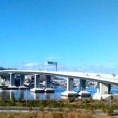
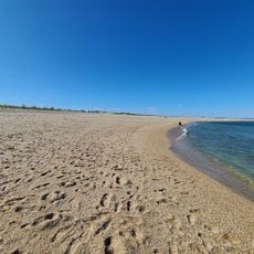
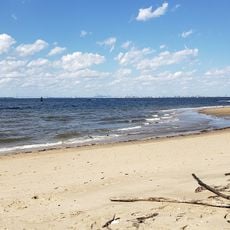
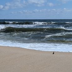
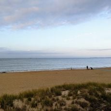
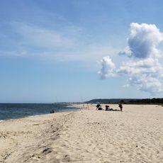
Raritan Bay is a coastal inlet on the border between Staten Island and New Jersey that connects several waterfront communities. The shoreline features beaches, marinas, and fishing spots that stretch across multiple access points for water activities.

The bay is named after the Raritan people, a Native American group who lived in the region before European settlers arrived in the 1600s. The area transformed significantly with European arrival and the growth of trade and fishing industries.

The shoreline communities practice fishing and hold waterfront gatherings that reflect how people here live with the water. These traditions shape the daily rhythm and character of the coastal neighborhoods.

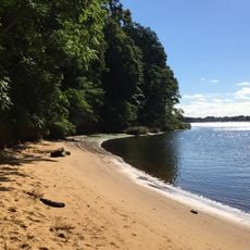
Access to the water is available from multiple points along the shoreline, with beaches and public areas for different activities. Check tide and weather conditions before visiting, as these affect water access and safety.

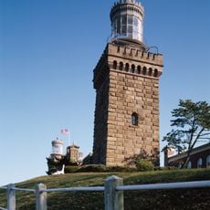
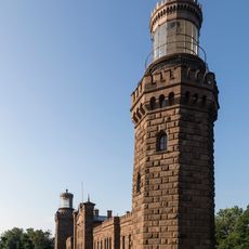
Mount Mitchill offers views of the entire bay and the New York City skyline from its elevated position. This viewpoint is often overlooked despite providing one of the best overviews of the whole water system.

The community of curious travelers

AroundUs brings together thousands of curated places, local tips, and hidden gems, enriched daily by 60,000 contributors worldwide.

Start exploring
GPS coordinates
40.44120,-74.04442
Latest update
December 10, 2025 15:59
Around this place
Gunnison Beach
United States of America

Gunnison Beach

4.6 km
Fort Hancock
United States of America

Fort Hancock

4.3 km
Sandy Hook Light
United States of America

Sandy Hook Light

4.3 km
Navesink Twin Lights
United States of America

Navesink Twin Lights

7.1 km
Henry Hudson Trail
United States of America

Henry Hudson Trail

5.5 km
Gateway National Recreation Area
United States of America

Gateway National Recreation Area

4.3 km
Highlands Air Force Station
United States of America

Highlands Air Force Station

7 km
Hartshorne Woods Park
United States of America

Hartshorne Woods Park

7.6 km
Seabrook-Wilson House
United States of America

Seabrook-Wilson House

4.1 km
Battery Gunnison
United States of America

Battery Gunnison

4.6 km
Highlands Army Air Defense Site
United States of America

Highlands Army Air Defense Site

6.2 km
Water Witch Club Casino
United States of America

Water Witch Club Casino

6.3 km
Conover Beacon
United States of America

Conover Beacon

2.4 km
Fort Hancock and the Sandy Hook Proving Ground Historic District
United States of America

Fort Hancock and the Sandy Hook Proving Ground Historic District

4.2 km
Water Witch Club Historic District
United States of America

Water Witch Club Historic District

6.1 km
Fort Hancock, U.S. Life Saving Station
United States of America

Fort Hancock, U.S. Life Saving Station

5.3 km
Battery Kingman
United States of America

Battery Kingman

4.5 km
First Presbyterian Church of Rumson
United States of America

First Presbyterian Church of Rumson

7.8 km
Highlands–Sea Bright Bridge
United States of America

Highlands–Sea Bright Bridge

7.5 km
Keansburg Firemen's Memorial Park
United States of America

Keansburg Firemen's Memorial Park

7.6 km
Beach C
United States of America

Beach C

6.1 km
North Beach
United States of America

North Beach

5 km
Beach E
United States of America

Beach E

5.4 km
Ideal Beach
United States of America

Ideal Beach

5.3 km
Navesink south lighthouse
United States of America

Navesink south lighthouse

7.1 km
Navesink north lighthouse
United States of America

Navesink north lighthouse

7.1 km
Victory Park
United States of America

Victory Park

7.7 km
FIshing Beach
United States of America

FIshing Beach

5.2 km
Show the full map
Reviews
Share your experience

No review yet

Discussions
Start a discussion...

No discussion yet

« Raritan Bayshore - Coastal inlet between Staten Island and New Jersey, United States » is provided by Around Us (aroundus.com). Images and texts are derived from Wikimedia project under a Creative Commons license. You are allowed to copy, distribute, and modify copies of this page, under the conditions set by the license, as long as this note is clearly visible.

Discover hidden gems everywhere you go!

From secret cafés to breathtaking viewpoints, skip the crowded tourist spots and find places that match your style. Our app makes it easy with voice search, smart filtering, route optimization, and insider tips from travelers worldwide. Download now for the complete mobile experience.

Around Us App Screenshot

A unique approach to discovering new places

Le Figaro

All the places worth exploring

France Info

A tailor-made excursion in just a few clicks

20 Minutes

Around Us
Travel Guide & Maps
Download

Send to your phone

QR Code
1

Open the camera app on your mobile.

2

Point at the QR code with your camera. A notification will appear.

3

Tap the notification to open the link.