Enable Location

We need your location to show you interesting places around you

Discover nearby places

Find interesting locations and hidden gems around you

Precise directions

Get accurate directions and distances to places

Your location is never shared with other users. It's only used when you tap the location button.

Sproul State Forest

Log in to your account

Start exploring — it's free

Trusted by 61,359 travelers worldwide

Continue with Google
Continue with Apple
or

We will send you a code to connect

By continuing, you accept our Terms and Conditions and our Privacy Policy

Check your inbox

We've sent a pincode in your inbox. Please enter the code below.

Sproul State Forest

Sproul State Forest, State forest in north central Pennsylvania, United States

Description

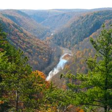
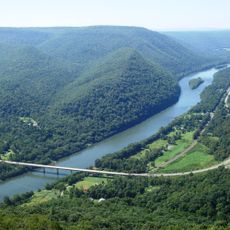
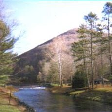
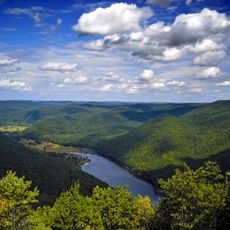
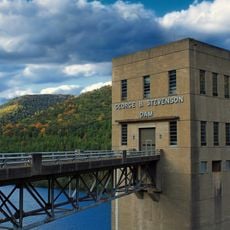
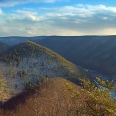
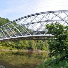
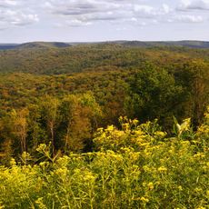
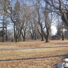
Sproul State Forest is a state forest in north central Pennsylvania covering roughly 305,000 acres across rolling ridges and deep valleys. The landscape is shaped by steep terrain carved by the West Branch Susquehanna River and numerous tributary streams that flow through the property.

History

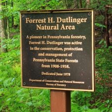
This forest was established in 1898 as Pennsylvania worked to restore its woodlands after heavy logging depleted vast tracts during the late 1800s. The creation of this forest became part of a broader effort to rebuild the state's natural resources.

Culture

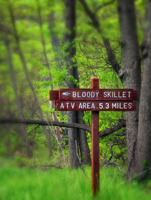
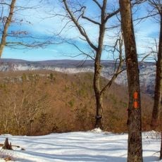
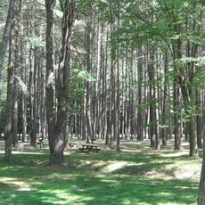
The forest has become a gathering place for people seeking outdoor adventure and a chance to disconnect from daily routines. Locals and visitors alike use the trails and waterways for recreation that connects them to the natural world.

Practical

You can reach the forest by taking US-220 Exit 111 and following PA-120W to the resource management center. Sturdy footwear and good preparation are important since the hilly terrain and remote areas require steady navigation.

Did you know?

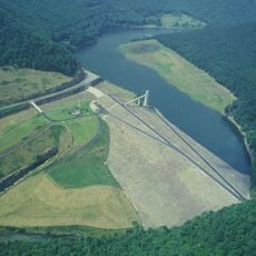
The forest maintains more than 1,000 miles of cold-water streams flowing through the landscape, with a dozen designated as pristine trout waters. These clean, cold waterways are what draw serious fishing enthusiasts from far away to experience the ecological richness hidden within the woods.

Location
GPS coordinates
41.32780,-77.74940
Latest update
December 10, 2025 20:02

AroundUs brings together thousands of curated places, local tips, and hidden gems, enriched daily by 60,000 contributors worldwide. Discover all places nearby (Pennsylvania).

Around this place
Pine Creek Gorge
United States of America

Pine Creek Gorge

35.9 km
Bald Eagle State Park
United States of America

Bald Eagle State Park

34.1 km
Upper Pine Bottom State Park
United States of America

Upper Pine Bottom State Park

27.4 km
Hyner View State Park
United States of America

Hyner View State Park

10.5 km
Ole Bull State Park
United States of America

Ole Bull State Park

23.4 km
Black Forest Trail
United States of America

Black Forest Trail

29.1 km
Kettle Creek State Park
United States of America

Kettle Creek State Park

16.5 km
Little Pine State Park
United States of America

Little Pine State Park

33.1 km
Sinnemahoning State Park
United States of America

Sinnemahoning State Park

28.4 km
Hammersley Wild Area
United States of America

Hammersley Wild Area

23.3 km
Hyner Run State Park
United States of America

Hyner Run State Park

10.3 km
Golden Eagle Trail
United States of America

Golden Eagle Trail

23.5 km
Piper Aviation Museum
United States of America

Piper Aviation Museum

34.6 km
Bald Eagle and Spring Creek Navigation
United States of America

Bald Eagle and Spring Creek Navigation

35.7 km
Forrest H. Duttlinger Natural Area
United States of America

Forrest H. Duttlinger Natural Area

19.2 km
Christian Bechdel II House
United States of America

Christian Bechdel II House

32.3 km
Nathan Harvey House
United States of America

Nathan Harvey House

32.8 km
Heisey House
United States of America

Heisey House

33.5 km
Water Street District
United States of America

Water Street District

32.8 km
Bridge in Brown Township
United States of America

Bridge in Brown Township

27.5 km
Isaac A. Packer Farm
United States of America

Isaac A. Packer Farm

29.5 km
Farrandsville Iron Furnace
United States of America

Farrandsville Iron Furnace

26 km
Rich-McCormick Woolen Factory
United States of America

Rich-McCormick Woolen Factory

36.1 km
Roxy Theatre
United States of America

Roxy Theatre

33.4 km
Susquehannock State Forest
United States of America

Susquehannock State Forest

36.3 km
Jay Street Bridge
United States of America

Jay Street Bridge

33.2 km
Memorial Park Site
United States of America

Memorial Park Site

34.9 km
Kettle Creek Reservoir
United States of America

Kettle Creek Reservoir

15.1 km
Show the full map
« Sproul State Forest - State forest in north central Pennsylvania, United States » is provided by Around Us (aroundus.com). Images and texts are derived from Wikimedia project under a Creative Commons license. You are allowed to copy, distribute, and modify copies of this page, under the conditions set by the license, as long as this note is clearly visible.

Discover hidden gems everywhere you go!

From secret cafés to breathtaking viewpoints, skip the crowded tourist spots and find places that match your style. Our app makes it easy with voice search, smart filtering, route optimization, and insider tips from travelers worldwide. Download now for the complete mobile experience.

Around Us App Screenshot

A unique approach to discovering new places

Le Figaro

All the places worth exploring

France Info

A tailor-made excursion in just a few clicks

20 Minutes

Around Us
Travel Guide & Maps
Download

Send to your phone

QR Code
1

Open the camera app on your mobile.

2

Point at the QR code with your camera. A notification will appear.

3

Tap the notification to open the link.