Enable Location

We need your location to show you interesting places around you

Discover nearby places

Find interesting locations and hidden gems around you

Precise directions

Get accurate directions and distances to places

Your location is never shared with other users. It's only used when you tap the location button.

Hammersley Wild Area

Log in to your account

Start exploring — it's free

Trusted by 65,326 travelers worldwide

Continue with Google
Continue with Apple
or

We will send you a code to connect

By continuing, you accept our Terms and Conditions and our Privacy Policy

Check your inbox

We've sent a pincode in your inbox. Please enter the code below.

Hammersley Wild Area
Discussion Reviews 1 Photos
4.1k Popularity

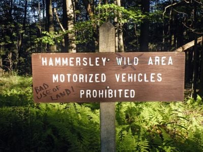
Hammersley Wild Area, Natural preserve in Potter County, Pennsylvania.

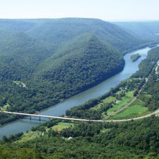
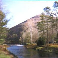
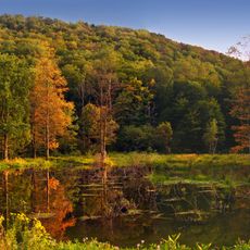
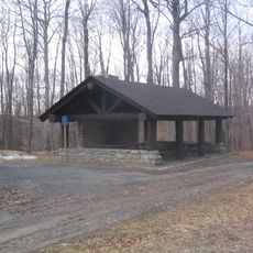
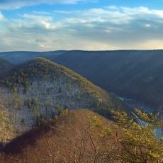
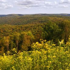
Hammersley Wild Area is a protected area spread across Potter and Clinton counties in north-central Pennsylvania. It covers forested valleys, high plateaus, and stream corridors that flow through the interior without roads crossing them.

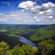
Heavy logging swept through the area during the late 1800s before timber operations shut down around 1900. The forest then grew back on its own over the following decades, producing the dense second-growth woodland that covers the land today.

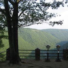
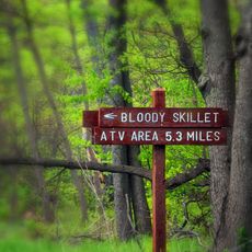
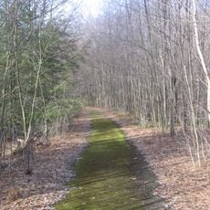
The Susquehannock Trail System runs through the preserve for 10.78 miles, enabling visitors to connect with Pennsylvania's natural heritage.

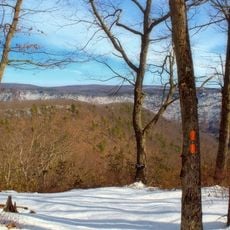
There are no paved roads inside the area, so sturdy footwear and weather-appropriate layers are a must before setting out. The trails cross hilly terrain and can feel remote, so carrying a map and allowing extra time is a good idea.

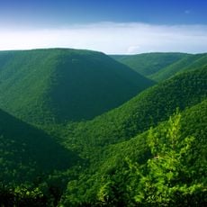
Hammersley Wild Area is considered the largest roadless forest territory in Pennsylvania, shaped entirely by natural stream systems rather than any human infrastructure. This means it is possible to walk deep into the state and find complete silence, far from any traffic.

The community of curious travelers

AroundUs brings together thousands of curated places, local tips, and hidden gems, enriched daily by 60,000 contributors worldwide.

Start exploring
Location
GPS coordinates
41.51310,-77.88000
Latest update
March 3, 2026 10:04
Around this place
Cherry Springs State Park
United States of America

Cherry Springs State Park

17.3 km
Colton Point State Park
United States of America

Colton Point State Park

40.3 km
Hyner View State Park
United States of America

Hyner View State Park

29.8 km
Ole Bull State Park
United States of America

Ole Bull State Park

14.2 km
Black Forest Trail
United States of America

Black Forest Trail

31.9 km
Sproul State Forest
United States of America

Sproul State Forest

23.3 km
Kettle Creek State Park
United States of America

Kettle Creek State Park

14.2 km
Lyman Run State Park
United States of America

Lyman Run State Park

24.8 km
Sinnemahoning State Park
United States of America

Sinnemahoning State Park

15.8 km
Elk State Forest
United States of America

Elk State Forest

39.7 km
Bucktail State Park Natural Area
United States of America

Bucktail State Park Natural Area

28.3 km
Denton Hill State Park
United States of America

Denton Hill State Park

28.6 km
Hyner Run State Park
United States of America

Hyner Run State Park

26.8 km
Sizerville State Park
United States of America

Sizerville State Park

27.8 km
Pennsylvania Lumber Museum
United States of America

Pennsylvania Lumber Museum

30.3 km
Patterson State Park
United States of America

Patterson State Park

20.4 km
Golden Eagle Trail
United States of America

Golden Eagle Trail

31.9 km
Wykoff Run Natural Area
United States of America

Wykoff Run Natural Area

40.8 km
Forrest H. Duttlinger Natural Area
United States of America

Forrest H. Duttlinger Natural Area

4.7 km
Coudersport Historic District
United States of America

Coudersport Historic District

31.5 km
Bridge in Brown Township
United States of America

Bridge in Brown Township

32.1 km
Cameron County Courthouse
United States of America

Cameron County Courthouse

29.7 km
Potter County Courthouse
United States of America

Potter County Courthouse

31.4 km
Cherry Springs Picnic Pavilion
United States of America

Cherry Springs Picnic Pavilion

17.2 km
Colton Point State Park Historic District
United States of America

Colton Point State Park Historic District

40.4 km
Susquehannock State Forest
United States of America

Susquehannock State Forest

13.5 km
Coudersport Theatre
United States of America

Coudersport Theatre

31.1 km
Kettle Creek Reservoir
United States of America

Kettle Creek Reservoir

17.4 km
Show the full map
Reviews
Share your experience

No review yet

Discussions
Start a discussion...

No discussion yet

« Hammersley Wild Area - Natural preserve in Potter County, Pennsylvania » is provided by Around Us (aroundus.com). Images and texts are derived from Wikimedia project under a Creative Commons license. You are allowed to copy, distribute, and modify copies of this page, under the conditions set by the license, as long as this note is clearly visible.

Discover hidden gems everywhere you go!

From secret cafés to breathtaking viewpoints, skip the crowded tourist spots and find places that match your style. Our app makes it easy with voice search, smart filtering, route optimization, and insider tips from travelers worldwide. Download now for the complete mobile experience.

Around Us App Screenshot

A unique approach to discovering new places

Le Figaro

All the places worth exploring

France Info

A tailor-made excursion in just a few clicks

20 Minutes

Around Us
Travel Guide & Maps
Download

Send to your phone

QR Code
1

Open the camera app on your mobile.

2

Point at the QR code with your camera. A notification will appear.

3

Tap the notification to open the link.