Chest opened
+${chestReward.xp} XP
Explorer
NOUVEAU ×${chestReward.collectible.quantity}
tapez pour fermer
Chest locked

Open chests in the app

Around Us is built for your phone — chests unlock when you walk, explore and capture nearby places.

Enable Location

We need your location to show you interesting places around you

Discover nearby places

Find interesting locations and hidden gems around you

Precise directions

Get accurate directions and distances to places

Your location is never shared with other users. It's only used when you tap the location button.

Tobyhanna

Log in to your account

Start exploring — it's free

Trusted by 72,889 travelers worldwide

Continue with Google
Continue with Apple
or

We will send you a code to connect

By continuing, you accept our Terms and Conditions and our Privacy Policy

Check your inbox

We've sent a pincode in your inbox. Please enter the code below.

Discussion Reviews 1 Photos
18.6k Popularity

Tobyhanna, human settlement in Pennsylvania, United States of America

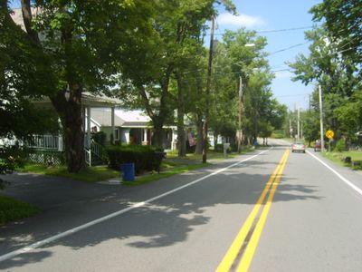
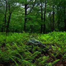
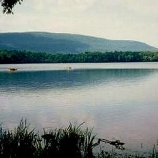
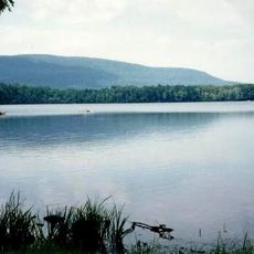
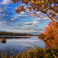
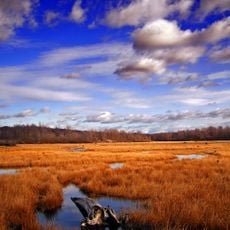
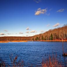
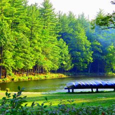
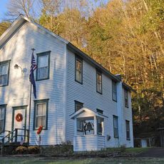
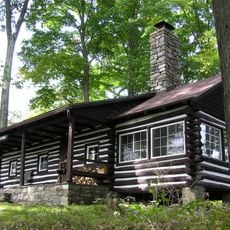
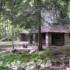
Tobyhanna is an unincorporated community in northeastern Pennsylvania located in Monroe County at about 1,568 feet (478 meters) above sea level. The area is largely forested with lakes and state game lands, threaded by Tobyhanna Creek and surrounded by mountains and valleys.

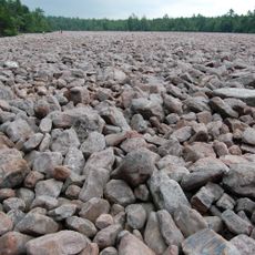
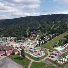
From the late 1800s through early 1900s, the area thrived on lumber mills, a clothespin factory, and silk production. Around 1900, residents shifted to harvesting ice from lakes, which continued until the 1930s, before the federal government later established the Tobyhanna Military Reservation for artillery training.

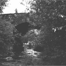
The name Tobyhanna comes from the Lenape language and means "a stream whose banks are fringed with alder." This connection to water and nature remains visible in how residents and visitors experience the forested landscape and creek systems today.

The area is best reached via Interstate highways 380, 80, and 84 or Pennsylvania Route 611, which connect it to nearby cities like Scranton, Wilkes-Barre, and the Lehigh Valley. Visitors should prepare for cool mountain weather, as the location sits at higher elevation with long winters.

The area once had an active ice harvesting business where workers cut large blocks from frozen lakes and shipped them in special railroad cars to East Coast cities. This unusual trade, which lasted from the early 1900s into the 1930s, is a fascinating chapter of local economic history that few visitors know about.

The community of curious travelers

AroundUs brings together thousands of curated places, local tips, and hidden gems, enriched daily by 60,000 contributors worldwide.

Start exploring
Location
GPS coordinates
41.17700,-75.41610
Latest update
February 16, 2026 23:42
Around this place
Pocono Raceway
United States of America

Pocono Raceway

15.7 km
Hickory Run State Park
United States of America

Hickory Run State Park

27.4 km
Promised Land State Park
United States of America

Promised Land State Park

23.8 km
Camelback Mountain
United States of America

Camelback Mountain

15.9 km
Big Pocono State Park
United States of America

Big Pocono State Park

16.2 km
Camelbeach Waterpark
United States of America

Camelbeach Waterpark

14.9 km
Tobyhanna State Park
United States of America

Tobyhanna State Park

7.8 km
Gouldsboro State Park
United States of America

Gouldsboro State Park

5 km
United States of America

Tannersville Cranberry Bog

20 km
Delaware State Forest
United States of America

Delaware State Forest

21.8 km
Pinemere Camp
United States of America

Pinemere Camp

21 km
Kalahari Indoor Waterpark
United States of America

Kalahari Indoor Waterpark

8.9 km
Pocono Manor Historic District
United States of America

Pocono Manor Historic District

19.1 km
Lacawac
United States of America

Lacawac

24.6 km
Stroud Mansion
United States of America

Stroud Mansion

28.2 km
Quiet Valley Farm
United States of America

Quiet Valley Farm

28.2 km
Nesbitt Reservoir
United States of America

Nesbitt Reservoir

25.9 km
Stoddartsville Historic District
United States of America

Stoddartsville Historic District

18.6 km
Patriotic Order Sons of America Washington Camp 422
United States of America

Patriotic Order Sons of America Washington Camp 422

12.7 km
Monroe County Courthouse
United States of America

Monroe County Courthouse

28.1 km
Academy Hill Historic District
United States of America

Academy Hill Historic District

28 km
Summit Lanes
United States of America

Summit Lanes

7.7 km
Bridge in Dreher Township
United States of America

Bridge in Dreher Township

14.3 km
Promised Land State Park Whittaker Lodge District
United States of America

Promised Land State Park Whittaker Lodge District

24.1 km
H2Oooohh! Indoor Waterpark
United States of America

H2Oooohh! Indoor Waterpark

21.2 km
Promised Land State Park-Bear Wallow Cabins
United States of America

Promised Land State Park-Bear Wallow Cabins

23.2 km
High Knob Fire Tower
United States of America

High Knob Fire Tower

27.9 km
Big Pocono Fire Tower
United States of America

Big Pocono Fire Tower

15.9 km
Show the full map
Reviews
Share your experience

No review yet

Discussions
Start a discussion...

No discussion yet

« Tobyhanna - human settlement in Pennsylvania, United States of America » is provided by Around Us (aroundus.com). Images and texts are derived from Wikimedia project under a Creative Commons license. You are allowed to copy, distribute, and modify copies of this page, under the conditions set by the license, as long as this note is clearly visible.

Discover hidden gems everywhere you go!

From secret cafés to breathtaking viewpoints, skip the crowded tourist spots and find places that match your style. Our app makes it easy with voice search, smart filtering, route optimization, and insider tips from travelers worldwide. Download now for the complete mobile experience.

Around Us App Screenshot

A unique approach to discovering new places

Le Figaro

All the places worth exploring

France Info

A tailor-made excursion in just a few clicks

20 Minutes

Around Us
Travel Guide & Maps
Download

Send to your phone

QR Code
1

Open the camera app on your mobile.

2

Point at the QR code with your camera. A notification will appear.

3

Tap the notification to open the link.