Enable Location

We need your location to show you interesting places around you

Discover nearby places

Find interesting locations and hidden gems around you

Precise directions

Get accurate directions and distances to places

Your location is never shared with other users. It's only used when you tap the location button.

Whitefish Dunes State Park

Log in to your account

Start exploring — it's free

Trusted by 62,997 travelers worldwide

Continue with Google
Continue with Apple
or

We will send you a code to connect

By continuing, you accept our Terms and Conditions and our Privacy Policy

Check your inbox

We've sent a pincode in your inbox. Please enter the code below.

Whitefish Dunes State Park
Discussion Reviews 1 Photos
6.1k Popularity

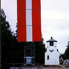
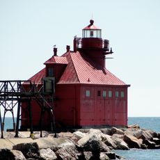
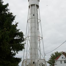
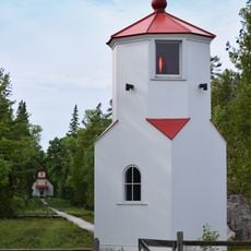
Whitefish Dunes State Park, State park and archaeological site in Door County, United States

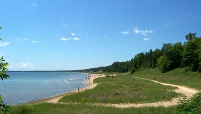
Whitefish Dunes State Park is an 863-acre park along Lake Michigan featuring sand dunes, rocky shores, forests, and sandy beaches. The landscape combines dune formations, stone shores, and wooded areas across the eastern Wisconsin coastline.

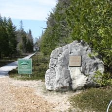
Native peoples inhabited this region for over 2000 years and left behind artifacts throughout the land. Eight archaeological sites within the park boundaries document this extended human presence in the area.

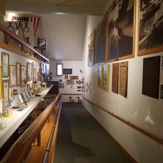
The nature center displays exhibits about indigenous peoples, local wildlife, and geological formations that shaped the landscape. Visitors can learn about the region's past through displays and information panels.

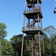
The park has 14.5 miles of marked trails for hiking and winter cross-country skiing paths. Well-maintained routes lead to viewpoints overlooking Lake Michigan and are accessible to most visitors.

The park contains Wisconsin's highest sand dunes, rising over 100 feet above Lake Michigan's surface. These dunes formed through glacial movements and deposits during the ice age thousands of years ago.

The community of curious travelers

AroundUs brings together thousands of curated places, local tips, and hidden gems, enriched daily by 60,000 contributors worldwide.

Start exploring
Location
Inception
1967
GPS coordinates
44.92030,-87.20440
Latest update
December 9, 2025 18:45
Around this place
Cana Island
United States of America

Cana Island

22.3 km
Cana Island Light
United States of America

Cana Island Light

22.4 km
United States of America

Potawatomi State Park

17.7 km
SS Lakeland
United States of America

SS Lakeland

14.7 km
Sturgeon Bay Bridge
United States of America

Sturgeon Bay Bridge

17.1 km
Baileys Harbor Range Lights
United States of America

Baileys Harbor Range Lights

18.1 km
Sturgeon Bay Canal North Pierhead Light
United States of America

Sturgeon Bay Canal North Pierhead Light

16.5 km
The Ridges Sanctuary
United States of America

The Ridges Sanctuary

18.3 km
Sturgeon Bay Canal Light
United States of America

Sturgeon Bay Canal Light

16.4 km
Sherwood Point Light
United States of America

Sherwood Point Light

18.3 km
Door County Maritime Museum
United States of America

Door County Maritime Museum

17.3 km
Baileys Harbor Light
United States of America

Baileys Harbor Light

17.3 km
Kangaroo Lake State Natural Area
United States of America

Kangaroo Lake State Natural Area

15 km
Bayshore Blufflands State Natural Area
United States of America

Bayshore Blufflands State Natural Area

14.7 km
Coast Guard Station Sturgeon Bay
United States of America

Coast Guard Station Sturgeon Bay

16.4 km
Cupola House
United States of America

Cupola House

15.8 km
L. A. Larson & Co. Store
United States of America

L. A. Larson & Co. Store

16.6 km
Albert Zahn House
United States of America

Albert Zahn House

17.9 km
Carnegie Free Library
United States of America

Carnegie Free Library

16.5 km
Teweles and Brandeis Grain Elevator
United States of America

Teweles and Brandeis Grain Elevator

17.4 km
Third Avenue Historic District
United States of America

Third Avenue Historic District

16.6 km
Freeman and Jesse Thorp House and Cottages
United States of America

Freeman and Jesse Thorp House and Cottages

23.2 km
Baileys Harbor Town Hall-McArdle Library
United States of America

Baileys Harbor Town Hall-McArdle Library

17.4 km
Baileys Harbor Range Rear Light
United States of America

Baileys Harbor Range Rear Light

18 km
Baileys Harbor Range Front Light
United States of America

Baileys Harbor Range Front Light

18 km
Potawatomi State Park Observation Tower
United States of America

Potawatomi State Park Observation Tower

18.3 km
Door County Historical Museum
United States of America

Door County Historical Museum

16.5 km
Cave Point County Park
United States of America

Cave Point County Park

2.5 km
Show the full map
Reviews
Share your experience

No review yet

Discussions
Start a discussion...

No discussion yet

« Whitefish Dunes State Park - State park and archaeological site in Door County, United States » is provided by Around Us (aroundus.com). Images and texts are derived from Wikimedia project under a Creative Commons license. You are allowed to copy, distribute, and modify copies of this page, under the conditions set by the license, as long as this note is clearly visible.

Discover hidden gems everywhere you go!

From secret cafés to breathtaking viewpoints, skip the crowded tourist spots and find places that match your style. Our app makes it easy with voice search, smart filtering, route optimization, and insider tips from travelers worldwide. Download now for the complete mobile experience.

Around Us App Screenshot

A unique approach to discovering new places

Le Figaro

All the places worth exploring

France Info

A tailor-made excursion in just a few clicks

20 Minutes

Around Us
Travel Guide & Maps
Download

Send to your phone

QR Code
1

Open the camera app on your mobile.

2

Point at the QR code with your camera. A notification will appear.

3

Tap the notification to open the link.