Enable Location

We need your location to show you interesting places around you

Discover nearby places

Find interesting locations and hidden gems around you

Precise directions

Get accurate directions and distances to places

Your location is never shared with other users. It's only used when you tap the location button.

Liberia

Log in to your account

Start exploring — it's free

Trusted by 65,191 travelers worldwide

Continue with Google
Continue with Apple
or

We will send you a code to connect

By continuing, you accept our Terms and Conditions and our Privacy Policy

Check your inbox

We've sent a pincode in your inbox. Please enter the code below.

Discussion Reviews 1 Photos
3k Popularity

Liberia, human settlement in United States of America

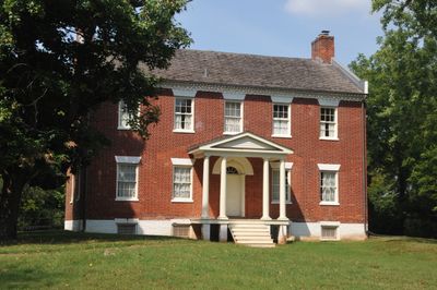
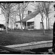
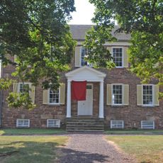
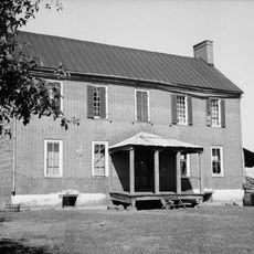
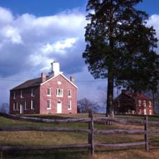
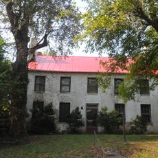
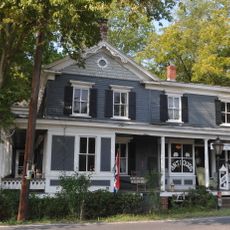
Liberia is a two-story brick house built in the Federal style in Manassas, Virginia, with a side-gabled roof and a decorative brick cornice featuring a saw-tooth pattern. The interior follows an early 19th-century layout, with a central hallway and rooms arranged on either side.

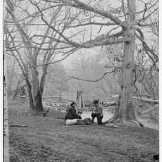
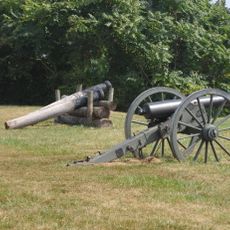
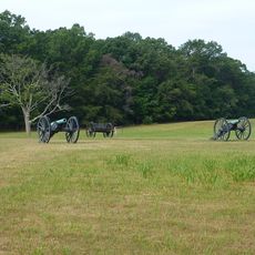
The house was built in 1825 for William and Harriet Weir and changed hands several times before the Civil War broke out. General P. G. T. Beauregard used it as a Confederate headquarters in 1861, and the Union took it over the following year, with President Abraham Lincoln visiting in 1862.

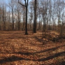
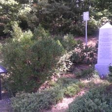
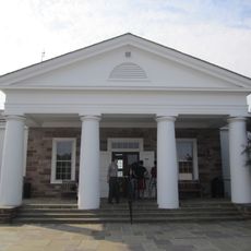
The site was once a working plantation where enslaved people lived and worked, though most of their names were never recorded. The story of the Naylor family, one of the few whose history can be traced, is told in an exhibit at the Manassas Museum called Sentry to the Ages.

The house opens for visitors on Saturdays during the warmer months in the afternoon, while the grounds can be visited any day. For private tours or special events, it is worth contacting the Manassas Museum in advance.

After the war, the land was taken over by Robert Portner, a brewer from Alexandria, who turned it into a dairy farm and employed descendants of people who had been enslaved there. The house itself came through the entire conflict without major damage, which is rare for a building that served both armies in turn.

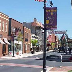
The community of curious travelers

AroundUs brings together thousands of curated places, local tips, and hidden gems, enriched daily by 60,000 contributors worldwide.

Start exploring
Location
GPS coordinates
38.76611,-77.46056
Latest update
March 3, 2026 13:52
Around this place
Centreville High School
United States of America

Centreville High School

7.9 km
Henry House
United States of America

Henry House

7.6 km
Stone House
United States of America

Stone House

8.2 km
Splash Down Waterpark
United States of America

Splash Down Waterpark

3.5 km
Hemlock Overlook Regional Park
United States of America

Hemlock Overlook Regional Park

4.4 km
Stone Bridge
United States of America

Stone Bridge

7.5 km
Robinson House
United States of America

Robinson House

7.8 km
Old Town Manassas
United States of America

Old Town Manassas

1.7 km
"A" Fort and Battery Hill Redoubt-Camp Early
United States of America

"A" Fort and Battery Hill Redoubt-Camp Early

3.9 km
Manassas Industrial School for Colored Youth
United States of America

Manassas Industrial School for Colored Youth

3.4 km
Ben Lomond Plantation
United States of America

Ben Lomond Plantation

4.6 km
United States of America

Culpeper Basin

5.7 km
Blackburn's Ford
United States of America

Blackburn's Ford

4.2 km
Prince William County Courthouse
United States of America

Prince William County Courthouse

1.9 km
Conner House
United States of America

Conner House

1.3 km
Moor Green
United States of America

Moor Green

7.3 km
Cannon Branch Fort
United States of America

Cannon Branch Fort

5.9 km
Signal Hill
United States of America

Signal Hill

2.5 km
Brentsville Courthouse and Jail
United States of America

Brentsville Courthouse and Jail

9.2 km
Manassas Water Tower
United States of America

Manassas Water Tower

1.7 km
White House
United States of America

White House

9.3 km
Clifton Historic District
United States of America

Clifton Historic District

6.6 km
Orange and Alexandria Railroad Bridge Piers
United States of America

Orange and Alexandria Railroad Bridge Piers

3.6 km
Atoka Historic District
United States of America

Atoka Historic District

6.6 km
Mayfield Fortification
United States of America

Mayfield Fortification

1.6 km
Davis-Beard House
United States of America

Davis-Beard House

8.2 km
Henry Hill Visitor Center
United States of America

Henry Hill Visitor Center

7.4 km
Henry Hill
United States of America

Henry Hill

7.6 km
Show the full map
Reviews
Share your experience

No review yet

Discussions
Start a discussion...

No discussion yet

« Liberia - human settlement in United States of America » is provided by Around Us (aroundus.com). Images and texts are derived from Wikimedia project under a Creative Commons license. You are allowed to copy, distribute, and modify copies of this page, under the conditions set by the license, as long as this note is clearly visible.

Discover hidden gems everywhere you go!

From secret cafés to breathtaking viewpoints, skip the crowded tourist spots and find places that match your style. Our app makes it easy with voice search, smart filtering, route optimization, and insider tips from travelers worldwide. Download now for the complete mobile experience.

Around Us App Screenshot

A unique approach to discovering new places

Le Figaro

All the places worth exploring

France Info

A tailor-made excursion in just a few clicks

20 Minutes

Around Us
Travel Guide & Maps
Download

Send to your phone

QR Code
1

Open the camera app on your mobile.

2

Point at the QR code with your camera. A notification will appear.

3

Tap the notification to open the link.