Enable Location

We need your location to show you interesting places around you

Discover nearby places

Find interesting locations and hidden gems around you

Precise directions

Get accurate directions and distances to places

Your location is never shared with other users. It's only used when you tap the location button.

River Street Historic District

Log in to your account

Start exploring — it's free

Trusted by 62,369 travelers worldwide

Continue with Google
Continue with Apple
or

We will send you a code to connect

By continuing, you accept our Terms and Conditions and our Privacy Policy

Check your inbox

We've sent a pincode in your inbox. Please enter the code below.

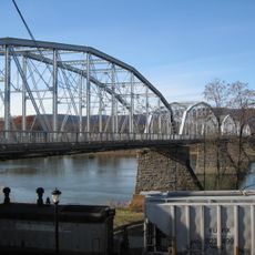
River Street Historic District, National Historic District in downtown Wilkes-Barre, United States.

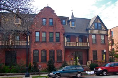
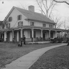
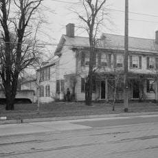
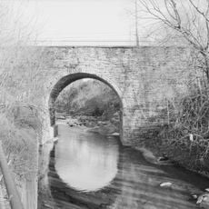
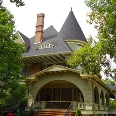
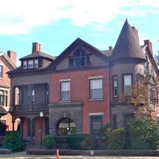
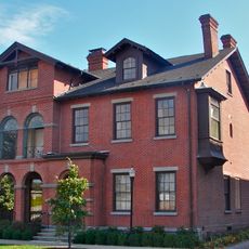
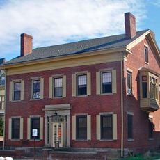
River Street Historic District is a downtown area of Wilkes-Barre covering 191 acres with 215 buildings built between 1860 and 1930 along the Susquehanna River. The structures show different architectural styles from that era and form a connected neighborhood rather than scattered individual sites.

The district formed during Wilkes-Barre's industrial growth period and received official recognition on the National Register of Historic Places in 1985. This designation honored the area's role in the city's economic expansion during the manufacturing era.

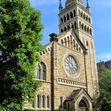
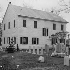
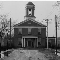
Franklin Street holds four churches built during the 1800s that show architectural styles influenced by major cities to the south. These buildings shaped how the neighborhood looked and reflected the community's connection to larger urban centers.

West Market Street serves as the main pathway through the district connecting significant buildings like the Osterhout Free Library and Wyoming Historical Museum. Walking this central route allows you to see most of the key structures and get a sense of how the neighborhood is organized.

Many buildings throughout the district feature local Wyoming Bluestone in their foundations, giving the area a distinctive reddish appearance. This regional material creates visual consistency across decades of construction by different builders.

The community of curious travelers

AroundUs brings together thousands of curated places, local tips, and hidden gems, enriched daily by 60,000 contributors worldwide.

Start exploring
Location
GPS coordinates
41.24690,-75.88580
Latest update
December 14, 2025 14:22
Around this place
Mohegan Sun Arena at Casey Plaza
United States of America

Mohegan Sun Arena at Casey Plaza

3.2 km
Frances Slocum State Park
United States of America

Frances Slocum State Park

10.4 km
Seven Tubs Natural Area
United States of America

Seven Tubs Natural Area

6.2 km
F.M. Kirby Center for the Performing Arts
United States of America

F.M. Kirby Center for the Performing Arts

408 m
Nescopeck State Park
United States of America

Nescopeck State Park

19 km
Luzerne County Courthouse
United States of America

Luzerne County Courthouse

733 m
Wyoming Monument
United States of America

Wyoming Monument

7.4 km
Ashley Planes
United States of America

Ashley Planes

6.6 km
Campbell's Ledge
United States of America

Campbell's Ledge

14.6 km
Market Street Bridge
United States of America

Market Street Bridge

194 m
Denison House
United States of America

Denison House

6.1 km
St. Stephen's Episcopal Pro-Cathedral
United States of America

St. Stephen's Episcopal Pro-Cathedral

123 m
St. Stanislaus Institute
United States of America

St. Stanislaus Institute

12.6 km
Swetland Homestead
United States of America

Swetland Homestead

6.7 km
Nesbitt Reservoir
United States of America

Nesbitt Reservoir

21.4 km
Firefighters' Memorial Bridge
United States of America

Firefighters' Memorial Bridge

11.6 km
Forty Fort Meetinghouse
United States of America

Forty Fort Meetinghouse

4.3 km
St. John the Evangelist Roman Catholic Church and School Building
United States of America

St. John the Evangelist Roman Catholic Church and School Building

2 km
Bear Creek Village Historic District
United States of America

Bear Creek Village Historic District

13 km
Laurel Run
United States of America

Laurel Run

2.9 km
Bridge in City of Wilkes-Barre
United States of America

Bridge in City of Wilkes-Barre

2.1 km
West End Wheelmen's Club
United States of America

West End Wheelmen's Club

1.2 km
Weiss Hall
United States of America

Weiss Hall

92 m
Luzerne Presbyterial Institute
United States of America

Luzerne Presbyterial Institute

8 km
McClintock Hall
United States of America

McClintock Hall

136 m
Luzerne County Fresh Air Camp
United States of America

Luzerne County Fresh Air Camp

12.6 km
Catlin Hall
United States of America

Catlin Hall

79 m
Forty Fort Theater
United States of America

Forty Fort Theater

4.8 km
Show the full map
« River Street Historic District - National Historic District in downtown Wilkes-Barre, United States » is provided by Around Us (aroundus.com). Images and texts are derived from Wikimedia project under a Creative Commons license. You are allowed to copy, distribute, and modify copies of this page, under the conditions set by the license, as long as this note is clearly visible.

Discover hidden gems everywhere you go!

From secret cafés to breathtaking viewpoints, skip the crowded tourist spots and find places that match your style. Our app makes it easy with voice search, smart filtering, route optimization, and insider tips from travelers worldwide. Download now for the complete mobile experience.

Around Us App Screenshot

A unique approach to discovering new places

Le Figaro

All the places worth exploring

France Info

A tailor-made excursion in just a few clicks

20 Minutes

Around Us
Travel Guide & Maps
Download

Send to your phone

QR Code
1

Open the camera app on your mobile.

2

Point at the QR code with your camera. A notification will appear.

3

Tap the notification to open the link.