Chest opened
+${chestReward.xp} XP
Explorer
NOUVEAU ×${chestReward.collectible.quantity}
tapez pour fermer
Chest locked

Open chests in the app

Around Us is built for your phone — chests unlock when you walk, explore and capture nearby places.

Enable Location

We need your location to show you interesting places around you

Discover nearby places

Find interesting locations and hidden gems around you

Precise directions

Get accurate directions and distances to places

Your location is never shared with other users. It's only used when you tap the location button.

Log in to your account

Start exploring — it's free

Trusted by 72,884 travelers worldwide

Continue with Google
Continue with Apple
or

We will send you a code to connect

By continuing, you accept our Terms and Conditions and our Privacy Policy

Check your inbox

We've sent a pincode in your inbox. Please enter the code below.

XL Ranch
Discussion Reviews Photo
3.5k Popularity

XL Ranch, Native American reservation in Modoc County, California.

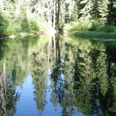
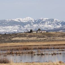
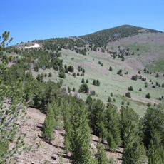
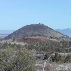
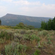
XL Ranch is a tribal reservation in Modoc County, in the far north of California, managed by the Pit River Tribes. The land is made up of open grasslands, natural terrain, and working agricultural areas that the community actively uses.

The reservation was officially set up in 1938 to give the Hewisedawi band and other Pit River groups a permanent home. It came after a period of displacement that had pushed Achomawi and Atsugewi peoples off their ancestral lands.

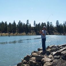
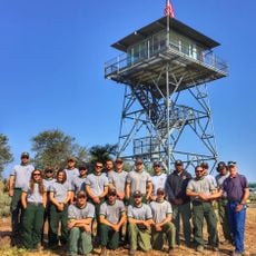
The Pit River Tribes, including the Hewisedawi band, keep their language and traditional practices alive on this land. Visitors who receive permission can see how the community actively works the land for farming and forestry.

Access to the reservation requires prior permission from the tribal office, since the land is under tribal administration. It is best to contact them well in advance to understand what is allowed and how to plan your visit.

The name XL Ranch comes from a cattle ranch that operated on this land before it became a reservation. Logging and hay ranching still take place here today, continuing an economic activity that predates the tribal settlement.

The community of curious travelers

AroundUs brings together thousands of curated places, local tips, and hidden gems, enriched daily by 60,000 contributors worldwide.

Start exploring
Location
GPS coordinates
41.55440,-120.45200
Latest update
March 3, 2026 14:01
Around this place
Modoc National Forest
United States of America

Modoc National Forest

65.6 km
Clear Lake National Wildlife Refuge
United States of America

Clear Lake National Wildlife Refuge

64.5 km
South Warner Wilderness
United States of America

South Warner Wilderness

33.1 km
Modoc National Wildlife Refuge
United States of America

Modoc National Wildlife Refuge

12.2 km
Greaser Petroglyph Site
United States of America

Greaser Petroglyph Site

88 km
Eagle Peak
United States of America

Eagle Peak

36.7 km
Petroglyph Point Archaeological Site
United States of America

Petroglyph Point Archaeological Site

84.5 km
Goose Lake State Recreation Area
United States of America

Goose Lake State Recreation Area

50.1 km
Schonchin Butte
United States of America

Schonchin Butte

91.9 km
High Rock Canyon Wilderness
United States of America

High Rock Canyon Wilderness

85.3 km
Hunter's Hot Springs
United States of America

Hunter's Hot Springs

74.5 km
Gerber Reservoir
United States of America

Gerber Reservoir

89.7 km
Booth State Scenic Corridor
United States of America

Booth State Scenic Corridor

71.4 km
Goose Lake meteorite
United States of America

Goose Lake meteorite

48 km
Dodge Reservoir
United States of America

Dodge Reservoir

70.3 km
Hat Mountain
United States of America

Hat Mountain

52.7 km
Deep Creek Falls
United States of America

Deep Creek Falls

80.5 km
Lake County Round Sale Barn
United States of America

Lake County Round Sale Barn

71.7 km
John N. and Cornelia Watson House
United States of America

John N. and Cornelia Watson House

71.2 km
William P. Heryford House
United States of America

William P. Heryford House

71.1 km
Tule Lake National Monument
United States of America

Tule Lake National Monument

85.3 km
Skull Cave
United States of America

Skull Cave

90.2 km
Mushpot Cave
United States of America

Mushpot Cave

89.7 km
Hospital Rock Trail
United States of America

Hospital Rock Trail

90.1 km
Lava Beds Visitor Center
United States of America

Lava Beds Visitor Center

89.8 km
Alger Theatre
United States of America

Alger Theatre

71.1 km
Niles Theater
United States of America

Niles Theater

10.9 km
Timber Mountain Lookout
United States of America

Timber Mountain Lookout

71 km
Show the full map
Reviews
Share your experience

No review yet

Discussions
Start a discussion...

No discussion yet

« XL Ranch - Native American reservation in Modoc County, California » is provided by Around Us (aroundus.com). Images and texts are derived from Wikimedia project under a Creative Commons license. You are allowed to copy, distribute, and modify copies of this page, under the conditions set by the license, as long as this note is clearly visible.

Discover hidden gems everywhere you go!

From secret cafés to breathtaking viewpoints, skip the crowded tourist spots and find places that match your style. Our app makes it easy with voice search, smart filtering, route optimization, and insider tips from travelers worldwide. Download now for the complete mobile experience.

Around Us App Screenshot

A unique approach to discovering new places

Le Figaro

All the places worth exploring

France Info

A tailor-made excursion in just a few clicks

20 Minutes

Around Us
Travel Guide & Maps
Download

Send to your phone

QR Code
1

Open the camera app on your mobile.

2

Point at the QR code with your camera. A notification will appear.

3

Tap the notification to open the link.