Log in to your account

AroundUs is a community-driven map of interesting places, built by curious explorers like you. It grows with every review, story, and photo you share.
Connect to save your favorite spots, contribute locations, and create personalized routes.
Continue with Google
Continue with Apple
Continue with X
Continue with Facebook
Continue with email
By continuing, you accept our Terms and Conditions and our Privacy Policy
Create an account

Maritime response following September 11 attacks

Add to collection
Map
Suggest a change
Share

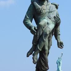
Maritime response following September 11 attacks, Maritime evacuation center at Port of New York and New Jersey, US

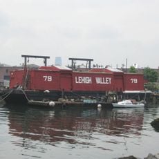
The Maritime Response was a large-scale evacuation effort at the Port of New York and New Jersey that transported people from Lower Manhattan. Over 500 different boats, including ferries, tugboats, and private vessels, worked together to handle the overwhelming flow of evacuees.

The operation took place on September 11, 2001, and was one of the first organized responses to the attacks. This coordinated effort made it the largest water evacuation in United States history.

Boat operators showed remarkable solidarity when civilian vessel owners voluntarily joined emergency responders to help with evacuation efforts. This spontaneous cooperation between professionals and ordinary people became a defining feature of the maritime response that day.

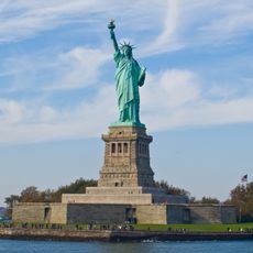
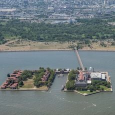
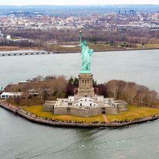
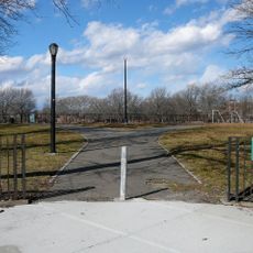
The evacuation operated from various port facilities and terminals along the East River and Hudson River, where boats picked up evacuees and transported them to different landing sites. Those visiting today can explore the waterfront areas along both river banks where many of these departure points remain visible.

Many private boat operators arrived to help without being asked, in what became known as a spontaneous civilian mobilization. This unexpected support from the local maritime community proved crucial to the evacuation's success.

Part of: aftermath of the September 11 attacks, September 11 attacks

GPS coordinates: 40.66833,-74.04556

Latest update: December 14, 2025 15:00

Photos
Around this place
Statue of Liberty
United States of America

Statue of Liberty

2.3 km
Ellis Island
United States of America

Ellis Island

3.5 km
To the Struggle Against World Terrorism
United States of America

To the Struggle Against World Terrorism

2.1 km
Liberty Island
United States of America

Liberty Island

2.4 km
Governors Island
United States of America

Governors Island

3.2 km
Industry City
United States of America

Industry City

3.5 km
Cape Liberty Cruise Port
United States of America

Cape Liberty Cruise Port

2.5 km
Fort Jay
United States of America

Fort Jay

3.5 km
Castle Williams
United States of America

Castle Williams

3.5 km
Statue of Liberty Museum
United States of America

Statue of Liberty Museum

2.4 km
Postcards
United States of America

Postcards

3.5 km
Port Jersey
United States of America

Port Jersey

2.4 km
Robbins Reef Light
United States of America

Robbins Reef Light

2.1 km
Sunset Park Material Recovery Facility
United States of America

Sunset Park Material Recovery Facility

3.2 km
Ellis Island National Museum of Immigration
United States of America

Ellis Island National Museum of Immigration

3.5 km
Liberation
United States of America

Liberation

2.9 km
Red Hook Park
United States of America

Red Hook Park

3.6 km
American Museum of Immigration
United States of America

American Museum of Immigration

2.3 km
Liggett Hall
United States of America

Liggett Hall

3.3 km
Rocky Sullivan's
United States of America

Rocky Sullivan's

2.9 km
Owls Head Park
United States of America

Owls Head Park

3.3 km
The Block House
United States of America

The Block House

3.5 km
Lehigh Valley Railroad Barge No. 79
United States of America

Lehigh Valley Railroad Barge No. 79

2.3 km
Ellis Island Immigrant Building
United States of America

Ellis Island Immigrant Building

3.5 km
Storehouse No. 2, U.S. Navy Fleet Supply Base
United States of America

Storehouse No. 2, U.S. Navy Fleet Supply Base

3.6 km
Ellis Island Hospital
United States of America

Ellis Island Hospital

3.3 km
The Interpretive Center
United States of America

The Interpretive Center

3.4 km
Saint Cornelius Chapel (Governors Island)
United States of America

Saint Cornelius Chapel (Governors Island)

3.4 km
Show the full map
Reviews

Visited this place? Tap the stars to rate it and share your experience / photos with the community! Try now! You can cancel it anytime.

« Maritime response following September 11 attacks - Maritime evacuation center at Port of New York and New Jersey, US » is provided by Around Us (aroundus.com). Images and texts are derived from Wikimedia project under a Creative Commons license. You are allowed to copy, distribute, and modify copies of this page, under the conditions set by the license, as long as this note is clearly visible.

Discover hidden gems everywhere you go!

From secret cafés to breathtaking viewpoints, skip the crowded tourist spots and find places that match your style. Our app makes it easy with voice search, smart filtering, route optimization, and insider tips from travelers worldwide. Download now for the complete mobile experience.

Around Us App Screenshot

A unique approach to discovering new places

Le Figaro

All the places worth exploring

France Info

A tailor-made excursion in just a few clicks

20 Minutes