Enable Location

We need your location to show you interesting places around you

Discover nearby places

Find interesting locations and hidden gems around you

Precise directions

Get accurate directions and distances to places

Your location is never shared with other users. It's only used when you tap the location button.

Malá Strana

Log in to your account

Start exploring — it's free

Trusted by 62,281 travelers worldwide

Continue with Google
Continue with Apple
or

We will send you a code to connect

By continuing, you accept our Terms and Conditions and our Privacy Policy

Check your inbox

We've sent a pincode in your inbox. Please enter the code below.

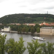
Malá Strana, Historic district on the left bank of Vltava River, Prague, Czech Republic

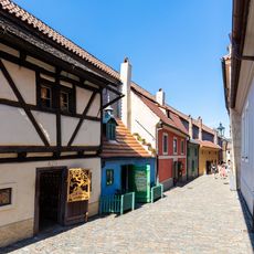
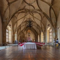
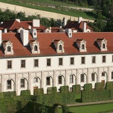
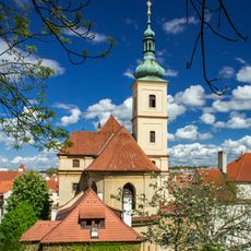
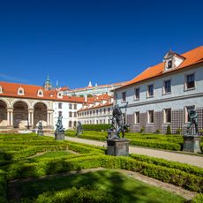
Malá Strana is a district on the left bank of the Vltava River in Prague, consisting of winding cobblestone streets lined with Renaissance and Baroque buildings. These structures layer up the slopes of Petřín Hill, with multi-story buildings wrapped around hidden courtyards and narrow passages.

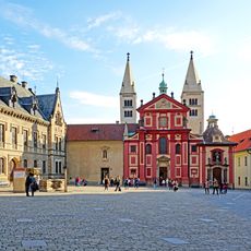
Founded in 1257 by King Ottokar II, the district grew as a settlement for German and Italian communities during medieval times. Subsequent centuries brought reconstruction and architectural evolution, as fires and conflicts reshaped the area and led to the layered building styles visible today.

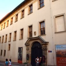
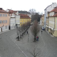
Daily life unfolds in quiet courtyards and small shops tucked beneath Renaissance arches, where locals still conduct business as they have for centuries. The district feels lived-in rather than frozen in time, with residents navigating the same winding streets as their ancestors did.

Early morning or late afternoon visits work best when crowds are smaller and streets feel less busy. The cobblestones and steep elevation changes require sturdy footwear and caution when surfaces are wet.

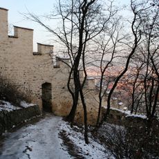
A network of medieval walls threads through the Petřín Hill slopes, including the Hunger Wall constructed during Charles IV's reign, now functioning as a walking trail. This ancient defensive line offers panoramic views across the city while linking hidden green spaces between built areas.

The community of curious travelers

AroundUs brings together thousands of curated places, local tips, and hidden gems, enriched daily by 60,000 contributors worldwide.

Start exploring
Location
Elevation above the sea
209 m
Reference
727091
Shares border with
Hradčany, Old Town, Smíchov, Holešovice
Address
Malá Strana, Prague 1, Czechia
GPS coordinates
50.08806,14.40389
Latest update
December 20, 2025 00:34
« Malá Strana - Historic district on the left bank of Vltava River, Prague, Czech Republic » is provided by Around Us (aroundus.com). Images and texts are derived from Wikimedia project under a Creative Commons license. You are allowed to copy, distribute, and modify copies of this page, under the conditions set by the license, as long as this note is clearly visible.

Discover hidden gems everywhere you go!

From secret cafés to breathtaking viewpoints, skip the crowded tourist spots and find places that match your style. Our app makes it easy with voice search, smart filtering, route optimization, and insider tips from travelers worldwide. Download now for the complete mobile experience.

Around Us App Screenshot

A unique approach to discovering new places

Le Figaro

All the places worth exploring

France Info

A tailor-made excursion in just a few clicks

20 Minutes

Around Us
Travel Guide & Maps
Download

Send to your phone

QR Code
1

Open the camera app on your mobile.

2

Point at the QR code with your camera. A notification will appear.

3

Tap the notification to open the link.