Log in to your account

AroundUs is a community-driven map of interesting places, built by curious explorers like you. It grows with every review, story, and photo you share.
Connect to save your favorite spots, contribute locations, and create personalized routes.
Continue with Google
Continue with Apple
Continue with X
Continue with Facebook
Continue with email
By continuing, you accept our Terms and Conditions and our Privacy Policy
Create an account
Add to collection
Map
Suggest a change
Share

Munsungan-Chase Lake Thoroughfare Archeological District, Archaeological site in Piscataquis County, United States.

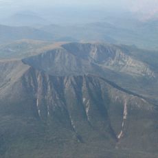
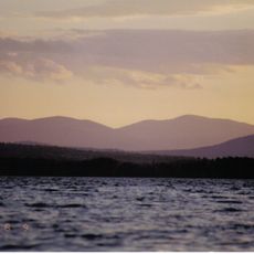
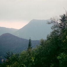
Munsungan-Chase Lake Thoroughfare Archeological District is an archaeological site between two lakes in northern Maine's forest region with numerous work areas and settlement remains. The area contains ancient stone tool workshops and camps where people created implements thousands of years ago.

The area was settled after glaciers retreated, when hunter-gatherer groups moved into this forested landscape thousands of years ago. They worked with local stone deposits, particularly red stone, over many generations to produce tools and hunting equipment.

This location served as a gathering place where communities came together to work with stone and exchange knowledge over many centuries. The workshop sites reveal how people learned from one another and shared techniques for creating tools from local materials.

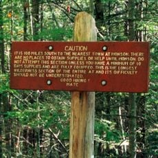
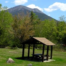
Access requires permission from local authorities because the site is remote and lies within protected wilderness. Visitors should prepare for rough forest terrain, wet conditions, and be ready for hiking in isolated areas.

Tools made from this location have been found at hundreds of archaeological sites throughout New England, showing that people here traded with distant groups. The red stone items traveled far and wide, revealing connections that spanned the entire region.

Location: Piscataquis County

GPS coordinates: 46.40306,-69.02472

Latest update: December 14, 2025 14:44

Photos
Around this place
Katahdin
United States of America

Katahdin

56.1 km
United States of America

Hundred-Mile Wilderness

88.4 km
Baxter State Park
United States of America

Baxter State Park

41.8 km
Double Eagle II
United States of America

Double Eagle II

80.8 km
Mount Kineo
United States of America

Mount Kineo

95.6 km
Mars Hill
United States of America

Mars Hill

93.8 km
Eagle Lake Tramway
United States of America

Eagle Lake Tramway

28.7 km
Hamlin Peak
United States of America

Hamlin Peak

53.8 km
North Brother
United States of America

North Brother

49.7 km
White Cap Mountain
United States of America

White Cap Mountain

96 km
National Weather Service Caribou, Maine
United States of America

National Weather Service Caribou, Maine

93 km
Doubletop Mountain
United States of America

Doubletop Mountain

52.1 km
Mark and Emily Turner Memorial Library
United States of America

Mark and Emily Turner Memorial Library

83.3 km
William Sewall House
United States of America

William Sewall House

72.9 km
Blackhawk Putnam Tavern
United States of America

Blackhawk Putnam Tavern

95.9 km
Gustaf Adolph Lutheran Church
United States of America

Gustaf Adolph Lutheran Church

91.2 km
Mount Coe
United States of America

Mount Coe

52.3 km
Aroostook County Courthouse and Jail
United States of America

Aroostook County Courthouse and Jail

96.3 km
Island Falls Opera House
United States of America

Island Falls Opera House

72.8 km
Gray Memorial United Methodist Church and Parsonage
United States of America

Gray Memorial United Methodist Church and Parsonage

92.3 km
Ambajejus Boom House
United States of America

Ambajejus Boom House

75.3 km
Appalaches Regional Park
Canada

Appalaches Regional Park

90.8 km
Market Square Historic District
United States of America

Market Square Historic District

96.2 km
First National Bank of Houlton
United States of America

First National Bank of Houlton

96 km
Walter P. Mansur House
United States of America

Walter P. Mansur House

96.2 km
Oakfield Grange, No. 414
United States of America

Oakfield Grange, No. 414

75.3 km
Pont du Sault
Canada

Pont du Sault

87.9 km
Pont des Défricheurs
Canada

Pont des Défricheurs

88.3 km
Show the full map
Reviews

Visited this place? Tap the stars to rate it and share your experience / photos with the community! Try now! You can cancel it anytime.

« Munsungan-Chase Lake Thoroughfare Archeological District - Archaeological site in Piscataquis County, United States » is provided by Around Us (aroundus.com). Images and texts are derived from Wikimedia project under a Creative Commons license. You are allowed to copy, distribute, and modify copies of this page, under the conditions set by the license, as long as this note is clearly visible.

Discover hidden gems everywhere you go!

From secret cafés to breathtaking viewpoints, skip the crowded tourist spots and find places that match your style. Our app makes it easy with voice search, smart filtering, route optimization, and insider tips from travelers worldwide. Download now for the complete mobile experience.

Around Us App Screenshot

A unique approach to discovering new places

Le Figaro

All the places worth exploring

France Info

A tailor-made excursion in just a few clicks

20 Minutes