·

Enable Location

We need your location to show you interesting places around you

Discover nearby places

Find interesting locations and hidden gems around you

Precise directions

Get accurate directions and distances to places

Your location is never shared with other users. It's only used when you tap the location button.

Lincoln Street Historic District

Log in to your account

Start exploring — it's free

Trusted by 62,678 travelers worldwide

Continue with Google
Continue with Apple
or

We will send you a code to connect

By continuing, you accept our Terms and Conditions and our Privacy Policy

Check your inbox

We've sent a pincode in your inbox. Please enter the code below.

Lincoln Street Historic District, historic district in Indiana, United States

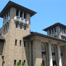
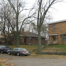
Lincoln Street Historic District is a neighborhood in Indiana with buildings and streets listed on the National Register of Historic Places. Most homes were built 50 to 60 years ago and feature wood or brick construction with architectural details that reflect earlier building styles.

The district has a long history stretching back many years, reflected in the building styles of older structures. It was officially added to the National Register of Historic Places on December 31, 2013, recognizing its historical value and ensuring protection of these buildings for future generations.

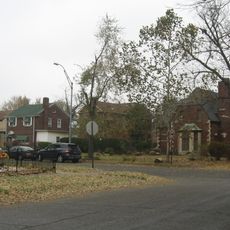
The neighborhood's name comes from the street itself, which has shaped the area's identity for many decades. The front porches on homes reflect past traditions where residents gathered outside to relax and socialize with neighbors.

The streets are quiet and not heavily trafficked, making it easy to stroll through and observe details of the old buildings and structures. Trees line the sides of streets, providing shade and creating a softer feel as you explore the historic area.

Some homes display simple, straight lines and small porches, while others are larger and showcase different styles from earlier periods. Windows with tiny panes, wooden doors, and brick walls reveal handcrafted details from long ago.

The community of curious travelers

AroundUs brings together thousands of curated places, local tips, and hidden gems, enriched daily by 60,000 contributors worldwide.

Start exploring
Location
GPS coordinates
41.59917,-87.35472
Latest update
February 9, 2026 11:07
Around this place
City Methodist Church
United States of America

City Methodist Church

1.4 km
Emerson High School
United States of America

Emerson High School

2.3 km
Wilbur Wynant House
United States of America

Wilbur Wynant House

293 m
Palace Theater
United States of America

Palace Theater

1.5 km
Marquette Park
United States of America

Marquette Park

8.2 km
Gary Bathing Beach Aquatorium
United States of America

Gary Bathing Beach Aquatorium

8.5 km
Knights of Columbus Building
United States of America

Knights of Columbus Building

1.1 km
St. Augustine's Episcopal Church
United States of America

St. Augustine's Episcopal Church

2 km
Indiana Botanic Gardens
United States of America

Indiana Botanic Gardens

7.1 km
American Sheet and Tin Mill Apartment Building
United States of America

American Sheet and Tin Mill Apartment Building

927 m
Polk Street Concrete Cottage Historic District
United States of America

Polk Street Concrete Cottage Historic District

398 m
Barney Sablotney House
United States of America

Barney Sablotney House

7.4 km
Gary City Center Historic District
United States of America

Gary City Center Historic District

1.5 km
West Fifth Avenue Apartments Historic District
United States of America

West Fifth Avenue Apartments Historic District

393 m
Gary Public Schools Memorial Auditorium
United States of America

Gary Public Schools Memorial Auditorium

1.6 km
Horace Mann Historic District
United States of America

Horace Mann Historic District

700 m
Combs Addition Historic District
United States of America

Combs Addition Historic District

1.3 km
Gary Land Company Building
United States of America

Gary Land Company Building

1.9 km
Carlson Oxbow Park
United States of America

Carlson Oxbow Park

8.7 km
Jefferson Street Historic District
United States of America

Jefferson Street Historic District

5.3 km
Monroe Terrace Historic District
United States of America

Monroe Terrace Historic District

1.1 km
Polk Street Terraces Historic District
United States of America

Polk Street Terraces Historic District

646 m
Van Buren Terrace Historic District
United States of America

Van Buren Terrace Historic District

929 m
Eskilson Historic District
United States of America

Eskilson Historic District

677 m
Louis J. Bailey Branch Library
United States of America

Louis J. Bailey Branch Library

1.7 km
Jackson-Monroe Terraces Historic District
United States of America

Jackson-Monroe Terraces Historic District

994 m
Gary Public Library
United States of America

Gary Public Library

1.3 km
Morningside Historic District
United States of America

Morningside Historic District

7.6 km
Show the full map
« Lincoln Street Historic District - historic district in Indiana, United States » is provided by Around Us (aroundus.com). Images and texts are derived from Wikimedia project under a Creative Commons license. You are allowed to copy, distribute, and modify copies of this page, under the conditions set by the license, as long as this note is clearly visible.

Discover hidden gems everywhere you go!

From secret cafés to breathtaking viewpoints, skip the crowded tourist spots and find places that match your style. Our app makes it easy with voice search, smart filtering, route optimization, and insider tips from travelers worldwide. Download now for the complete mobile experience.

Around Us App Screenshot

A unique approach to discovering new places

Le Figaro

All the places worth exploring

France Info

A tailor-made excursion in just a few clicks

20 Minutes

Around Us
Travel Guide & Maps
Download

Send to your phone

QR Code
1

Open the camera app on your mobile.

2

Point at the QR code with your camera. A notification will appear.

3

Tap the notification to open the link.