Chest opened
+${chestReward.xp} XP
Explorer
NOUVEAU ×${chestReward.collectible.quantity}
tapez pour fermer
Chest locked

Open chests in the app

Around Us is built for your phone — chests unlock when you walk, explore and capture nearby places.

Enable Location

We need your location to show you interesting places around you

Discover nearby places

Find interesting locations and hidden gems around you

Precise directions

Get accurate directions and distances to places

Your location is never shared with other users. It's only used when you tap the location button.

Log in to your account

Start exploring — it's free

Trusted by 72,888 travelers worldwide

Continue with Google
Continue with Apple
or

We will send you a code to connect

By continuing, you accept our Terms and Conditions and our Privacy Policy

Check your inbox

We've sent a pincode in your inbox. Please enter the code below.

Texas Hill Station
Discussion Reviews Photo
1.3k Popularity

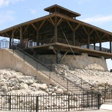
Texas Hill Station, Former stagecoach station in Yuma County, Arizona, United States.

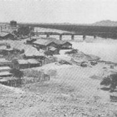
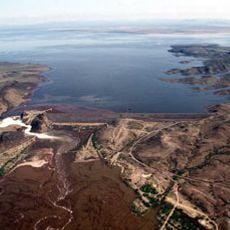
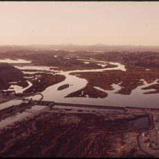
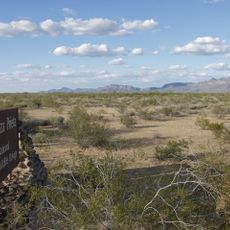
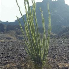
Texas Hill Station was a stagecoach stop located near the Gila River valley in Arizona's Yuma County. The station sat about 2 miles (3 km) east of Texas Hill and provided rest and water access to travelers moving through the region.

This stop began operations in 1859 as part of the Butterfield Overland Mail route, a major transportation line crossing the southwestern United States. It functioned as a critical point for changing teams of horses and providing supplies until its closure around 1880.

The station served multiple purposes throughout its existence, functioning as a water stop and camp for soldiers, freighters, and travelers until 1880.

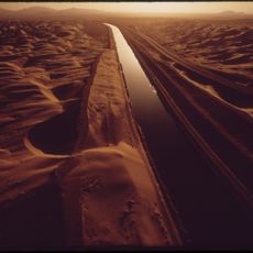
The stop sat about half a mile (0.8 km) back from the Gila River and positioned between two other stations on the route. Visitors should know that no physical remains of the original station exist today because of river changes and erosion over time.

The station once served military operations during westward expansion and the American Civil War period, making it strategically valuable beyond ordinary commercial traffic. This location along major supply routes demonstrates how remote posts shaped regional development and frontier settlement patterns.

The community of curious travelers

AroundUs brings together thousands of curated places, local tips, and hidden gems, enriched daily by 60,000 contributors worldwide.

Start exploring
Location
GPS coordinates
32.83056,-113.65917
Latest update
December 14, 2025 18:10
Around this place
Yuma Territorial Prison
United States of America

Yuma Territorial Prison

90.2 km
All-American Canal
United States of America

All-American Canal

76.2 km
Kofa National Wildlife Refuge
United States of America

Kofa National Wildlife Refuge

56 km
El Camino Del Diablo
United States of America

El Camino Del Diablo

88.2 km
Painted Rock Petroglyph Site
United States of America

Painted Rock Petroglyph Site

61 km
Cabeza Prieta National Wildlife Refuge
United States of America

Cabeza Prieta National Wildlife Refuge

69.6 km
Ocean To Ocean Bridge
United States of America

Ocean To Ocean Bridge

90.2 km
McPhaul Suspension Bridge
United States of America

McPhaul Suspension Bridge

71.8 km
Yuma Crossing
United States of America

Yuma Crossing

90.2 km
Painted Rock Dam
United States of America

Painted Rock Dam

65.9 km
Little Picacho Wilderness
United States of America

Little Picacho Wilderness

85.9 km
Imperial Reservoir
United States of America

Imperial Reservoir

75.9 km
Cabeza Prieta Wilderness
United States of America

Cabeza Prieta Wilderness

66.5 km
Mission Puerto de Purísima Concepción
United States of America

Mission Puerto de Purísima Concepción

90.2 km
Eagletail Mountains Wilderness
United States of America

Eagletail Mountains Wilderness

72.7 km
United States of America

Ajo Peak

89.6 km
Brown House
United States of America

Brown House

90.8 km
Z Fun Factory and Waylon's Water World
United States of America

Z Fun Factory and Waylon's Water World

85.5 km
Muggins Mountain Wilderness
United States of America

Muggins Mountain Wilderness

56.2 km
United States Post Office–Yuma Main
United States of America

United States Post Office–Yuma Main

90.5 km
Blaisdell Slow Sand Filter Washing Machine
United States of America

Blaisdell Slow Sand Filter Washing Machine

90.4 km
Ortiz House
United States of America

Ortiz House

90.7 km
Cactus Press-Plaza Paint Building
United States of America

Cactus Press-Plaza Paint Building

90.6 km
Yuma City Hall
United States of America

Yuma City Hall

90.7 km
Westwind Golf Course
United States of America

Westwind Golf Course

77.3 km
Gila Bend Visitor Center and Museum
United States of America

Gila Bend Visitor Center and Museum

87.8 km
Yuma Theater
United States of America

Yuma Theater

90.5 km
Stout's Hotel
United States of America

Stout's Hotel

89.1 km
Show the full map
Reviews
Share your experience

No review yet

Discussions
Start a discussion...

No discussion yet

« Texas Hill Station - Former stagecoach station in Yuma County, Arizona, United States » is provided by Around Us (aroundus.com). Images and texts are derived from Wikimedia project under a Creative Commons license. You are allowed to copy, distribute, and modify copies of this page, under the conditions set by the license, as long as this note is clearly visible.

Discover hidden gems everywhere you go!

From secret cafés to breathtaking viewpoints, skip the crowded tourist spots and find places that match your style. Our app makes it easy with voice search, smart filtering, route optimization, and insider tips from travelers worldwide. Download now for the complete mobile experience.

Around Us App Screenshot

A unique approach to discovering new places

Le Figaro

All the places worth exploring

France Info

A tailor-made excursion in just a few clicks

20 Minutes

Around Us
Travel Guide & Maps
Download

Send to your phone

QR Code
1

Open the camera app on your mobile.

2

Point at the QR code with your camera. A notification will appear.

3

Tap the notification to open the link.