Chest opened
+${chestReward.xp} XP
Explorer
NOUVEAU ×${chestReward.collectible.quantity}
tapez pour fermer

See the monuments around you in AR Open chests in the app

Around Us is built for your phone — point your camera at the streets and discover the monuments and places around you in augmented reality. Around Us is built for your phone — chests unlock when you walk, explore and capture nearby places.

•

Enable Location

We need your location to show you interesting places around you

Discover nearby places

Find interesting locations and hidden gems around you

Precise directions

Get accurate directions and distances to places

Your location is never shared with other users. It's only used when you tap the location button.

Tacora

Log in to your account

Start exploring — it's free

Trusted by 94,367 travelers worldwide

Continue with Google
Continue with Apple
or

We will send you a code to connect

By continuing, you accept our Terms and Conditions and our Privacy Policy

Check your inbox

We've sent a pincode in your inbox. Please enter the code below.

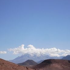
Tacora, Dormant stratovolcano in northern Arica y Parinacota Region, Chile.

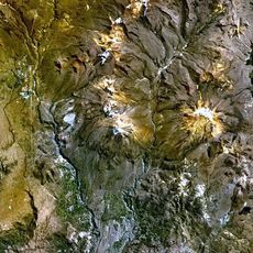
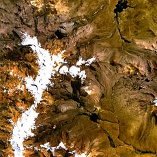
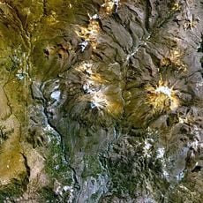
Tacora is a 5,980-metre stratovolcano in Chile's Arica y Parinacota Region, about 100 km northeast of Arica. Its summit caldera opens northwest and holds a 500-metre-wide crater below the caldera scarp. Steep lava flows, lava domes and pyroclastic material form the cone, which rises about 1.7 km above the surrounding terrain and shows a sector-collapse scar on its southeastern flank.

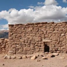
Mining began on the volcano during the 1800s, focusing on sulfur extraction from its slopes and crater area. Processing works were built on the mountain to handle the extracted material during this period.

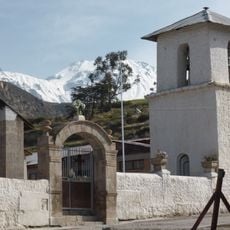
Local communities view the mountain as an important landmark that shapes their relationship with the Andean landscape. The peak serves as a reference point in their daily life and connection to the highland region.

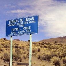
Access is by unpaved road that requires four-wheel drive vehicles, starting from the nearby settlement of Chislluma. The route gains over 1,300 meters of elevation and can be rough, so checking conditions beforehand is recommended.

Tacora's fumaroles reach temperatures of 82–93 °C, and their gases are mostly water vapour with carbon dioxide, hydrogen chloride, hydrogen fluoride, hydrogen sulfide and sulfur dioxide. Geyserite cones on the mountain show that geysers were formerly active there. In 2009 Chile's Ministry of Mining recorded bids for geothermal development at Tacora, and one bid was approved in early 2010.

The community of curious travelers

AroundUs brings together thousands of curated places, local tips, and hidden gems, enriched daily by 94,367 contributors worldwide.

Start exploring
GPS coordinates
-17.72037,-69.77273
Latest update
October 24, 2026 19:38
Reviews
Share your experience

No review yet

Discussions
Start a discussion...

No discussion yet

« Tacora - Dormant stratovolcano in northern Arica y Parinacota Region, Chile » is provided by Around Us (aroundus.com). Images and texts are derived from Wikimedia project under a Creative Commons license. You are allowed to copy, distribute, and modify copies of this page, under the conditions set by the license, as long as this note is clearly visible.

Discover hidden gems everywhere you go!

From secret cafés to breathtaking viewpoints, skip the crowded tourist spots and find places that match your style. Our app makes it easy with voice search, smart filtering, route optimization, and insider tips from travelers worldwide. Download now for the complete mobile experience.

Around Us App Screenshot
❝

A unique approach to discovering new places❞

— Le Figaro

❝

All the places worth exploring❞

— France Info

❝

A tailor-made excursion in just a few clicks❞

— 20 Minutes

Around Us
Travel Guide & Maps
Download

Send to your phone

QR Code
1

Open the camera app on your mobile.

2

Point at the QR code with your camera. A notification will appear.

3

Tap the notification to open the link.