·

Enable Location

We need your location to show you interesting places around you

Discover nearby places

Find interesting locations and hidden gems around you

Precise directions

Get accurate directions and distances to places

Your location is never shared with other users. It's only used when you tap the location button.

Casiri

Log in to your account

Start exploring — it's free

Trusted by 62,660 travelers worldwide

Continue with Google
Continue with Apple
or

We will send you a code to connect

By continuing, you accept our Terms and Conditions and our Privacy Policy

Check your inbox

We've sent a pincode in your inbox. Please enter the code below.

Casiri

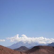
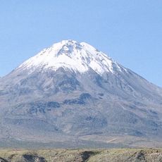
Casiri, Stratovolcano in Tacna Department, Peru.

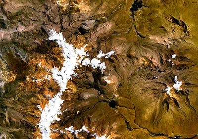
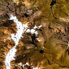
Casiri is a stratovolcano in the Barroso mountain range of the Andes, rising to about 5,650 meters elevation in the Tacna region. The volcanic system consists of multiple structures and shapes the landscape of this remote highland area.

The volcano's last known lava flow occurred roughly 2,600 years ago, marking its most recent volcanic activity in the region. Since then, it has evolved into a stable landmark of the southern Andean landscape.

The mountain carries a name rooted in the Aymara language, reflecting the linguistic traditions of Andean communities. For local inhabitants, this highland landscape remains part of their geographical and cultural identity.

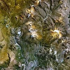
Access to this high-altitude location requires good physical preparation and equipment suited for extreme elevation conditions. The active sulfur mines nearby are not accessible to visitors, but the surrounding landscape offers opportunities to observe volcanic formations.

The volcano features multiple lava domes with flows ranging from about 50 to 500 meters in width, creating visibly distinct geological features. These varying flow widths reflect different eruption phases and make the terrain geologically complex.

The community of curious travelers

AroundUs brings together thousands of curated places, local tips, and hidden gems, enriched daily by 60,000 contributors worldwide.

Start exploring
Location
Elevation above the sea
5,650 m
Part of
Volcanic arc of Peru
GPS coordinates
-17.47231,-69.80435
Latest update
December 14, 2025 11:04
« Casiri - Stratovolcano in Tacna Department, Peru » is provided by Around Us (aroundus.com). Images and texts are derived from Wikimedia project under a Creative Commons license. You are allowed to copy, distribute, and modify copies of this page, under the conditions set by the license, as long as this note is clearly visible.

Discover hidden gems everywhere you go!

From secret cafés to breathtaking viewpoints, skip the crowded tourist spots and find places that match your style. Our app makes it easy with voice search, smart filtering, route optimization, and insider tips from travelers worldwide. Download now for the complete mobile experience.

Around Us App Screenshot

A unique approach to discovering new places

Le Figaro

All the places worth exploring

France Info

A tailor-made excursion in just a few clicks

20 Minutes

Around Us
Travel Guide & Maps
Download

Send to your phone

QR Code
1

Open the camera app on your mobile.

2

Point at the QR code with your camera. A notification will appear.

3

Tap the notification to open the link.