Enable Location

We need your location to show you interesting places around you

Discover nearby places

Find interesting locations and hidden gems around you

Precise directions

Get accurate directions and distances to places

Your location is never shared with other users. It's only used when you tap the location button.

Log in to your account

Start exploring — it's free

Trusted by 65,076 travelers worldwide

Continue with Google
Continue with Apple
or

We will send you a code to connect

By continuing, you accept our Terms and Conditions and our Privacy Policy

Check your inbox

We've sent a pincode in your inbox. Please enter the code below.

Lata Mountain
Discussion Reviews Photo
7k Popularity

Lata Mountain, Mountain summit in Manuʻa District, American Samoa

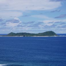
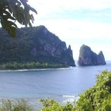
Lata Mountain, on the island of Taʻu in the Manuʻa District, is the highest summit in all of American Samoa, reaching 963 meters (3,160 ft) above sea level. It sits within the boundaries of the National Park of American Samoa, surrounded by dense tropical rainforest that covers the slopes nearly to the top.

For generations, sailors crossing the South Pacific used the mountain's profile as a navigation point because it could be spotted from far out at sea. When the National Park of American Samoa was established in 1988, the mountain and its surrounding forest came under formal protection.

The name Lata appears in songs and oral stories passed down through the villages of Taʻu, woven into everyday conversation as naturally as the weather or the sea. Visitors who spend time talking with locals often notice how the peak comes up as a point of reference in daily life.

A trail maintained by the National Park Service leads to the summit, but the climb is physically demanding and should not be taken lightly. Starting early in the morning gives you the best chance of clear conditions, since clouds tend to build up around the peak as the day goes on.

The forest on the slopes of Lata Mountain is home to several bird species found nowhere else in the world, making the trail as much a wildlife experience as a hike. Walkers who move quietly and pay attention to the trees around them are likely to spot some of these birds without any special effort.

The community of curious travelers

AroundUs brings together thousands of curated places, local tips, and hidden gems, enriched daily by 60,000 contributors worldwide.

Start exploring
Location
Elevation above the sea
963 m
GPS coordinates
-14.23304,-169.45243
Latest update
March 3, 2026 08:18
Reviews
Share your experience

No review yet

Discussions
Start a discussion...

No discussion yet

« Lata Mountain - Mountain summit in Manuʻa District, American Samoa » is provided by Around Us (aroundus.com). Images and texts are derived from Wikimedia project under a Creative Commons license. You are allowed to copy, distribute, and modify copies of this page, under the conditions set by the license, as long as this note is clearly visible.

Discover hidden gems everywhere you go!

From secret cafés to breathtaking viewpoints, skip the crowded tourist spots and find places that match your style. Our app makes it easy with voice search, smart filtering, route optimization, and insider tips from travelers worldwide. Download now for the complete mobile experience.

Around Us App Screenshot

A unique approach to discovering new places

Le Figaro

All the places worth exploring

France Info

A tailor-made excursion in just a few clicks

20 Minutes

Around Us
Travel Guide & Maps
Download

Send to your phone

QR Code
1

Open the camera app on your mobile.

2

Point at the QR code with your camera. A notification will appear.

3

Tap the notification to open the link.