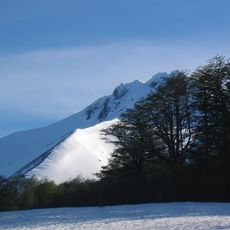
Mocho-Choshuenco, Stratovolcano in El Ranco Province, Chile
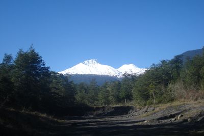
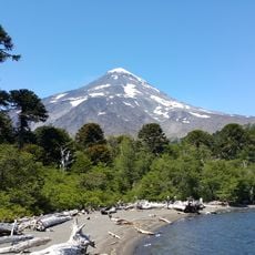
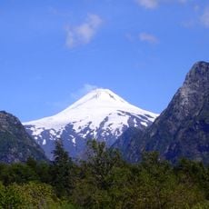
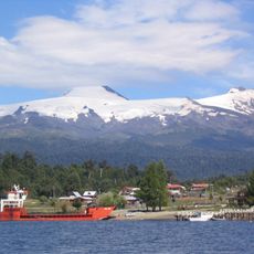
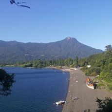
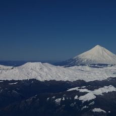
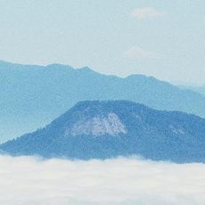
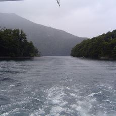
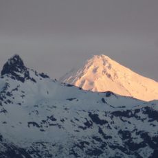
Mocho-Choshuenco is a stratovolcano in the Los Ríos Region with two prominent peaks reaching about 2400 meters and covered by glaciers. Temperate rainforest surrounds the slopes, creating a dramatic landscape where ice and vegetation meet.
The volcano experienced its last major eruption in 1937, sending lava and ash across the surrounding land. Before that, an eruption in 1864 caused significant changes to the landscape with powerful explosions.
The name blends Spanish and Mapuche words, with Mocho meaning headless and Choshuenco referring to yellow waters. This linguistic mix reflects how indigenous and colonial cultures have shaped the region's identity.
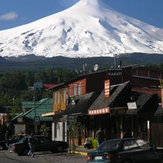
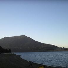
The volcano is accessible from the shores of Lago Ranco with several routes available for climbing. The Choshuenco peak offers a more manageable approach for those attempting the ascent.
About twenty small cones sit at the base of the volcano, forming what geologists call the Grupo Fuy system. These subsidiary cones spread across extensive fields of lava and volcanic deposits that tell the story of repeated eruptions.
Location: El Ranco Province
Elevation above the sea: 2,422 m
Made from material: andesite
GPS coordinates: -39.91386,-72.04010
Latest update: December 8, 2025 19:54
Villarrica Volcano
55.5 km
Lanín
55.3 km
Huilo-Huilo Biological Reserve
9.9 km
Lanín National Park
64.3 km
Villarrica National Park
57.4 km
Puerto Fuy
13.4 km
Termas geométricas
48 km
Liquiñe
24.9 km
Choshuenco
9.3 km
Quetrupillán
53.9 km
Carrán-Los Venados
44.6 km
Casino de Pucón
71.5 km
Sitio de Villarrica
72.7 km
Huilo-Huilo Falls
10 km
Cascada Chachín
40.2 km
Estadio Municipal de Villarrica
71.3 km
Cathedral of the Sacred Heart, Villarrica
72.4 km
Tralcán
38.3 km
Huanquihue Group
39.4 km
Cerro Quinquilil
59.6 km
Mocho-Choshuenco National Reserve
2.6 km
Volcanic Caves Park
60.7 km
Casa del Fundo El Llolly
51.9 km
Category:Iglesia de San Sebastián, Curarrehue
72.9 km
Puente Collilelfu
66.4 km
El León waterfall
59.9 km
La China waterfall
61.2 km
Paseo de la Memoria Herida de Villarrica
73.1 kmVisited this place? Tap the stars to rate it and share your experience / photos with the community! Try now! You can cancel it anytime.
Discover hidden gems everywhere you go!
From secret cafés to breathtaking viewpoints, skip the crowded tourist spots and find places that match your style. Our app makes it easy with voice search, smart filtering, route optimization, and insider tips from travelers worldwide. Download now for the complete mobile experience.
A unique approach to discovering new places❞
— Le Figaro
All the places worth exploring❞
— France Info
A tailor-made excursion in just a few clicks❞
— 20 Minutes