Chest opened
+${chestReward.xp} XP
Explorer
NOUVEAU ×${chestReward.collectible.quantity}
tapez pour fermer

See the monuments around you in AR Open chests in the app

Around Us is built for your phone — point your camera at the streets and discover the monuments and places around you in augmented reality. Around Us is built for your phone — chests unlock when you walk, explore and capture nearby places.

•

Enable Location

We need your location to show you interesting places around you

Discover nearby places

Find interesting locations and hidden gems around you

Precise directions

Get accurate directions and distances to places

Your location is never shared with other users. It's only used when you tap the location button.

Lanín

Log in to your account

Start exploring — it's free

Trusted by 93,444 travelers worldwide

Continue with Google
Continue with Apple
or

We will send you a code to connect

By continuing, you accept our Terms and Conditions and our Privacy Policy

Check your inbox

We've sent a pincode in your inbox. Please enter the code below.

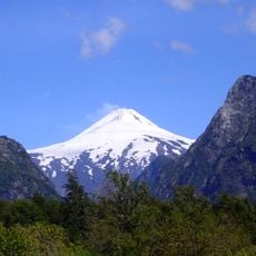
Lanín, Stratovolcano on the Argentina–Chile border, Andes

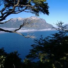
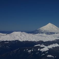
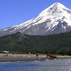
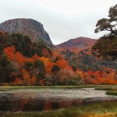
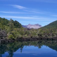
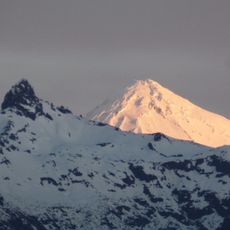
Lanín is a mountain in the Andes range on the border between Argentina and Chile. Its snow-covered slopes rise above forests of southern beech trees and form a slender cone visible from far away.

Basilio Villarino sighted the volcano in 1782 and recorded that locals called it Yajaunaujén. Radiocarbon dating places possible activity around 540 AD, and the last eruption is estimated at about 1,600 years ago. A 1906 newspaper report of an eruption was disputed by Karl Sapper in 1917; seismic movements were detected inside the volcano from 15 February 2017.

The Mapuche name Lanín may derive from Lanlil, "we sink", or mean "dead rock"; some Mapuche say it means "died of a binge". In their legend, the god Pillán lived on the summit and demanded the sacrifice of Huilefún, after which the volcano fell silent. Mapuche communities regard the mountain as sacred and do not climb it.

Hikers need permits from park authorities on the Argentine or Chilean side depending on the route. Early morning starts help with cooler temperatures and firmer snow underfoot.

The snow line shifts through the seasons so the ice cap shrinks smaller in summer months. The summit crater has no open vent but shows only gentle depressions in the snow.

The community of curious travelers

AroundUs brings together thousands of curated places, local tips, and hidden gems, enriched daily by 93,444 contributors worldwide.

Start exploring
Elevation above the sea
3,776 m
GPS coordinates
-39.63722,-71.50306
Latest update
October 24, 2026 09:23
Reviews
Share your experience

No review yet

Discussions
Start a discussion...

No discussion yet

« Lanín - Stratovolcano on the Argentina–Chile border, Andes » is provided by Around Us (aroundus.com). Images and texts are derived from Wikimedia project under a Creative Commons license. You are allowed to copy, distribute, and modify copies of this page, under the conditions set by the license, as long as this note is clearly visible.

Discover hidden gems everywhere you go!

From secret cafés to breathtaking viewpoints, skip the crowded tourist spots and find places that match your style. Our app makes it easy with voice search, smart filtering, route optimization, and insider tips from travelers worldwide. Download now for the complete mobile experience.

Around Us App Screenshot
❝

A unique approach to discovering new places❞

— Le Figaro

❝

All the places worth exploring❞

— France Info

❝

A tailor-made excursion in just a few clicks❞

— 20 Minutes

Around Us
Travel Guide & Maps
Download

Send to your phone

QR Code
1

Open the camera app on your mobile.

2

Point at the QR code with your camera. A notification will appear.

3

Tap the notification to open the link.