Amarillo Hill, Mountain summit in Concepción, Chile.
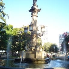
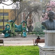
Cerro Amarillo is a 30-metre-high hill in Concepción covering 3,000 m² between Rozas and Rengo streets. Its summit holds a park created in 1933, managed by the Municipality of Concepción, with gardens, walkways and viewpoints enclosed by stone masonry walls. From the top, the peak of Cerro Chepe and much of the city centre are visible.
The hill was long known as Cerro Gavilán, forming the northern edge of Concepción in the 18th and 19th centuries. It is said to be named after Josefina Gavilán, who lived in the old city before the 1751 earthquake and donated the hill and other lands to help the city move to the Valle de la Mocha. On 5 May 1817 the Battle of Cerro Gavilán was fought here: Juan Gregorio de Las Heras's patriots defeated José Ordóñez's royalists, who fled to Talcahuano. As the city spread toward Cerro Chepe, the hill was cut down to its present size.
The hill's name changed from Cerro Gavilán to Cerro Amarillo as Concepción expanded and the ridge was cut down to this remnant. A bronze plaque of 60 by 40 cm at the Rozas and Rengo entrance commemorates the 1817 Battle of Cerro Gavilán, and the park created in 1933 is still run by the Municipality of Concepción.
The park on Cerro Amarillo is reached from the intersection of Rozas and Rengo streets, where a bronze plaque commemorates the Battle of Cerro Gavilán. The hill covers 3,000 m² and rises 30 m, so the walk is short. From the top you can see the summit of Cerro Chepe and much of the city centre.
The hill was once part of the larger Cerro Gavilán, named after Josefina Gavilán, who donated the land to Concepción after the 1751 earthquake forced the city to move to the Valle de la Mocha. City growth toward Cerro Chepe later cut the ridge down to this 30-metre, 3,000 m² hill.
The community of curious travelers
AroundUs brings together thousands of curated places, local tips, and hidden gems, enriched daily by 92,630 contributors worldwide.