Chest opened
+${chestReward.xp} XP
Explorer
NOUVEAU ×${chestReward.collectible.quantity}
tapez pour fermer

See the monuments around you in AR Open chests in the app

Around Us is built for your phone — point your camera at the streets and discover the monuments and places around you in augmented reality. Around Us is built for your phone — chests unlock when you walk, explore and capture nearby places.

•

Enable Location

We need your location to show you interesting places around you

Discover nearby places

Find interesting locations and hidden gems around you

Precise directions

Get accurate directions and distances to places

Your location is never shared with other users. It's only used when you tap the location button.

Cerro Chacarillas

Log in to your account

Start exploring — it's free

Trusted by 92,783 travelers worldwide

Continue with Google
Continue with Apple
or

We will send you a code to connect

By continuing, you accept our Terms and Conditions and our Privacy Policy

Check your inbox

We've sent a pincode in your inbox. Please enter the code below.

Cerro Chacarillas

Cerro Chacarillas, Mountain summit in Santiago, Chile

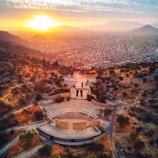
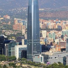
Cerro Chacarillas, also called Tupahue, is a 796-metre summit with 280 metres of prominence, the third-highest point in Santiago after Renca and San Cristóbal. It lies northeast of San Cristóbal, between Providencia to the south, Vitacura to the east and Recoleta to the north, and belongs with San Cristóbal, La Pirámide and Los Gemelos to the 722-hectare Parque Metropolitano de Santiago.

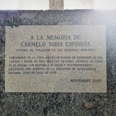
On 9 July 1977 the Frente Juvenil de Unidad Nacional held a rally on the summit for Youth Day, where Augusto Pinochet, head of the military junta, gave a speech outlining the new institutional order for the state. Right-wing politicians including Joaquín Lavín, Juan Antonio Coloma Correa, Carlos Bombal and Andrés Chadwick attended. Earlier, under Salvador Allende, the Chacarillas public pool had been built on the hill, designed by architect Carlos Martner; it was closed for three years after the 1973 coup and reopened in 1976 as Antilén.

The name Chacarillas is Spanish, while Tung Pawe comes from Mapudungún and means "place of peace"; Centinela is Quechua for "sentinel". The summit sits between the communes of Providencia, Vitacura and Recoleta, and its slopes belong to the Metropolitan Park of Santiago, about 722 hectares in all.

The location offers direct access to hiking trails and connects to Santiago's Metropolitan Park through entry points in Providencia and Vitacura districts. Visitors should wear proper footwear and watch weather conditions, as the exposed summit is known for sudden wind gusts.

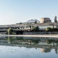
The Chacarillas public pool was built under Salvador Allende at the request of park union leaders, who wanted to turn a disused irrigation pond into affordable swimming, since the Tupahue pool was too expensive for workers. Architect Carlos Martner designed it with stepped picnic terraces and a 360° viewpoint. Closed after the 1973 coup, it reopened in 1976 as Antilén.

The community of curious travelers

AroundUs brings together thousands of curated places, local tips, and hidden gems, enriched daily by 92,783 contributors worldwide.

Start exploring
GPS coordinates
-33.40884,-70.61347
Latest update
October 24, 2026 22:11
Reviews
Share your experience

No review yet

Discussions
Start a discussion...

No discussion yet

« Cerro Chacarillas - Mountain summit in Santiago, Chile » is provided by Around Us (aroundus.com). Images and texts are derived from Wikimedia project under a Creative Commons license. You are allowed to copy, distribute, and modify copies of this page, under the conditions set by the license, as long as this note is clearly visible.

Discover hidden gems everywhere you go!

From secret cafés to breathtaking viewpoints, skip the crowded tourist spots and find places that match your style. Our app makes it easy with voice search, smart filtering, route optimization, and insider tips from travelers worldwide. Download now for the complete mobile experience.
Around Us App Screenshot
❝

A unique approach to discovering new places❞

— Le Figaro

❝

All the places worth exploring❞

— France Info

❝

A tailor-made excursion in just a few clicks❞

— 20 Minutes

Around Us
Travel Guide & Maps
Download

Send to your phone

QR Code
1

Open the camera app on your mobile.

2

Point at the QR code with your camera. A notification will appear.

3

Tap the notification to open the link.