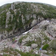
Cuchilla Grande, Mountain range in Maldonado Department, Uruguay.
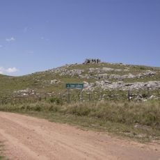
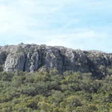
Cuchilla Grande is a mountain range extending through eastern Uruguay with granite hills and sharp ridges that form distinctive topography across Maldonado Department. The highest point reaches about 513 meters and rocky outcrops dot the slopes throughout the area.
The range formed during Precambrian times when ancient geological forces created the granite and gneiss that make up its structure today. These ancient rocks have remained largely unchanged and continue to define the landscape.
Local ranchers have adapted their cattle operations to the steep slopes and valleys, with grazing patterns following the natural contours of the land. This way of working shapes how the region looks and how the landscape is used today.
The area is best explored during drier months when rural paths are more accessible for hiking and observation. Bring sturdy footwear and supplies as the region is remote with limited amenities nearby.
The range acts as a natural watershed between the Río Negro basin and Mirim Lagoon, redirecting water flows that shape the hydrology of eastern Uruguay. Few visitors realize this hidden role in controlling where water travels across the region.
The community of curious travelers
AroundUs brings together thousands of curated places, local tips, and hidden gems, enriched daily by 60,000 contributors worldwide.